
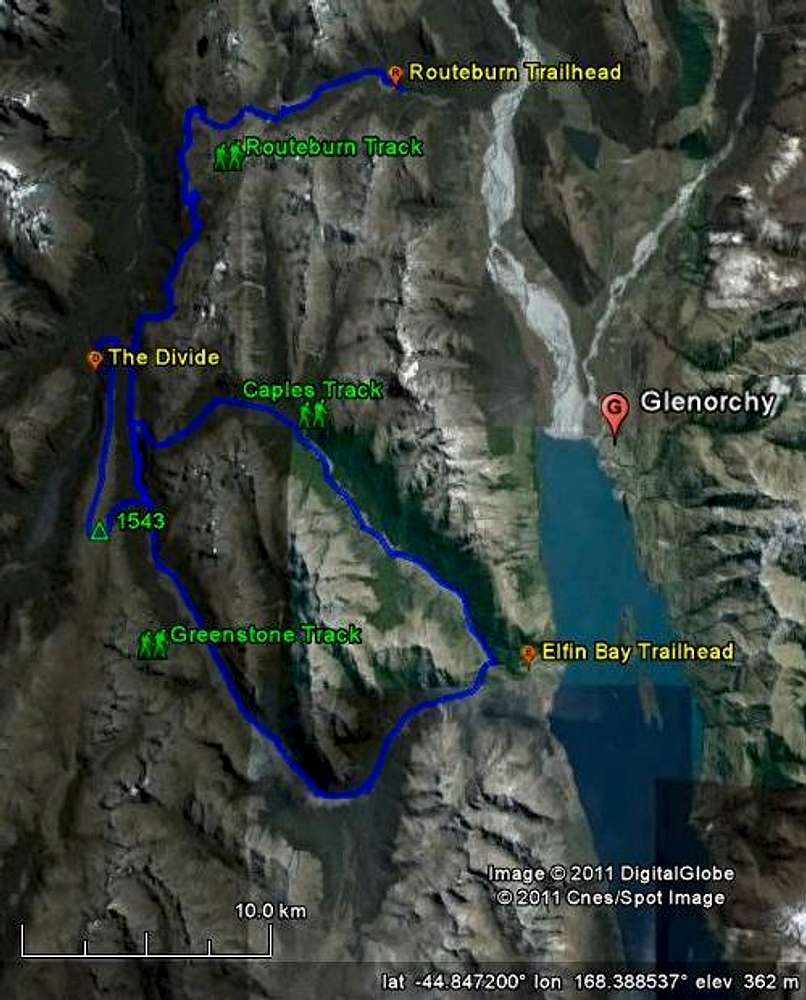
Map of the Routeburn, Caples and Greenstone Tracks
The Routeburn Track is a 32km Great Walk from the Routeburn Shelter to The Divide. The high point is Harris Saddle (1255m), well above the tree line, which is around 1000m. Because it is a Great Walk, the tracks are very well maintained.
The Greenstone Track is about 30km easy tramping between the trailhead at Elfin Bay and McKellar Hut, just south of Lake McKellar.
The Caples Track also connects Elfin Bay with McKellar Hut, but is substantially harder, especially when the route is wet, as it crosses McKellar Saddle, just above the tree line. The track is much rougher than the Routeburn.
If you want to start and return at Glenorchy, you can connect any two of these tracks. About 3km east of The Divide, you can leave the Routeburn Track and head south along Lake Howden and Lake McKellar for the Greenstone Track. Turn left before reaching Lake McKellar to go over McKellar Saddle for the Caples Track.
Finally, from McKellar Hut, there is a much longer and nicer alternative to the low route to The Divide along Lake Howden: via Point 1543 on the ridge of the Livingston Mountains.
Close to McKellar Hut, a sign points the way to an ascending trail heading south-west. When I was there, back in 2007, the trail gradually faded away higher up. The last bit to the high point was a bit of a scramble, but there must be an easier way up than the route I took. I went straight up the east face, and I suspect that it's better to do the final approach coming from the south. Once you've reached the high point, simply follow the very wide ridge north until you reach Key Summit and the Routeburn Track just beyond.


