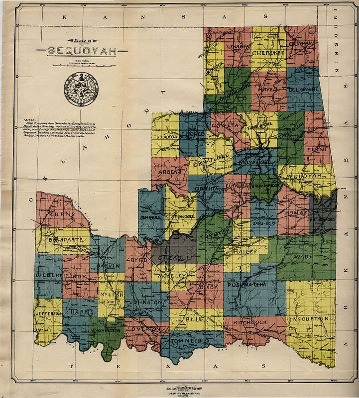
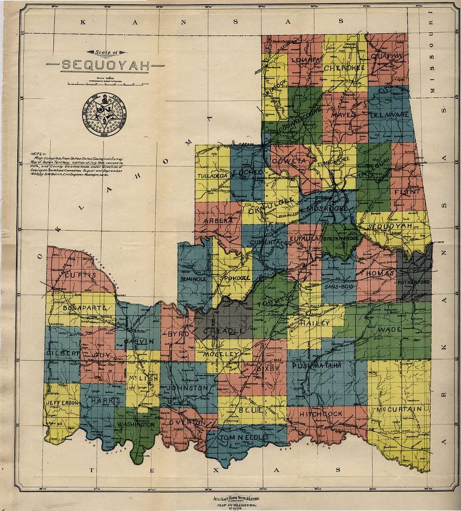
This map of the ‘State of Sequoyah’ - complete with a proposed State Seal - was compiled from the USGS Map of Indian Territory (1902), revised to include the county divisions made under direction of Sequoyah Statehood Convention (1905), by D.W. Bolich, a civil engineer at Muskogee. It was found at this page of the McCasland Digital Collection of Early Oklahoma & Indian Territory Maps at the Oklahoma State University Library.
http://www.library.okstate.edu/scua/collect/maps/index.htm
Provided for Information Purposes Only


