Introduction
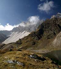
![Hoher Schlug (2776m) and Moarer Spitze (2806m), mirrored in one of the lakes of Obere Senner Egete]() Lake on Oberer Senner Egete Lake on Oberer Senner Egete |
„There is a Seven Lakes Loop“ – on the first night of our vacation I knew what was coming towards me. Judith had started reading our guidebooks and had come across a tour which I had found easy to overlook. But not anymore! The above sentence implicated unspoken messages.
Like: “If ever there is a perfect day we’ll do the hike.”
Or: “Don’t you think about climbing any summits unless you agree doing this tour.”
Well, sacrifices have to be made and I know when I’m licked. So the Seven Lakes Tour it was this time and I started to get into a frame of mind to accept it. We agreed on some weekend as the trailhead was in the valley we were living in and it is no good idea to venture out on the Brenner road or motorway on a weekend. The first two weekend slipped by without any lake making an appearance but the third and last finally promised to be the one. The weather report claimed high clouds and fog, vanishing during the morning. The scene was set and I started to prepare myself.
The trailhead in Maiern at the end of the Ridnaun Valley, where there are lots of mines. They made a museum out of the accompanying buildings with the possibility to visit the mines themselves, which are high up in the mountains. Part of our route would be along the access roads, which buses would be travelling in order to bring visitors up to the mines. Since it was the weekend I anticipated lots of traffic. Oh well!
The Right Frame of Mind
… started to fail me as I left the apartment and saw perfect weather at the mouth of the valley and the forecasted high clouds and fog at its end, where were planning to go. Add two narrow valleys with barely a view (or so I thought) one of which with bus traffic and you can imagine my mood swinging back to being annoyed. There was no use in complaining and I figured that the sacrifice of this day would see my own projects through afterwards so I drove the car to Maiern and started to prepare for the hike. The parking lot was already packed at 8:15 a.m., a sign of things to come?
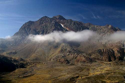
We decided to do the tour counter-clockwise in order to skip the morning traffic and maybe have an unperturbed view of a small canyon on the northern leg of the loop. We set out and almost immediately got swallowed up by trees and fog. After a while we found the entrance to the “canyon” which turned out to be a series of cascades but certainly no canyon. Still, taking this route we missed out on the road traffic and enjoyed a quiet half hour until we ran headlong into a flock of sheep being driven down-valley to their winter quarters.
We reached Aglsboden, a high valley at about 1800m, complete with hut and pastures. The valley floor was swampy, however, and we were glad that after a short while the path led out of the valley along its northern slopes. Still we hadn’t seen any sun and we seemed to be climbing directly into the fog. Indeed we soon lost sight of everything around us but the rocks at our feet. We passed two large parties of people snd I have to admit that from that time on we only saw two more people. My prediction of a crowded day thus turned out to be wrong…
A Glimpse of Sky
![Hochgewand (3196m) and Botzer (3251m)]() Hochgewänd with Botzer behind
Hochgewänd with Botzer behind
By now I was in a real dark mood. All my anticipations seemed to be true (I didn’t now about the lack of crowds yet) – a narrow valley, no views, bad weather, no summit. And now we were climbing through dense fog with cascades somewhere invisible at our feet. We closed in on Grohmann Hut at 2254m, one of the two huts which serve as bases for the ascents of Wilder Freiger and both Feuerstein summits. As we reached the plateau underneath the hut, a large cirque, filled with gushing water coming down from the glaciers from all sides, suddenly the fog cleared away on one side to reveal Hochgewänd and Botzer. And this was the direction we were to take from here. Maybe the decision to come here wasn’t as bad after all?
![Fernerbach Creek]() Crossing Fernerbach Creek
Crossing Fernerbach Creek
The next move called for descending onto the plateau and trying to cross the Fernerbach “creek” which is fed by glaciers all around the cirque. It comes rushing down the valley, noisily jumping from cascade to cascade. Luckily – the advantages of being of well travelled terrain – there is a hanging bridge spread across the waters so crossing is no issue. By missing to recognize an intersection we started hiking to the Obere Senner Egete, one of two possible routes to the highpoint of the tour, Egetjoch. Behind us the clouds finally broke away and in front of us everything was already bright and blue.
![Wilder Freiger]() Wilder Freiger Wilder Freiger | ![Hohe Wand (2968m)]() Hohe Wand Hohe Wand | ![Westlicher Feuerstein]() Westlicher Feuerstein Westlicher Feuerstein |
Lakes! Seven?
![Feuersteine and Aglsspitze]() Feuersteine and Aglsspitze in the perfect mirror
Feuersteine and Aglsspitze in the perfect mirror
We came across the first (and largest) lake, Trüber See. A green expanse at the base of Krapfenkarspitze but our upper route took us away to the west of it. We climbed a cirque at the base of Hochgewänd, which contains so many lakes that “Seven Lakes” certainly is an understatement. Add the creeks which come down from the glaciers in waterfalls and cascades and which suddenly slow down to wind across the shallow plain and you can get an approximate picture. By noon, when we lunched somewhere on the banks of one of these lakes, I was already feeling quite happy again, having forgotten any misgivings I might have had before.
![Obere Senner Egeten]() Obere Senner Egeten Obere Senner Egeten | ![Cotton Gras on Obere Senner Egete]() Cotton Grass Cotton Grass |
Several of the lakes serve as perfect mirrors for the mountains in their background. The colour palette between the brightly red rock (Glimmerschiefer we call it, micaceous schist), reflected in the green lakes and the deep blue sky is among the most beautiful nature settings I have ever seen. Yet there was more to come…
![Trüber See and Moarer Spitze]() Trüber See Trüber See | ![Krapfenkarspitze above Trüber See]() Trüber See Trüber See | ![Schwarzseespitze (2988m) and Timmelsspitze (3033m) above Hinterer Senner Egetensee]() Hinterer Senner Egetensee Hinterer Senner Egetensee |
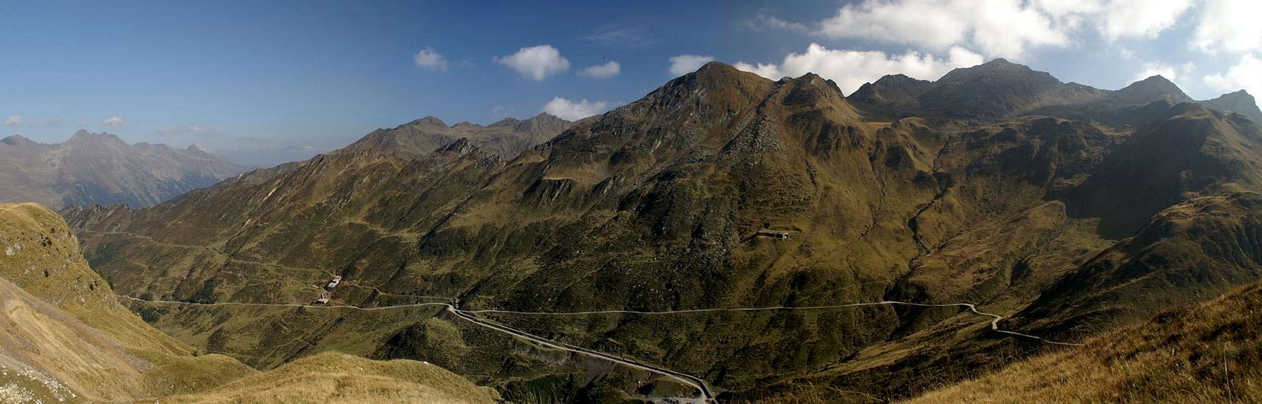
As we headed up to our highpoint, the Egetjoch Saddle, colours got even more intense with the brightly red bulks of Hochgewänd, Nock and Botzer looming above us. Schwarzseespitze and Timmelsspitze tower above the brightly green Hinterer Senner Egetensee and to the south the long brightly white ridge of Moarer Weißen startet to distinguish itself against the surrounding mountains. Finally we reached the saddle and where awarded with additional views towards the Zillertal Alps. In the south the Sarntal Alps were heavily covered with clouds and only few summits peeped out of the cover.
![Nock (3185m) and Botzer (3251m)]() Nock and Botzer Nock and Botzer | ![Nock (3185m), Botzer (3251m) and Hochgewand (3196m)]() Botzer Group Botzer Group | ![Hochgewänd]() Hochgewänd Hochgewänd |
The Marble Marvel
![Neither snow nor ice - it s marble]() Moarer Weißen mirrored in Moarer Egetensee
Moarer Weißen mirrored in Moarer Egetensee
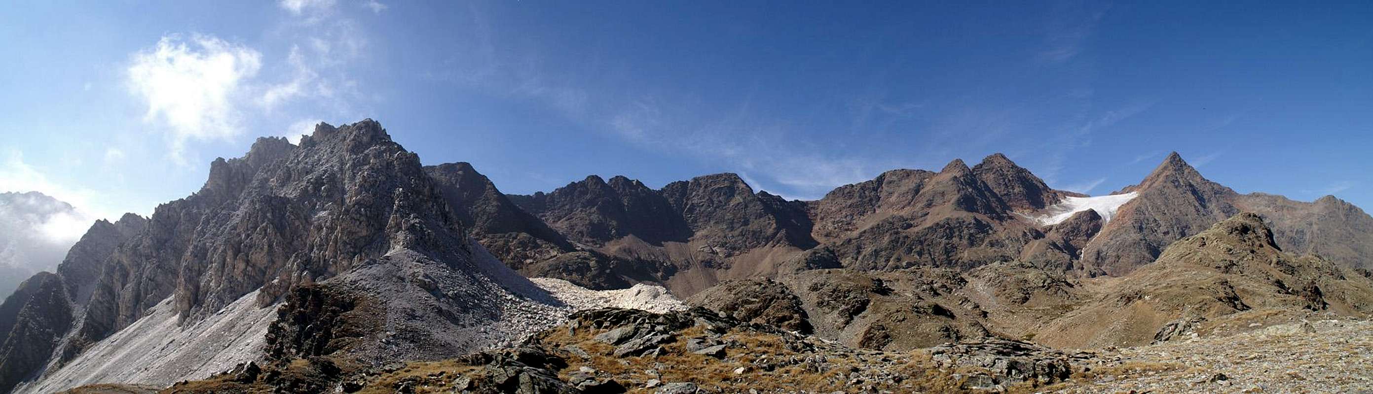
Yes, Moarer Weißen, the ridge stood out against everything around. As mentioned above, most of the mountains in this part of the Stubai Alps are made up from brightly red micaceous schist. However there are several exception of that rule. Most are limestone mountains, like Telfer Weißen or Weißwand but some are made up from marble like Mareiter Stein or Schneeberger Weißen. Most of the mountains carry their colour in their name (weiß = white) and Moarer Weißen is no exception.
However, its long ridge consists of blindingly white marble, which in the brightness of the early afternoon was absolutely dazzling. Our descending route used a path through a scree field – a marble scree field – between the mountain and yet another one of the many lakes. Moarer Egetensee is a deep blue and a sight in itself. Together with Moarer Weißen it is a real show! But decide for yourself.
![Moarer Weißen]() Moarer Weißen Moarer Weißen | ![Moarer Egetensee]() Moarer Egetensee Moarer Egetensee | ![Moarer Weißen]() Moarer Weißen Moarer Weißen |
Mining Facilities
Zünderspitze (2445m), Gleckspitze (2620m) and Hohe Ferse (2669m) |
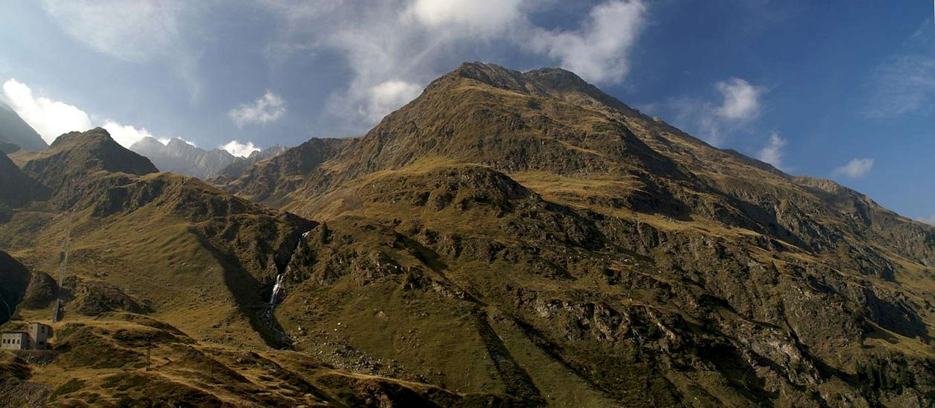
At this point we had already climbed more than 1600m but only two thirds of the tour were done. It was starting to get late, the sun was starting to slip behind the encompassing mountains and it was getting cold. We expected a long drag down the mountain, even more so since now we were entering the mining area. At first we remained on a mountain path, which – as our map told us – would lead to Poschaalm, where the main entry to the mines is located. We enjoyed the views as we could and wondered about the marble, which every now and then glistened out of the accompanying creek. It must have originated from Moarer Weißen but now we wer already far away from the mountain and still the white stuff called out for us.
But anyway, all things have an end – and so did our path to Poschaalm – we reached a point roughly 200m above it where we could see all the mining facilities stretch out beneath us. There were several lifts, several roads, all somehow directing down to the facilities in Maiern, were in former times the zinc and silver ore was processed. Up here, were we were, we could see the entry gates and one or two rail lines, which in German are called “Bremsberg” (Brake Slopes). I’m not sure what they were supposed to brake but I assume that the lifts in the mines somehow had to stop and this was done by dragging a heavy “train” up the slopes. The slope we were standing on definitely was steep and the line ran straight up. Rails being gone we started to hike down the slope, which turned out to be very hard on our already week and wobbly knees.
Egetspitze (2774m), to the left the straight line of the braking facility ("Bremsberg") of the Poschahaus Mine |
Once at the mining gate we inspected the tableaus they put up there and wondered about the sheer number of galleries which have been dog underneath the mountain. Actually the galleries run right through Schneeberg to come out on the Passeiertal Valley / Val Passira. And thanks to the diverse composition of the rock just about any kind of ore could be found here. We decided to take the road, regardless of any bus traffic, we were really starting to feel week around the knees now and the “Bremsberg” experience had only added to that feeling. To the right and left of the road we were accompanied by the posts of an old chair lift and we wished that it was still running. Three buses overtook us on our way down – not too bad as this last stage took about two hours to complete.
And in the end I had to admit that – summit or no – the day was a day well spent.
Moarer Weißen (2867m), Schwarzseespitze (2988m), Timmelspitze (3033m), Nock (3185m), Botzer (3251m) and Hochgewand (3196m) |


Comments
Post a Comment