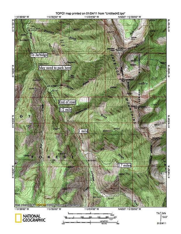
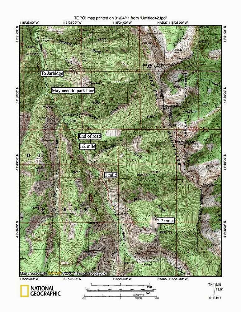
This map represents the route that we took to attain the summit. Since we were able to drive the last bit to the end of the road, we had about a 9.5 mile roundtrip effort with a bit over 4000 feet of elevation gain. If your vehicle can't get to the end of the road, you will need to hike from where you find the best place to park and that will add between two and three miles to your effort but not a lot of elevation gain. Once you leave the trail after crossing Dry Gulch Creek, there is no trail, it is cross country.


