There are few, if any, hikes I had undertaken before this one that I could justifiably label as “perfect”, but this is one hike that I most certainly could. On this particular day, I was blessed with great hiking partners, perfect weather, and some of the most impressive terrain I have yet to encounter in the mountains. The Wasatch, while providing easy access from a sizeable city, wasn’t a range I’d often mention in the same breath as other great mountain ranges, but this day single-handedly forced me to change my opinion. While my experience in the Alps, Tetons, and Glacier National Park is limited, each new view we encountered during the Beatout hike couldn’t help but remind me of those places. Ironically, this was the first big hike on which I forgot to bring my camera (and hence, had to resort to a lower quality phone camera). Even with it, though, I don’t think the pictures would have done justice to just how amazing it was to be there in person, scrambling across a gauntlet of serrated ridges as a steady stream of dew-filled clouds revealed one impressive granite monolith after another, all the while basking in the serenity that only an alpine environment can provide. The bottom line is that if anyone asks me why it is that I like to hike or climb, I can simply direct them to this trip report as a prime example why.
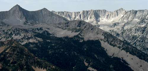
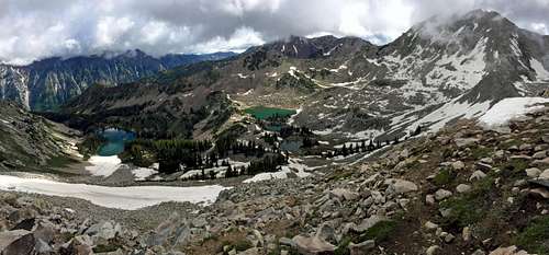
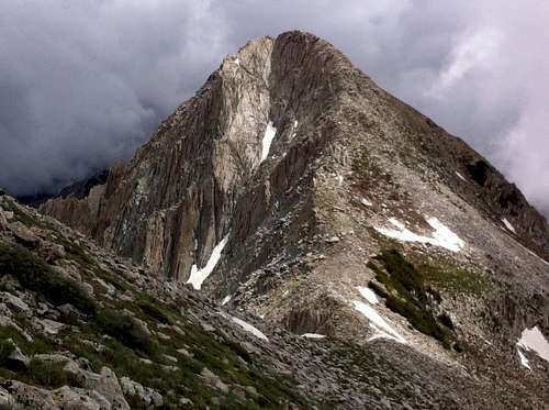
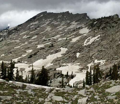
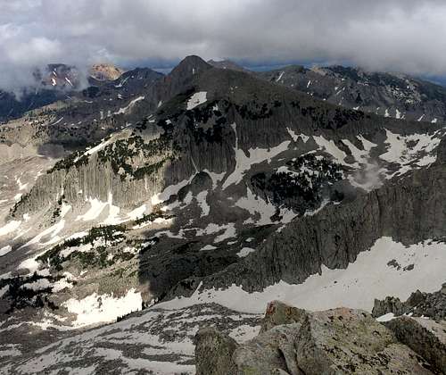
![Beatout north aspect]()
Northern aspect of peaks on the Beatout (from left to right: Pfeifferhorn, Upwop, Chipman Peak, & Thunder Mountain), with Lightning Ridge illuminated
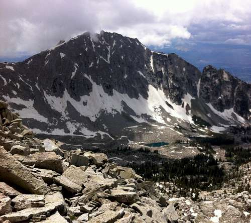
After realizing that I had already made it to the top of over half of the Wasatch 11ers, I figured I might as well summit the rest of them, and Thunder Mountain was one of the ones I hadn’t tried yet. The easiest way appeared to be the southern approach from the town of Alpine, but after doing the Bullion Divide and seeing how much better and varied the scenery was when doing a multi-peak ridge traverse, I was leaning towards trying the Beatout instead, which was reputed to be one of the most difficult hikes in all of the Wasatch. That way we’d be able to get in a lot more fun scrambling, as well. Despite the fact that this more difficult route would require us to lose over 7,000 feet of elevation as we made our way back down through the infamous Upper Bells Canyon, Lightning Ridge (which connects Pfeifferhorn and Thunder Mountain) was the main reason I wanted to do it. When viewed using the satellite view on Google Maps, it was apparent that this part of the Wasatch contained the largest contiguous area above tree line of any area in the range, and the exposed ridge in the middle of this sea of granite was something that I just had to see for myself.
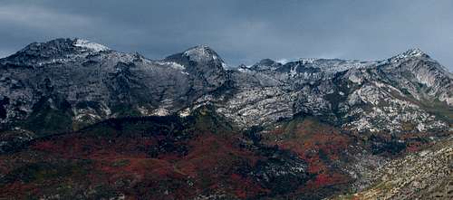
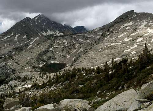
![Beatout south aspect]()
Southern aspect of Alpine Ridge (from left to right: Lone Peak, Bighorn Peak, Thunder Mountain, & Chipman Peak), the last two peaks of which are found on the standard Beatout Hike
It had been over 9 months since my last hike (I don't think the boardwalk around Silver Lake near Brighton counts), so David and I were both a bit hesitant about jumping straight into something as difficult as the Beatout for our first summer hike, and at first were leaning towards trying the easier Provo Peak. Leading up to the day which David and I had agreed upon for the hike, I kept a close eye on the forecast. To my delight, the daily highs of 80 and 90 degree temperatures gave way to a single day with highs in just the mid 70’s, and this was all I needed to pull the trigger on doing the Beatout. I’m a much bigger fan of the cold than the heat, and it was unlikely we’d get another summer day with temperatures this nice, so I figured it would actually maximize our chances of success to go for it when we had the chance (the dry summer heat, more than anything else, had made what would have been just moderate Wasatch hikes quite difficult for me in the past). Kendrick had dreamed of exploring up around the Thunder Bowl for several years but until now never had the opportunity, so he agreed to come along as well.
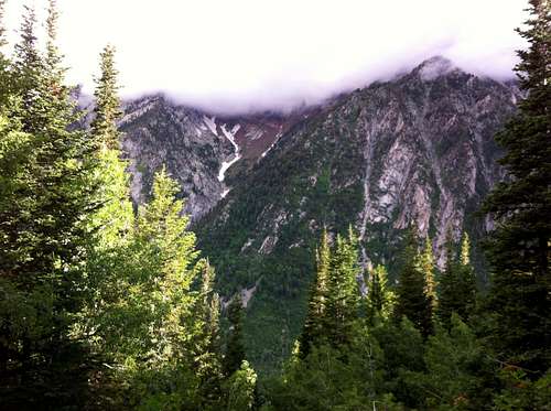
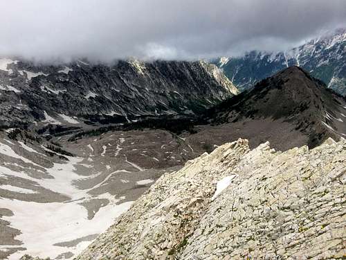
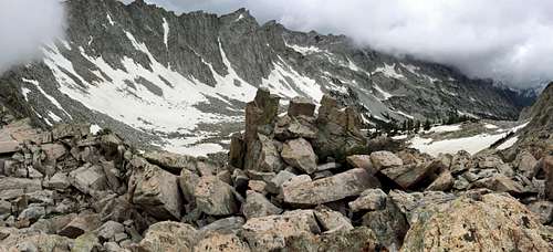
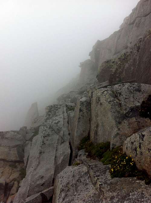
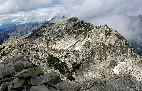
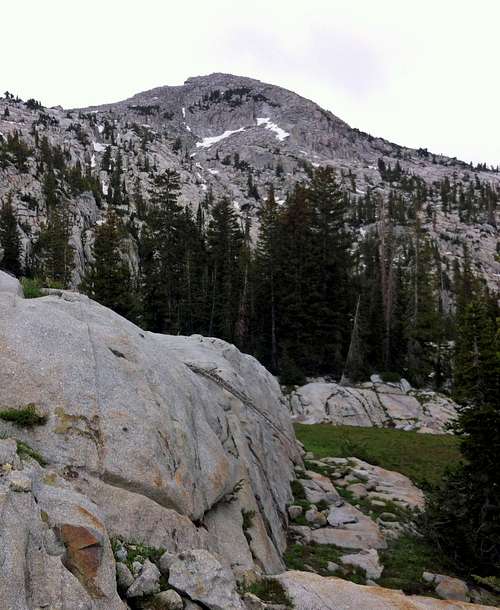
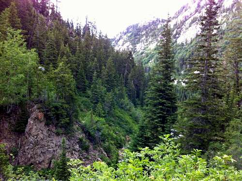
![Cliffs above Bells Canyon]() Cliffs above Bells Canyon
Cliffs above Bells CanyonAfter driving home from work the day before our hike through what for Salt Lake City would end up being a record-setting torrential downpour, I was nervous that the suddenly cooler temperatures and precipitation would result in a fresh batch of snow in the mountains, but to my relief after the clouds cleared I did not see any new snow at the higher elevations. That night the local weather forecasters changed their predictions to include scattered thunderstorms throughout the area during midday of our hike, which gave me a moment of pause, but I was optimistic that if we played our cards right then we’d be fine. I figured that after summiting Pfeifferhorn we could decide whether or not the conditions were suitable enough to commit to the long traverse across Lightning Ridge (which I figured was the last place we’d want to be stuck during a lightning storm).
Visiting an Old Friend (Pfeifferhorn)
![White Pine crossing]() White Pine crossing
White Pine crossing
The three of us met at the Bells Canyon Trailhead (the Granite Trailhead, to be specific) off of Little Cottonwood Canyon Road, and then drove my car up to the White Pine Trailhead to start hiking at 7:30. Upon loading up our packs and starting down the trail, I quickly realized that I had left my Canon Powershot camera at home, which was frustrating. The previous evening I had even completely charged up the two custom batteries for the camera, but after calling my wife I realized that I had left it on the couch when putting my boots on. After decent boots and water, my camera is hiking essential number three, so it felt weird having to resort to using my phone instead.
![Misty Cottonwood Ridge]() Misty Cottonwood Ridge
Misty Cottonwood Ridge
![Clouds over Tanners Gulch]() Clouds over Tanners Gulch
Clouds over Tanners Gulch
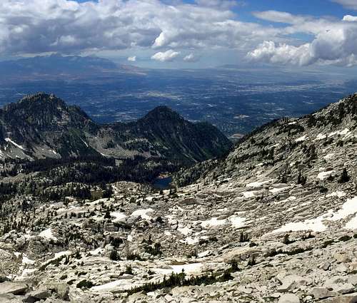
![LCC Mouth]() Little Cottonwood Canyon
Little Cottonwood CanyonDavid and I agreed that it would be best to maintain a leisurely pace to ensure that we didn’t burn ourselves out on the way up, so we let Kendrick go first. The towering peaks on the other side of Little Cottonwood Canyon were veiled by clouds, and would remain this way for most of the day, letting our imaginations guess as to the details of the rugged terrain hidden above. We reached the split for the trail leading towards the Red Pine Lake, and soon reached a nice vantage point from which we could look down towards the mouth of Little Cottonwood Canyon.
![Red Pine Lake]() Red Pine Lake
Red Pine Lake
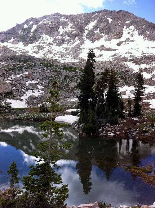
![White Baldy over Red Pine Lake]() White Baldy over Red Pine Lake
White Baldy over Red Pine Lake
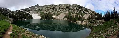
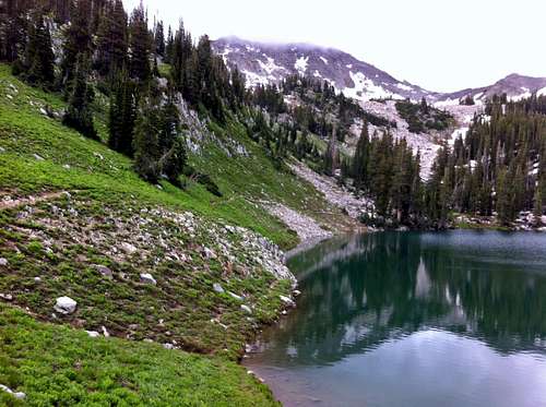
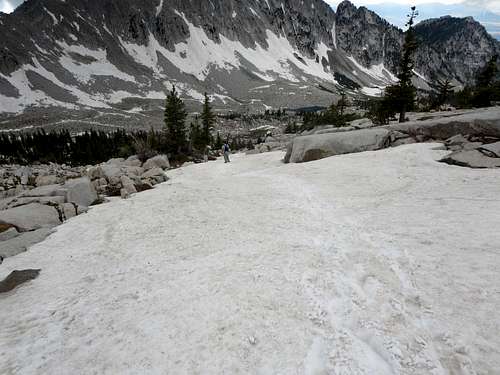
Despite our relatively slow pace, we were still able to pass a group of scouts, whose leaders said hi to us as we walked past. Above 9,000 feet as we got closer towards Red Pine Lake, we started running into several sizeable patches of snow, but I was hopeful it wouldn’t present any significant difficulties for us since it was likely these patches had just remained intact due to the shade from nearby trees. After passing some more scouts camping, we arrived at the lake, where we were greeted with a nice view of White Baldy and Little Pfeifferhorn, as well as an interesting snowfield running into the south end of the lake which resembled a sort of mini-glacier.
![Upper Red Pine panorama]() Upper Red Pine panorama
Upper Red Pine panorama
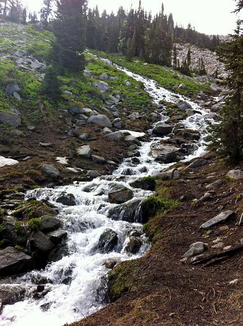
![Upper Red Pine run-off]() Upper Red Pine run-off
Upper Red Pine run-off![Upper Red Pine Lake]() White Baldy over Upper Red Pine Lake
White Baldy over Upper Red Pine LakeThe last time Kendrick and I had been up here (hard to believe it had been eight years for me and Kendrick, and four years for David) we went up too far to the left (southeast), going straight to Upper Red Pine Lake, so this time we made sure to keep a more southerly course on the trail that was now going in and out of the snow. We then made our way up a mini-ridge leading up the Alpine Ridge to the east of Little Pfeifferhorn. From what I remembered, the trail went straight up this mini-ridge to the top, but Kendrick and David were sure the correct path was further to the left (east), so due to the majority vote we dropped down into the snow to go that way instead. Another group ahead of us stayed on the mini-ridge, but with everything on this north-facing slope still covered in snow, it was impossible to tell where the trail really led.
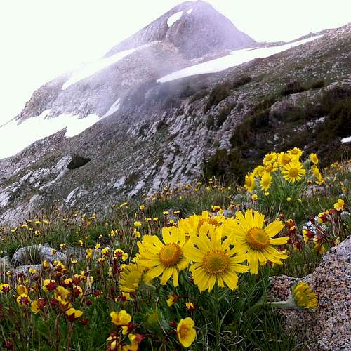
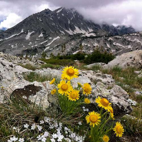
![Alpine Ridge wildflowers]() Alpine Ridge wildflowers below Pfeifferhorn
Alpine Ridge wildflowers below Pfeifferhorn
![Upper Red Pine Ridge]() Upper Red Pine Ridge
Upper Red Pine Ridge
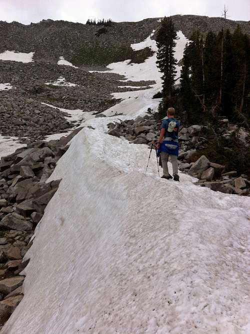
![Snow-covered ridge]() Snow-covered ridge
Snow-covered ridgeKendrick made quick progress up the snow with the help of his trekking poles, but since David and I didn’t have any, we decided to get onto a snow-free grassy section sooner rather than later. As the terrain steepened, my elbows occasionally knocked into the water bottles hanging from the sides of my pack, and a couple times this caused one of the bottles to unclip from my should strap and roll back down the mountain. The first time this happened on the snow, causing me to backtrack a few dozen feet to reclaim the bottle where it had finally stopped sliding.
![Pfeifferhorn east aspect]() Pfeifferhorn east aspect
Pfeifferhorn east aspect
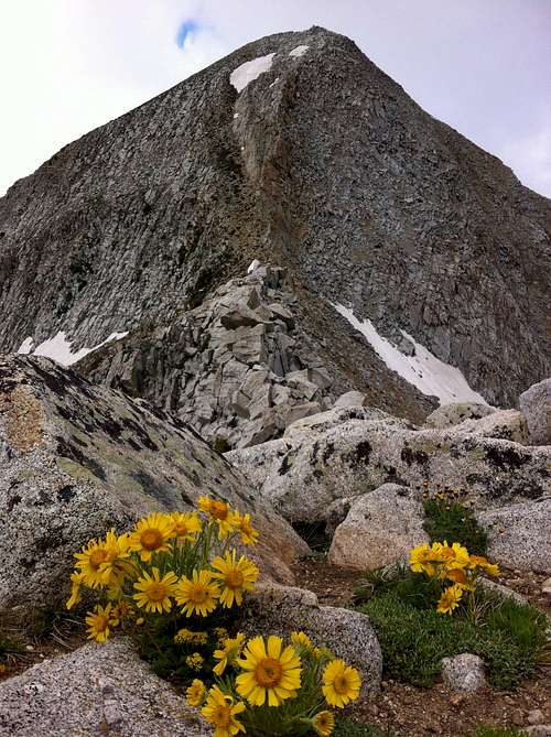
![Pfeifferhorn wildflowers]() Pfeifferhorn wildflowers
Pfeifferhorn wildflowers
![Dark clouds]() Dark clouds
Dark cloudsOff of the snow, we started scrambling up towards the top of the Alpine Ridge. Since the terrain was quite steep, I stayed a few yards to the left (east) of David so that any falling rocks wouldn’t make their way towards me, but one pizza box-shaped rock had other ideas. I watched as he shouted “Rock!” and thought I’d be fine staying put, but the rock started making a hard sideways turn towards me as it came rolling down the slope. I ran the opposite direction to put some more distance between me and the rock, making sure to keep an eye on its trajectory, which was a good thing, since after running to the side it missed me by just a few feet. With no harm done, I huffed and puffed the rest of my way up to the ridge to join David and Kendrick.
![East ridge scramble]() East ridge scramble
East ridge scramble
![White Baldy & Alpine Ridge]() White Baldy & Alpine Ridge
White Baldy & Alpine Ridge
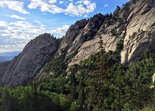
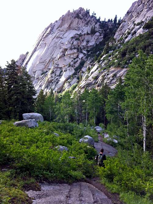
From up on the ridge, White Baldy looked quite impressive to the east. Last fall we climbed that one from the other east side, but the west ridge looked like a lot of fun so I figured I’d have to come back and try it some time. Our views to the south were still obscured by clouds, but that just added to the overall alpine feel of the hike. The group ahead of us made it up the mini-ridge behind us, and I stopped to answer some of their questions about the Pfeifferhorn. We then went through some nice fields of yellow wildflowers as we made our way closer to our first peak of the day.
![Steep east face]() Steep east face of Pfeifferhorn
Steep east face of PfeifferhornThe view of Pfeifferhorn from its east ridge is one I’ll never tire of, and after all of these years I can still say that it is probably my favorite standalone peak in all of the central Wasatch. Both the ridge and the face look intimidating, but once you get on them you realize they’re easier than they look. For whatever reason, the easiest path moving towards the peak often seemed to present itself by dropping a few feet below the top of the ridge on the north side. After a short ridge scramble we made our way up the east face, bypassing a lingering patch of steep snow by staying to the left, and around 11 am we made it to the top.
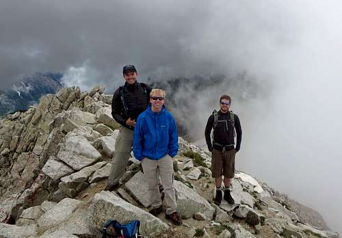
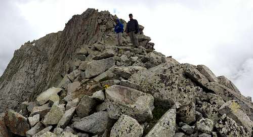
![Pfeifferhorn summit shot]() The Fellowship of the Beatout (Brandon, David, & Kendrick) on Pfeifferhorn summit
The Fellowship of the Beatout (Brandon, David, & Kendrick) on Pfeifferhorn summit
Climbing in the Clouds
![Hogum Gulch]()
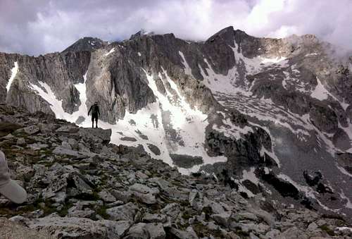
The deep breath before the plunge ... contemplating whether we were ready to commit to venturing farther along the ridge. Below is the seldom-visited Hogum Gulch.
The temperature at the top was quite cool, which prompted me to don my insulating jacket and gloves for the first time. Usually I never wear them, but I came prepared this time since the potential was there for us to experience much colder conditions today. Kendrick decided to pull up the weather app on his phone to check on the forecast nearby, and as he did so I was silently hoping that everything checked out, since a dark gray cloud coming in from the west looked a bit ominous. Fortunately, the app showed that all of the lightning was isolated in an area of the Wasatch to the north of Bountiful (about 30 miles north), so we were safe to continue our adventure. After second breakfast, we said good luck to the group behind us who had just come up, who had a slightly puzzled/concerned look when they saw that we were continuing down the other side of Pfeifferhorn instead of going back down the way we had come up.
![Pfeifferhorn northwest aspect]() Pfeifferhorn northwest aspect
Pfeifferhorn northwest aspect
![Pfeifferhorn descent]() Pfeifferhorn descent
Pfeifferhorn descent
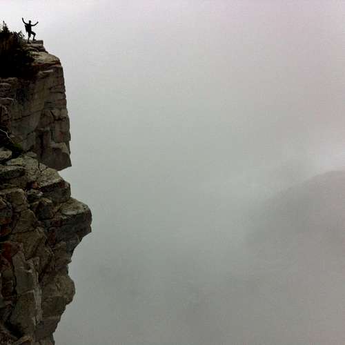
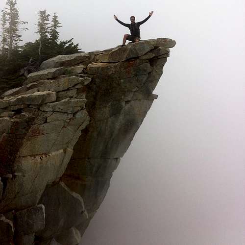
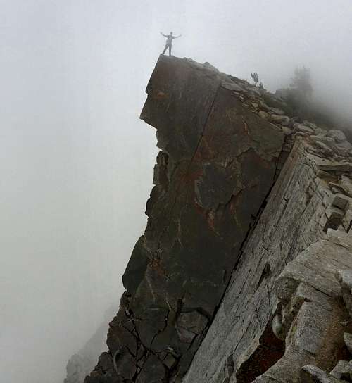
![Precarious photo op]() Precarious photo op
Precarious photo op
![Committing to the route]() Committing to the route
Committing to the route
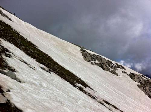
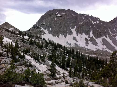
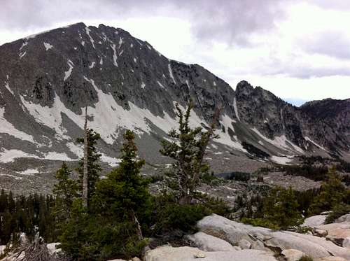
The west ridge of Pfeifferhorn had some fun, easy down climbing, and gave us nice views of the cliffs dropping down from the northwest side of the peak as we made our way down. At one point we came to a larger boulder that forced us to detour slightly to the south, but for the most part we were able to stay directly on the west ridge. As we made our way down to the saddle and back up to the summit of Upwop (“Unnamed Peak West of Pfeifferhorn”), our second summit of the day, the sun started playing peak-a-boo with us, casting some interesting light on Lightning Ridge and Thunder Mountain to the west of us.
![Pfeifferhorn from Pfeiff/Upwop saddle]() The Lonely Mountain
The Lonely Mountain
![Pfeifferhorn from Upwop]() Pfeifferhorn from Upwop
Pfeifferhorn from Upwop
![Chipman Peak from Upwop]() Chipman Peak from Upwop
Chipman Peak from Upwop
![Up to Upwop]() Up to Upwop
Up to Upwop
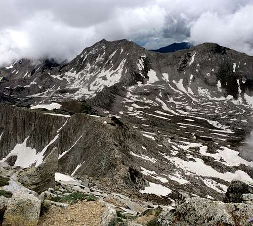
Below us to the northwest was the seldom-visited Hogum Gulch, below the impressive cliffs of Lightning Ridge. With all of the snow still present on these north-facing slopes, it looked like we were hiking in the Wind Rivers. The views on this part of the Alpine Ridge did not disappoint, and luckily for us, they would only get better as the day went on.
![Lighting Ridge & Thunder Mountain]() Lighting Ridge & Thunder Mountain
Lighting Ridge & Thunder Mountain
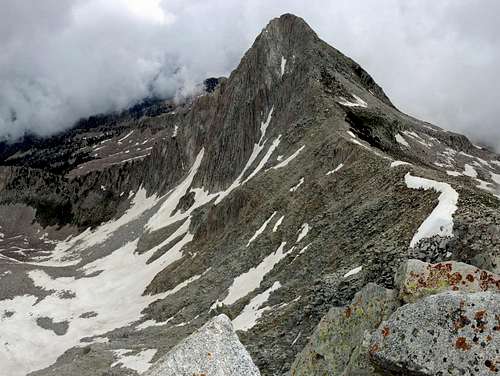
![Thunder Mountain]() Thunder Mountain glimmering like a spike of pearl and silver
Thunder Mountain glimmering like a spike of pearl and silver
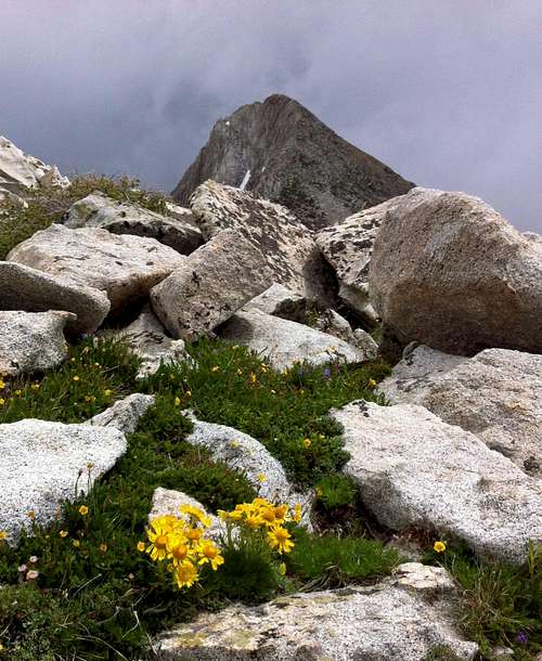
![Pfeifferhorn west wildflowers]() Another gratuitous wildflower pic
Another gratuitous wildflower picHalfway down to the next saddle on our way towards Chipman Peak and Lightning Ridge, I realized that I had left my gloves on the summit of Upwop, but since I knew this would be a long day and would still require a lot of energy I made the tough decision to leave them behind. Off to the south, Box Elder Peak and Mount Timpanogos were still shrouded in cloud cover, and the only thing we could see in that direction was the occasional scenic pond (usually found in little pockets/oases of green, surrounded by large granite slabs). The clouds seemed to be getting stuck on the south side of the Alpine Ridge, which made for some awesome scenery. To the north we had great views of Lightning Ridge, and to the south, the wall of clouds made it seem as if we were traversing at the top of some bottomless cliffs, never quite knowing what was beneath us or how far down solid ground was.
![Majestic Pfeifferhorn]() Majestic Pfeifferhorn
Majestic Pfeifferhorn
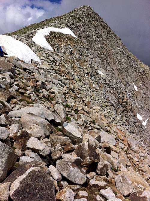
![Best Beatout scrambling]() Awesome scrambling coming up
Awesome scrambling coming up
![Down to the saddle]() Down to the saddle
Down to the saddle![Misty oasis]() Misty oasis
Misty oasis
At the low point of the ridge between Pfeifferhorn and Thunder Mountain we took a quick break, where I popped a couple Advil to help combat the elevation along our prolonged ridge scramble above 10,500 feet.
![Lightning Ridge preview]() Lightning Ridge preview
Lightning Ridge preview![Across the misty ridge]()
Looking forward to our ridge traverse ...
![Up the misty ridge]() ... in the mist
... in the mist
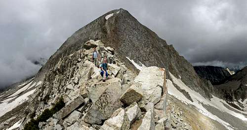
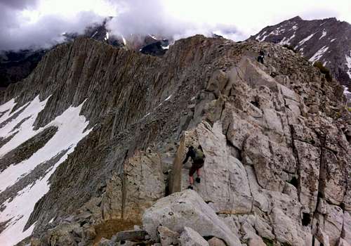
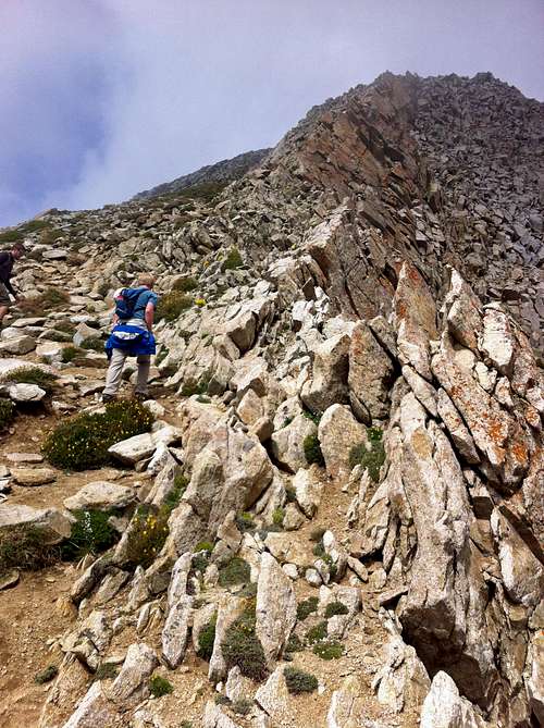
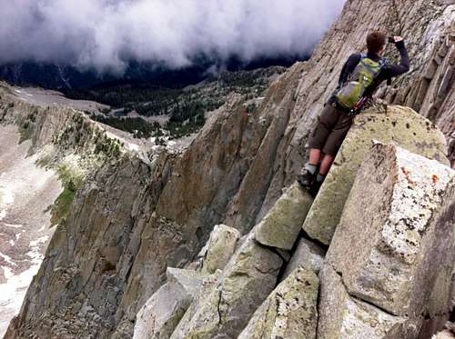
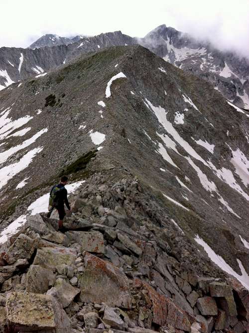
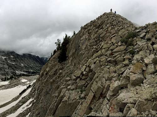
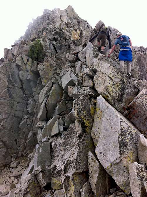
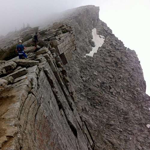
Making our way up toward Chipman Peak is where we encountered probably our most exciting scrambling of the day. The terrain was exposed on both sides, with the clouds making it seem as if a slip would have resulted in quite a long freefall, but the terrain never exceeded class 3 in difficulty.
![Ridge from Upwop]()
Looking back at Upwop Peak from the saddle between it and Chipman Peak
![Fun Beatout scrambling]()
Forth Eorlingas!
As we topped out on a more gentle section of the ridge, the clouds to the south parted, granting us some awesome views of Chipman Peak and Utah Valley.
![Box Elder Peak from Chipman Peak]() Box Elder Peak and a far green country
Box Elder Peak and a far green country
![Chipman Peak]() Chipman Peak
Chipman Peak
![Lone Peak from Chipman Peak]() Lone Peak from Chipman Peak
Lone Peak from Chipman Peak
![Lightning Ridge south aspect]() Lightning Ridge south aspect
Lightning Ridge south aspect
With the Advil kicking in quickly and the others feeling good as well, we decided to make the short side trip to the top of Chipman Peak, passing several bright white and yellow wildflowers as we made our way to the top. Off to the west were some great views of Lone Peak and Lake Hardy below, surrounded by a sea of light granite, to the south were the bright green slopes of Box Elder Peak and Mount Timpanogos, and to the east every now and then the Pfeifferhorn would tease us with the occasional glimpse through the clouds. We marveled that views like this could exist so close to Salt Lake City, and that most people were completely oblivious to them down below.
![Granite Giants]() Granite giants Lone Peak and Thunder Mountain over Lake Hardy
Granite giants Lone Peak and Thunder Mountain over Lake Hardy
![Pfeifferhorn from Chipman Peak]() Upwop and Pfeifferhorn from Chipman Peak
Upwop and Pfeifferhorn from Chipman Peak
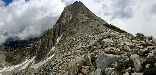
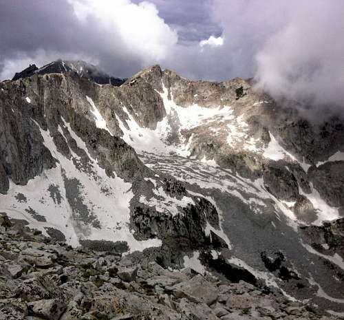
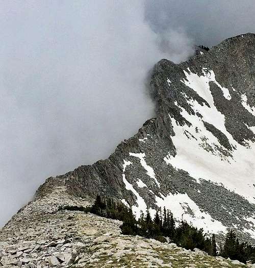
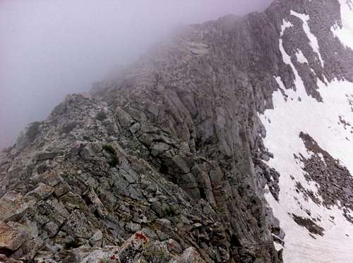
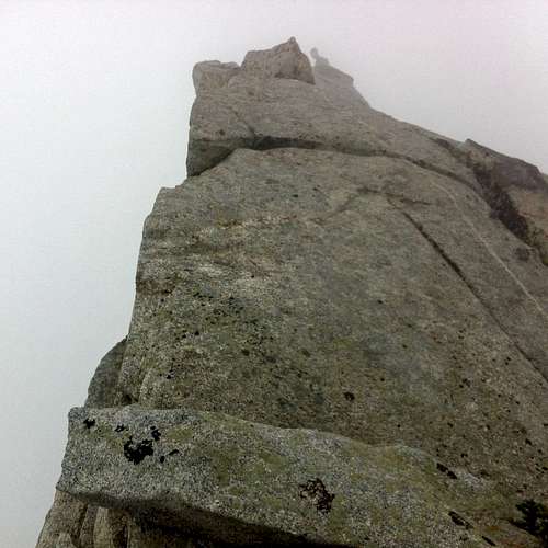
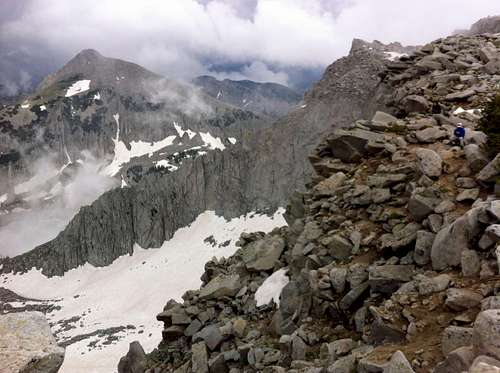
Next up was Lightning Ridge, where we achieved some of the most impressive vantage points of the day. At this point a new group of clouds rushed in from both sides of the ridge, but for the time being it was still easy enough to see a few hundred yards in the distance towards the next pinnacles along the way.
![Lightning Ridge in clouds]() Lightning Ridge in clouds
Lightning Ridge in clouds
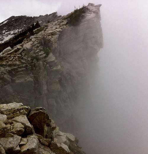
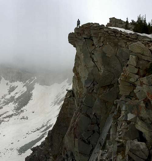
![Lightning Ridge eastern end cliff]() Lightning Ridge eastern end cliff
Lightning Ridge eastern end cliff
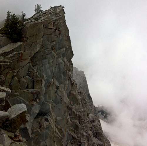
![Lightning Ridge spire]() Lightning Ridge spire
Lightning Ridge spire
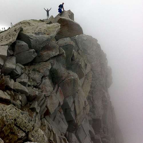
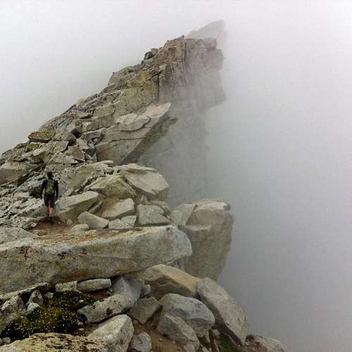
Each time we topped out on a new one we’d get some more hero shots, but we were always mindful of the sheer drops of several hundred feet off to the north. The cloud cover became denser as we made our way across Lightning Ridge, with only occasional views opening up to the east of the lower slopes of Upwop.
We felt like clever hobbits to climb so high:
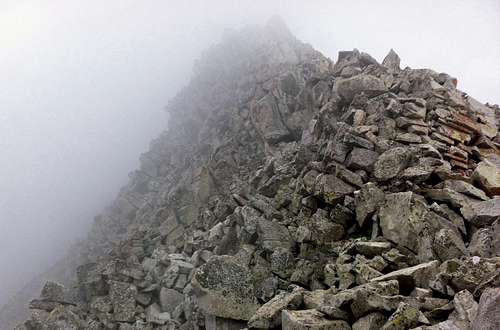
![False Summit]() False Summit
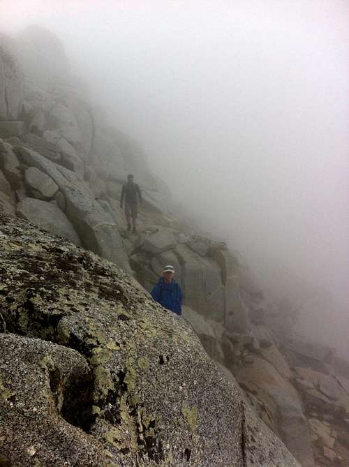
False SummitHalfway across this part of the ridge we were completely socked in by fog, and at this point we experienced some light rain and then hail. Up until now it had been easy to walk straight along the edge of the ridge and the cliffs since the south end was still a gradual slope, but with the ridge becoming more knifey with large slabs and wet boulders, it became more dangerous to keep this up (at one point we had to jump across a small gap while being careful to not bash our heads on an overhanging boulder), so we decided to trace our way a few dozen feet below the top of the ridge on the south side across a series of exposed ledges. Each time we came across a new pinnacle in the fog we wondered if it was the summit of Thunder Mountain, but a quick scan of the immediate terrain made me figure that it couldn’t have been, since we were on a knife edge and Thunder Mountain supposedly had a much more gradual sloping three-sided, pyramid-shaped profile, at least according to the topo map I’d printed out.
![Misty ridge traverse]() Misty ridge traverse ... stay on target!
Misty ridge traverse ... stay on target!
![Upwop through clouds]() Upwop through clouds
Upwop through clouds
![Slick slabs]() Slick slabs
Slick slabsKendrick busted out his GPS device and confirmed that we were only halfway across the ridge to Thunder Mountain, and at this point I had a fleeting feeling of doubt that we’d make it to Thunder Mountain under the current conditions. If not for my previous knowledge of the forecast stating that the skies should've started clearing by now, I would've feared for our safety in finding our way off Lightning Ridge and all the way back down Bells Canyon with only a couple dozen yards of visibility and the granite becoming ever slicker from the rain and hail. In the middle of Lightning Ridge we were now in the most isolated area of the Wasatch (retreating back across Pfeifferhorn, continuing towards Bells Canyon, or bailing down towards the town of Alpine to the south would all take about 6 hours for us from here). I held on to the hope that the previous night’s forecast would eventually pan out though, since it was getting close to 3 pm, and they said the cloud cover around Salt Lake City was supposed to disperse in the early afternoon.
![Lightning Ridge ledges]()
To know the right way to go without a topo map or GPS ...
![David & Kendrick on ledges]() ... even the wisest cannot tell
... even the wisest cannot tell
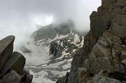
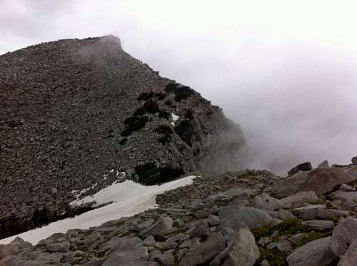
Gradually the precipitation stopped and the cloud cover started to dissipate enough that upon rounding the corner of a steep granite slab, I could finally make out the faint shape of what could only have been the summit of Thunder Mountain, several hundred feet above us in the distance. We had started branching off onto different ledges at this point, but eventually regrouped at the saddle below the final section of steep terrain below Thunder Mountain, just in time for the clouds to start clearing to give us an awesome view of Upwop and Pfeifferhorn to the east.
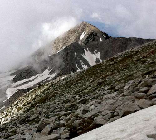
![Thunder Mountain summit]() The gray rain-curtain rolls back, and then you see it ... Thunder Mountain!
The gray rain-curtain rolls back, and then you see it ... Thunder Mountain!
![Thunder Mounain above Hogum Gulch]()
Hogum Gulch visible far below
Excited by the fact that we were in the clear, I took the lead for the remaining scramble to the top of Thunder Mountain, our fourth and final summit of the day, and my primary goal. Once on top we had an awesome 360 degree view, ranking at the top of summit views I’ve seen not just in the Wasatch, but anywhere. I would have signed the register in the summit mailbox, but unfortunately there was no pen inside. We had truly lucked out with perfect weather and awesome conditions, and so far we all still had plenty of energy. It was so peaceful and secluded that I wouldn’t have minded spending all afternoon on top of Thunder Mountain, but we knew that we still had a long way to go to get back down off of the mountain.
![Pfeifferhorn from Lightning Ridge]() Pfeifferhorn from Lightning Ridge
Pfeifferhorn from Lightning Ridge
![Pfeifferhorn from Thunder Mountain]() Pfeifferhorn from Thunder Mountain
Pfeifferhorn from Thunder Mountain
The Long Way Down
![Lone Peak from Thunder Mountain]() Lone Peak from Thunder Mountain
Lone Peak from Thunder Mountain
![North Thunder Mountain]() North Thunder Mountain
North Thunder Mountain
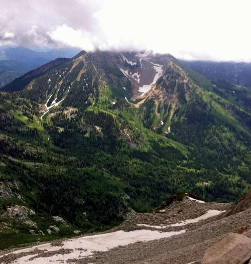
![Box Elder & Timp]() Box Elder Peak & Mount Timpanogos
Box Elder Peak & Mount Timpanogos
While the upper reservoir didn’t look too far away below us, it would take quite a while for us to reach it. We followed the advice from the route description to head back down the south/southwest slopes of Thunder Mountain to avoid getting cliffed out, and soon encountered several snow fields, which offered some fun boot skiing. We were having so much fun sliding down the snow towards the basin below Lone Peak that at one point we went a little too far and had to backtrack a bit further to the south to find a more gradual way down next to a small waterfall. We followed our map, which proved invaluable for route-finding and was spot on in terms of granting us the easiest way down.
![Utah Lake from Thunder Mountain]() Utah Lake ...
Utah Lake ...
![Salt Lake Valley from Thunder Mountain]() ... and Salt Lake Valley from Thunder Mountain
... and Salt Lake Valley from Thunder Mountain
![Snow slide]() Snow slide
Snow slide
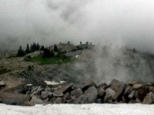
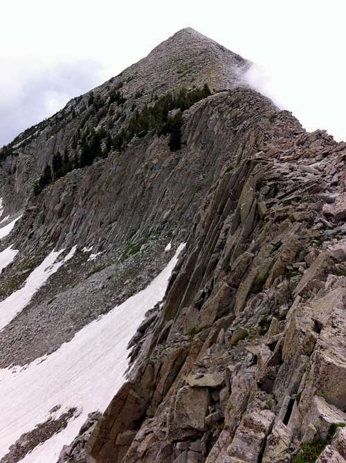
We eventually got below the steepest granite slabs below Thunder Mountain to a point that was more flat, walking through some scenic meadows that reminded me of terrain you’d see in the Uintas, except that here we had an awesome view of Bighorn Peak and Lone Peak towering above us on the other side of Upper Bells Canyon. The grass, dirt, and soft pine cone needles were a nice change for our now tired feet. Proving useful as well was the occasional stack of cairns. We stayed just below the steep western slopes of Thunder Mountain to avoid losing too much elevation too quickly, and were glad we did when we discovered that the correct path would lead us to a small notch in a ridge directly above and to the south of the Upper Bells Reservoir.
![Bighorn Peak over Upper Bells]() Bighorn Peak ...
Bighorn Peak ...
![Lone Peak over Upper Bells]() ... and Lone Peak over Upper Bells
... and Lone Peak over Upper Bells
At this point we had a little route-finding hiccup, despite our best efforts in constantly assessing our surroundings and consulting the map, GPS, and route description. Above the reservoir was another snow field which we gladly started sliding down, perhaps a bit too quickly, because a couple hundred feet above the reservoir we found it very difficult to maintain our elevation above the water (we followed the advice to stay above and to the left/west of the reservoir) due to the very steep terrain. The map still showed that we should stay below the ridge crest to the west of the reservoir, but it may have been easier to get on top of the ridge instead.
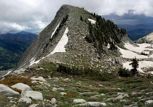
![Thunder Mountain west aspect]() Thunder Mountain west aspect
Thunder Mountain west aspect
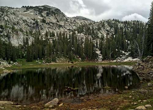
![Pond below Lone Peak]() Pond below Lone Peak
Pond below Lone Peak
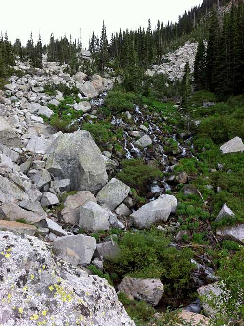
This marked the start of our struggles in beating our way out of Upper Bells Canyon (I guess this is where the Beatout route gets its name). We had to re-ascend the ridge to the west of us, using any tree branches we could find to get up the steep and muddy 70-degree slopes. I slipped quite a few times but luckily didn’t get too dirty in the process. David lost his glasses at one point as well, which we figured must've gotten knocked off the top of his head by one of the many branches we had to duck under. Eventually, closer to the top of the ridge just to the west of the upper reservoir we spotted some more cairns, and at this point the route-finding down to the north shore was easy enough. Across the water we spotted a tent, marking the first sign of other people since we were on the summit of the Pfeifferhorn.
![Upper Bells Reservoir]() Upper Bells Reservoir
Upper Bells ReservoirAt the north shore there was now a very visible trail, but this was fool’s gold as it promptly disappeared shortly thereafter. We continued down the drainage, staying slightly west of the runoff from the reservoir, and despite the fact that this was our first time up here and there was often no obvious way to get down or any cairns, I felt we performed quite admirably in our route-finding. On our way down, we encountered a mixture of boulders, smooth granite slabs, swampy meadows (the previous night’s rain probably being the main contributor), and dense bushes and trees to navigate. Luckily, we never had to beat our way through any thick vegetation though, as we were always able to find a way around if we took a few seconds to reassess our position. The scenery all around us was very green and lush, but due to the difficult terrain we had to keep our eyes down when not looking for the best route, which prevented us from enjoying the scenery as much as I would have liked. The route we took seemed to be the path of least resistance, but even with careful route-finding I doubt I’d be able to duplicate it on a return trip. Having mud stuck on the bottoms of my shoes also made descending the many granite slabs a slippery challenge.
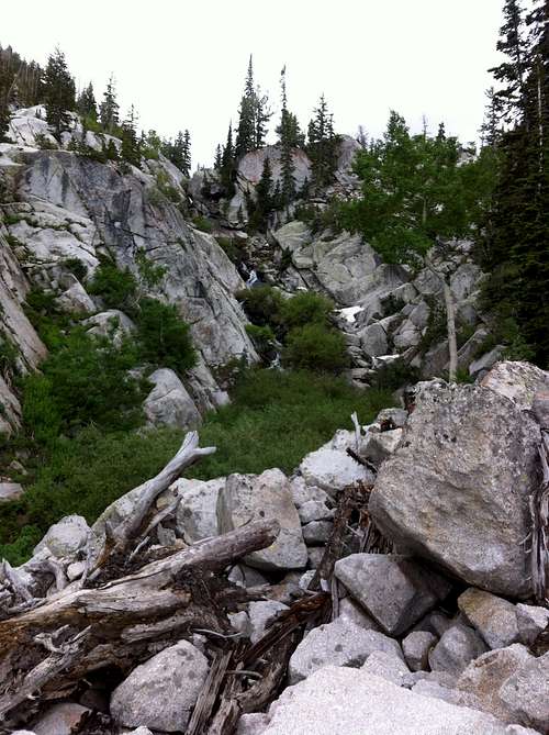
![Upper Bells terrain]() Some of the typical terrain we encountered ...
Some of the typical terrain we encountered ...
![Upper Bells run-off]() ... in Upper Bells Canyon
... in Upper Bells Canyon
![Green Bells Canyon]() Greenery galore
Greenery galoreWe finally found an identifiable trail at the point where the run-off from the upper reservoir joined with a stream coming down in parallel from the west side of Upper Bells Canyon, and it was refreshing to know that now we had lost over half of the 6,000 feet of elevation from Thunder Mountain to the Bells Canyon Trailhead, and now just had half of that to go on an actual trail. We took one last break, during which I finished my snacks (and enjoyed some of the jerky that Kendrick had brought along) and distributed some Advil to help ease the descent. Upon getting off of the log we’d been sitting on, my feet suddenly felt like they were on fire, so I decided to take off my boots to inspect. Some big blisters had begun to form under my big toes, but the main problem was that my feet were completely soggy and soaked (they had that wrinkly look as if I’d been in a pool or tub all day). I’m not sure if it was all from sweat or from water spilling over the tops of my boots during my traipse through one of the marshy sections up above, but luckily I had brought a pair of low-top athletic cotton socks to put under my wicking socks, which helped keep my feet dry the rest of the way down (this was the first time I’ve brought extra socks, which I’m so glad I did in this case, since my feet would have gotten thrashed on the way down, otherwise).
![Bells Canyon granite]() Bells Canyon granite
Bells Canyon granite
![Bells Canyon scenery]() Almost to the waterfall
Almost to the waterfall
On the way down, Kendrick filtered some water (I had brought just enough that I finished my own four liters right at the bottom), and we ran into a few people on their way up Bells Canyon for an evening hike. One guy asked how much further it was to the upper reservoir, and after telling him the blunt, honest truth about the difficult terrain above him, he admitted that he’d probably just go until the end of the trail instead. We passed a couple more tents as well. Upper Bells Canyon is definitely a good place to find seclusion and awesome scenery, but we all agreed that it’s not somewhere we’d personally want to carry heavy packs for camping, due to the steepness and rough terrain. Even in the spots where there is a trail, it’s more like walking down steep stairs (if those stairs were designed by a drunkard).
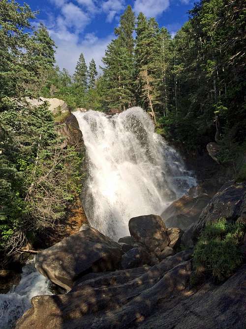
![Lower Bells Canyon waterfall]() Lower Bells Canyon waterfall
Lower Bells Canyon waterfallWe tried finding the upper waterfall, which Kendrick had not seen on his previous hike up Bells Canyon, but never saw it (we weren’t sure if it was just seasonal and dried up by the summer or was somewhere farther off the trail), but since we just wanted to get down we didn’t worry too much about missing it. The lower falls (which I’d visited on a family hike the previous spring) were still going strong though, so we took a minute to enjoy the mist before the remainder of our hike down. The relentlessly steep trail started taking its toll on our legs, and part of me wished I’d brought along trekking poles like Kendrick. Eventually we made it to the lower reservoir and finally the trailhead, just as the sun was about to drop behind the Oquirrh Mountains on the other side of the Salt Lake Valley. David drove back up to Logan, while Kendrick drove me back up to the White Pine Trailhead to pick up my car. Earlier on the way down we mentioned that it might be nice to eat out somewhere together after the hike, but since it had taken a bit longer than we’d anticipated, David and I had to get back to our families.
![Bells Canyon Lower Reservoir]() Lower Bells Reservoir
Lower Bells ReservoirThe next few days my quads felt a bit like butter scraped over too much bread, but my thoughts were constantly drawn towards the amazing terrain we encountered on the Beatout hike, especially between Pfeifferhorn and Thunder Mountain along Lightning Ridge, where we did not see another soul. I knew that it would be a fun hike, but I was honestly floored by how fun the scrambling was, how grand and rugged the views were, and how lucky we were with the weather (due to the cloud cover, we didn’t have to apply sunscreen even once). We timed it just right in terms of finding a day where there was still enough snow to add to the scenery and make some parts of the hike a little easier, but not enough to add any technical difficulty. All in all, I’d say it was the most enjoyable day hike I’ve ever done, even taking into consideration the challenging descent, and we used every ounce of summer daylight to do it (to not get burned out on our first hike of the summer we took a nice leisurely pace with several snack breaks for soaking in the scenery and ended up taking just over 13 hours, although we could easily have done it in under 12 if we’d gone faster). It will be hard to top this one, but maybe sometime I’ll be lucky enough to have another day as good as this one in the mountains.
Beatout Stats
DISTANCE:
13 miles one way
WHITE PINE TRAILHEAD:
7,640 feet
PFEIFFERHORN ELEVATION:
11,326 feet
UPWOP ELEVATION:
11,137 feet
CHIPMAN PEAK ELEVATION:
10,954 feet
THUNDER MOUNTAIN ELEVATION:
11,154 feet
BELLS CANYON / GRANITE TRAILHEAD:
5,200 feet
ELEVATION GAIN / LOSS:
5,000 feet / 7,440 feet
DIFFICULTY:
Class 3
TIME:
13 hours
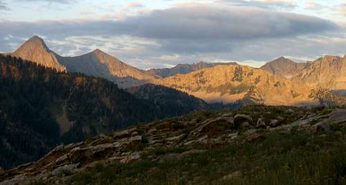
![Alpenglow on Alpine Ridge]() Alpenglow on Alpine Ridge, with Pfeifferhorn on the left and Thunder Mountain on the right
Alpenglow on Alpine Ridge, with Pfeifferhorn on the left and Thunder Mountain on the right


Comments
Post a Comment