From Torino, Milano, etc: Motorway A5. Exit at Morgex.
From Switzerland: through the Grand St. Bernard Tunnel or the homonym pass.
From France: through Mont Blanc Tunnel or Petit St. Bernard Pass.
BY PLANE:
Aeroporto "Corrado Gex" Saint Christophe (Aosta).
From A5 Morgex toll drive along the SS.26 toward Courmayeur, cross it and once in Entréves follow for the Val Ferret. Till the end of the road (Arnouva - 1.769m) - car parking.
Dall'uscita dell'Autostrada A5 nel comune di Morgex (921 m) proseguire lungo la SS.26, verso il Paese di Courmayeur (1.228 m) e, raggiunta la Frazione di Entrèves (1.326 m), continuare verso N lungo la Val Ferret. Oltrepassate le Frazioni di: la Palud (1.370 m), Plampincieux (1.593 m) e la Vachey (1.642 m) si raggiunge l'Alpeggio di Arnouva (1.769 m palina di divieto di transito alle auto), dove inizia l'itinerario a piedi.
Route Description
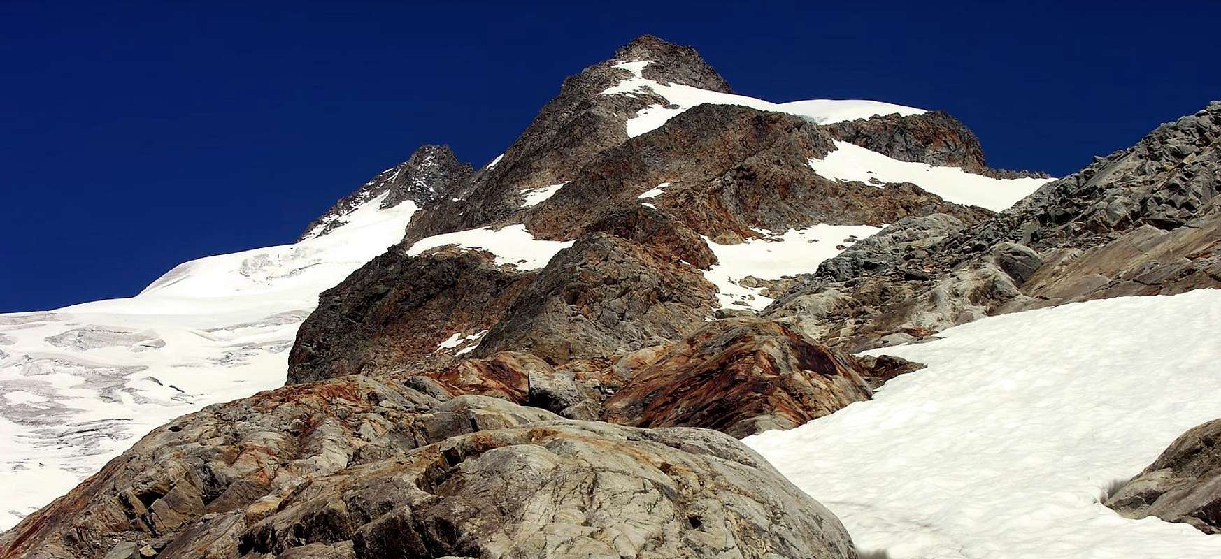
From Arnouva follow along the road (open only to the cars of the ones that have a booking at Rifugio Elena) and along the path n° 25 get the Refuge. To the last curve, to take the path n° 24 that it brings du to the Petit Ferret Pass (2.540m). To Continue following the indications that conduct to the two Bivacchi Fiorio (2.800-2.810m2h'30/3h'00). To Go up again awry the small glacier in direction of the crest of border, that from the Peak Allobrogia raises again him in the Petit Grapillon and in the Peak Gratien Volluz. To reach the small pass (3.356m) immediately awry of this last and, with slant that progressively climbs from 25° to 35°, to overcome a rocky line (3.516m) to reach the Mont Grapillon (3.580m). To actually go down the easy crest N-NW to a small carving (3.620m), to overcome a Gendarme (I°, II°, III°) and the following small carving (3.608m); to climb the crest If (normal route) reaching the shoulder (3.774m), from here on the thread of crest the peak is reached (9h'00/9h'30).
Descent: from Normal Route.
Da Arnouva (1.769 m) proseguire per breve tratto sulla strada, chiusa al traffico, sino al bivio (1.793 m) dove parte il sentiero n° 25 per il Rifugio Elena. All'ultimo tornante, prendere il sentiero n° 24 che porta al Colle du Petit Ferret (2.540 m). Continuare seguendo le indicazioni che conducono ai due Bivacchi Fiorio (2.800 m – 2.810 m2h'30/3h'00). Risalire il piccolo ghiacciaio a monte in direzione della cresta di confine, che dalla Punta Allobrogia si rialza nel Petit Grapillon e nella Punta Gratien Volluz. Arrivare al piccolo colle (3.356 m) subito a monte di quest'ultimo e, con pendio che sale progressivamente da 25° a 35°, superare un tratto roccioso (3.516 m) per raggiungere il Mont Grapillon (3.580 m). Scendere la facile cresta N-NW sino a un piccolo intaglio (3.620 m), superare un Gendarme (I°, II°, III°) e il successivo piccolo colle (3.608 m); salire la cresta SE (normal route) raggiungendo la spalla (3.774 m), da qui sul filo di cresta si raggiunge in breve la vetta (9h'00/9h'30).
Discesa: dalla via normale.
Crossing in Ridge: Mont Grapillon - Mont Dolent: Osvaldo Cardellina, Camillo Roberto Ferronato and Giuseppe Lamazzi, (Aug 05th, 1979).
Essential Gear
Mountaineering equipment, including rope, iceaxe, and crampons.
Parents refers to a larger category under which an object falls. For example, theAconcagua mountain page has the 'Aconcagua Group' and the 'Seven Summits' asparents and is a parent itself to many routes, photos, and Trip Reports.

 10285 Hits
 81.84% Score
 14 Votes