

-
 2693 Hits
-
 80.49% Score
-
 12 Votes
|
|
Route |
|---|---|
|
|
Hiking, Mountaineering, Trad Climbing |
|
|
Spring, Summer, Fall |
|
|
A long day |
|
|
Tournanche Overview Val d'Ayas
All the pictures of this route are by Emilio Bertona aka emilius, Gabriele Corvini alias Corvus, Antonio Giani ie Antonio, mar.ali, daniele_p, andreaperino, Sarme, zuraw & Osw.
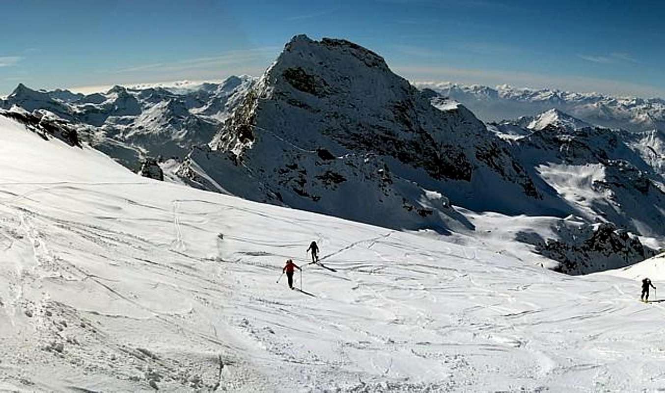
Two routes, both from Valternounanche and from the Ayas Valley, are rather long and require a good training; in addition to good snow conditions in winter, since they are very exposed to snowslides and avalanches A mountain easy but not to be underestimated; the last important after the Grand Tournalin (3379m) before reaching the Italian-Swiss border crest between the Matterhorn (4478m) and the Western Breithorn (4165m). A long but fairly easy is very rarely traveled; because the approach remains a little outside of the usual pathways.
![]()
Two routes, both from Valternounanche and from the Ayas Valley, are rather long and require a good training; in addition to good snow conditions in winter, since they are very exposed to snowslides and avalanches A mountain easy but not to be underestimated; the last important after the Grand Tournalin (3379m) before reaching the Italian-Swiss border crest between the Matterhorn (4478m) and the Western Breithorn (4165m). A long but fairly easy is very rarely traveled; because the approach remains a little outside of the usual pathways.
Due vie che, sia partendo dalla Valternounanche che dalla Valle di Ayas, risultano piuttosto lunghe e richiedono un buon allenamente; oltre a delle buone condizioni della neve in inverno, poiché molto esposte alle slavine ed alle valanghe Una montagna facile ma da non sottovalutare; l'ultima importante dopo il Grand Tournalin (3379m) prima di raggiungere la cresta di confine italo-svizzero tra il Cervino (4478 m) ed il Breithorn Occidentale (4165 m). Una salita lunga ma abbastanza facile e piuttosto raramente percorsa; perché l'avvicinamento rimane un pò al di fuori dai soliti percorsi.
![]()
Getting There
By car:
From FRANCE: through the Mont Blanc Tunnel to Entrèves/Courmayeur. By Little Saint Bernard Pass, closed since November until half May to La Thuile Valley - Pré Saint Didier - Morgex – Aymavilles, Aosta, Châtillon and Valtournanche Municipalities.
It is not necessary to take Motorway A5: you can drive on State Road n° 26, in the direction of AOSTA - IVREA – TURIN
BY PLANE:
Aeroporto Internazionale "Corrado Gex" Saint Christophe (Aosta).
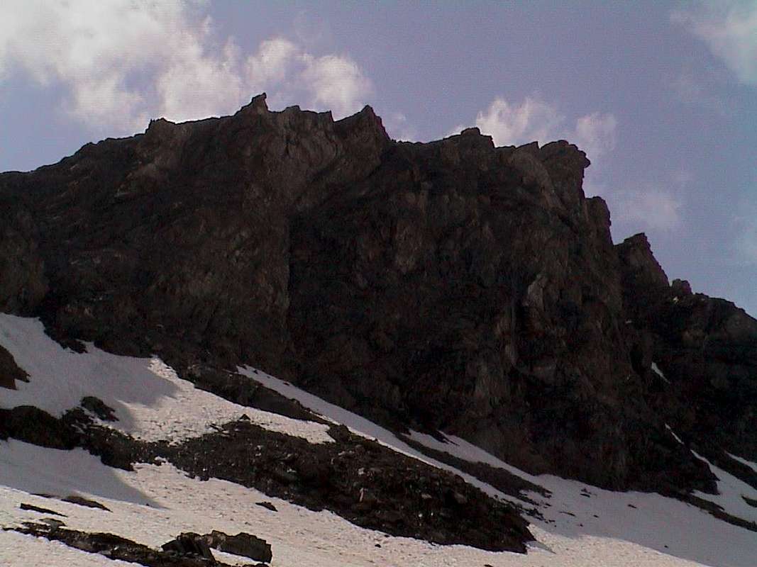
Mont Roisetta (2952/3m) from Southwest, South and Southeast, by mar.ali 2005, Corvus 2008, emilius 2002 & Osw 2015
![]()
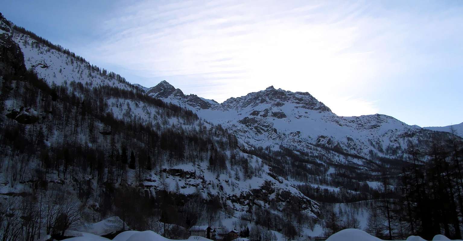
Valtournanche Valley
Mont Roisetta (3332m) from West
- From TORINO, MILANO, etc: Motorway A5. Exit at IVREA or Quincinetto (PIEDMONT) also Pont St. Martin, Châtillon Municipalities.
![]()
SPECIFIC ROADS
From Piedmont or by Courmayeur/Aosta City towards Verrès or Châtillon
From Ivrea Town: before in West (Southern side) to Pont Saint Martin, Verrès, Saint Vincent and Châtillon Municipalities, after in North until Valtournanche.
From Courmayeur Resort: in East-southeast towards Pont Saint Martin, Verrès, Saint Vincent and Châtillon Municipalities, after in North until Valtournanche in locality Losanche; from this last towards Cheneil Hamlet.
From Aosta or from Ivrea Cities to Châtillon Municipality at the beginning of Valtournanche: before in West towards Châtillon, after towards Antey and Valtournanche (locality Losanche) Commons; from this last towards Cheneil.
From Aosta or from Ivrea Cities to Verrès at the entrance on Val d'Ayas Valley: before until Verrès Municipality; after crossing the Ayas Valley up to the Antagnod (1662/84m), Ayas (1696/1720m) also towards St. Jacques (+; 1697m) Communes.
![]()
It is not necessary to take Motorway A5: you can drive on State Road n° 26, in the direction of AOSTA - IVREA - TURIN.

From FRANCE: through the Mont Blanc Tunnel to Entrèves/Courmayeur. By Little Saint Bernard Pass, closed since November until half May to La Thuile Valley - Pré Saint Didier - Morgex – Aymavilles, Aosta, Châtillon and Valtournanche Municipalities.
It is not necessary to take Motorway A5: you can drive on State Road n° 26, in the direction of AOSTA - IVREA – TURIN
BY PLANE:
Aeroporto Internazionale "Corrado Gex" Saint Christophe (Aosta).
First Ascents
- First known on the Summit: unknown.
- First in Winter: unknown.
- South-southwest Slope (Normal Route by Cheneil): unknown.
- South-southeast Slope (Normal Route by Val d'Ayas): unknown.
- Southwest Ridge (from Dents d'Aran: Giovanni Bobba with Guide Casimiro Thérisod; August 29th, 1901.
- West Wall of the Southwestern Shoulder (Via Camanni): Enrico and Marco Camanni; August 20th, 1979.
- West Wall (Via Cogliati-Manenti): Alberto Cogliati and Mario Manenti; September 10th, 1946.
- West Wall (Via Bich): Anna Maria Pira with Valtournanche Guide Jean Bich and armando Perron; September 24th, 1953.
- Northern Crest (from Roisetta's Pass): unknown. First winter: Guya Caradonna and Vittorio De Tuoni with Valtournanche Guide Marco Barmasse; January 03th, 1983.
- Southeast "Crestone" (Via Mauri-Pedrotti): José Mauri and Franco Pedrotti; August 25th, 1942).
- South-southeast Ridge (integral from Collar 3091m) : Osvaldo Cardellina, Christian Cardellina (10 years), Marco Cossard and Giuseppe Lamazzi; July 20th, 1983).
 |  |  |  |  |
Routes Description
Mont Roisetta (3332m) from West
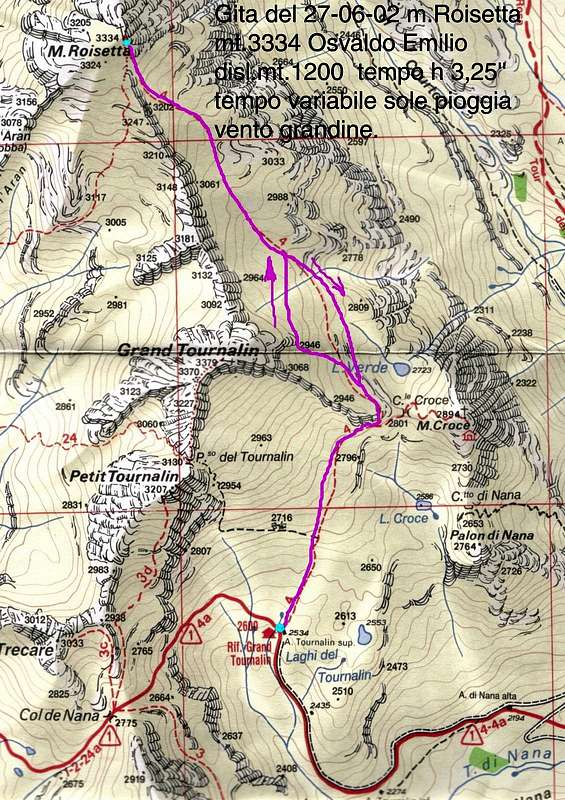
Approach from Cheneil: from Cheneil small Hamlet (2097m) with trail n°29/30/31/Alta Via n° 1 towards Southeast up to the junction 2300 metres into the Comba de Cheneil; after decisively changing to the Norheast with path n°29 on valley floor always of the same basin towards the following fork 2650 metres. From this point always continuing with path n°29 along the rather boring and tiring scree Southwestern Face quite easily to Mont Roisetta (+; 3332m; EEA/F+; 3h'45/4h'15).
Mont Roisetta (3332m) da Occidente
Mont Roisetta (3332m) da Occidente
Avvicinamento da Cheneil: dal Villaggetto di Cheneil (2097 m) con il sentiero n°29/30/31/Alta Via n° 1 verso Sudest fino al bivio 2300 metri nella Comba de Cheneil; poi cambiando direzione decisamente verso Nordest con sentiero n°29 sul fondovallone sempre della stessa comba insino al successivo 2650 metri. Da questo punto continuando sul sentiero n°29 lungo il piuttosto noioso, detritico nonché faticoso Versante Sudovest al Mont Roisetta (+; 3332 m; EEA/F+; 3h'45/4h'15).
![]()
Ayas Valley
Mont Roisetta (3332m) from East
Mont Roisetta (3332m) from East
Approaches from St. Jacques (+; 1697m) or by Antagnod (1685m), through the private dirt road: A)- from St. Jacques (+; 1697m) toward Fusine (1713m), Blanchard/Bernosin-Armaz (1721m) Villages to fork 1804 metres (signal no transit); from this, through dirt road or path Haute Route n° 1 (by St. Jacques), toward fhe cross 1838 metres, Croués (1870m), Nannaz Dèsott and Damon (2049m, 2193m) Pastures, cross 2289 metres near Tournalin Dèsott Alp (2278m) to Grand Tournalin Refuge (2544m), nearby Tournalin Damon Alp (2535m), below Grand (Northern Summit 3379m, +; Southern 3371m) and Petit Tournalin (+; 3207m). From refuge in West-southwest to a)- Nana or Nannaz Hill (2772m); in North to b)- saddle 2800 metres, Mont Brun or Monte Croce (2895 m; EE/F; 1h'15/1h'30 refuge), always through path n° 4 on slightly sloping but long Slope Southeastern passing above the Lac de Tournalin or Verde and Crest South in final part (2721 m; 4h '00/5h 00 from St. Jacques). B)- Or from Antagnod-Ayas Common, Barmasc Village (1896m), through the long dirt road to North connecting with previous route (EE/F+; 2h'15/2h'45 refuge; 5h'30/6h'30 in total).
Mont Roisetta (3332m) da Oriente
Mont Roisetta (3332m) da Oriente
Avvicinamento da St. Jacques (+; 1697 m) o da Antagnod (1685m), tramite la strada poderale: A)- da St. Jacques (+; 1697 m) verso i Villaggi di Fusine (1713 m), Blanchard/Bernosin-Armaz (1721 m) sino al bivio 1804 metri (segnale di divieto); da qui, con la poderale od il sentiero Alta Via n° 1 (da Saint Jacques), verso l'incrocio 1838 metri e le Alpi di Croués (1870 m), Nannaz Dèsott e Damon (2049m, 2193m), successivo bivio 2289 metri all'Alpe Tournalin Dèsott (2278 m) in direzione del Rifugio Grand Tournalin (2544 m), presso l'Alpe Tournalin Damon (2535 m), al di sotto di Grand (Nord 3379 m, +; Sud 3371 m) e Petit Tournalin (+; 3207 m). Dal rifugio in Ovest-sudovest al a)- Col di Nana o Nannaz (2772 m); a Nord alla b)- sella 2800 metri vicino al Mont Brun o Monte Croce (2895 m; EE/F; 1h'15/1h'30 dal rifugio), sempre con sentiero n° 4 sul poco inclinato ma lungo Versante Sudest passando al di sopra del Lac de Tournalin o Verde e Crestina Sud nel finale (2721 m; 4h'00/5h'00 da Saint Jacques). B)- Oppure dal Villaggetto di Barmasc (1896 m) con la lunga poderale verso Settentrione che si collega al precedente itinerario (EE/F+; 2h'15/2h'45 dal refugio; 5h'30/6h'30 in totale).
Both these routes can be considered as E/F or EE/F+ (Experts Hikers); in winter BSA (Good Skiers-Mountaineers, even by snowshoes or Ski).
Gli itinerari sono da classificare in E/F oppure EE/F+ (Escursionisti Esperti); in inverno BSA (Buoni Sciatori-Alpinisti, anche tramite Racchette da neve od in Scialpinismo).
![]()
Normal Route to Mont Roisetta from South-southeast below the South-southeast Ridge, by emilius 2002
EQUIPMENT
Hiking gear, in winter as for Ski-Mountaineering or with Snowshoes.
Da Escursionismo, in inverno da Scialpinismo o con Racchette da neve.
Essential Gear with Difficulties
DIFFICULTIESBoth these routes can be considered as E/F or EE/F+ (Experts Hikers); in winter BSA (Good Skiers-Mountaineers, even by snowshoes or Ski).
Gli itinerari sono da classificare in E/F oppure EE/F+ (Escursionisti Esperti); in inverno BSA (Buoni Sciatori-Alpinisti, anche tramite Racchette da neve od in Scialpinismo).
EQUIPMENT
Hiking gear, in winter as for Ski-Mountaineering or with Snowshoes.
Da Escursionismo, in inverno da Scialpinismo o con Racchette da neve.