Intro
Summer 2013 was (as usual) spent in the Alps doing a mixture of hiking, climbing, orienteering and mountainbiking. Until a few days before departure the weather forecasts had been looking rather questionable and we had been arguing back and forth between Western Alps or Eastern Alps. In the end Eastern Alps won - a lucky pick since it turned out to be close to three weeks with absolutely perfect weather almost every day!
The first week was spent hiking with a friend in the Grossglockner group including a climb to the summit itself. Then I moved on to Slovenia for some orienteering, mountainbiking and via ferrate climbing with other friends before heading towards the Montasio / Jof Fuart group in the northeastern part of Italy just on the border to Austria and Slovenia for a small solo hiking trip.
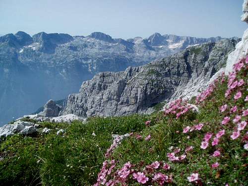
This trip report is about my three days trip through this, in my opinion, very much overlooked part of the Eastern Alps. OK, the mountains may not be quite as high or spectacular as their more well known counterparts in the Dolomites further south, but the area fully makes up for that in the lack of the crowds and the plentiful wildlife.
Day 1, Thursday, August 1st
I had spent a couple of days in the Trenta valley in Slovenia and spent the morning climbing the Hancova route to the top of Mala Mojstravka above the Vrsic pass. I continued scrambling along the ridge to Velika Mojstravka and Zadnja Mojstravka enjoying views of a huge part of the Eastern Alps with Mangart and Jalovec close by and a good chunk of Austria including Grossglockner, Ankogel and Hochalmspitze further north. To the west I could see parts of the Montasio and Fuart group - target of the next couple of days.
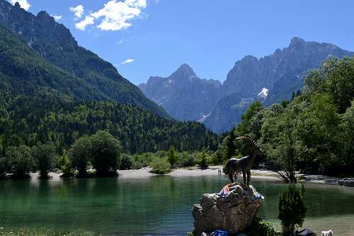
I "scree-surfed" part of the way back to Vrsic, got into the car and went for a swim in a lake outside Kranjska Gora before driving into Italy. Here I passed the Rabeljsko Jez lake. Blue sky, green water and mountains all
around. Finding a nicer scenery is hard.
![The lake outside Kranjska Gora]() The lake outside Kranjska Gora
The lake outside Kranjska Gora
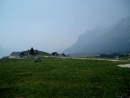
My plan was to crash at the trail head, which was a parking lot at the Malga Montasio pastures, so I could start very early the next morning. The last section of the drive went up a steep one lane paved road. The surface of the road was decorated with cyclist names and various slogans and it turned out that one of stages of the Giro d'Italia bike race had finished up here earlier this year. Again, a stretch that would never have been included in the (in my opinion less entertaining) Tour de France!
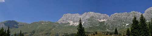
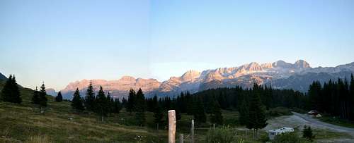
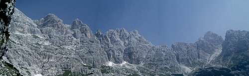
The views from the parking lot were great. On one side I had the whole southern face of the mountain range running between Montasio and Jof Fuart and across the valley I could see the Kanin massive on the Italian/Slovenian border. The parking lot was filled with cars but 95% were Italian and the rest Austrian or Slovenian. As I said - totally overlooked destination except for locals!
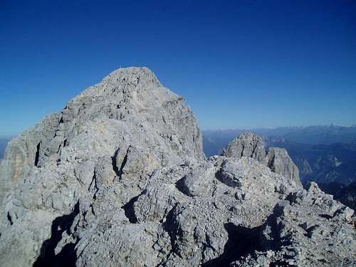
![Panorama of the south face of the Jof di Montasio / Montaz massive]() Panorama of the south face of the Jof di Montasio / Montaz massive
Panorama of the south face of the Jof di Montasio / Montaz massive
![View towards Mt. Kanin - and yes the Giro d'Italia riders came up this way!]() View towards Mt. Kanin - and yes the Giro d'Italia riders came up this way!
View towards Mt. Kanin - and yes the Giro d'Italia riders came up this way!
![Panorama of the Mt. Kanin group]() Panorama of the Mt. Kanin Group
Panorama of the Mt. Kanin Group
I dug out a book to do some reading but was "captured" by a group of Italians that returned from a climb of one of the smaller peaks. They invited me to join them for a taste of homemade specialties, wine and grappa. I don't speak Italian and only one of them spoke a Little English and German, but with a mixture of those three languages we got by.
The rest of the day was spent relaxing and doing photo shooting. I the evening the only sounds were cowbells, grasshoppers, marmots and birds of prey. Why do I live 1.000 km from this place ....
![I can only agree ...]() I can only agree ...
I can only agree ...
![Milka Kanin]() Milka chocolate people let me know if you want to use this picture in one of your commercials ...
Milka chocolate people let me know if you want to use this picture in one of your commercials ...
![Alpenglow on Mt. Kanin]() Alpenglow on Mt. Kanin
Alpenglow on Mt. Kanin
![More alpenglow]() More alpenglow
More alpenglow
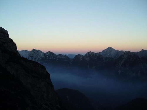
![Alpenglow panorama of the Mt. Kanin group - and my trailhead camp]()
Alpenglow panorama of the Mt. Kanin group - and my trailhead camp
Day 2, Friday, August 2nd
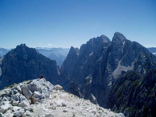
The plan for my hiking day in the area was to climb to the summit of Jof di Montasio / Montaz ( 2,753 m), follow the Senterio Leva to Cima Terra Rossa / Spik Hude Police and then continue on Ceria Merlone until Rif Corsi. I knew I was in for a long day, so I got up at 5 in the morning and ate a quick breakfast (I had misplaced my planned breakfast the day before, so instead on some nice youghurt I had to do with dry bread and some fruit). Then I broke camp and was ready to leave at 5:40. There were a few other hikers at the parking lot who had slept in their cars or their campers, so there was little activity around already.
![Sunrise over Mt. Kanin]() Sunrise over Mt. Kanin
Sunrise over Mt. Kanin
![Fog down in the valley that was apparently smoke from forest fires]() Fog down in the valley that was apparently smoke from forest fires
Fog down in the valley that was apparently smoke from forest fires
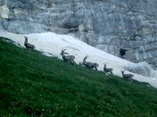
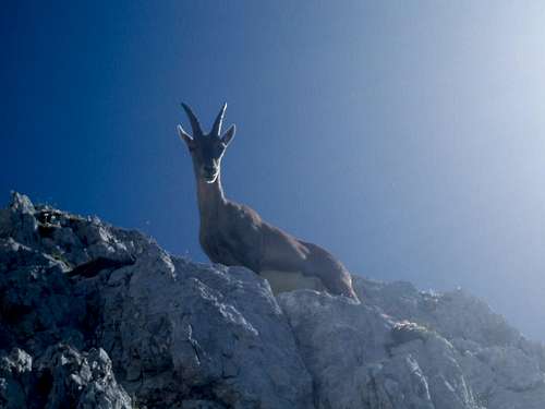
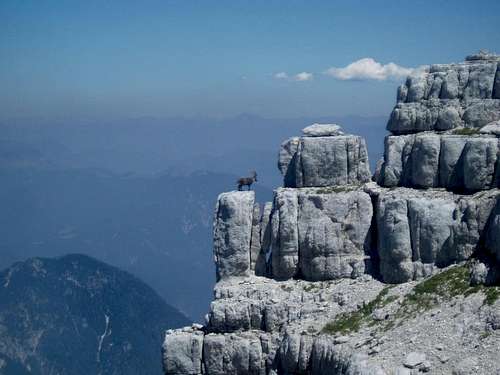
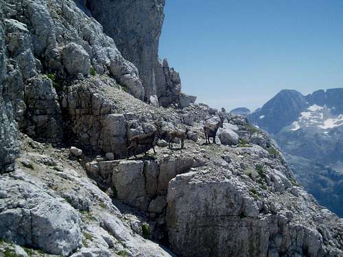
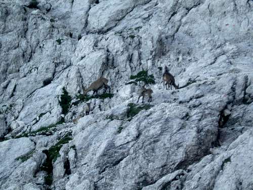
The first long section up to a pass named forc. Part Disteis went over "Altopiano del Montasio" - large open grassy slopes with a good view up to Montasio and towards Mt. Kanin on the opposite side of the valley. As I reached the pass, I discovered a group of 5-6 ibex further up the mountain side. Later I came even closer and ended up being less than 100 meters from them. They seemed more keen on banging their horns together than paying any attention to me or the other hikers. It is not that often I have seen ibexes, so I was quite exited and fascinated. It later turned out that there was no need for excitement - I would be seeing ibexes all that and that they were at least as curious as us humans.
![The first group of many, many ibex that day]() The first group of many, many ibex that day
The first group of many, many ibex that day
The path I followed bypassed the Disteis pass with some 15-20 vertical meters. I had originally planned to come up from that side, so I walked up to have a look. Compared to the grassy Southern slopes of the mountain the western face was much steeper and it turned out the path had been closed. Lucky decision to start from the southern side of the mountain instead then.
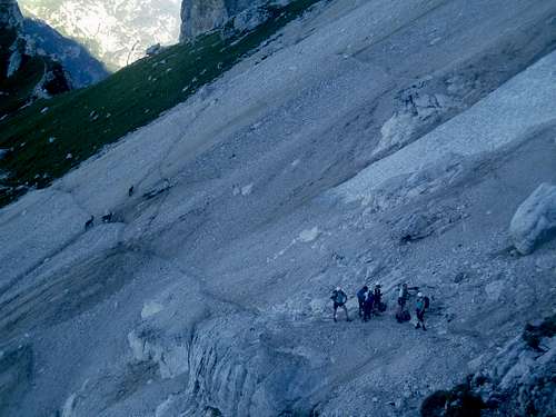
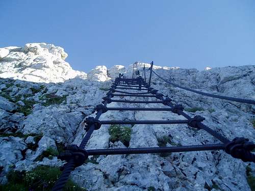
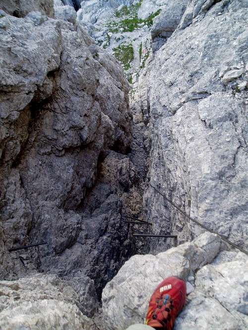
Shortly after the pass the character of the route changed. Until then it had been a steep but fine hiking path winding it's way up the grassy slopes. Now it changed to steep, fragile rocks with the most exposed sections being cabled with steel wires. I therefore put on my helmet, harness and via ferrate lanyard. The difficulty of the climb however was no so great and the worst place was actually a stretch with no cables, but where the
surface was very slippery, as it consisted of loose gravel on a hard steep slope. The most special part of the route was "Pipans ladder". The ladder, made of steel wires, covered 30-40 vertical meters. I would have
preferred to stay on the rocks to be more in control myself instead of depending on some cables ...
![Gearing up - ibexes couldn't care less]() Gearing up - ibexes couldn't care less
Gearing up - ibexes couldn't care less
![Looking up Pipans ladder]() Looking up Pipans ladder
Looking up Pipans ladder |
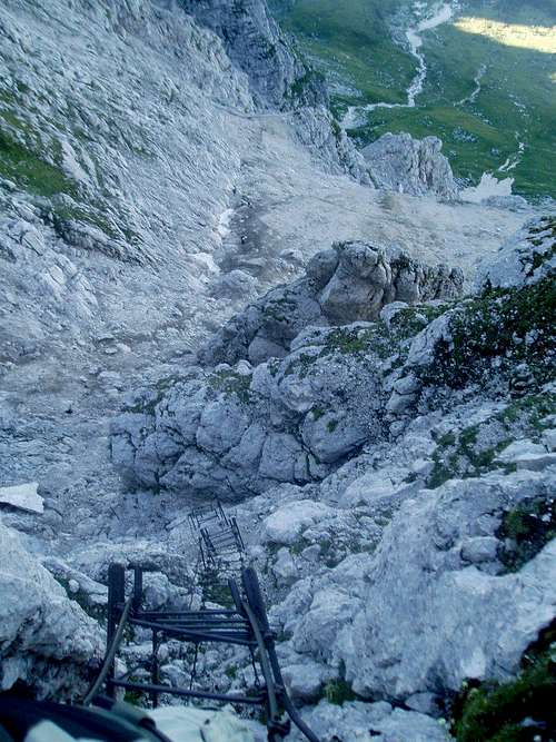
![And looking down Pipans ladder]() And looking down Pipans ladder
And looking down Pipans ladder |
From the top of Pipans ladder I only had approx. 100 vertical meters left to the summit. This part was mostly simple scrambling and only the most difficult places were secured with cables. This route design was more or less to be the standard for the rest of the day: Generally cables were only put up on places where a fall with 100% certainty would be fatal. Other places where it was less difficult or where you would only break a leg or
two, there were no cables.
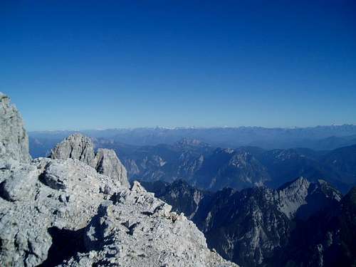
![First view towards the heart of the Julian Alps in Slovenia]() First view towards the heart of the Julian Alps in Slovenia
First view towards the heart of the Julian Alps in Slovenia | ![View back down on Malga Montasio with the karst plateau of Mt. Kanin on the other side of the valley]() View back down on Malga Montasio with the karst plateau of Mt. Kanin on the other side of the valley
View back down on Malga Montasio with the karst plateau of Mt. Kanin on the other side of the valley |
![Summit within sight - and lot's of rotten rock around]() Summit within sight - and lot's of rotten rock around
Summit within sight - and lot's of rotten rock around
| ![Nice view towards the Hohe Tauern group in Austria]() Nice view towards the Hohe Tauern group in Austria. From left to right Gr. Venediger (second glaciated peak), Grossglockner (the spiky one with glaciers to the right of it) and Hochalmspitze (on the far
Nice view towards the Hohe Tauern group in Austria. From left to right Gr. Venediger (second glaciated peak), Grossglockner (the spiky one with glaciers to the right of it) and Hochalmspitze (on the far |
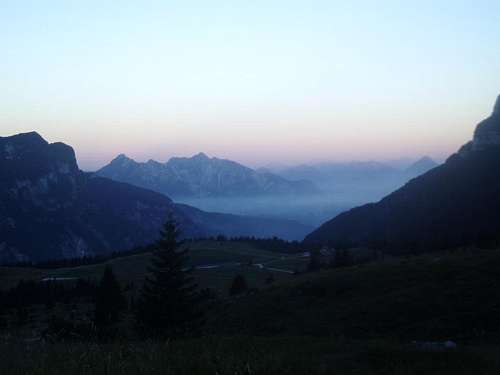
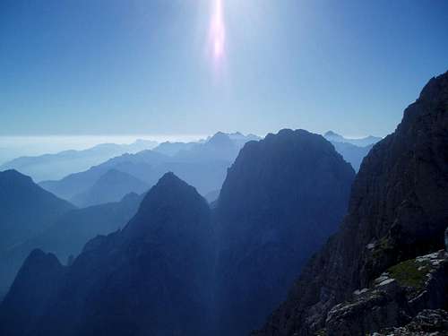
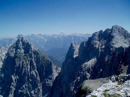
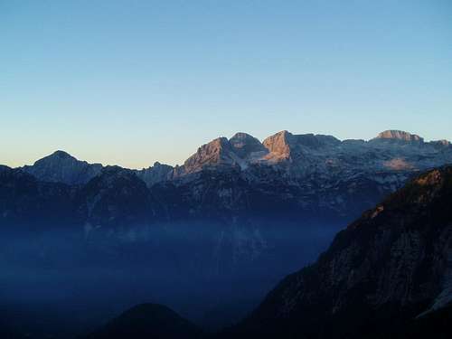
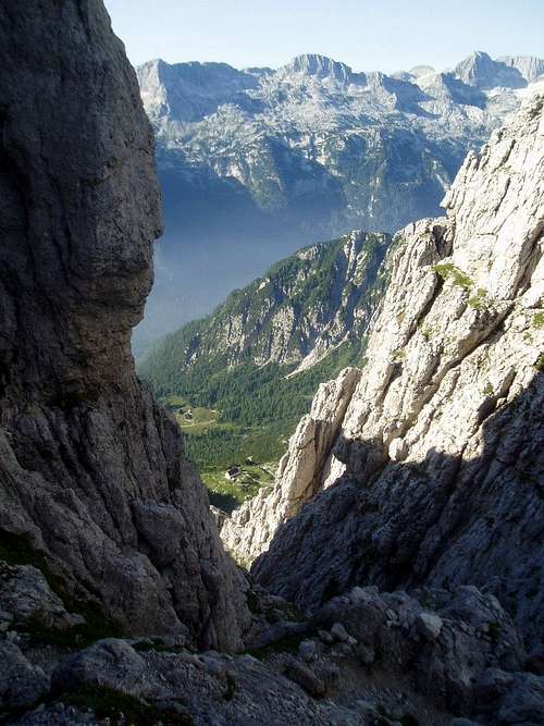
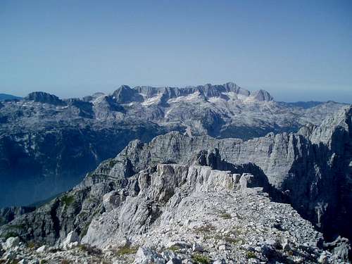
I reached the summit at half past eight. The view were amazing; Dolomites in the west and south, Austria in the north and Slovenia in the east. There was, however, a mist, which meant that it was not as clear as the previous days (5 days before I had been able to see the Adriatic See from the top of Prisank / Prisojnik in Slovenia!). If one should mention a positive thing about the mist however, it was that it created a superb classical view of "blue mountains" fading out towards the horizon - especially when looking towards Slovenia.
I had a short break drinking some coke, eating some chocolate and enjoying the views.
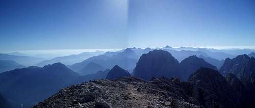
![Panorama from the summit of Montasio]() Panorama from the summit of Montasio
Panorama from the summit of Montasio
![The Blue mountains of Slovenia]() The Blue mountains of Slovenia
The Blue mountains of Slovenia
![On the summit]() On the summit
On the summit
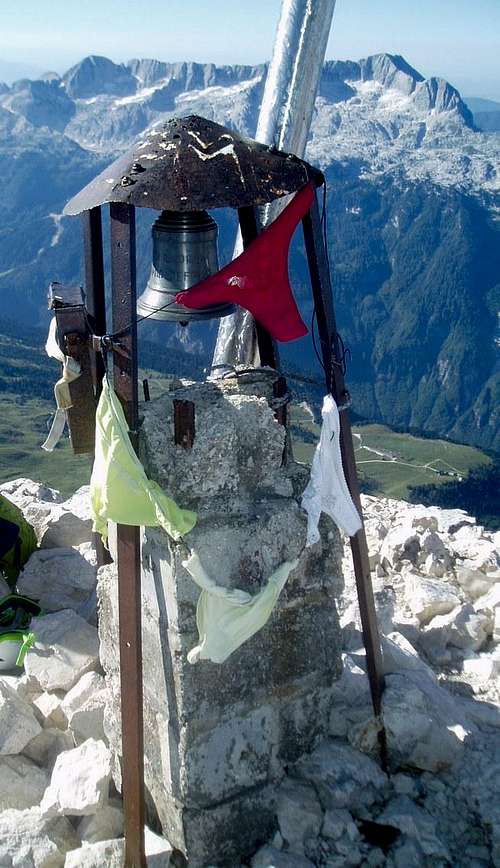
![Prayer flags on the summit - you gotta love Italy!]() Prayer flags on the summit - you gotta love Italy!
Prayer flags on the summit - you gotta love Italy!
From the summit of Montasio I teamed up with an Austrian climber, who had "left" his wife at the Adriatic coast for a long day in the mountains. That's courage! We went down the same way as we came up and thus again had the pleasure of Pipans Ladder. Until then I had been feeling that the climb up to Montasio was quite tough, but as I was heading down the ladder I passed a 60+ year old woman climbing up. And she only had one hand! That brought me to the conclusion that either the mountain was not quite as hard, or that Italian grandmothers are extremely tough...
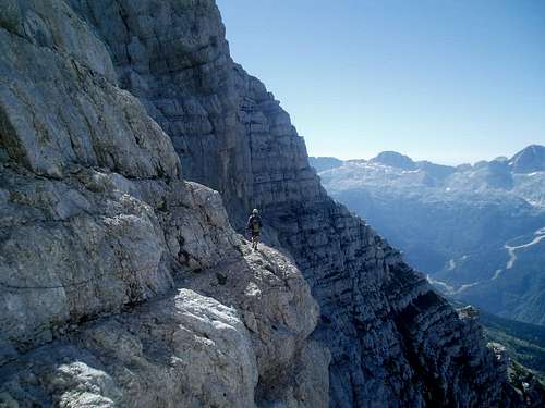
The slippery piece at the foot of the ladder, where I had been having a little trouble on the way up, was no less tricky on the way down. I managed however to get through with just one crash on my butt. After the tricky section we turned east on "Senterio Leva", a secured trail running vertically across the southern face of the Montasio massif. The first part went on wide shelves, which slightly reminded me of similar ones of Tofane di Roses in the Dolomites, but without being quite as extreme.
![Walking on the shelves on Senterio Leva]() Walking on the shelves on Senterio Leva
Walking on the shelves on Senterio LevaThe shelves gave way to short section on grass slopes before a more technical section with cables first down to a small pass and then up again towards Cima Terra Rossa / Spik Hude Police ( 2420 m). Once again there
were loads of ibex in this area and many times it seemed more as if they were jumping around on the rocks just for the fun it than because they were looking for food.
![An easy grassy section. Cima Terra Rossa is the spiky peak in the center]() An easy grassy section. Cima Terra Rossa is the spiky peak in the center
An easy grassy section. Cima Terra Rossa is the spiky peak in the center
![Another skilled climber]() Another skilled climber
Another skilled climber
The last part of the route to the summit of Cima Terra Rossa went on good walking paths. After being in the shade most of the time so far, we now came out into the sun and it was baking hot. On the summit it was time for lunch - and as yesterday a group of Italian hikers offered Prosecco the climb. Italy has got to be the best place for hiking/climbing!!!!
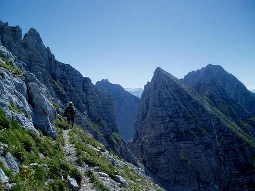
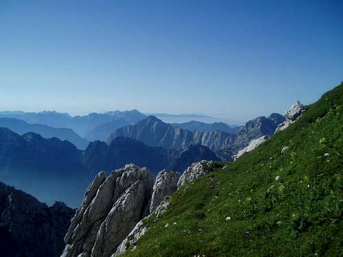
From the summit it was possible to see the majority of the route that lay ahead of me in the form of a ridge with the peaks of Foronon del Buinz ( 2,531 m) and Modeon del Buinz terminating at the pass Spranje. The distance to the pass did not seem to be more than maximum a few kilometers as the crow flies, but it came to take me over 3 hours which tells a Little about the terrain.
![View towards the Spanja pass]() View towards the Spanja pass. Foronon del Buinz with the steep northern face on the right. The route goes along the ridge and on the slightly more gentle southern face
View towards the Spanja pass. Foronon del Buinz with the steep northern face on the right. The route goes along the ridge and on the slightly more gentle southern face
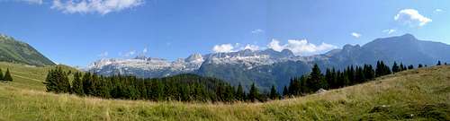
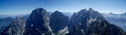
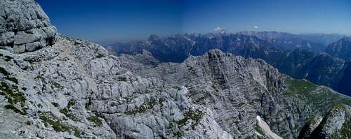
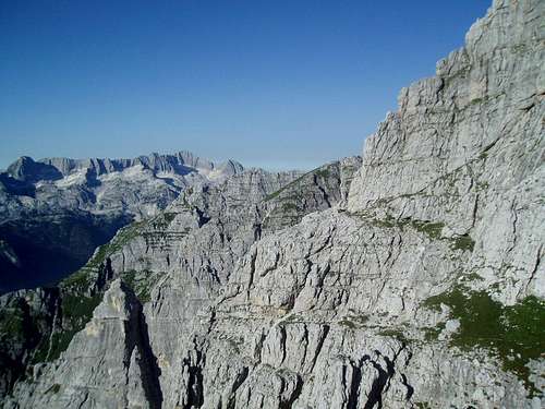
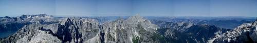
![Panorama of the Jof Fuart part of the massive]() Panorama of the Jof Fuart part of the massive
Panorama of the Jof Fuart part of the massiveI started out on the decent together with the Austrian, but we split after a while since he had to return to his car while I wanted to continue toward the Rif. Corsi on the route "Ceria Merlone" - another secured hiking path along the ridge between Montasio and Fuart.
The first part of the on the route over to a small pass went along a perfectly smooth path and I thought I would quickly have completed the route. Wrong! From the pass it would be a long climb up to the summit of Foronon. Most places were well secured and most of the way I was following a group of six ibex. Again it seemed more as if they were playing around than looking for food.
![King of the hill]() King of the hill
King of the hill
Foronon consisted of two peaks, where part of the path between the two went right along the ridge of the mountain. Great! At the highest of the Foronon peaks a brand new, large bivouac of wood had been built. Pure luxury. Unfortunately it had not been shown on my map, because otherwise I would surely have considered planning the trip after spending a night here.
![View towards Slovenia from the summit of Foronon. Triglav himself in the center]() View towards Slovenia from the summit of Foronon. Triglav himself in the center
View towards Slovenia from the summit of Foronon. Triglav himself in the center
![Five star accommodation!]() Five star accommodation!
Five star accommodation!
After the bivouac there were less cables. At the same time I started to get really tired and I was quickly running out of water which was highly unfortunate, since I was more or less constantly in the sun. I therefore had to force myself to keep focus and avoid any falls.
The route skirted around the summit of Modeon del Buinz just 50 vertical meters below the summit or so. I had originally thought about climbing up there, since it should be relatively easy scrambling. With the lack or water and my tiredness in mind that plan was quickly discarded. At this time I tried hard to enjoy the trip and the views but must admit that I was mainly just looking forward to coming down from the mountain. Savior of the day ended up being a bag of gummy bears (remains of a trip to Ecuador some months earlier) that provided a much needed energy boost.
![When in doubt, just follow the ibex]() When in doubt, just follow the ibex
When in doubt, just follow the ibex
![And the ridge just never stops ... Julian Alps in the background]() And the ridge just never stops ... Julian Alps in the background
And the ridge just never stops ... Julian Alps in the background
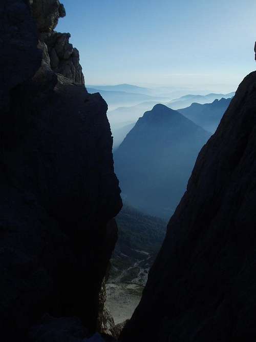
The last stretch of the route down to the Spranje pass was no less spectacular than the rest; About 150 vertical meters diagonally down a steep mountainside, again only equipped with cables the worst places.
![Looking back up the final decent. The route goes more or less diagonally across the face]() Looking back up the final decent. The route goes more or less diagonally across the face
Looking back up the final decent. The route goes more or less diagonally across the face
![View from Spranje towards Montasio]() View from Spranje towards Montasio
View from Spranje towards Montasio
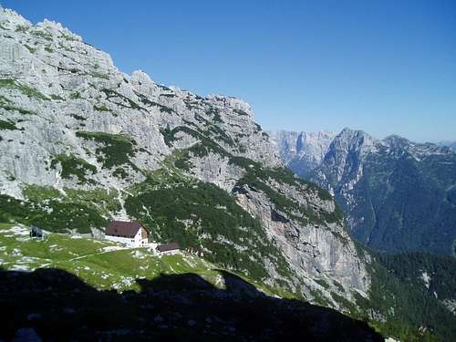
From the pass there was only approx. 40 minutes of more or less gentle walking on good hiking trails left before reaching Rif. Corsi. I got to the refuge slightly before four in the afternoon after close to 11 hours of hiking and climbing. I was tired! I immediately gulped 2 liters of water and half a liter of coke and spent the rest of the day relaxing.
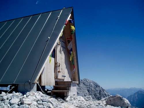
![Rif. Corsi. Finally!]() Rif. Corsi. Finally!
Rif. Corsi. Finally!
![What I felt like after finally getting to Rif. Corsi]() What I felt like after finally getting to Rif. Corsi
What I felt like after finally getting to Rif. Corsi
![Sunset over the Julian Alps tainted with a little forest fire smoke]() Sunset over the Julian Alps tainted with a little forest fire smoke
Sunset over the Julian Alps tainted with a little forest fire smoke
Day 3, Saturday, August 3rd
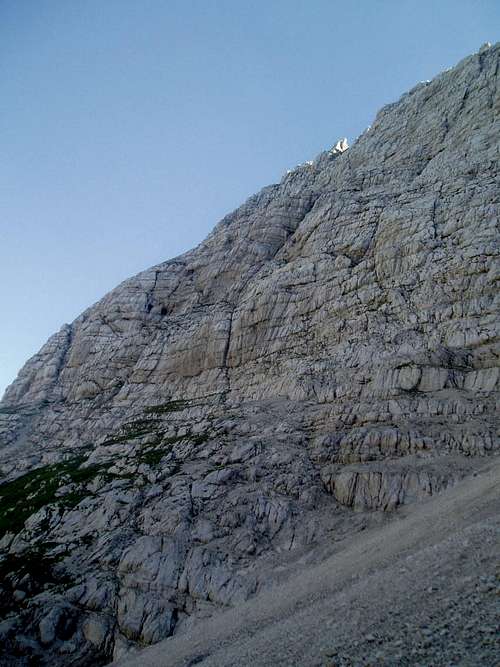
I knew it was going to be anotherhot day, so I get up already at 5:45, so I was ready for breakfast at 6 and could be on trail early and get to the summit while part of the route was still in the shade. Originally I had planned for another long day including Jof di Fuart and a number of lesser summits, but given the previous long day I decided to shorten the route and more or less go directly to the top of Jof di Fuart / Viz ( 2,666 m). The host at the refugio however suggested me to take the route "Anita Goitan" up and down, since it was far more beautiful and interesting than the direct route - and anyways it was not much longer. The legs felt surprisingly well, so I took his advice.
![Sunrise over the Mt. Kanin group - another day of perfect weather]() Sunrise over the Mt. Kanin group - another day of perfect weather
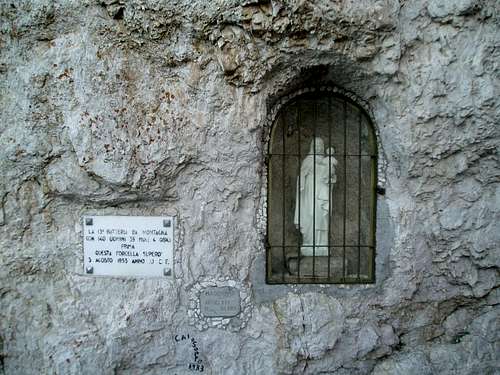
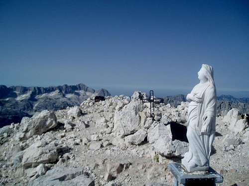
Sunrise over the Mt. Kanin group - another day of perfect weatherThe first half hour or so it was not so steep and I followed a good hiking trail, but at the foot of the mountain face it got more technical and some places were secured with cables. Compared to Ceria Merlone the standard of the safety aids was much better this day. Maybe because the route was under protection of the Madonna herself? (see picture)
![Start of the Anita Goitan secured trail]() Start of the Anita Goitan secured trail
Start of the Anita Goitan secured trail
![View to the north from the start of Anita Goitan route]() View to the north from the start of Anita Goitan route
View to the north from the start of Anita Goitan route
Like the day before the trail in many places followed natural ledges on mountain face; these were called the "Ledges of the Gods" by early explorer Kugy. Most of the time I walked more or less vertically across the face, but on a few places I had to climb steeply down and up through narrow cracks to cross minor mountain passes.
![Ledges of the Gods - the trail follows the lower of the two ledges]() Ledges of the Gods - the trail follows the lower of the two ledges
Ledges of the Gods - the trail follows the lower of the two ledges
![A glimpse down one of the steeper sections secured with cables and iron poles]() A glimpse down one of the steeper sections secured with cables and iron poles
A glimpse down one of the steeper sections secured with cables and iron poles
![View down to Rif. Corsi]() View down to Rif. Corsi
View down to Rif. Corsi
Where the day before had been full of ibex I didn't see many of them today. Instead I saw a bunch of chamois. Sadly I didn't get any got photos of neither of them.
![Another pack of goats]() Another pack of goats
Another pack of goats
![A more gentle part of the Anita Goitan trail]() A more gentle part of the Anita Goitan trail
A more gentle part of the Anita Goitan trail
After an hour or so following the ledges my trail met the normal route to the summit. Now it was just to follow a steep trail with some smaller scrambling sections to the top. On the downside I was not in the shade anymore and although it was only 8 in the morning, it was already baking hot.
The summit of Fuart was divided into two parts. I climbed to the false summit at first, since the host at the refugio had told me there were some caves from World War I up there, since it was used as a look out. Apparently 7 Austrian soldiers had spent a whole winter up there, while the Italians had been occupying the summit of Montasio. Crazy.
I then scrambled over to the true summit and reached it 2.5 hours after leaving the hut. There were again superb views to Austria in the north, while the views towards the Dolomites and Slovenia was much cloudier than the day before due to a mixture of heat and smoke from the forest fires in the valley far below.
![Mt. Kanin seen from the summit of Jof di Fuart]() Mt. Kanin seen from the summit of Jof di Fuart
Mt. Kanin seen from the summit of Jof di Fuart
![Panorama from the summit of Jof di Fuart]() Panorama from the summit of Jof di Fuart
Panorama from the summit of Jof di Fuart
![The usual summit decorations in Italy]() The usual summit decorations in Italy
The usual summit decorations in Italy
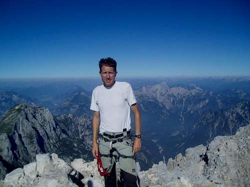
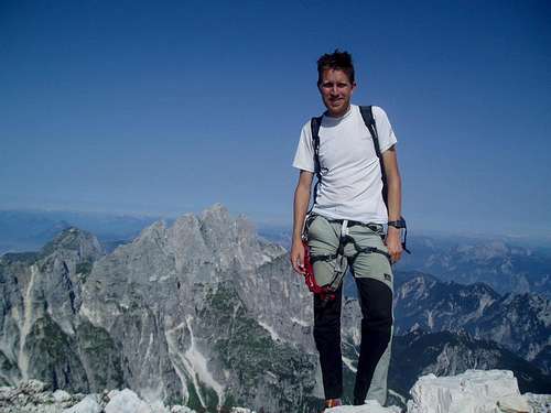
![Me on the summit of Fuart, Montasio in the background]() Me on the summit of Fuart, Montasio in the background
Me on the summit of Fuart, Montasio in the background
I spent half an hour on the summit and then descended using the same route. As I got down to the intersection with the Anita Goitan route, I again turned off onto this but this time continued west towards the Forcella Moses pass. The first section was quite simple and went mostly on grassy slopes and I considered packing away helmet and harness. The last bit down to F. Moses, however, was very steep and secured with tons of cables,
but even though it was steep, the descend was in many places not so hard, since steps had been carved into the rock during WWI, where the Austrians used it to get to their look outs at F. Moses and Fuart. These steps actually continued almost all the way down to Rif. Corci.
![Easy section of the Anita Goitan route]() Easy section of the Anita Goitan route
Easy section of the Anita Goitan routeFrom F. Moses the route was not so steep and only a few places were secured with cables. I made it back to the hut in 4.5 hours. Not bad. I bought a coke, packed some gear I didn't take to the summit of Fuart and then headed back towards my car.
The first couple of kilometers I followed a good hiking trail to the pass Sella degli Scalini. The views were getting ever more blurred due to smoke from the forest fires and I could also smell the smoke once in a while. Actually I started to worry a little about whether the fires had reached the car park.
![A final glimpse back towards the Jof de Fuart group]() A final glimpse back towards the Jof de Fuart Group. The Anita Goitan route crosses the face more or less half way up.
A final glimpse back towards the Jof de Fuart Group. The Anita Goitan route crosses the face more or less half way up. I ate my lunch in the pass and then continued on fine hiking trails towards a small cottage. From here it was approx. 5 flat km's along a gravel road back to the car. It was getting really hot by now and very hazy / smoky. Back at the pastures of Malga Montasio it was even hard to see the summit of mountains. I got back to my (unburned!) car after approx. 7 hours of walking, so I did manage to make it a shorter day than the day before.
![Malga Montasio covered in smoke]() Malga Montasio covered in smoke
Malga Montasio covered in smoke
I drove directly to the Rabeljsko Jez lake on the border between Italy and Slovenia to go for a swim and cool down. Then the direction was set towards Austria. Here the temperature topped at 40 degrees Celsius between Villach and Spittal (no kidding!) and I was grateful my new car has AC.
A check at the tourist office in Gmünd informed about stable weather for another couple of days. I therefore decided to postpone the return to Denmark for a couple of days and squeeze in a climb of Hochalmspizte - Königin of the Hohe Tauern and something very different from Montasio and Fuart.
As written in the title of this trip report, the Montasio / Fuart area is an overlooked gem in Eastern Alps that can be highly recommended. Great views, mountains, wild life and hospitality - and without the crowds of the more famous areas like Dolomites.


Comments
Post a Comment