
|
|
Mountain/Rock |
|---|---|
|
|
45.66920°N / 10.62076°E |
|
|
Lombardia |
|
|
Hiking, Trad Climbing, Scrambling, Via Ferrata |
|
|
Spring, Summer, Fall, Winter |
|
|
2854 ft / 870 m |
|
|
Overview
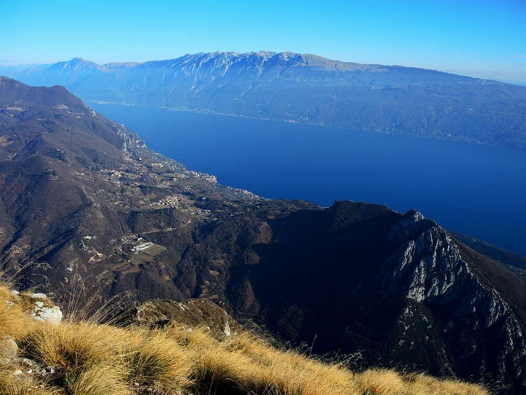
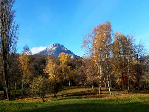
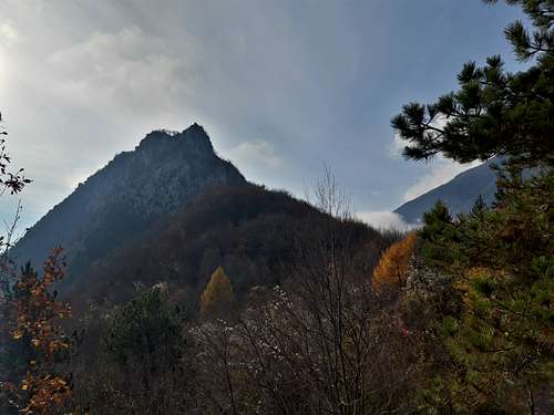
Monte Castello di Gaino 870 m
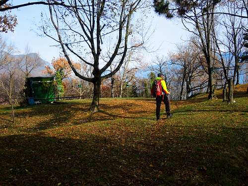
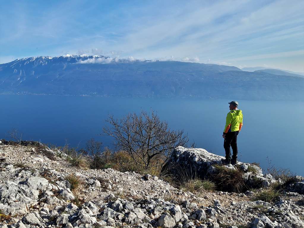
Monte Castello di Gaino 870 m is an isolated limestone peak located between Garda Lake and the higher Monte Pizzocolo. It's a very interesting peak despite its modest height, enjoying a vast and fascinating panorama. It is also called Monte Tre Punte due to the fact that close to the main peak there are two quite strong fore-summits, the Western one 848 m and the Eastern one 789 m. Very popular mountain in all seasons and known since the end of the nineteenth century, it is mainly wooded, with rocky slopes to the North and West where various climbing routes run. The most famous climb is the South-West Ridge. Moreover there are two Normal routes reaching the top, one from the town of Navazzo and the other one from Gaino. The two itineraries converge on a saddle in the upper part of the climb.
Getting There
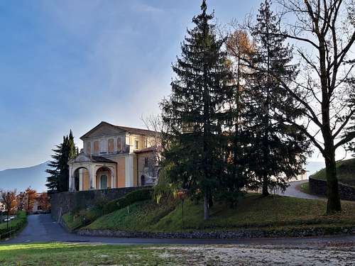
Road to Navazzo - Whether you come from Riva del Garda or from Salò you need to reach the town of Gargnano on the Western shore of Lago di Garda. In Gragnano take the road directed towards Valvestino and after several hairpin bends, at the entrance to the village of Navazzo, take a small road on the left that leads to the Church of Santa Maria di Navazzo 494 m., near which you can park near the sports field.
Road to Gaino - The village of Gaino can be reached from Toscolano Maderno, also located on the Western coast of the lake. From Toscolano Maderno we leave the Gardesana state road and go up the mountain following the signposts to Gaino, arriving there after about 3 km. Cross the village (piazza Michelangelo) and take the small and steep road uphill following the signposts "Castello-Palestra di roccia" and reaching Castello 362 m. Parking lot. Near a bar (immediately before which the path to the climbing crag (Palestra di roccia) starts on the left, signposted. Scarce parking possibilities, possibly continuing a few hundred meters, on the right there is a widening with a fence (space for two cars) where the descent route emerges. Park and go back down to the barrier.
Normal Route from Navazzo (NE route)
Monte Castello di Gaino from Navazzo
Difficulty: EE
Difference in level: 376 m.
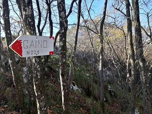
Just in front of the church, take an asphalted road in the opposite direction to the church, which ends immediately and continue along a path running alongside a fence. The path crosses another asphalted road (various signposts, among which "Monte Castello di Gaino"), and continues along a forest road leading near a hunting lodge, which can be avoided on the right (path CAI n. 221, red-white signs).
The path proceeds in the dense wood with some glimpses towards Monte Pizzocolo. After passing near an underground concrete building on the right, an old war post, the path proceeds obliquely to the left to reach the ridge at the point where it converges the itinerary coming from Gaino.
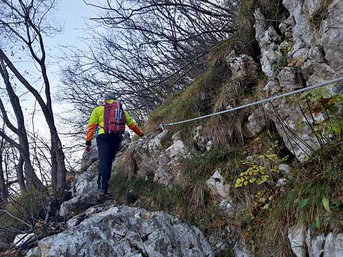
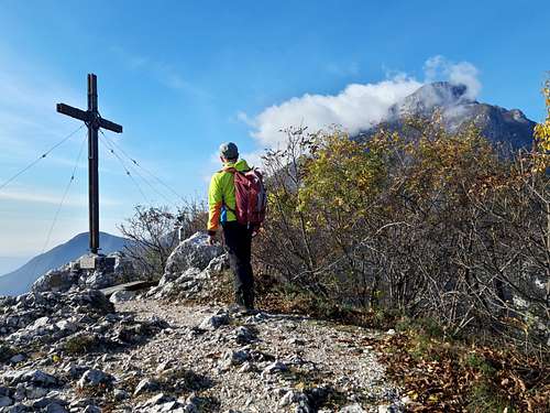
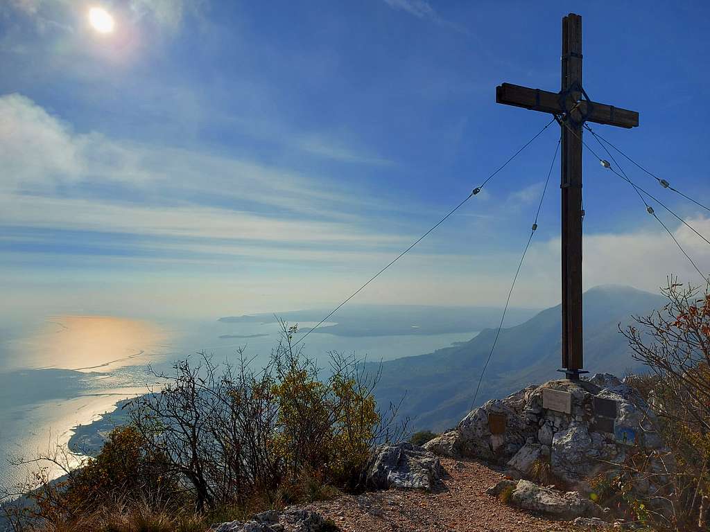
Proceed until you soon arrive below the summit, where the path climbs steeply up rocks and ledges with the help of a fixed metal cable, which facilitates to reach the last stretch, where you definitively exit the vegetation to get the summit with its huge summit cross and enjoy the spectacular view of the vast body of water of the Garda lake, on its coastal villages, on Monte Baldo and the Pizzocolo.
Normal Route from Gaino (South route)
Monte Castello di Gaino from Castello
Difficulty: EE
Difference in level: 508 m.
When arrived in Castello 362 m, take a small road that reaches a bar and a crossroads. Here follow the right direction along a wide track, sometimes cemented, (on the left there is the path approaching the sport climbing crag and the SW ridge). The track enters the woods and passes alongside a house, then it becomes a path heading towards the SW ridge, then bending Eastwards and overcoming a channel (the climbers' descent route). The path passes with some ups and downs under gray walls and with a last steep section equipped with a fixed rope reachs a wooded saddle where joins the previous itinerary.
South West ridge
Monte Castello di Gaino SW ridge
Difficulty: III+ (the original route, but more difficult variants are possible)
Difference in level: 508 m.
Long and pleasant route with moderate difficulties, it offers fun climbing. Some variants are possible that can increase the difficulties, however they can be circumvented. There aren't many pegs on the route, but there are many possibilities to place natural protections.
Road to Gaino - The village of Gaino can be reached from Toscolano Maderno, also located on the Western coast of the lake. From Toscolano Maderno we leave the Gardesana state road and go up the mountain following the signposts to Gaino, arriving there after about 3 km. Cross the village (piazza Michelangelo) and take the small and steep road uphill following the signposts "Castello-Palestra di roccia" and reaching Castello 362 m. Parking lot. Near a bar (immediately before) it starts on the left a signposted path to the sport climbing sector and the start of the SW ridge. Scarce parking possibilities here, eventually above there is a widening with a fence.
Walking approach - From the bar go up briefly to the left, then walking between two fences cross the slope towards the West, proceeding through a wood. After a landslide, you arrive at the sport climbing sector in about 15 minutes. At the left end of sector A there is the attack of the SW ridge, at the base of a gully.
Descent: along the Normal route to Gaino - From the summit, walk briefly northwards along the summit ridge, then head to left where it begins the stretch equipped with fixed iron ropes, at the end of which the path heads right to reach a col where the two Normal routes diverge. Here we must take the route to Gaino, so leave the track that continues downhill to the left (route to Navazzo) and go up a few meters to the saddle on the ridge to cross the hill on the E side overlooking the lake. After descending a short rocky stretch with a fixed rope, ignore the track that descends steeply, going up to the right (white red stamps and cairns), skirting the rocky walls of the SW Crest at the base with various ups and downs and passing by a memorial stone. Then the path descends more decisively and increasingly wider until it becomes a mule track and emerges on the road at the possible parking area with a fence, from which you reach the barrier in a few minutes.
Red Tape
No fees no permits required
Hiking and scrambling scale
T - Turistico (Tourist): Itineraries on wide, clear and well worn paths, sometimes on mule tracks or gravel roads. The routes are never exposed, don't give any orientation problems and don't exceed 2500 meters of altitude. Suitable also for children.
E - Escursionisti (Hikers): Itineraries on marked trails, even narrow and with possible steep and impervious sections. They are never exposed and don't give any orientation problems. They can tread different kinds of ground, such as forests, gravel, meadows, pastures, easy rocks, etc.). They form the majority of the trails that wind up in the mountains and require a certain habit to walk; you need equipment suitable for the altitude and resistant footwear with soles suitable for rough terrain.
EE - Escursionisti Esperti (Experienced Hikers): Itineraries for hikers with experience and good knowledge of the mountain. Some of these paths may have exposed sections, however brief, which require firm foot and no dizziness. They require the ability to adapt to particular terrain, such as steep grassy slopes or stretches of rocks with difficulties that can reach the 1st degree of the UIAA scale. They can also reach high altitudes (3000 m or more). Sometimes they may include unmarked sections, requiring a good sense of orientation. Snow slopes are possible, however which can be overcome without specific mountaineering gear (rope, harness, crampons, ice-axe).
EEA - Escursionisti Esperti con Attrezzatura (Experienced Hikers with equipment - The same as EE, in addition these routes require the use of via ferrata equipment (lanyards, harness, carabiners, heat sink, helmet). This kind of itineraries range from the trails with short easy and not much exposed sections, previously equipped with fixed ropes and iron pegs, to the true and more difficult Via Ferratas climbing on rocky walls or on aerial ridges and ledges, previously equipped with long stretches of iron ropes, iron steps, ladders without which proceeding would constitute a real climbing. It is necessary to know how to use the technical equipment and have a certain habit of exposure and mountaineering terrains.
When to Climb
All year round
Accomodation
Different possibilities thereabout.
Bibliography
- "Prealpi Gardesane Occidentali" by R. Bontempi, F. Camerini, R. Ciri - Idea Montagna edizioni 2018
Meteo forecast