
-
 15311 Hits
-
 78.27% Score
-
 9 Votes
|
|
Route |
|---|---|
|
|
45.67880°N / 7.38461°E |
|
|
A long day |
|
|
PD- |
|
|
Approach
TO PILA By car
Autostrada A5 Torino-Aosta (99 km). Exit Aosta Est, then follow the regional road in the direction Pollein-Charvensod-Pila. From abroad: Via the Great St Bernard tunnel, then on State Highway SS.27 to Aosta or via the Mont Blanc Tunnel, then on State Highway SS.26 to Aosta. From Aosta, follow the signs to Gressan-Pila.
By train From Turin or Milan to Aosta via Chivasso. The cable car to Pila is joined to the station by a short pedestrian subway.
By bus The regular Turin-Aosta and Milan-Aosta autostrada coach services are joined in the winter by the "Freccia delle nevi" service from Bergamo, Milan and Genoa (Monday to Friday).
![]()
Route Description
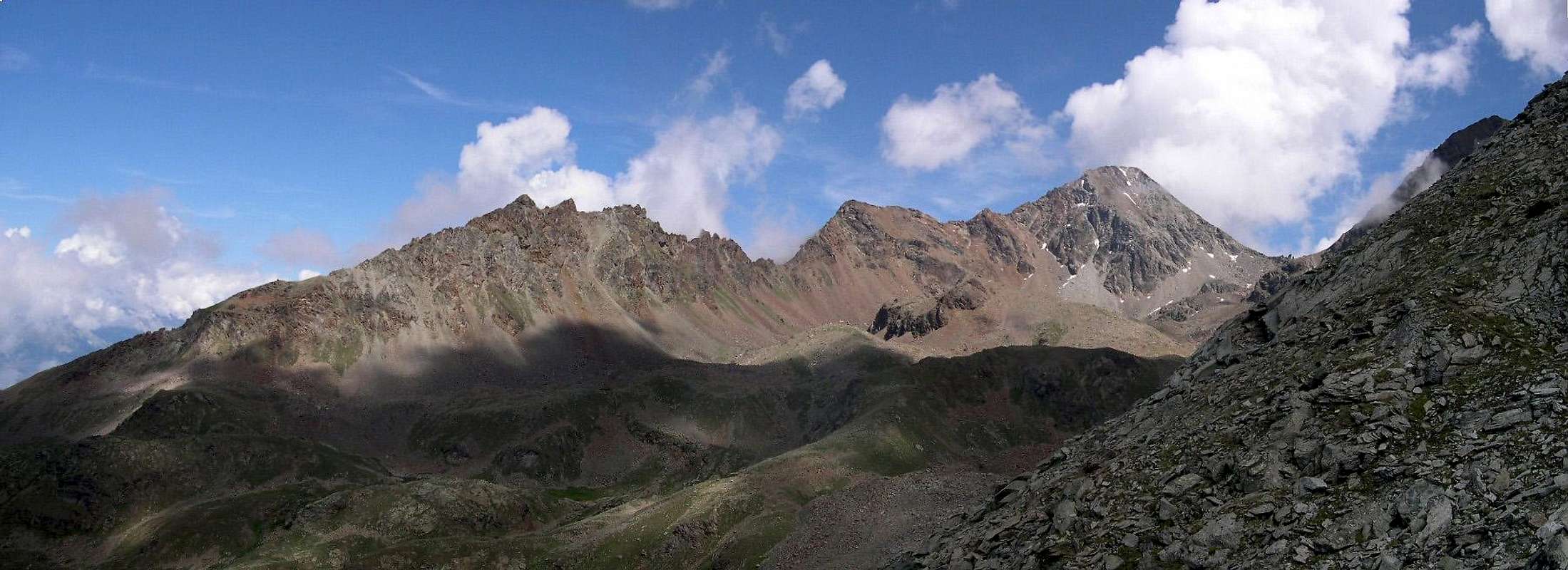
From Pila to refuge Alpe Arbole (first part by chair-lift, then 1h'30 by walk through a pass, evident signals on the path), situated near a nice lake. From the refuge take the left side of the lake.
Walk until a moraine and go up on it. You will arrive on the Emilius ridge that leads to the peak (be carefull to the signals!).
TIME REQUEST: 4 hours from the refuge, 7 hours to go and come back.
 |
 |
 |
 |
 |
Essential Gear
Hiking equipment, a rope if you want to be more sure on the ridge (not necessary if you are expert). In early or late season crampons for the ridge.Miscellaneous Info
If you have information about this route that doesn't pertain to any of the other sections, please add it here.- Meteo: you can find all the needed informations at the official site of the Valle d'Aosta Region:
- Valle d'Aosta Meteo
Books and Maps
- "Guida del Monte Emilius", di Osvaldo Cardellina Editore in collaborazione con il Club Alpino Italiano Sezione di Aosta, Dicembre 1978.
- "Guida dei Monti d'Italia – Emilius Rosa dei Banchi Parco del Mont Avic" di Giulio Berutto e Lino Fornelli - Club Alpino Italiano/Touring Club Italiano, Marzo 2005.
- "Guida delle Alpi Occidentali" di Giovanni Bobba e Luigi Vaccarone C.A.I. Sezione di Torino Volume II (parte II), 25 Maggio 1896.
- "80 itinerari di Escursionismo Alpinismo e Sci Alpinismo in Valle d'Aosta", di Osvaldo Cardellina, Ed. Musumeci, Giugno 1977 (in Italian); seconda Ed. Luglio 1981; terza Ed. Luglio 1984; (in French), prima Ed. Febbraio 1978; seconda Ed. Marzo 1980.
- "Diari Alpinistici" di Osvaldo Cardellina e Indice Generale accompagnato da Schedario Relazioni Ascensioni 1964-2019 (inediti).
 |
 |
 |
- Kompass "Gran Paradiso Valle d'Aosta Sentieri e Rifugi" Carta turistica 1:50.000.
- L'Escursionista "Conca di Aosta-Pila-Monte Emilius" Carta dei sentieri (n° 4) 1:25.000.
- Hapax "Les Sentiers Comunità Montana Monte Emilius", Luglio 2000 1:25.000.
- Enrico Editore Ivrea-Aosta "Gruppo del Gran Paradiso" 1:50.000.
- I.G.C. Istituto Geografico Centrale, Torino "Carta delle Passeggiate ed Escursioni in V.D.A. Conca di Pila-Gressan, 1:20.000.
External Links
- More about Emilius Another description with 40 shots, 6 panoramas and a "handmade" map, about Emilius.
- Pila web-site Pila, the famous winter station, has an active life even in summertime. In this link, you'll able to find time schedule for Chamolè Chair Lift.
- REGIONE AUTONOMA VALLE D'AOSTA the official site.
- FONDAZIONE MONTAGNA SICURA Villa Cameron, località Villard de la Palud n° 1 Courmayeur (AO) Tel: 39 0165 897602 - Fax: 39 0165 897647.
- A.I.NE.VA. (Associazione Interregionale Neve e Valanghe).
Useful numbers
- Protezione Civile Valdostana località Aeroporto n° 7/A Saint Christophe (Ao) Tel. 0165-238222.
- Bollettino Valanghe Tel. 0165-776300.
- Bollettino Meteo Tel. 0165-44113.
- Unità Operativa di Soccorso Sanitario Tel. 118.