The closest town is Stepsantminda, about 3 hour’s drive from Tbilisi. The town is fairly well stocked with groceries and some limited climbing equipment for rental – if you need anything other than the basics, you’ll need to get this beforehand. There are plenty of places offering guides for Kazbek here if you are after one. Sun cream doesn’t seem to be available anywhere in the town so buy this before you arrive.
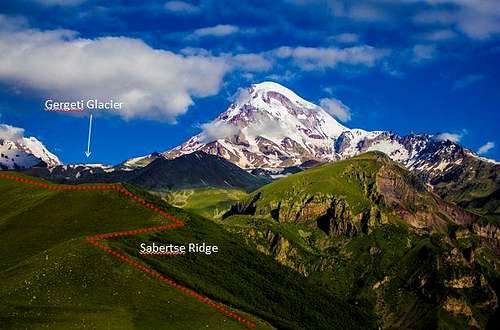
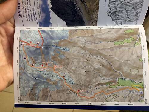
The hike in starts from Gergeti church which overlooks the town at 2170masl. From the central square in Stepsantminda you can take a shared taxi up to the church for 5 Lari. From here it’s a 9 km hike to the Bethlemi Hut, which is where route starts.
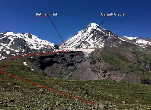
The path from the church follows the Sabertse Ridge for about 3 hours before traversing North West to join the bottom of the Gergeti Glacier. From here the Bethlemi Hut is visible and can be reached in 1-1.5 hours across the glacier. This section of the glacier appears to be relatively free from crevasses and most groups were crossing on a well-established path without a rope (do so at your own risk!).
Accommodation
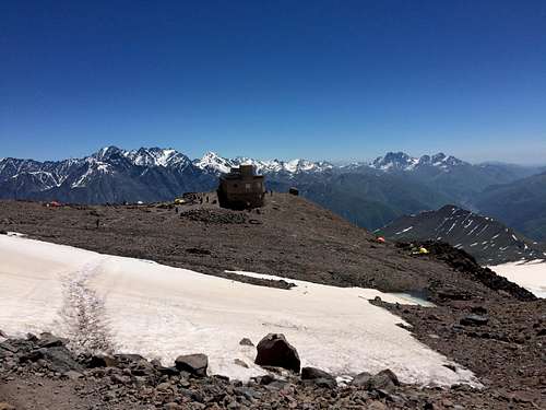
Bethlemi Hut (3670m)
If you are expecting a traditional French, Swiss or Italian alpine hut then you will be sorely disappointed. There are beds available at the hut and a rudimentary kitchen, but there is no running water and you will need to bring all your food with you. There are also numerous camping spots around the hut which you can use for free.
There are some very basic toilets but these are wholly in adequate and poorly maintained considering the number of people using the camp. In general the sanitation in this camp is pretty bad.
Depending on the conditions, water can be taken from a stream running off the snow field, but given the above, I would hesitate to drink this untreated.
There is a medic / rescue team that appears to be permanently based here.
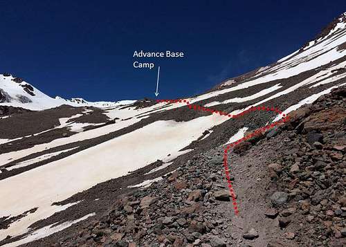
Advance Base Camp (3820m)
A mere 30minutes further from Bethlemi Hut you reach a white cross and some more camping spots. This camp, in our opinion, is far nicer than the hut. Fewer people, less rubbish and generally feels much cleaner. A small stream ran from a snow field adjacent to the camp whilst we were there and we had no problems drinking this water.
At either of these two camps I would completely avoid drinking the water untreated if it has been raining / snowing, as surface water run-off from the camps probably has a high chance of being contaminated.
Camp 1
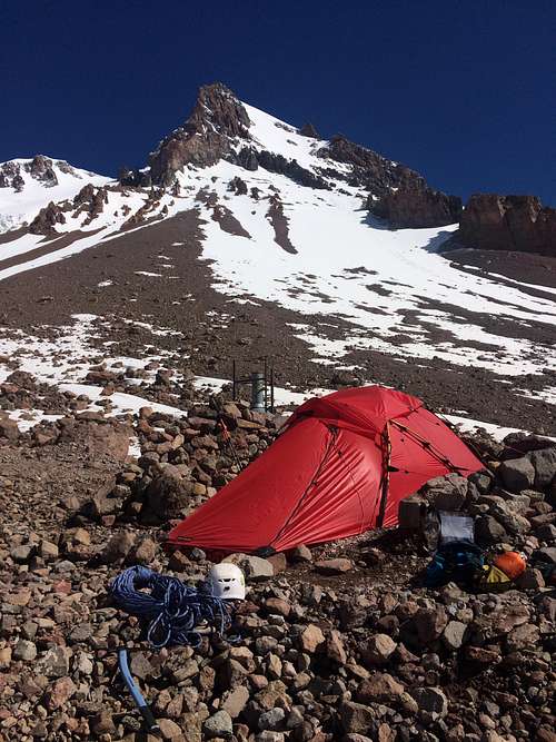
For those wanting to sleep higher again and have an easier summit day, there is a camp on the glacier at around 4250m. You will be camping in the snow here so, snow shovel + pegs etc. would be recommended.
The Route
From Bethlemi Hut the route, which is well established, heads west traversing scree and snow fields to reach the white cross and ABC in about 30-40minutes (3820m). From here it’s another 20minutes to the black cross (3880m) and the point at which you re-join the glacier. The glacier from here is crevassed so rope up.
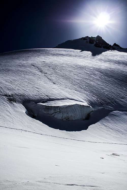
After the black cross the path winds through moraine deposits on the glacier and passes the Khmaura Wall on your right. There is heavy and constant rock fall from this wall, so stick well to the left. Once you have passed the wall you get on to the open glacier where there are some fairly sizable crevasses.
Pass the seracs on your right and follow the glacier north up to a plateau where the path heads east (into Russia) and starts climbing steeply.
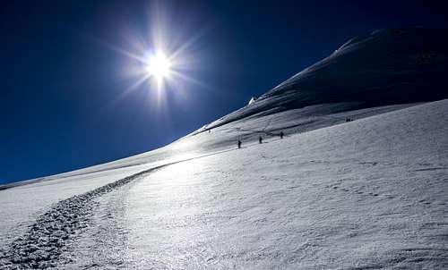
The path continues up steep snow slopes, often requiring steps to be cut in, winding past some big crevasses before turning back south west to climb up to a small plateau about 150m below the summit.
The last section before the summit is 45 degrees in parts and often icy. Ice screws are useful, particularly on the descent. When we did this there was an in situ belay at the rocks to the left for the first section.
Depending on what shape you’re in and how well you’re acclimatised, the route should take about 4-5 hours from ABC, but there were groups taking nearly double this.
Acclimatisation
I would strongly recommend taking at least one acclimatisation day around BC / ABC. We took two in the end with an excursion up to 4550m the day before we summited and it made all the difference
Trekking maps are available in various shops in Stepsantminda. We picked up a guide book produced by the local tourist board (for free) in Mestia, Svaneti, which included a map. It didn’t seem to be available in Stepsandminda.
External Links
Remote Corner Adventures offers guided climbing, trekking and skiing trips in Georgia and throughout Central Asia.
Parents refers to a larger category under which an object falls. For example, theAconcagua mountain page has the 'Aconcagua Group' and the 'Seven Summits' asparents and is a parent itself to many routes, photos, and Trip Reports.