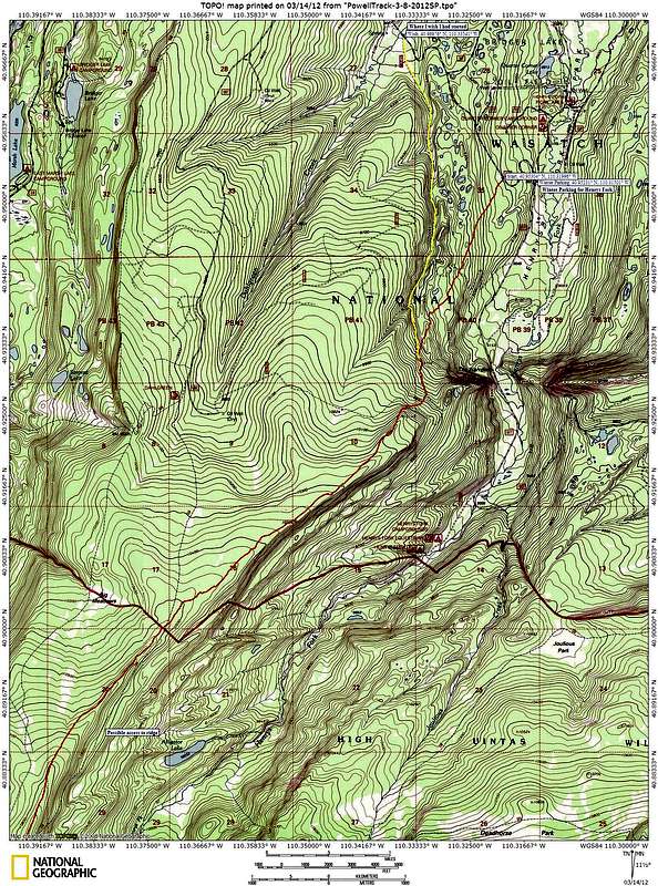
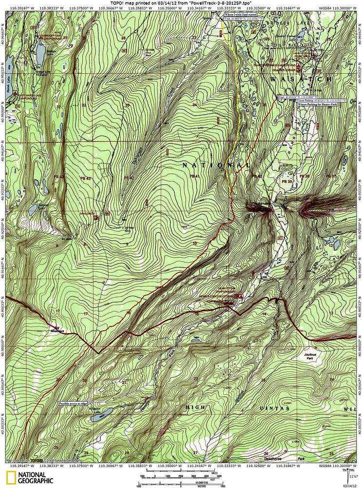
This map shows the first part of my route to Mount Powell. Contour lines are every 20' so the terrain appears steeper than in map 2 which has 40' contour intervals. The red line shows the way I went. There is an unplowed dirt road under the yellow line which shows the way I wish I went.


