
|
|
Mountain/Rock |
|---|---|
|
|
42.02226°N / 78.86673°W |
|
|
Hiking |
|
|
Spring |
|
|
2144 ft / 653 m |
|
|
Overview

Mount Tuscarora is located in the Allegany State Park just south of Salamanca, New York. The mountain runs along the southern boarder of the park towards the Pennsylvania state line. It is not the highest peak in the park but does offer a scenic hike along the ridge. Mount Tuscarora makes for a easy day of hiking for most anyone. There are also two other hikes in the same area that could be easly hiked following Mt Tuscarora, the Three Sisters hike and Mt Scenca. For a much longer hiking option the North Country trail runs through 18 miles of the park with possible backpack camping. I know this is not the region of New York that most people would like to travel to in search of hiking or big mountains but if you should happen to be in the area or are looking for a small trip I would highly recommend this area.
Getting There
Take interstate 86 from the west to exit 18. Take 280 south towards the park entrance road which will be one your left. Trun onto Allegany State Park road 3. Take this road into the park for 4 miles to Coon run road where the trailhead is located.
From the east get off at exit 23 and take 219 south to limestone road and head towards ASP 2. Take ASP 2 to ASP 3 until you reach the Coon run junction on your left.
The Hike
Mt. Tuscarora- Firetower trail. The trail is five miles one-way from the Coon Run trailhead to the end which is located near the Quaker Lake entrance. This can make for a unpleasent hike back to your camp or car some four miles back down the road or what I would recommend is that before the trail begins to descend towards the road you turn around and hike back the way you came. Unless you want to spend some time down by the lake, which is a cool place but I would highly recommend that you go back the way you came.
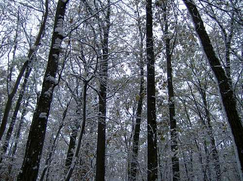
From the trailhead you will see a sign for the designated hike with a topo map and description. Once on the trail follow the blue blazes. The start is pretty flat for the first mile and is a slow start but eventually the trail makes a rather easy climb up to the ridge. Once on the ridge you can sneek some views out through the trees at the surrounding terrain but nothing to impressive. You will know that you have reached the summit when you come to the abandoned firetower which for some reason they have decided to close. If in dry conditions or with someone else to give you a boost you might be able to get up to the first set of stairs but when I was there it was rather wet and it just wasn't going to happen. The trail continues on straight along the ridge towards what on the map lists as a scenic vista but I never found it. The next thing I know I was down and out of the snow back on the road. The snow level was a very unique part of this hike. I know that I am no expert but we are dealing with a relatively low elevation mountain and from the summit to the base was a drastic difference in snow. So if you do not want to hike out on the road or go down to the lake once the trail heads down turn around and go back the way you came.
Camping
Plenty of camping and cabin rental options in differnt parts of the park. Nearest campgrounds to the trail are are Diehl and Cain Hollow. call (716)354- 9101 to consult about camping details and the seasonal use of the campgrounds.
External Links
Allegany Regionenchantedmountains.info
Enchanted Mountains
Contact Information:
2373 ASP, Route 1, Suite 3
Salamanca, NY 14779
Phone:
(716) 354-9121
Reservations:
(800) 456-2267