
-
 4944 Hits
-
 78.27% Score
-
 9 Votes
|
|
Mountain/Rock |
|---|---|
|
|
37.93418°N / 107.72316°W |
|
|
Ouray |
|
|
Hiking, Mountaineering |
|
|
Spring, Summer, Fall, Winter |
|
|
13359 ft / 4072 m |
|
|
Overview
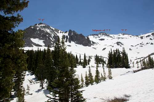
T 7 is the boring looking summit on the right side
T 7 combines really well with surrounding 13ers, either Telluride Peak (simple walk), or T 8 (a little more challenging traverse consider dropping down below the saddle on the north side).
T 7 is great on skis early in the season, and the skiing is not very steep.
T 7 is great on skis early in the season, and the skiing is not very steep.
Colorado Rank: 350
Class: 2
Parent Lineage: Line Parent: Unnamed 13,510
Proximate Parent: Chicago Peak
What's up with the name? There are many summits that have unofficial names that have sprung up because of local usage or traditional agreement in the climbing community. Examples of these are some of the "T", "S", or "V" designation summits in the San Juans ("T" after Telluride, "S" after Sneffels, and "V" after Vermillion).
Nearby Peaks: "T 8" 13,315 feet 0.66 miles
Telluride Peak 13,509 feet 0.95 miles
Chicago Peak 13,385 feet 1.29 miles
Unnamed 13,510 13,510 feet 1.40 miles
United States Mnt 13,036 feet 1.78 miles
Tomboy Peak 13,095 1.79 miles
Hayden Mnt South 13,206 feet 1.80 miles
Trico Peak 13,321 feet 2.14 miles
"T 5" 13,436 feet 2.80 miles
Getting There
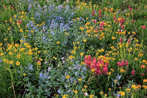
Wildflowers along Imogene Pass
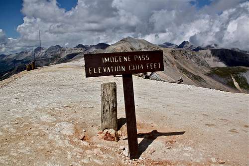
Imogene Pass
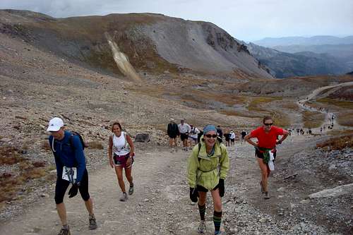
Imogene Pass Run around 13,000 feet high - keep smiling
Imogene Pass Rd
The Imogene Pass Road is a popular rough 4 WD road which connects two historical and beautiful mountains towns: Ouray and Telluride. Imogene pass is also the highest pass road in the San Juan Mountains - elevation 13,114 feet.
History of the road: The Imogene Pass road was built in 1880 for access to Ouray from Tomboy Mine. It was named for Imogene Richardson, the wife of one of Thomas Walsh's partners in the Camp Bird Mine. Wires carrying the first commercial transmission of alternating current electricity were strung across this pass in the 1890s. The power was generated in Ames and transmitted to Ouray.
The Tomboy Mine, located in 1880 by Otis Thomas, was situated high above Telluride. Tomboy was Thoma's nickname. For several years there was little activity in Tomboy because it was hard to reach. But after the silver crash in 1893, prospectors struck gold at the Tomboy, and the mine was very productive. The Tomboy Mine was sold for $2 million to the Rothschilds of London in 1897 and continued to operated until 1927.
Imogene Pass Road Description: Imogene Pass is the second highest pass road in the United States and provides a wonderful scenic route though the San Juan Mountains. The route passes through two major mining camps: Camp Bird and Tomboy. I usually come from Ouray side since it is closer to me. The Imogene Pass run always runs from Ouray to Telluride. I have actually never driven the road, but hiked it and ran it many times.
From the Yankee Boy turnoff, the road deteriorates and high clearance 4WD is needed. The track travels through the forest and Imogene Creek Valley. There are number of shallow creek crossings, the roads narrows for the final ascent to the pass. The summit is well marked and a great place to stop. There is parking for several cars.
About two miles from the pass, the track enters the ghost town of Tomboy. The town site has several historic remains. Another couple of miles past Tomboy, the road passes through Social Tunnel, a short passage through a rocky outcrop. Near this tunnel is a good place to spot and view Ingram and Bridal Veil Falls.
Route
T 7 has a gentle rounded summit easily approachable from Imogene Road higher up or from the top of Imogene Pass. The eastern aspects of its slopes offer basically just a gentle stroll, class 2. This mountain is great for ski approach. There is no establish trail, you just have to leave Imogene Pass road at some point. If coming from Ouray side, stay on the road as long as possible, otherwise you will ran into some steep scree terrain. Also the traverse from T 7 to T 8 is not easy! The best way is to descend way down on its northern side and try to find a grassy slopes (steep) up T 8.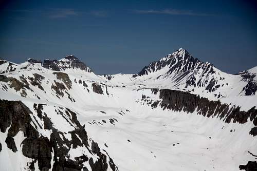 Mount Sneffels and Gilpin on the left as seen from T 7 | 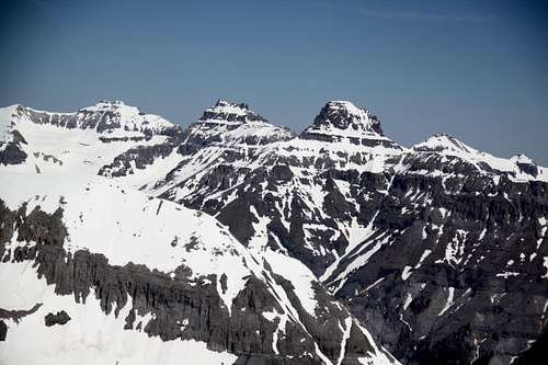 Potosi and Teakettle as seen from T 7 |
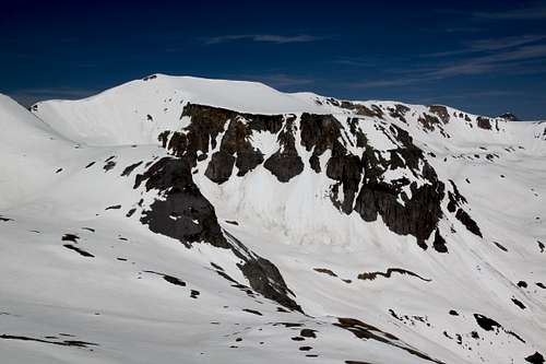 Chicago Peak as seen from T 7 | 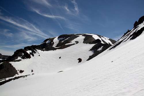 T 8 as seen from the slopes of T 7 |
Red Tape
There is no red tape. Hiking, parking are for free.