
-
 8319 Hits
-
 77.48% Score
-
 8 Votes
|
|
Mountain/Rock |
|---|---|
|
|
38.71834°N / 106.42285°W |
|
|
Chaffee&Gunnison |
|
|
Hiking |
|
|
Spring, Summer, Fall, Winter |
|
|
13345 ft / 4068 m |
|
|
Overview
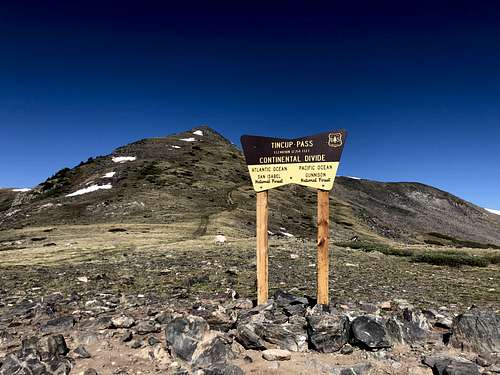 Tincup Pass
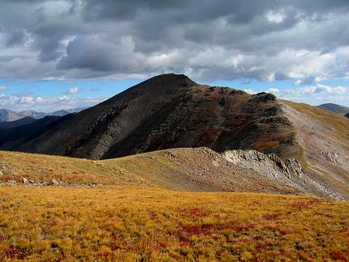
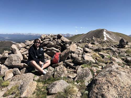 False summit
Colorado Rank: 357
Class: 1+
Line Parent: Emma Burr (saddle between Emma Burr and Tincup is at 12,900 feet).
Nearby Peaks: Emma Burr Mountain 1.11 miles
Unnamed 13050 1.49 miles
Fitzpatrick Peak. 2.08 miles (on the south side of Tincup Pass)
Mt. Kreutzer 2.70 miles
Tincup Pass is 4 wheel road, from the East it connects historic and quaint mountain town of St. Elmo and on the west side Tincup - a small residential community with many century old buildings. The top of the pass is 12,154 feet high. The road is open seasonally from mid June to early autumn (depending on snow conditions). You need a high clearance 4WD vehicle to access this road, and it is easier from the east. The west side of the pass is pretty rough.
Tincup Pass has been a route from east to the town of Tincup since the 1800s. It was first a burro trail and later a toll road. The road and pass are part of the Continental Divide Trail (segment 26).
Both the town Tincup and the pass acquired their names because an early prospector reputedly carried his gold dust in a cup.
Getting There
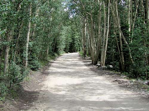 Tincup Pass Road
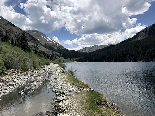 Mirror Lake
From the west, you can come either via Cumberland Pass from US 50 and via Pitkin or from Taylor Park to the town of Tincup. It is 6.7 miles from Tincup town to the pass. The first section of the road is passable by regular vehicles all the way to the Mirror Lake. From here you do need a high clearance 4 WD vehicle. The road is a lot rougher from the west. It is about 3 miles from the Mirror Lake to the top of the pass and if water is high and you may have to drive through some water on the road (it is right along the shore of the road and higher up crosses a cree
Route
The route finding is very obvious. From the pass head north on a small trail. It is initially a little bit steeper, but soon you will reach a false summit with a little wind shelter. From here the stroll to the actual summit is very easy. You may return the same way, or continue onto Emma Burr Mountain - highly recommended.
 Emma Burr as seen from the slopes of Tincup Peak
 | 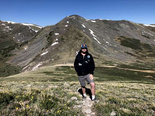 Hiking up Tincup with a view of Tincup pass below (can you spot 2 cars?)
 |
Red Tape
There are no fees to hike or drive up the Tincup Pass.
When to Climb
Summer are the easiest since you can drive up all the way to the pass, winters are more complicated and provide a long snowy access in an avalanche zone. Always check avalanche conditions prior venturing out in the winter.
Camping
There are many beautiful primitive campsites on the east side of the pass, some provide privacy and are located by a stream. The west side - there is a campground by Mirror Lake.
External Links