
|
|
Mountain/Rock |
|---|---|
|
|
47.94073°N / 123.28726°W |
|
|
Callam |
|
|
Hiking, Scrambling |
|
|
Spring, Summer, Fall |
|
|
5622 ft / 1714 m |
|
|
Overview
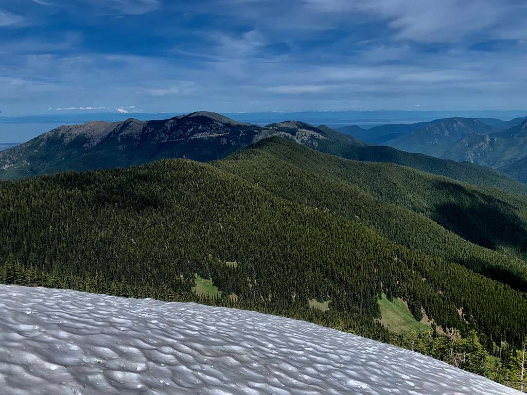
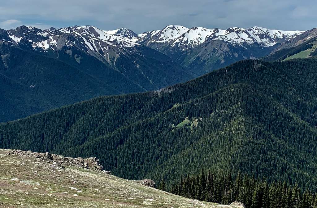 Sorry folks. Green Mountain is the peak in the right foreground. Taken from Blue Mountain
Ever go to Maiden Peak and wonder what this Green Mountain is doing on the topo maps. The point isn't even 200 feet of prominence. What is the signifance of this peak. Well folks now you will know all about Green Mountain. Green Mountain is nothing more than a bump that lies between the awesome drive up Blue Mountain and another stunning peak in Maiden to the southwest. Honestly this peaklet is overshadowed for a number of reasons. First the trail goes just south of it and it is a steep 150 foot elevation gain offtrail bushwhack to get to the summit and second the views on Green are not nearly as impresseve as neighboring Blue and Maiden. But the National Park Service named so I had to just check it out.
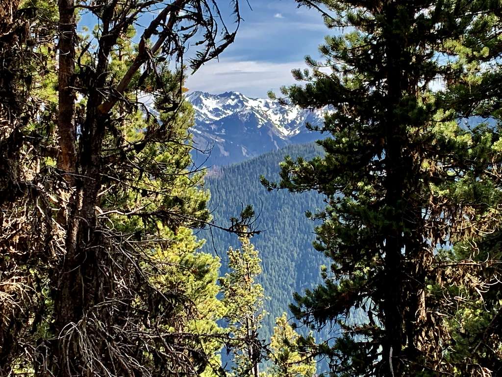
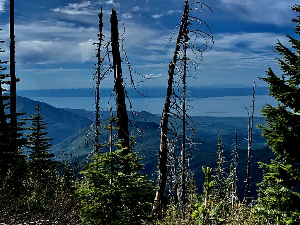 Nice view through the burn to the north
Due to recent burn activity a view has started to open up on the very north end of Green Mountain toward Blue Mountain and the Straight of Juan de Fuca. I suspect this view will get even better in the next couple of years as well. There is also a nice cairn on the summit of this Green Mountain as well. From the Deer Park trailhead it is 3 miles roundtrip and 1300 of loss gain to the summit. I would anyone here on this site that this summit actually isnt all that bad but if you are to head to Green Mountain make the extra effort to head on over to Maiden peak which add another 4 miles roundtrip and 800 feet of gain. You will be glad you did.
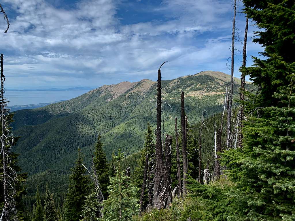 Nice shot of Blue Mountain through the burn scar
Getting There
FROM THE NEARBY TOWN OF SEQUIM: Go northwest on Route 101. After 12 miles make a left Deer Park Road and head south. Stay on it for 17 miles until road junction up high on Blue Mountain. The road does turn into a gravel road for the last 9 miles but it is in good condition. Make a right there and the Deer Park Trailhead pullout will be on your right.
Route
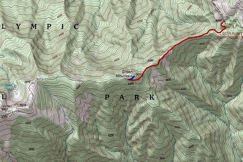
From the Deer Park Trailhead take the Deer Park Trail southwest for about 1.4 miles. Once you spot that you are close to the summit of Green Mountain then bushwhack straight uphill to the summit of Green Mountain. You will know you are on the summit by the small cairn that marks it. For a view bushwhack another 100 feet and decent views through the dead trees await of Blue Mountain and the Straight of Juan de Fuca. Either return the way you came or head back to the trail and for Maiden Peak.
 A good shot of both Blue Mountain and Green Mountain
Red Tape
National Park permit required. America the Beautiful Pass can be used at this location as well.
When to Climb
 Peak-a-boo while decending the steep bushwhack of Green Mountain
This peak is best done June through November when Deer Park Road is accessible.
Camping
Backcountry permits are required and honestly this hike does not require overnight camping. There are 14 established areas at the Deer Park Campground that have toilet located very close to the trailhead.
External Links
Green Mountain Peakbagger Page