
|
|
Mountain/Rock |
|---|---|
|
|
38.76210°N / 78.2739°W |
|
|
Warren |
|
|
3474 ft / 1059 m |
|
|
Overview
Nestled in Shenadoah National Park, Hogback Mountain is highest mountain in the Northern part of Skyline Drive, it is also the highpoint of Warren County, Virginia. Hogback is only a few miles south of Mount Marshall. The summit area of Hogback is not much to look at, since it is blocked by trees, and a little house behind a high voltage radio tower. However, the hike up is an enjoyable, sometimes steep and rocky excursion. It is very accessible from Skyline Drive, on both sides. On the South side of the mountain (in front of Hogback Overlook 3385') you can do some real rock climbing to get a better viewpoint of the mountain. |  |  |  |
Getting There
SKYLINE DRIVEFrom Washington DC follow I-66 West and exit onto US 29 at Gainesville. Follow to Warrenton, and take 211 West. Take 211 to Sperryville until you reach Skyline Drive. Go North on Skyline Drive for about 11 miles. Start your hike at Milepost 20.1 off of Skyline Drive, called Little Hogback Overlook. Elevation 3,035 feet. At the overlook is a full map of the entire Appalachian trail. You hike down the Appalachian trail, behind a brick wall, and then hike up to the Hogback summit about 1 mile away.
The total elevation gain is about 475 feet given the early loss of elevation.
The unceremonious summit is a little house and some high voltage signs. A dirt road comes up from another direction. If you follow the Appalachian trail, you descend about 100 feet very quickly to an overlook at milepost 21. An innovative route is to do a 2 mile loop hike where you hike up from Little Hogback Overlook, and hike down Skyline Drive on the brick wall.
If you want to try a longer, steeper hike, you may want to start at Gravel Springs Gap (mp 17.5). That would be over 900' of elevation gain and about 5 miles round trip.
Or, you can follow the Appalachian Trail to the summit from the Elkwallow Picnic Area. Follow Skyline Drive to about Mile 24, and then make a right turn into the Elkwallow Picnic Area. Park where you see a sign for the Appalachian Trail.
Follow the trail in front of you to the Appalachian Trail, and make a right. Hike on the Appalachian Trail for about 3.3 miles; you will cross Skyline Drive four times. After the fourth crossing, hike on a fire road for 0.2 miles to the summit.
Round trip: About 7 miles with an elevation gain of 1,100 feet.
OFF-SKYLINE DRIVE
The best option from off Skyline Drive is to take the Little Devils Staircase. This route climbs over 2,100 feet from the Shenandoah Valley to the top of Hogback Moutain over stream crossings and waterfalls. Directions and information can be found on the Little Devils Staircase route page.
 |  |  |
When To Climb
Climb all year. The park, or sections of the park, may be closed if road conditions are poor. Check with the park at 540-999-3500.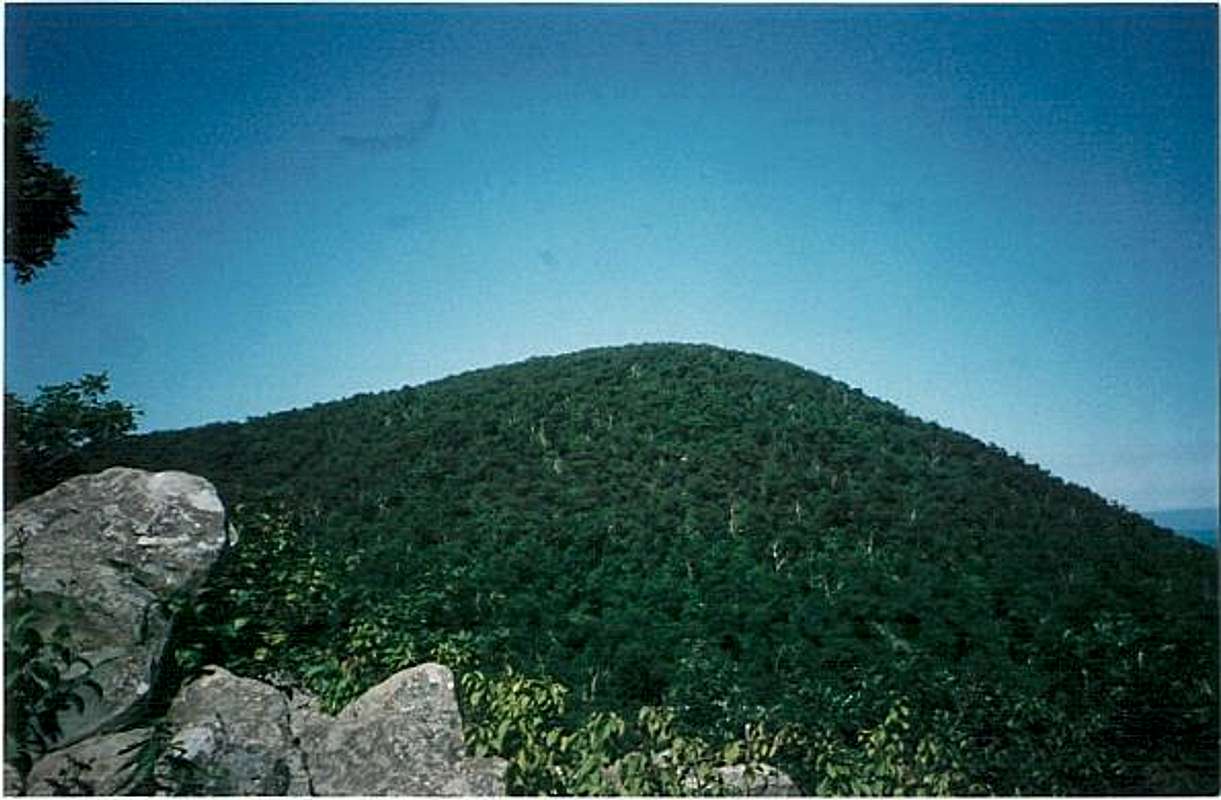
Hogback is very green in the early summer
Red Tape
Access to Skyline Drive in Shenandoah National Park cost $30 for an annual pass. If you do not live in the DC area, you can pay the $15 fee to enter Skyline Drive ($10 from December-February).Camping
Campsites are not always open during the winter and spring. Backcountry Camping Permits are required and are available free from park headquarters, visitor centers, and entrance stations. Appalachian Trail hikers may self-register for permits on the AT near Rockfish Gap (south) and Chester Gap (north).Campfires are not permitted (except at pre-constructed fireplaces at backcountry huts and day-use shelters). Groups may not exceed 10 people. For more info consult the park website.
Mountain Conditions
Check with the park at 540-999-3500.External Links
- Shenandoah National Park
Shenandoah National Park homepage
- weather
Weather in nearby area town of Bentonville
CheesySciFi - Feb 4, 2012 10:59 pm - Voted 10/10
Elkwallow Picnic AreaAnother way to follow the Appalachian Trail to the summit is from the Elkwallow Picnic Area. Follow Skyline Drive to about Mile 24, and then make a right turn into the Elkwallow Picnic Area. Park where you see a sign for the Appalachian Trail. Follow the trail in front of you to the Appalachian Trail, and make a right. Hike on the Appalachian Trail for about 3.3 miles; you will cross Skyline Drive four times. After the fourth crossing, hike on a fire road for 0.2 miles to the summit. Round trip: About 7 miles with an elevation gain of 1,100 feet.