

-
 23226 Hits
-
 87.31% Score
-
 24 Votes
|
|
Mountain/Rock |
|---|---|
|
|
45.83100°N / 7.78670°E |
|
|
10873 ft / 3314 m |
|
|
Overview
Testa Grigia (3.314m)
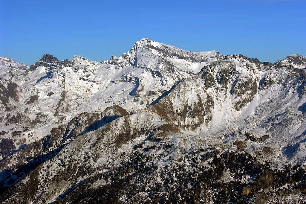
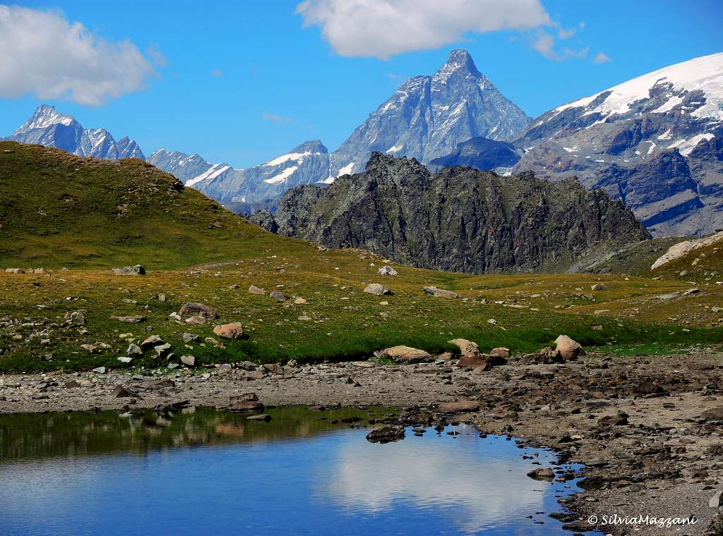
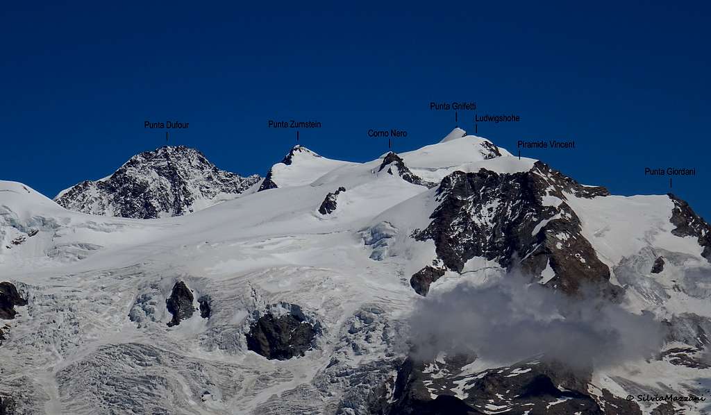
Not to be confused with the homonymous snowy hill nearby Breithorn Col, Testa Grigia (3.314m), also known by the toponym Groab Hont, is a massive mountain belonging to the Monte Rosa group, the highest summit located on the buttress that divides Val d'Ayas and Valle di Gressoney, South from Monte Rosa. Testa Grigia represents one of the classic ascents on the "Three thousand" of the Aosta Valley and It is probably the best balcony for dawn/sunset show on Monte Rosa and Cervino. A confortable bivouac (Ulrich Lateltin, 3.153m), located on Monte Pinter summit, at about 45 min/1 hour from Testa Grigia top, helps the alpinist in this goal. Another facilitation is the existence of a cable car starting from Champoluc which reduces the difference in level to be faced. Due to its height and its isolated and predominant position Testa Grigia offers an exceptional panorama both on the nearby peaks of Monte Rosa group and other Aostan mountains and generally on the Alpine chain.

On the mountain there are few climbing routes, but they are rarely attended due to the friability of the rock. In practice the summit is nowadays only climbed along the Via Normale, which, however, can be reached from three different starting points converging in the upper part. One from Gressoney La Trinitè, the second from Gressoney St. Jean and the third one, assisted from a cableway in Champoluc - Val d'Ayas. The last two trails join them at Colle Pinter. The only difficulties consist in some sections of easy climbing just before the summit, however facilitated by the presence of fixed ropes.
First Ascents
- First on the summit from Pinter Pass: by mountaineers L. Delapierre, A. Laurent, B. Rignon, J. and J.C. Pinney, Aug 7th, 1858
- In winter: Antonio Laurent, Jan 10th, 1864
- From Torino or Milan: Motorway A5, exit in Pont Saint Martin. Follow Val di Gressoney direction or alternatively exit Verrès and follow the Val d'Ayas direction.
- From Switzerland (Tunnel or Grand Saint Bernard Pass): in Aosta Est, get into Motorway A5. Follow Torino direction, exit from A5 in Pont Saint Martin, follow Val di Gressoney direction or alternatively exit Verrès and follow the Val d'Ayas direction.
- From France (Tunnel Mont Blanc or Petit Saint Bernard Pass): get into Motorway A5, follow Torino direction, exit from A5 in Pont Saint Martin, tell a couple of bad words to the man in the box for the huge motorway fee, and follow for Val di Gressoney direction or alternatively exit Verrès and follow the Val d'Ayas direction.
- Route 1, "La diretta". Park the car in Gressoney la Trinitè, and look for a shop called "Alimentari Welf". Very close to this shop there is the headtrail.
- Route 2, "Ondre Castel, Pinter", Gressoney Saint Jean. At Km 31 of Val di Gressoney Road, there is a little park, close to a garbage collector. 50 meters under this little parking there is headtrail ("Colle Pinter" indication on yellow panel). It is possible to begin this route from Chamonal village (km 28,8 of Val di Gressoney road). It's a little big longer, but a visit to the typical village of Alpenzu Grande (1.779m) will satisfy your curiosity for old Walser architecture. People interested in Champoluc destination, follow the same instruction as before changing Pont Saint Martin with Verres (exit from A5), and follow Val d'Ayas direction.
Testa Grigia Normal route from Champoluc (Val d'Ayas)
Testa Grigia Normal route from Champoluc
Summit altitude: 3.314m
Difficulty: EEA
Difference in level: 907m from Ostafa, 1.745m from Champoluc
A good and panoramic route to summit one of the classic 3.000m peak of Valle d'Aosta
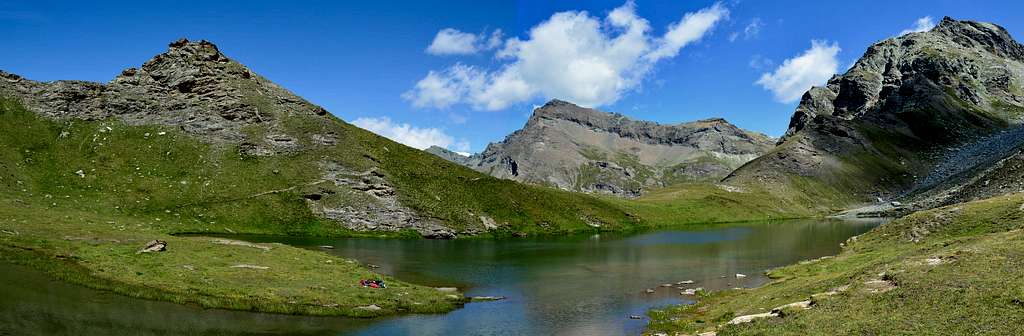
From Champoluc you can reach the Ostafa cable car station with the path n° 13 or using the cable car. Go down briefly to take the path n° 12. Follow the path winding along the slope with moderate ascent and finally reach the Alta Via n 1 just before the detour to the right to the Pinter lakes. Ignore the detour to the lakes (that can be reached in a few minutes) and climb up the easy gully leading to Colle Pinter (2.777m).
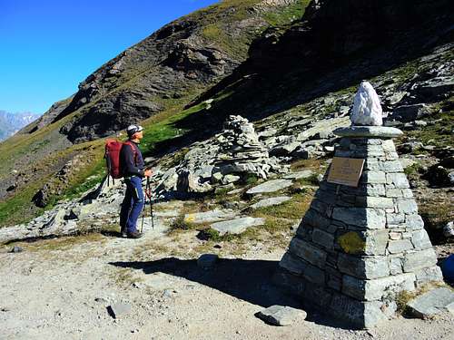
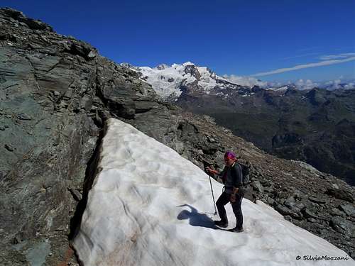
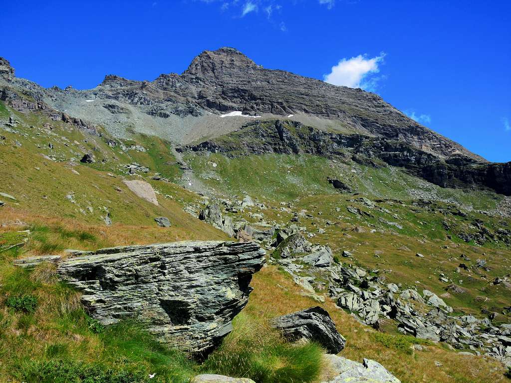
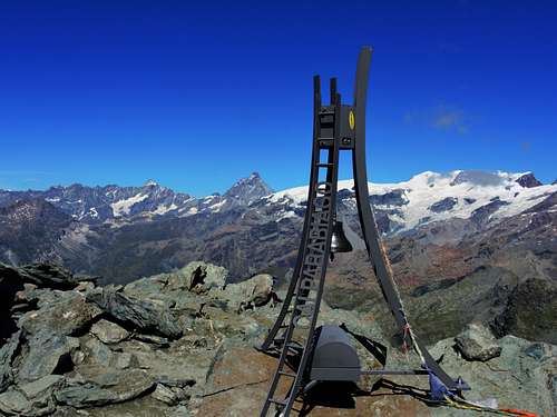
From the col turn to left taking the path n° 12 along the steep ridge that descends from Monte Pinter. With a series of hairpins quickly gain altitude. The path slowly head to West, overlooking the Val Ayas and entering the severe world of the high mountains. Proceed on crumbly ground and go up a short gully, just below Monte Pinter, to exit on the semi-flat ridge of the Testa Grigia. The slanting path head to the North-East to reach the wide ridge and the detour to the Ulrich Lateltin bivouac (3.115m). Now proceed towards the summit, climb up a first buttress and then go up again in the direction of a second one to be circumvented on the side of Gressoney. After passing a slight collar on rocky slabs, proceed around a particular rocky conformation eroded by the wind to the west and finally reach the most difficult passage of the ascent: a rocky step that can be overcome with the aid of a chain. Follow now a ledge on the Gressoney side until you meet some metal ropes that facilitate the ascent of a short stretch of rocks, after which you finally reach the summit of Testa Grigia. On the top there is a Madonna and a bell.
Descent: reversing the same itinerary. Do not miss the Pinter Lakes which can be reached with a very short digression!
Testa Grigia from Chemonal (Valle Gressoney)
Testa Grigia from Chemonal
Summit altitude: (3.314m)
Difficulty: EEA
Difference in level: (1.900m) from Chemonal
A long interesting itinerary joining the previous route on Colle Pinter
Drive up the Gressoney valley, pass Gressoney Saint Jean and after about 2 km reach the Chemonal locality. After Chemonal reach the parking lot of the Alpenzù Refuge. From here take the path n° 6 which climbs up with several hairpin bends and exits the wood to reach the Alpenzù Grande village where the Rifugio Alpenzù (1.779m) is located. Pass through the houses and exit to the left reaching Alpe Meher (1.856m), from where with a long traverse to the right you reach the Pinter valley which starts from Alpe Montil Inferiore. After crossing the Alpe Loasche (2.355m) go up the detrital slope that leads to Colle Pinter (2.777m), where the itinerary coming from Val d’Ayas also arrives. Continue as described in the previous itinerary.
Gear
High mountain clothes, Via Ferrata set, mountain shoes
Camping and other accomodation
Warning In Val d'Aosta, free camping is forbidden below 2.500m. Over 2.500m is allowed, from sunset until dawn. Several possibilities of accomodation both in Val d'Ayas and Valle di Gressoney.Huts
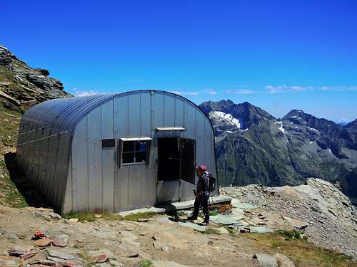
Bivacco Lateltin (Monte Pinter) (3.153m) - 16 places, very confortable.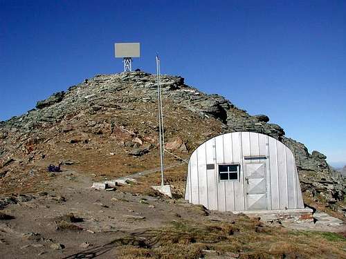
Mountain Conditions
- You can get meteo information at the official site of the Regione Valle d'Aosta:
- Valle d'Aosta Meteo
- Meteo: You can find more weather information on the website 3B Meteo:
- Meteo Brusson
Webcam
- WEBCAM on Aosta Valley:
- Webcam
Guidebooks and Maps
BOOKS:
- "Guida delle Alpi Occidentali" di Giovanni Bobba e Luigi Vaccarone C.A.I. Sezione di Torino Volume II (parte II), 25 Maggio 1896.
- "Diari Alpinistici" di Osvaldo Cardellina e Indice Generale accompagnato da Schedario Relazioni Ascensioni 1964-2019 (unpublished).
- "Guida dei Monti d'Italia" Monte Rosa di Gino Buscaini - Club Alpino Italiano/Turing Club Italiano, Maggio 2002 (In Italian).
 |
 |
 |
MAPS:
- I.G.C. Istituto Geografico Centrale Torino "IVREA-BIELLA e Bassa Valle d'Aosta" 1:50.000.
- I.G.C. Istituto Geografico Centrale Torino "Cervino e Monte Rosa" 1:50.000.
- L'Escursionista editore "Alte Valli d'Ayas e del Lys" Carta dei sentieri (8) 1:25.000.
Important Information
- REGIONE AUTONOMA VALLE D'AOSTA the official site.
- FONDAZIONE MONTAGNA SICURA Villa Cameron, località Villard de la Palud n° 1 Courmayeur (AO) Tel: 39 0165 897602 - Fax: 39 0165 897647.
- A.I.NE.VA. (Associazione Interregionale Neve e Valanghe).
Useful numbers
- Protezione Civile Valdostana località Aeroporto n° 7/A Saint Christophe (Ao) Tel. 0165-238222.
- Bollettino Meteo (weather info) Tel. 0165-44113.
- Unità Operativa di Soccorso Sanitario Tel. 118.