
|
|
Mountain/Rock |
|---|---|
|
|
42.56380°N / 23.27870°E |
|
|
Hiking, Skiing |
|
|
Spring, Summer, Fall, Winter |
|
|
7513 ft / 2290 m |
|
|
Overview
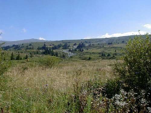
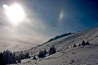
Located only 7 miles south of Bulgarian capital Sofia, Vitosha (Витоша in Bulgarian) is Bulgarias most visited mountain. Starting from where the suburbs end, the whole mountain has been designated a national park, the oldest one in the Balkans.
Although a rather small mountain, it is a real pleasure to hike in it. Paths are wide and it is very hard to get lost. Transport to the starting points for most of the routes is quite easy and cheap. All this makes Vitosha mountain quite attractive for hiking. Spots worth visiting are two biosphere preserves - Bistrishko Branishte and Torfeno Branishte, as well as "Zlatnite mostovi" (golden bridges) moraine. A very popular hiking trail connects the aforementioned moraine with Aleko chalet and is doable inside 1 day. Vitosha is also home to the longest cave in Bulgaria, 11 miles long Dhulata.
Vitosha is a popular ski resort in winter, while in summer a chairlift operates for the benefit of sightseers. With its highest peak - Cherni Vrah (2290 m.) Vitosha occupies the fourth place among the Bulgarian mountains.
Main peaks
|
Vitosha
|
|
|
Peak name |
Altitude (m)
|
|
Samara |
2108
|
|
Silimitca |
2014
|
|
Ostretc |
1836
|
|
Ostritca |
1696
|
|
Vladaiski Cherni Vrah |
1641
|
|
Cherni Vrah |
2290
|
|
Kamen Del |
1862
|
|
Lavcheto |
2052
|
|
Sredetz |
1969
|
|
Chernata Skala |
1869
|
|
Kopitoto |
1348
|
|
Kominite |
1620
|
|
Ushite |
1960
|
|
Golyam Rezen |
2277
|
|
Malak Rezen |
2191
|
|
Golyam Kupen |
1930
|
|
Skoparnik |
2226
|
|
Kupena |
2195
|
|
Siva Gramada |
2003
|
|
Petrus |
1454
|
|
Krasta |
1561
|
Cheerful Bulgaria
Apart from its proximity to the country capital Sofia, another reason why Vitosha is so popular with the Bulgarian mountaineers is hidden behind the historical leg. In 1897. popular Bulgarian journalist, writer and mountaineer Aleko Konstantinov published in a local newspaper a manifesto in the name of "Vesela Balgarija" (the "cheerful Bulgaria" ) club, inviting anyone who might feel interested, to climb the Cherni Vrah on Vitosha at Sunday noon exactly, in order to establish an Alpine club. That occurred just 2 years after Konstantinov's failed attempt to establish Alpine club at a national level.
To his amusement, more than 300 hundred people saw his manifesto and climbed the Cherni Vrah peak. Right at the spot, they've founded the first Alpine club of Sofia. 20 years later, Bugarian alpine club already counted 8000 membership. Bulgarians tributed their mountaineering pioneer by naming one of the most important peaks in Rila massif "Aleko". Main chalet on mt. Vitosha is also named after him "Aleko chalet" and in his hometown Svishtov a small museum was founded, hosting various memorabilia from Mr. Konstantinov life.
If you ever visit Bulgaria and decide to change some cash into local currency, you may have a handgrip on Aleko Konstatinov, hence he is featured on the front side of 100 Leva banknote ( Back side of the banknote features various Bulgarian mountain trekking movement motifs). Konstantinov achieved a certain amount of intl fame as well. His excellent travelbook "A Journey to Chicago and Back" was translated into numerous languages. Today, English edition of this book is available at better online bookstores for under 20 $.
Getting there and away
Bulgaria is situated in the Balkan Peninsula in Southeastern Europe.
Time Zone is GMT+2 hrs, official currency 1 Lev (roughly, 1 Euro equals 2 Leva). For comparison, three-tickets set for Sofia tram or bus costs 1,20 Leva, 1 day ski lift pass on Vitosha costs around 25 Leva, half-day pass around 15 Leva.
Official script is cyrillic, yet main roads and resorts are often posted in latin script as well. (Side note; if you prefer non-vocal way of communication, please bear in mind that Bulgarians nod their head left-right for "Yes" and forward-backward for "negative"...)

Getting there by plane: National carrier is Bulgaria air For flight schedules to Sofia, please click here
Bus and train networks in Bulgaria are extensive and pretty cheap (especially busses).
For train tametable, please click here
Once in Sofia, Vitosha is easy to see from almost every downtown spot (only 7 miles out of city centre, remember?) In order to reach the mountain use Tram No 9, heading for the southern suburbs of Sofia. Afterwards took bus No 64 to go to Dragalevski village where the Lift takes you to mount Vitosha.
The lift to Aleko Ski Center works only in wintertime . To reach Aleko Ski Center you can take a taxi from Dragalevski (about 15 Leva) even from Sofia. The classic route to the highest peak of Vitosha Cherni Vrah begins from Aleko Ski center and it is an easy hike.
When To Climb
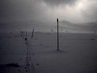
Generally, summertime is the best period. It is possible to climb every time of year, though. in winter, snowshoeing and ski - friendly mountain as well. Please, note, Vitosha is famous for the foggy weather because about 200 days per year is foggy. (Unlike Sofia, which tends more toward being smoggy, rather than foggy...)
Mountain conditions
Up-to-date weather forecast for Vitosha in English language can be found here. Since 1935 a meteorological station has been operating on Cherni Vrah, with many posts, mostly in the chalets. Comparative data about Sofia and Cherni Vrah weather conditions: the average monthly and annual temperature - for the coldest month - January - in Sofia is minus 1.7° and on Cherni Vrah - minus 8.3°. For the warmest month - July in Sofia - 21.2° and for Cherni Vrah - August - 9.0°C. The average annual temperature in Sofia is 10.5°C and at Cherni Vrah - 0.3°C.
There is an interesting phenomenon featuring the Vitosha climate - the inversion (mostly in December and January). When Sofia is covered by thick fog and cold, the Vitosha Mountain shines in sun and warmth. This happens at an average of 15 days per year. An average of 140 days per year are very cold on Cherni Vrah - the maximum values in these days are negative and there are 222 frosty days (when only the minimum temperatures are negative). The winter in the high parts of the mountain lasts between 5 and 7 months, and truly summer months are only July and August.
Webcam
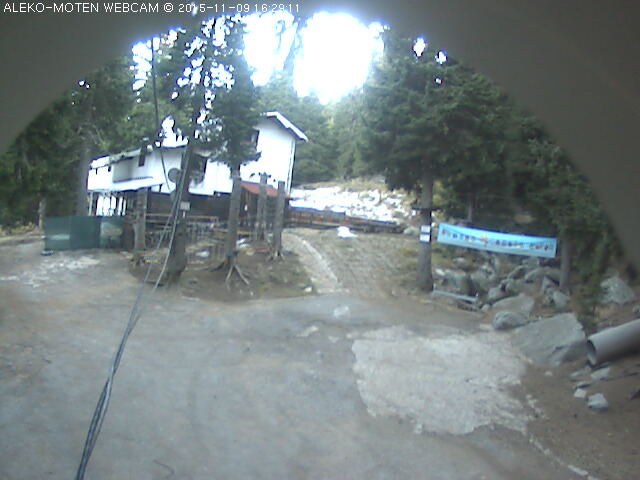
Up-to-date interactive weather feed for Mt. Vitosha
Camping & Huts
There are no organized camping grounds on Vitosha mountain.
Yet, it is possible to camp everywhere in the mountain without problems.
There are also some huts on the mountain that are usually opened only the summer period
and the weekends in winter, including the fine Planinec hut
Phone: +359 2 8573139, cellular: +359 887 751187;
e-Mail: info@planinec.com
website in English
The cross trek can be done inside one day,
therein to stay on the mountain is not necessary.
Topo Maps
Vitosha topo maps
 |
 |
 |
 |
Red Tape
It is a National Park. Regular behavior rules inside NP do apply.
Otherwise, no permits of any kind are required in order to climb the Vitosha mountain.
Eleutheros - Jan 19, 2006 2:10 am - Voted 10/10
Untitled CommentThis peak is also the location of some of the world's largest peat reserves.
Thebulgarianguy - Feb 21, 2014 11:36 am - Voted 9/10
More infoThere is a better map of vitosha mountain http://www.iskartour.com/en/interactive-maps/vitosha Camping in the nature park outside the hutts is forbidden They are as followed : aleko, kumata, edelweiss, ofeliite, tihia kut, iglika, ostrica and selimitsa. Also some refuges: kikish, ushite, smiljo and Jivata voda. Visiting the reserves outside the marked paths is also forbidden, beside of being very dangerous. There are bears, wolves, wild pigs, deers and I.e. Some good paths start from bistritsa, iarlovo, chuipetlovo, kladnitsa, boiana and Simeonovo. You can visit the very old forest within 2 hours from bistritsa, the path is marked green.2 more hours and you go to aleko hut. From yarlovo - 6 hours to kupena. From there you can see mountains 250 km far. The path from chuipetlovo is very wild and there are the bears. Kladnitsa is nearest to cherny vrah - 5 hours. 1.5 hours from bojana is the boiana waterfall - 30 meters high. The path from simeonovo is also good. If you go from aleko to jeleznitsa you will see some very high rocks. Kominite rock is 3 hours from dragalevtsi. The paths in the peat reserve, bistritsa reserve and those from jarema are very dangerous - you can get lost very easy.