
-
 22781 Hits
-
 81.18% Score
-
 13 Votes
|
|
Mountain/Rock |
|---|---|
|
|
45.93830°N / 113.516°W |
|
|
Hiking |
|
|
Summer |
|
|
9498 ft / 2895 m |
|
|
Overview
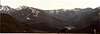
This Peak is not the highest around, but it sure does have a place of it's own among the other Pintler Peaks, with it's alpine scenery and lush looking Tarns, with Beargrass scattered among rare alpine grass.West Pintler Peak is a non technical one from the West, South and from the East sides, and on the North West Face the route offers some Class 4 Scrambling with moderate exposure on bad rock.
All routes can be done in one day in summer moving fast.
There is no summit log as with most Peaks in the Pintlers and most likely the Peak is not climbed much, compared to other Montana Peaks.
The summits in the Pintlers offers great solitude and 99.8 percent of the time you will have the summit for your group only.
 |  |  |
Getting There
(Driving info is also listed under Warren Peak and McGlaughlin Peak pages, some more info can also be gained on those pages as well.)-From Anaconda drive West on Hwy. 1 for about 20 miles.
-Take a Left at the Skalkaho Hwy. continue on it for about 10 miles.
-Take a Left at the Forest Sevice Sign Moose Lake and Wilderness Access.
-Now on a well maintained dirt road continue on up the road past Moose Lake and past the first Trailhead Sign to the very end of the road, about 3.4 miles from Moose Lake, at the end of the road there are two Trailheads, you will want to take Trail (#28) at an elevation of 6,433 feet and (N 45*59.840'-----W 113*31.707'.)
Dont get this trail confused with the Edith Lake (#29) Trail, both trailheads share the same parking lot.
-Now hiking South on Trail (#28) for about 3.6 miles you will run into a big meadow with a trail junction at ( N 45* 57.063'----- W 113*32.245'), you will want to hang to the LEFT and continue on up towards Upper Phyllis Lake. The trail to the Right will lead you up over towards Little Johnson Lake and on up to Bitteroot Pass.
-After the trail junction you will encounter about ten swithcbacks at a moderate elevation gain, once on top of the ridge you will see a sign saying "no camp fires within 1/4 mile of the lake" at an elevation of 8,203 feet and ( N 45* 56.870'----- W 113* 31.555'.)
--------------------WEST RIDGE ROUTE--------------------
If you choose this route it's mostly Class 2 / 3 along the ridge to gain the summit, this is also the safest route in snow and winter conditions.
When you hit the sign instead of dropping 100 feet into Upper Phyllis Lake just head due South from the sign, until you gain the West Ridge of the Peak, once on the ridge you will head East along the now Class 2 / 3 rock.
--------------------NORTWEST FACE COULOIRS-------------------
It's only about 1/4 mile from the sign to Upper Phyllis Lake (see camping below.) Now at the South end of the lake there are 4+ couloirs up the Face most are the same with chances of rock fall and most are between 45 to 60+ degrees snow. This route is in the shade most all day and will give you some better snow climbing than the other sides of the Peak.
Once you gain the ridge line it's a Class 2 maybe to the summit.
These couloirs will hold there snow until Mid July, the two couloirs to the right of the summit offers the safest routes.
 |  |
Red Tape
There are no campfires allowed within 1/4 mile of the following Lakes, Lower or Upper Phyllis Lakes, Oreamnos, and Sawed Cabin Lake, there are other lakes also, but these apply to West Pintler Peak area.This is a Wilderness Area and "Leave No Trace" ethics should be applied.
When To Climb
For most Peakbaggers early July to early September have the best route conditions and also will make the climb achievable in one day.EARLY SPRING, offers good snow climbing along the West Ridge and has some nice snow couloirs on the North West Face, which angles up to about 60 degrees on most years.
WINTER, you will add on 3.4 miles each way, the road is plowed only to Moose Lake, you will have to slog the road up to the Trailhead. The winter trip I took was 5 days with a failed attempt due to the weather (roughly 2 days hard snowshoeing to the base of the Peak and one / two days to climb and one super hard day out.)
 |
Camping
For Camping there is Upper Phyllis Lake on the North West Side at an elevation of 8,115 feet and ( N 45*56. 819'----- W 113*31.395'), which is the jump start for the route describe on this page.Other camping options on the West side is Hidden Lake.
The East has Sawed Cabin Lake.
The North East has the most remote spots,being Oreamnos Lake and even better yet the Tarn West of the lake.
 |