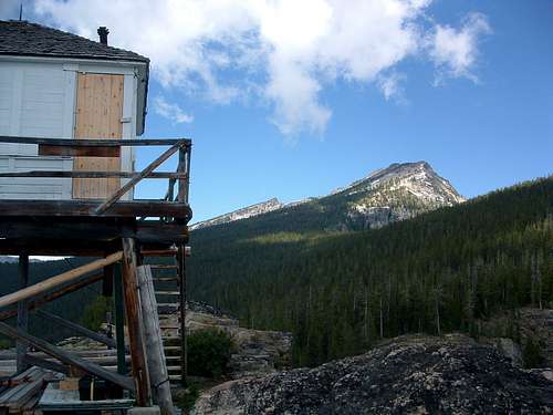
The lookout with Point 9,442 in the background
![The Lookout]() |
Elevation – 7,753’
Route Type – Hike
Class Level – Class 1
Length of Time Required to Complete Route – Half a Day
Boulder Point, with an elevation of 7,753’, lays along a long west-northwest ridge crest which it shares with three(3) other high points over 9,000', Bouler Peak at 9,804', East Boulder Peak at 9,442', and Boulder Peak North at 9,334'.
Some may wonder why Boulder Point is considered to be a high point when three(3) higher points lay along the crest of the same ridge. Well, if you ever visit Boulder Point, you will come to appreciate the formidable effort required to reach this particular outcropping makes it a "destination" in its own right (There is more elevation gain from the trailhead to Boulder Point than there is from Boulder Point to Boulder Peak).
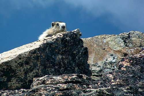
The Lookout Greeter!
![Hoary Marmot]() |
The Boulder Peaks Ridge is on the south side of the Boulder Creek Drainage with Trapper Peak just to the north. The Boulder Peak Ridge high-points are little known and seldom visited in spite of the fact that an old lookout tower awaits visitors on the Boulder Point summit.
Said lookout tower is no longer in use but is currently being repaired and restored by volunteers and the Forest Service.
These peaks are visited so seldom because of their remoteness coupled with the fact that the trail to Boulder Point is a real lung-buster and the lack of any defined trail from Boulder Point to the Boulder Peak summits.
Getting There
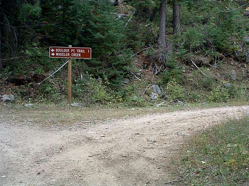
Turn right at this sign
![Turn right at this sign]() |
From Darby, MT, go south on Hwy 93 just under 4.5 miles and turn right (southwest) onto Montana Highway 473 (West Fork Road). Drive a short distance past mile marker 13 and turn right (northwest) onto Barn Draw Road (373) - the second road on your right.
Continue on Barn Draw Road for almost 2 miles to a signed junction and turn right (northeast), following the sign for Boulder Point Trailhead. The road will end at the trailhead in just over a mile.
The trailhead is now marked. There are parking spots for several vehicles, but no restroom facilities.
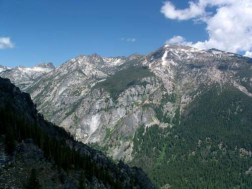
There is a great view of Trapper Peak's south side
from Boulder Point
![Trapper Peak]() |
Red Tape
The standard wilderness regulations apply.
Camping
The best camping spot I saw was the lookout tower on Boulder Point. Even if you don't use the lookout itself, there are several other locations where one could set up camp AND be close to an outhouse. Pretty nice for a summit!
Route Description
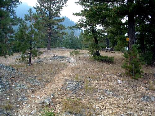
The trail as it passes over School Point
![School Point]() |
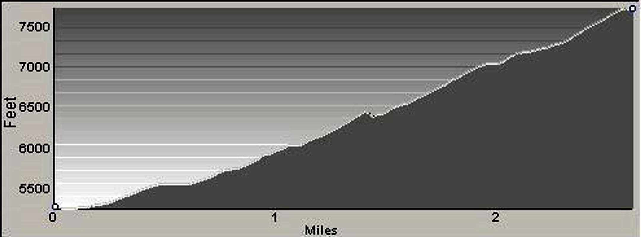
At this point the trail turns in a more westerly direction and enters patches of very thick woods. About .75 mile from the trailhead the trail enters a series of switchbacks and ascends an especially steep section before once again turning west and traversing from about 6,000’ to 6,400’.
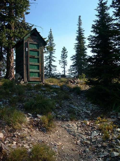
An outhouse greets you at Boulder Point
![Boulder Point Outhouse]() |
Another section of steep switchbacks begin about 1.25 miles from the trailhead as you move upward to 6,500’. This is followed by steep trail taking you up another 800’ as you traverse west over the mountain's side.
The last half mile of trail goes directly north and straight up the mountain to the small saddle just west of the lookout – not a switchback in sight. This is undoubtedly the steepest section of the trail and will thoroughly test your legs. The fact that the outhouse sits in the saddle directly in your path as you reach the ridgeline, suggests to me that the builders of the trail (and maybe the outhouse) had a twisted sense of humor.
Several Hoary Marmots live near Boulder Point
![Hoary Marmots]() |
Some guide books suggest the length of the trail from trailhead to Boulder Point is around 2.25 miles. My GPS measured it as 2.7 miles with 2,629’ of gain. Since the same books describe the trail as generally following the ridgeline from School Point to Boulder Point and this is absolutely not the case, I can only assume the trail has been re-engineered to include more switchbacks since their publication.
In any case, this is a difficult hike which requires strong lungs and legs plus a good deal of stamina. No water is available along the trail, so you must carry whatever you believe you will need.
Essential Gear
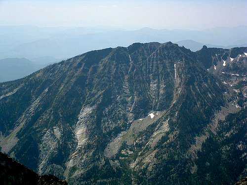
The Boulder Point ridgeline
from Trapper Peak's summit
![Boulder Point Ridgeline]() |
When to Go
The trail to Boulder Point is good enough to be used anytime during the year. Obviously since a ski club is working to improve the lookout, even winter use is expected.
Route Statistics
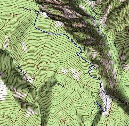
![3D Topo of route]() |
Summit – 7,753’
Gain – 2,629’
Distance – 2.7 miles
(one way)
|
![Profile of the Route]() |
|
 11850 Hits
 74.92% Score
 5 Votes


