|
|
Mountain/Rock |
|---|---|
|
|
38.30956°N / 107.63313°W |
|
|
Montrose |
|
|
Hiking, Scrambling |
|
|
Summer, Fall |
|
|
11457 ft / 3492 m |
|
|
Overview
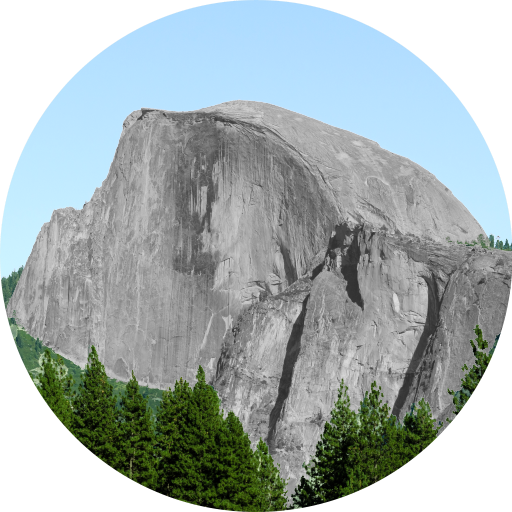
Located in southwest Colorado is a sub-range of the San Juan Mountains called, The Cimarron Range. Located primarily in a north-south axis, the Cimarrons rose to prominance and fame in large part due to a twilight career movie from John Wayne most of us have heard of called, True Grit. In fact, the famous shootout scene towards the end of the movie happened in, 'Deb's Meadow,' near Owl Creek Pass where Chimney Rock is clearly visible.
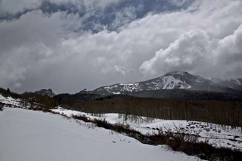
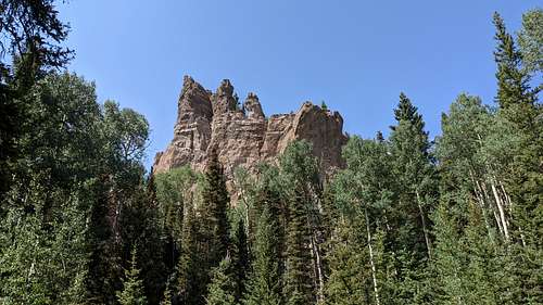
Being situated east of the towns of Ridgway, Colona and Ouray, the mountains of the Cimarrons are known for steep, volcanic bad rock. Mountains like Courthouse and Dunsinane have moderate trails coursing to their summits. While other peaks like: Chimney Rock (wasn't scaled until 1934) and Turret Ridge (12,264') are known as some of Colorado's hardest to reach. In fact, Turret Ridge is Colorado's hardest twelve thousand foot peak and in the top-5 hardest overall.
Positioned at the northern terminus of the Cimarrons like a bookend, is the highpoint of Montrose County, Castle Rock. At 11,457', it is the highest feature in Colorado bearing the ubiquitous name, Castle Rock, of which, there are 21 named features; only two are ranked. Castle Rock (Montrose) is one of the two.
Why a flat mountain received a name that is more indicative of something having more prominence or perhaps features compromising of sheer walls, I don't know. Because from the west, highway 550, Castle Rock is unnoticeable and practically indistinguishable from the ridge it lies on. From the east, it is no more than an end point along a forested ridge with a sharp drop to a saddle.
The summit of Castle Rock is forested with an old weather station or shack. I left a register back in 2021 inside an old tree stump with the typical characteristic rock cairn next to it. There are no official trails to the summit. There is a sub-summit called, "Storm King" about .4 mile to the north. However, even from the top of Storm King, one cannot see Castle Rock due to the forest.
Realistically, with so many other peaks in the San Juans, it can be hard to find a reason to bushwhack up a relatively non-descript, eleven-thousand foot peak. But because of it being the highpoint of Montrose County and a true, dyed-in-the-wool, off the beaten track peak, solitude is guaranteed here. And in Colorado, that is increasingly harder and harder to find.
Quadrangle: Buckhorn Lakes
Getting There
The starting point for Castle Rock is Buckhorn Lakes. From Montrose, drive south for 12.4 miles to the small CDP (Census Designated Place) of Colona. On the east side of the road, turn left onto Buckhorn Road. The first few miles are paved. After that, expect washboard dirt roads to the lakes. It's not hard and a 2WD vehicle can make it. The road twists and turns frequently, so it'll take better than 20 minutes to arrive. There is ample parking at the lakes with a few picnic tables and open shelters.
For those with 4WD vehicles, you can continue another 1.5-3.0 miles into the forest and higher. However keep in mind, the road will devolve into a primitive 4x4 track and it does get more potholed and rougher. When I was up there last (couple years ago), there were downed trees crossing the track. So pick your spot to park when it's available.
Buckhorn Lakes Park is a pair of lakes owned by the city of Montrose and is located high above the Uncompahgre Valley and just south/east of Montrose Colorado. The lakes sit among the pines and aspens on a large bench type area and in the shadow of the prominent Sawtooth Rocks to the east.
Also, the roads in and around Buckhorn Lakes are potholed and large. They frequently fill with water and stagnant. Just an FYI.
From the town of Ridgway, travel north for 14.7 miles to Colona and follow the directions detailed above.
The upper stretches of Buckhorn Road are NOT maintained in winter.
Routes
North Ridge: This route isn't too difficult to follow as it starts out on a good 4x4 road. Leave Buckhorn Lakes following the Jeep road as it winds higher toward the apparent ridge to the east. The road will gradually diminish into an ATV track becoming narrower & narrower and harder to follow. It will eventually disappear entirely into the forest before you reach the ridge. There is a faint single track that weaves in/out of existence that does lead to the ridge but good luck following it. At this point, just keep your eastern trajectory aiming for the ridge and a small plateau area just south of S. Sawtooth Rocks. The forest is dense and thick with ample deadfall, mushrooms, decaying matter, ferns and other vegetation indicative of plenty of precipitation.
Once on the ridge, there is a primitive and faint trail one can follow. The ridge itself isn't too bad, but due to the deadfall in the forest, stay the trail if you can; it'll speed your ascent.
The summit of Storm King from South Sawtooth Rocks is about .6 mile but it will feel a lot longer as even the trail is sprinkled with generous deadfall and seemingly no plan to its creation. Once you reach this easy plateau, Castle Rock is only another .4 mile away...give or take. There are remnants of a trail but again, it will be almost impossible to follow.
Northwest Gully
Follow Buckhorn Lake Road higher as it winds towards the ridge. Take the first right hand off-shoot and follow this as it courses south into a large and flat open meadow. This spur road has no numerical designation thus, I can't say what it is other than a social road. At the large meadow, the road will basically end at a couple of fire rings. This will be around 10,440'. Start an easy bushwhack due south on grass paralleling the ridge and across the bottom of a talus field. After roughly 15 minutes (maybe .1 mile), look towards the ridge and spy an obvious gullly. This is the Northwest Gully.
The scrambling isn't the best. The gully starts off as loose rock & embedded rock in hardpan dirt with the occasional small evergreen tree. Scramble up the gully staying pretty much either center or slightly left of center. Around half way up, start to contour climbers right. The top of the gully is guarded by small cliffs that you cannot climb. And the higher one climbs, the harder it will be to traverse right to an apparent steep shoulder.
Around 3/4 the way up, there will be a mature pine tree, climbers right on a steep shoulder. Aim for this as the footing will get better. From the tree, look up towards the cliffs and you'll an obvious path through them. It's not hard, but the steepness and the loose dirt shelves will make you test everything before committing. After 30' or so, the pitch will relent as deadfall and more trees come into play. It's only another 40' or so before the scramble is over. Make your way across the easy and flat summit of Storm King and enjoy the views south and out to the west from the edge of the cliffs.
The pro of doing this route is you get to avoid the horrendous forest of the North Ridge (wet, mosquitoes, deadfall, sweat) and get some good, challenging scrambling in; plus you get to do a "Tour da Castle Rock" or sorts. The con is that it'll work your legs harder.
Camping
The City of Montrose offers free camping at Buckhorn Lakes Park. This is pretty good considering it is labeled a City Park but located well outside the city. Camping is dispersed and there are some pre-existing fire rings already in place.
The road leading up to the park is surrounded by private land. The road itself is privately owned. No camping, hunting, or other forms of recreation will be tolerated, according to posted signs. There is NO TRASH service, so pack everything out. The Buckhorn Lakes are public, however, and the entire route is on public (BLM) land. ATVs are permitted on the back roads. The actual summit is recorded as county property.
Buckhorn Lakes History

The following is taken from, 'The Montrose Press.' Written by Marilyn Cox, June 26th, 2013. "A Step back in Time."
“Have you ever been to Buckhorn Lakes?” asked my neighbor Jim the other day.
I have only been there once, and that was more than 30 years ago. I need to go again. I remember the road being pretty bad, but I like the fact it is considered one of our city parks, owned and operated by the city of Montrose, thanks to a grassroots effort that dates back to April 1916.
A group of citizens, spearheaded by O.C. Skinner, approached the city with a signed document pledging various amounts of money to help pay for the U.S. government land that cost $1.25 an acre. A contribution of $10 each was offered by 22 people — nine paid $5, two donated $1.25 each, the Colona Fish and Game Club donated $210, Montrose firefighters donated $10. a Boy Scout troop sponsored by C. J. Moynihan contributed $25 and the Chamber of Commerce donated $25.
A resolution was offered by City Commissioner Waldo, stating that since a committee of citizens was going to furnish $650 for the purchase of the land for the site of a public park, it should be accepted. The city would cause building or camp sites to be platted throughout the park, and those who had contributed would get a camp site. Others would pay $10 per camp site. The motion carried unanimously.
The first patent, signed by President Woodrow Wilson, was dated Oct. 20, 1917, and deeded to the city of Montrose, 480 acres in Sections 9 and 16. A second patent, dated Nov. 9, 1922, signed by President Warren G. Harding, confirmed the purchase of 120 acres in Section 17.
The July 6, 1916, minutes of the City Council meeting stated, “It was moved that all parties pasturing cattle and sheep on the site of the City Park, Buckhorn Lakes, must cease and desist.”
From what I have heard and read, the Buckhorn access road has always been a bone of contention. An editorial in the Montrose Press, dated Aug. 9,1949, states, “It’s a shame that a road has never been made to Buckhorn Lakes as has been talked about for 25 years. The city owns practically a section of land about the lakes, embracing one of the most beautiful camp sites around here, and it is but nine miles from Colona.
“Elmo Cooper, who helped carry the first fish to be planted in the lakes, says it would require but a couple or three days work by a bulldozer and grader to fix the road so it could be traveled.”
“If city or county cannot repair the road, why not a group of public spirited citizens so this beautiful place in the aspens and spruce so close to Montrose, might be enjoyed?” he wrote. “Sheep herders are reported to be making fine catches of fish from the lakes. Ask Cooper about the possibilities.”
My late friend, Russ Cook, always enjoyed fishing, hiking and the great outdoors. Because Buckhorn was so close, he and his family could go up there for the evening after he got off work. His wife, Nellie, would have something fixed for a picnic, and they would take off right after he got home and stay until after dark.
When asked about the road, he said, “Oh yes, it was always bad.”
Cook fished in the early spring when there was snow between the lakes and the upper lake was still frozen.
“The lower lake was about halfway open, and there was a beaver lodge in it,” he said. “I caught about four or five nice rainbows right there.”
He told a story about a group who decided to have barbecued lamb at Buckhorn Lakes. For some reason, they thought it would be easier to take the live lamb and dress it on the spot. The lamb had a different idea, got loose and literally ran for his life. The group spent hours trying to find and catch the lamb. No barbecue that day!
External Links