
-
 27571 Hits
-
 90.48% Score
-
 32 Votes
|
|
Mountain/Rock |
|---|---|
|
|
35.99170°N / 105.6459°W |
|
|
Rio Arriba |
|
|
Hiking, Scrambling |
|
|
Spring, Summer, Fall |
|
|
12990 ft / 3959 m |
|
|
Overview
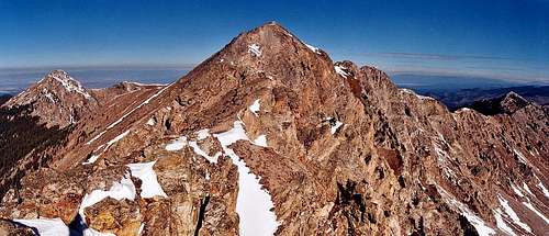
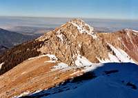
 UN 12,900
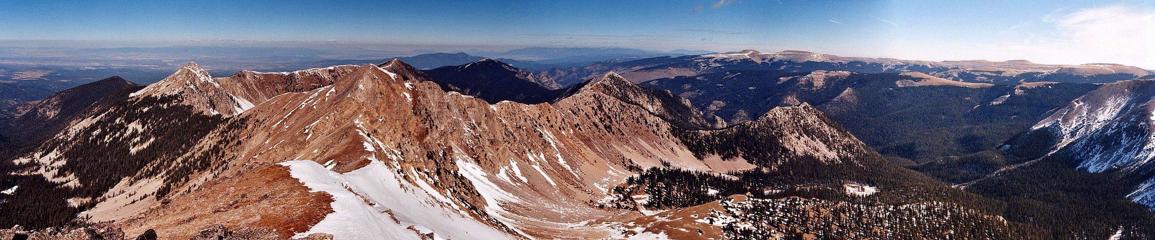  |
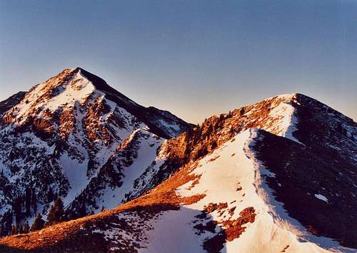
 Sheepshead & UN 12,900
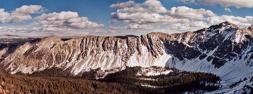 UN 12,900
Getting There
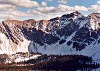
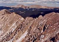
 The Truchas Massif from the Espanola Valley
Follow FR 207 through the picturesque community of El Valle to its end, approximately 8 miles.
FR 207 is a well-maintained dirt road that should pose no problems to passenger cars. Snow might be a problem, but Las Trampas is not a good place to go in heavy snow conditions in any case. The nearby Borrego Mesa and Rio Quemado trailheads are known for vandalism issues and problematic access (see here), but I have never heard of any such problems at Las Trampas, and the place generally feels safe. All of New Mexico has its share of scumbags, though, and it's probably wise not to leave valuables in your car.
Shortly before the trailhead and the end of the road, FR 639 branches off to the right. This road leads 1 mile or so to the trailhead for the San Leonardo lakes, which is a possible alternate approach to the peaks. FR 639 may be difficult in wet weather.
Approaches
 Las Trampas Canyon
Other approaches are certainly possible. One such is via the San Leonardo Lakes (see "Getting There"); the approach hike is shorter at 4 miles, but the trail is reputed to be steeper and rougher than Las Trampas. One could also approach via Rio Quemado from the town of Truchas, or via the Borrego Mesa trailhead outside Chimayo; however, these trailheads are notoriously fraught with access and vandalism issues. Indeed, due to lack of these issues, the route from Trampas Lakes over Sheepshead's ridge is arguably the best access to the spectacular Rio Quemado Basin and Falls.
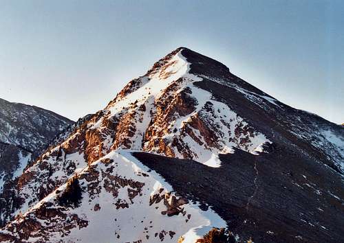
 Not Recommended
One final option that bears mentioning is the ridge from North Truchas Peak. If you have climbed North Truchas via a different route, the scramble out to UN 12,900 would be a splendid side-trip if time and weather permit.
Red Tape
Standard wilderness regulations apply. Camping is prohibited within 50 feet of any stream or 200 feet of any lake. Please maintain good wilderness ethics: far too much of New Mexico's backcountry is trashed, and this seems to be a particular problem near lakes.There are no fees at Las Trampas trailhead.
Camping
Camping is permitted at the trailhead, where an outhouse is provided. You will see several campsites in the first couple miles of trail (some of which seem too close to the creek to be legal). I found a place to camp in the trees to the left of the trail near where it makes its bend southward. There are certainly campsites near Trampas Lakes, as well as at Hidden Lake. Hidden Lake is reached by a 1-mile spur trail which travels northward from Trampas Lakes along the west side of the drainage.Seasons
Summer is also a good time in the Pecos, green lush and cool. You may find substantial snow lingering well into June. Afternoon thunderstorms usually start up in mid-July and continue through August. Since climbing Sheepshead and UN 12,900 involves plenty of time above timberline, an early start and early descent is essential in monsoon season.
Winter is not a good time for most people to visit the Truchas area, though the increasingly common dry years may sometimes provide opportunities into December or even January. All the approaches to this area present avalanche danger, however, and would be long and tedious in heavy snow. This area is remote and help is a long ways away. You should have substantial winter mountaineering skills before attempting winter climbs here.
In the spring, the Pecos usually starts becoming accessible in May, though there are often opportunities in April in dryer years. Substantial amounts of snow may linger below treeline, making travel and routefinding difficult. For those with the necessary skills, the headwall above Trampas Lakes might offer some good snow couloir possibilities.
Weather

Maps & Resources
The Forest Service publishes a large-scale Pecos Wilderness map. Given the straightforwardness of climbing these peaks, this map is probably adequate.7.5-Minute USGS Quad: Truchas Peak
7.5-Minute USGS Quad: El Valle.
The Falcon Guide Hiking New Mexico describes both the Las Trampas and San Leonardo Lakes approaches.
These books, maps and many more can be found at The Travel Bug in Santa Fe.
Trip Report
Carson National Forest
Supervisor's Office
208 Cruz Alta Rd.
Taos, NM 87571
505-758-6200
Camino Real Ranger District
P.O. Box 68
Penasco, NM 87553
505-587-2255