
|
|
Mountain/Rock |
|---|---|
|
|
40.44720°N / 105.6204°W |
|
|
Larimer |
|
|
Hiking, Scrambling |
|
|
Spring, Summer, Fall, Winter |
|
|
11254 ft / 3430 m |
|
|
Overview
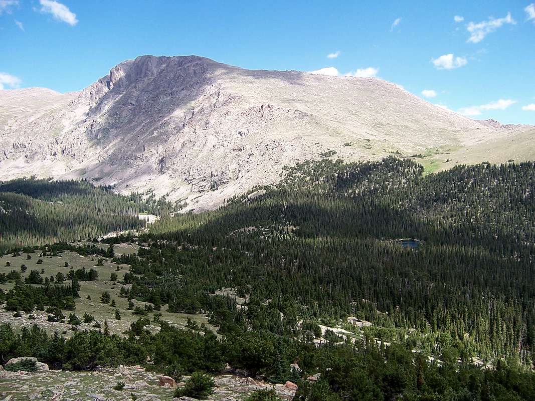
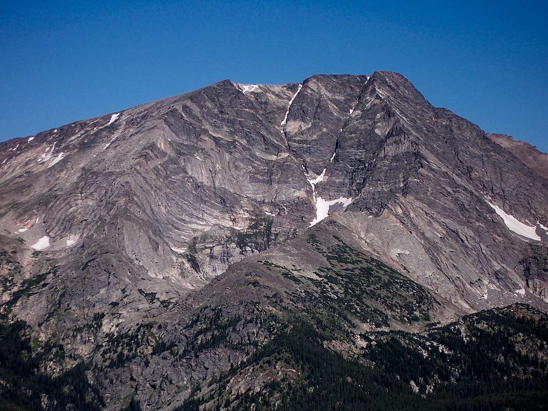
Mt. Tileston is a small summit. It is not an overtly high mountain nor does it carry much prominence as a separate peak. Fact, Mt. Tileston can only claim 314ft. of prominence barely making it a ranked mountain. It comes in at #69 on the peak list for Rocky Mountain National Park according to Roach. One could easily mistake this small peak as nothing more than a high point along the northern Bighorn Mountain Ridge but due to it rising above the de facto 300ft, it carries it’s own distinction. Not to mention, it is also named on most USGS Quads and NPS maps, so, it too shall have its’ home here on Summitpost.This narrow summit lies almost exactly two miles south of Mummy Mountain and 1.2 miles due north of Bighorn Mountain. One could practically draw a straight 90º line and connect all three summits including Point 11,080. The views of Mummy Mountain, especially from the summit of Mt. Tileston are among the best to be had in Rocky Mountain National Park. The rugged southwestern face of Mummy Mountain looks that much more imposing when viewed at similar elevation just across the valley. Mt. Tileston’s northern aspect melds into the confluence of the Roaring River Valley and the Black Canyon. This gentle slope is the predominant route up this small mountain and many people will tend to use Pott’s Puddle as their launching point up this easy mountain.
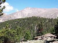 Mt. Tileston is in the middleground.
Mt. Tileston was named thus as a tribute to the late Mrs. Stanley, Flora Jane Record Tileston, later Mrs. Stanley (1848-1939). She was born originally in Maine and eventually died in Estes Park. She was an active member of the community in Estes Park. She was known for her dressing as a gypsy and telling peoples fortunes as a fundraiser for the Estes Park Women’s club. In fact, her spirit is one of many thought to haunt the Stanley Hotel in Estes Park!
Getting There
The launching point for Mt. Tileston is the small town of Estes Park. This mountain town is also the entrance to the eastern side of Rocky Mountain National Park via Trail Ridge Road. To reach Estes Park, use the following directions:FROM DENVER:
Take I-25 north to exit #243. This is the exit for hwy. 66. It is roughly 22 miles or 30km north of Denver. Head west (left) towards the city of Longmont. Hwy. 66 just skirts the northern edge of Longmont. Continue west for an additional 5 miles to the small town of Lyons. Continue through Lyons, slowly (the police here are eager to hand out speeding tickets) following the signs for Estes Park. Continue west up St. Vrain Canyon for 20 or so miles until you reach Estes Park.
FROM GREELEY/LOVELAND/FORT COLLINS:
From I-25, in either direction coming north from Fort Collins or as an alternate route, south from Denver, take exit #257 and merge onto hwy. 34 heading west towards Loveland. From Greeley, simply stay on hwy. 34 into Loveland. As one approaches Loveland, hwy. 34 turns into Eisenhower Blvd. Continue west through Loveland as hwy. 34 progresses west into Big Thompson Canyon, a scenic drive onto itself. Estes Park is 21.7 miles west from Loveland through the serpentine canyon.
Once in the town of Estes Park, There are three choices of trailheads one can utilize for Mt. Tilston. These are Lawn Lake, Black Canyon and Cow Creek. The later two involve the greatest mileage but do not require an entrance fee into Rocky Mountain National Park since the entrance points for these two trails are via backcountry trails. Lawn Lake Trail is the shortest & most expedient of the three and probably the most scenic. The Fay Lakes, the Y-Couloir on Mt.Ypislon, Hourglass Couloir on Fairchild and the eastern aspect on Mt. Chiquita are also accessible from this trail.
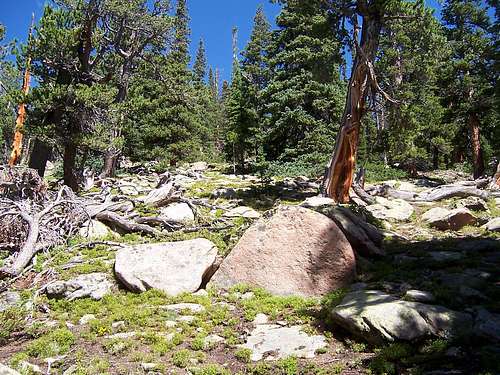 The summit ridge is still in treeline!
Trailheads
1.) LAWN LAKE: This trailhead lies inside of Rocky Mountain National Park at 8,540ft. and involves roundtrip mileage of ~11 miles. This route involves the least hiking mileage of the three but invariably, the busiest of the three. This trail even sees a fair amount of traffic in the winter. Since it is located inside RMNP, the mandatory $20.00 is required. Leave Estes Park on hwy. 34 west for five miles to RMNP Fall River entrance. At the park boundary, hwy. 34 ends and the famous Trail Ridge Road begins. Continue up into the park for 2.6 miles to a “T” intersection. This is the turnoff for Old Fall River Road and it is signed. Turn right (west) and proceed for .1 mile. The trailhead is located off to the right a short distance. There are ample parking and restroom facilities available. As said, this is a popular trailhead, so other vehicles will likely be present.Lawn Lake Trail starts roughly at the center of Horseshoe Park and climbs rather steadily with some steeper sections as it parallels the Roaring River to the immediate west. This trail is maintained and easy to follow, even in winter. After 1.6 miles, the trail junction for Ypislon Peak and Fay Lakes comes into access. After this junction, the trail will switchback frequently through dense forest with an occasional clearing down to the river below. Please keep in mind, since Mt. Tileston has no trails leading to it’s summit, off-piste trekking and bushwhacking will be involved.
* At the present (6.21.07), entrance fees to Rocky Mountain National Park are $20.00 per vehicle, good for seven consecutive days. Due to a measure from Washington and from the NPS, many national parks and monuments will be increasing entrance fees over the course of the next three years (calendar end date, 2009). This is due to the government cutting the amount of monies appropriated to national parks and historic sites (Department of the Interior). At this point, Park Administration has no plans to raise entrance fees or pass prices at least through 2007.
2.) BLACK CANYON:
THIS TRAILHEAD IS NOW CLOSED. PLEASE USE THE LUMPY RIDGE TRAILHEAD WHICH IS LOCATED 1/2 MILE FURTHER (EAST) DOWN THE ROAD PAST MACGREGOR RANCH. THERE IS SIGNIFICANTLY MORE PARKING HERE AND BETTER RESTROOMS. THIS NEW TRAILHEAD WILL ADD ABOUT ONE MILE ADDITIONAL TO ANY LISTED MILEAGES IN THE FOLLOWING.
The trailhead is located 1.1 mile from a predominant intersection in Estes Park. Take Wonderview Avenue north past a Safeway shopping complex. It will gently curve to the west in front of the Stanley Hotel. Turn right (north) at Macgregor Avenue and follow north for the remaining .7 mile to the ranch. The road will bend sharply at this point and eventually turn into Devil's Gulch road. Continue straight on the rough dirt road and simply follow the signs to the TH where the road comes to an end. There are a couple of half-moon outhouses located at the trailhead and water. This is also the staging area for technical climbs up onto Lumpy Ridge.
From the small parking area located at Black Canyon TH, launch out towards the west, past the trailhead sign. The first .4-.6 miles of this trail pretty much just skirts the meadow and parallels Lumpy Ridge. As soon as the trail starts to climb up into Black Canyon, the shade will be a welcome relief as this area can get hot in the summer and water is scarce. The Black Canyon trail segment, from the TH to the junction with Dark Canyon on the west end of the saddle is only 1.6 miles; shorter then following Cow Creek.
I can't say which is more scenic because both have their pluses and minuses. However, Black Canyon TH would make for a more convenient and shorter day vs. Cow Creek. At the junction with the Dark Canyon Trail, Lawn Lake is an additional 5.4 miles west. Mt. Tileston's northern slope and Pott’s Puddle lie 5.2 miles west just past the two campgrounds: Lower Tileston and Tileston Meadows.
Bridel Veil Falls is 1.4 miles to the east.
3.) COW CREEK: From the town of Estes Park (central intersection), drive north on Macgregor Avenue as it swings westward past the Stanley Hotel to Devils Gulch Road. This is also Larimer County 43. Turn right onto CR 43. Follow this road north. At 1.7 miles from Estes Park, you'll pass a small parking area for Gem Lake on the left. At 3.4 miles, the road will turn gently to the right. At this bend, the road will continue straight to McGraw Ranch. Follow this dirt road as it weaves through private land for an additional 2.1 miles to its terminus at the McGraw Ranch and Cow Creek trailhead.
There is enough room at the TH proper for 3-4 vehicles. Because of gradual increased use of this area, additional parking has been implemented along the road. There is no potable water at the TH, however there are restroom facilities and an emergency phone.
Cow Creek Trail starts out as an access road bisecting the McGraw Ranch eventually diminishing to a double-breasted wagon track and finally to a single track. The lower portion of this trail is easy and straightforward. It follows Cow Creek through the meadow passing a few campsites and rock formations such as, "The Pear" and "The Book" along the way until the Bridal Veil spur is reached after 2.1 miles. Continue straight towards Lawn Lake. This second half is the Dark Canyon portion. The meadow will eventually disappear and the canyon will narrow. The trail continues to weave up the canyon through ever-denser forest with occasional switchbacks until it tops out at a saddle in between Dark Mountain, Sundance Buttress and Macgregor Mountain. The saddle is 3.5 miles from the Cow Creek trailhead. The trail junction for Black Canyon is .1-.2 mile down the other side of this gentle saddle where the trail continues on towards Lawn Lake and Stormy Peaks. Coming from this direction, that is, from the east vs. from the south as in the case of Lawn Lake, will involve considerable more mileage and time commitment however; this option affords one more scenery in lesser-visited areas of Rocky Mountain Park. Once you leave the Dark Canyon junction, travel west towards Lawn Lake for 2.2 miles. At this point, Mt. Tileston’s lower northern slopes and Pott’s Puddle will be quite noticeable.
Camping
There are six drive in campgrounds of which two take reservations. The remaining three are first come, first serve. The sixth site is a group site. There is no electricity, sewer hook-ups or water available at any campground.1.) Aspenglen- (8200 ft)- 54 sites. Open from May 17 to noon September 17, 2007. No reservations taken. Camping fee $20/site/night.
2.) Glacier Basin- (8500 ft)-150 sites. Open from May 23 to noon September 10, 2007. Reservations recommended. Camping fee $20/site/night.
3.) Long’s Peak- (9405 ft)-26 sites. Open year round. No reservations taken. Tents only. Camping fee $20/site/night when water is on, May 13-September 16, 2007; $14/site/night when water is off.
4.) Moraine Park- (8160 ft)-245 sites. Open year round. Reservations taken and recommended from May 25 to September 30, 2007. First-come, first-served the remainder of the year. Camping fee $20/site/night during the reservation period. Water is on May 13-October 14, 2007. Fee after water is turned off is $14/site/night.
5.) Timber Creek- (8900 ft)- 98 sites. Open year round. No reservations taken. Camping fee $20/site/night from May 22-September 30, 2007. Fees $14/site/night when water is off.
6.) Glacier Basin Group Site- Open from May 23 to noon September 10, 2007. Reservations recommended. Camping fee $3/person/night. Tents only. Small sites fit 10 - 15 people, medium sites 16-25 people, large sites 26- 40 people. No limit on number of tents. No more than five vehicles per site.
Further Camping Beta
Rocky Mountain National Park also offers 120 backcountry sites for camping ranging from 8,100ft. all the way to 12,760ft. Backcountry permits are now $20.00 and attainable at the Backcountry office. The permit is good for seven consecutive nights and is good at one location or spread out over multiple locations. Look at this link:
Backcountry Guide Campsites.
It is absolutely invaluable. I would normally have reproduced the information contained therein but the sheer amount of information is enormous.
Use this for temperature conversions:
Red Tape/Official Stuff
Since Bighorn Mountain and Mt. Tileston lie within the confines of Rocky Mountain National Park, the bittersweet fact is that the mountain is still pristine and undeveloped BUT under the yoke of many rules and regulations.To name but a few:
☺Backcountry fires are strictly prohibited save for within existing fire rings.
☺Wood gathering is prohibited.
☺Motorized vehicle travel is prohibited on ALL backcountry trails, as are mountain bikes. Road cycling is allowed.
☺Climbing, chipping and drilling though permitted, is not recommended. Motorized and pneumatic drills are not allowed and it is also recommended that removable pro is used.
☺All trash must be packed out.
☺Area Closures.
☺Use existing trails when available.
☺Leave no trace ethics.
☺Pets are NOT permitted on hiking trails or in the backcountry. They are permitted only in areas accessed by vehicles.
☺Things to know before you come.
☺Firearms and fireworks are not permitted.
The entrance as said, is $20.00 and is good for seven consecutive days from the date of purchase. An annual pass is also available for purchase for $35.00 and is valid for one calendar year from the date of purchase. Bicycles, motorcycles and pedestrians are $10.00.
Additional Information
Fall River Entrance:
Rocky Mountain National Park
1000 Highway 36
Estes Park, Colorado 80517
Beaver Meadows Entrance: #(970) 586-1206
Backcountry Office: #970-586-1242
Visitor Information Recorded Message #970-586-1333 (24 hours a day, updated daily)
Visitor Information for the Hearing Impaired (TTY) #970-586-1319 (Daily 8 a.m. to 5 p.m. MST)
Campground Reservations: #877-444-6777