
-
 13903 Hits
-
 74.4% Score
-
 5 Votes
|
|
Mountain/Rock |
|---|---|
|
|
40.48867°N / 121.35455°W |
|
|
Shasta |
|
|
Hiking, Scrambling |
|
|
Summer, Fall |
|
|
7267 ft / 2215 m |
|
|
A Great Place

You can't judge a man by the color of his skin, and you can't judge a mountain by its size or height. Sure, massive mountains like Shasta, Fuji, Kilamenjaro, Denali, etc. are immensly immpresive, beautiful, and fun to climb. But small mountains are also almost as, if not as, great as huge massifs.

If you ever visit this area, you will remember it for the rest of your life.
Overview
Crater Butte is an old, forested, and small mountain, but it is spectacular in its own way. Like Cinder cone, the popular mountain that lies to the north of Crater Butte, it is short, steep, and has a magnificant crater. The shortness and steepness cancel each other out, so this is an enjoyable and rewarding detour from the two trais that intersect at its south-west base, no matter what your experience or fitness level is.
 |
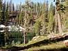 |
On the north side of the mountain,below a dip in the crater rim, lies a large plateau, which may have once been like the fantastic lava beds are today. on the wesdtern edge of that dip there is an interesting area comprised of slate like rock, and grass, something very unusual for Lassen volcanic park, much less a cinder cone, no matter how old or degraded the scree heap is.
Although small, this mountain is challenging to climb, because the slopes are angled at 35 degrees and you are climbing on loose cinder. You will be rewarded, however, with impressive views that you would expect more from Brokeoff than a cinder cone.
Views from the true summit, located on the Eastern rim, include Juniper Lake, Horeshoe lake, Saddle Mountain, Mount Harkness, Cinder cone, Prospect peak, the crater and Crater Pool.

You can see Lassen Peak, Brokeoff Mountian, Fairfield butte, Mount Diller, Chaos Crags, and the rest of the park from the true summit as well, but the veiw is better from the western rim. The veiws make this climb much more rewarding than a first impression from the base gives. I strongly reccomend this as a hike if you are visiting the park for multiple days. If you are doing this in late summer/early fall conditions, a hike down into the crater might be worth it for a short and brisk swim, but any other time the misquitoes are horrendous, especially around bodies of water.
To the west of the mountaion lies the pacific crest trail, which intersects the trail coming from juniper lake at the South-west base of the mountain.
The best way to ascend crater butte is to leave the juniper lake trail just east of the mountain, travel north until you reach a small gully that will lead you up to the the old lava beds. from there, climb until you reach the gap in the rim, and travel east along the rim to the summit, which lies on the East-North-East side of the peak. Total round-trip distance is about 8 miles from the trailhead. Count on 3+ hours round trip for a day hike.
The mountain is much more than a glance at the map, or in reality from its base, can give. I regret that during my trip I did not take any pictures of the whole mountain.
T. White - Sep 25, 2021 7:36 am - Hasn't voted
Dixie FireAs of 09/2021, Crater Butte had burned in the Dixie Fire.