
|
|
Mountain/Rock |
|---|---|
|
|
35.67200°N / 83.176°W |
|
|
Hiking |
|
|
Spring, Summer, Fall, Winter |
|
|
6155 ft / 1876 m |
|
|
Overview
Big Cataloochee, aside from having one of the coolest names of any Southern Sixer, is also one of the most isolated 6,000-foot peaks in the South. It lies within a cluster of very high ridges in the eastern half of the Great Smoky Mountains National Park.Unless one is a long-distance runner trying to break a record, accessing Big Cataloochee is a long one-way hike with an overnight stay. Unless you want to put in a 16+-mile day. Big Cataloochee looms large when viewed from Mount Sterling, standing abruptly and quite separately from the ridge along which the Appalachian Trail runs, and which is home to peaks such as Old Black, Sequoyah, Mount Guyot, Mount Chapman, and others.
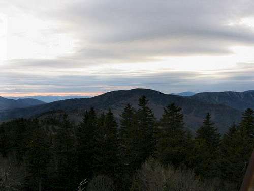 Big Cataloochee from Mount Sterling.
This part of the park is relatively secluded, and the hiker can sometimes find real solitude in this area at certain parts of the seasons. It also has a very hefty bear population, and some of the backcountry campsites and trails can be closed due to problems with bears. This side of the park has the best of the spruce-fir forests, and the Canadian Zone is prevalent above 4500 feet on these ridges. The elk reintroduction took place in Cataloochee, and the big deer can sometimes be seen in the forests here.
Big Cataloochee is the first 6,000-foot mountain I ever hiked. I made my first (and only) visit to the peak in the summer of 1973, when I turned 16. I have never been back there, but I have hiked some of the other mountains near it, and hope to return there this year. The most popular access points for reaching Big Cataloochee are from the Big Creek and Cosby ranger stations, from Cataloochee ranger station, or from the Mount Sterling area along the Cove Creek Road.
 Red spruce forest.
Getting There
 Mount Sterling Trail
Red Tape
 Balsam Ridge Trail
Camping
 Laurel Gap Shelter
External Links
Great Smoky Mountains TrailsGreat Smoky Mountains National Park Official Website
South Beyond 6000 (Smoky Mountains)
 Grandstand