
|
|
Mountain/Rock |
|---|---|
|
|
35.70494°N / 82.21704°W |
|
|
Hiking |
|
|
Spring, Summer, Fall, Winter |
|
|
4300 ft / 1311 m |
|
|
Overview
One of the first things you notice when you start hiking the Southern Appalachians is that mountain names are repeated widely over the range. In fact, it’s not unusual to encounter different peaks with the exact same name within a few miles of one another. Go to Topozone and type in something like “Pine Mountain” or “Blackrock Mountain”, etc. It can get terribly confusing.One peak that was not particularly on my list to bag, but which was part of a longer hike on the way to nab one that was, happened to be Laurel Knob.
 Wild turkey
Laurel Knob itself is a relatively nondescript peak of vaguely pyramidal shape that rises up between the free-standing mass of Mackey Mountain and the Blue Ridge Parkway. It’s quite steep on the eastern side and drops precipitously into various rugged watersheds. It’s also the western boundary for the roadless Mackey Mountain Backcountry, and would be notable for this alone.
 Trail
TrailI was fortunate enough to be able to hike to the summit of Laurel Knob and beyond, walking as I did from the Curtis Creek Campground at 1800 to the summit of a nearby 5,000-footer, thus hiking from early Spring into late Winter in the process, and getting an education into why it’s always wise to carry some extra clothing on a hike into the southern high country in March.
Getting There
From Old Fort, NC, take State Rt. 70 east 0.2 miles to campgroundsign (Curtis Creek Rd./State Rt. 1227). Turn left onto Curtis
Creek Rd. and go 4.7 miles to campground. The Snooks Nose Trail starts directly across the road from the campground.
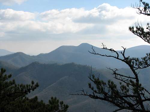 Mackey Mountain
Red Tape
None.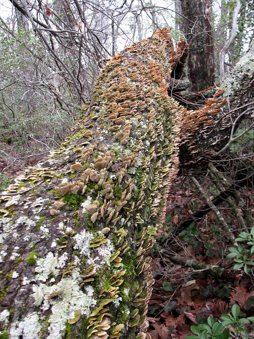 Fungus
Camping
National Forest camping in the backcountry is free. The Curtis Creek Campground has sites that vary from free to $10 per night.
 Waterslide
External Links
Old Growth ReportMackey Mountain Roadless Area
Curtis Creek Area