

|
|
Mountain/Rock |
|---|---|
|
|
38.74000°N / 120.0515°W |
|
|
Alpine |
|
|
Hiking |
|
|
Spring, Summer, Fall, Winter |
|
|
9590 ft / 2923 m |
|
|
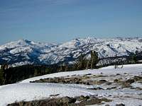
Overview
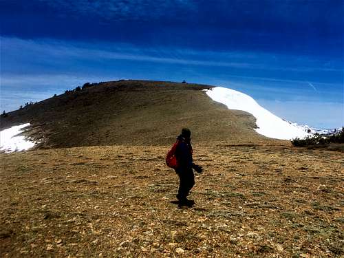
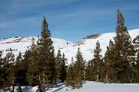
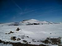
Little Round Top is an easily accessible summit located west of Carson Pass. It gets its name from Round Top 10,381', the most prominent mountain in the area, which is 6 miles southeast. The peak offers stunning views in all directions and a good workout, and for those of us who can't ski, a great way to get outdoors in the winter. Snowshoeing is a definite option. Because the peak is south facing, it can be hiked earlier in the year than the summits south of Carson Pass and Caples Lake. Routes range from 4 miles to 5 1/2 miles one way; and as close to 2 3/4 miles one way if taking the dirt road up Schneider Cow Camp Road to the trail.
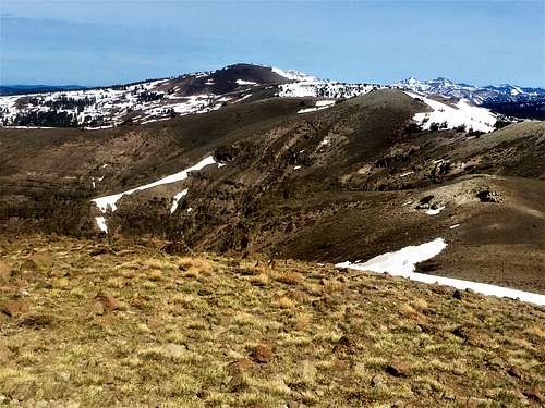
The terrain up to Little Round Top is fairly open, so it is easy to route find, and hard to get lost. Ideal times to hike Little Round Top are late spring and early fall.
Getting There
There are three primary options. The shortest are around Caples Lake.
Southeast Ridge route:
The best option is probably just to park on Highway 88 right at the east end of Caples Lake. There is an open slope to the north of the highway that heads up the south side of the ridge. You can simply walk up to the ridge from there to Peak 9452, and then head west over to Little Round Top. The route is pretty straightforward, and is only about 4 miles on way and less than 2,000' when hiking both summits. A lot of this is off-trail, but still easy to follow.
South Side via Schneider Cow Camp:
The best trail route is to head up Schneider Cow Camp Road north of Highway 88. Turn right onto the road and continue for less than 2 miles and there is a trailhead on the left with space for a few cars. The trail leads to the ridge in about 1 1/4 miles, gaining about 800'. From there, Little Round Top is less than 1 1/2 miles away and another 470'. Total round trip distance is less than 5 1/2 miles.
East Ridge PTC route:
For the PCT route, get to the Meiss Meadow Sno-Park, 0.2 miles west of Carson Pass on the north side of Hwy 88. From the lot, head west (left) and wrap your way around through some neat looking trees and make your way up to the obvious saddle to the north. This is a popular XC ski and backpack route that continues on over the saddle. When you reach the top of the saddle, cut west (left) and head up to Peak 9452, which is at about the half way point. From there, and undulating ridgeline leads to Little Round Top. The total gain one way is about 1,500'. This is about 5 1/2 miles each way.
Red Tape
Make sure to have a Sno-Park pass for the parking lot Nov. 1-May 30. You can pick one up at Kirkwood, a few miles down Hwy 88. More information found here: http://ohv.parks.ca.gov/?page_id=1233
Camping
Due to the short approach and popularity of the area, the peak is usually climbed as a dayhike. The Forest Service has a variety of campgrounds along Highway 88, including ones at Caples Lake, Kirkwood Lake, and Woods Lake. For a comprehensive list, check the Eldorado National Forest web page.