
-
 14352 Hits
-
 87.76% Score
-
 25 Votes
|
|
Mountain/Rock |
|---|---|
|
|
35.43774°N / 117.8159°W |
|
|
Kern County |
|
|
Hiking |
|
|
Spring |
|
|
5244 ft / 1598 m |
|
|
Overview

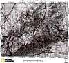
Black Mountain is the highpoint of the El Paso Mountains in Kern County southwest of Ridgecrest, and about 20 miles northeast of Mojave east of State Highway 14. Parts of the range are a wilderness area, which was created in 1994 and now has a total of 23,780 acres. All of the wilderness is managed by the Bureau of Land Management. The Wilderness contains numerous reddish-colored buttes and dark, uplifted volcanic mesas dissected by narrow canyons. Two of the main canyons to the southwest and south are the Last Chance Canyon and the Mesquite Canyon. The main geological feature is the east-west leading Garlock Fault to the south of the El Paso Mountain. This is one of the major earthquake faults in Southern California.
The highest point and central feature of this wilderness is Black Mountain (5,244 feet), an extinct volcano. Surrounding the mountain is badlands topography. The most spectacular attribute of this area is the abundance of cultural sites. The southern portion of the wilderness is included in the Last Chance Archaeological District and is listed on the National Register of Historic Places. Wildlife includes raptors, Mojave Ground Squirrel, and the Desert Tortoise. Vegetation primarily consists of creosote bush scrub community with Joshua trees on the western side of the mountain.
This mountain range has been the site of intense mining activities. Access to the mountain is usually via the Mesquite Canyon Road, a rough dirt road accessible for 4WD, high clearance vehicles. Black Mountain is on the list of the Hundred Peak Section of the Los Angeles Chapter of the Sierra Club (listed as Black Mountain #6). The routes up the summit are usually trail-less, cross-country hikes through beautifully dark, basaltic rocks. The canyons around Black Mountain especially Mesquite Canyon and Last Chance Canyon are very popular with off-highway vehicles.
 |
 |
 |
Burro Schmidt Tunnel
Located southwest of Black Mountain, in the Last Chance Canyon, is the Burro Schmidt Tunnel (35.41033°N 117.87583°W), a half-mile long tunnel dug entirely by hand, constructed over a 32-year period by William "Burro" H. Schmidt (1871-1954). Schmidt, who was mining gold, was faced with a dangerous ridge between his mining area and the smelter at Mojave, California. Schmidt said that he would "never haul his ore to the smelter in Mojave down that back trail" using his two burros. Thus, he began his tunnel in 1906. The tunnel was about six feet tall and ten feet wide, but it cut through solid granite and required little shoring. The path was not straight, but took several turns. Schmidt was trapped many times by falling rock and injured often, and eventually installed a cart on rails. In 1920 a road was completed from Last Chance Canyon to Mojave, eliminating the need for the tunnel, but Schmidt claimed to be obsessed with completion, and dug on. In fact, it was not a desire to punch through the mountain that motivated his digging, but a vein of gold extending in that direction. Schmidt simply claimed an irrational desire to dig through the mountain to prevent others from moving in on his find. By 1938 he had achieved his "goal", having dug through nearly 2,500 feet of solid granite using only a pick, a shovel, and a four pound hammer for the first portion, and carefully placed dynamite with notoriously short fuses for the majority. It was estimated that he had moved 5,800 tons (5,260 metric tons) of rock to complete his work. Interestingly Schmidt never used the tunnel to move his ore. Instead, he sold the tunnel to another miner and moved away. Schmidt's cabin in Garlock has been largely abandoned and stands as it was in the 1930s, preserved by the dry climate.
Getting There
Black Mountain can be reached from several directions: from the town of Mojave go north on SR 14 for about 20 miles to the Randsburg Road on the right. Go east on the Randsburg Road about 11 miles to a dirt road, Mesquite Canyon Road (signed EP 100). This turn-off is about one mile west of the junction of the Garlock Road and the Randsburg Road. Mesquite Canyon Road can also be reached from the east coming from Randsburg.
Red Tape
Black Mountain lies within the El Paso Mountains Wilderness but no special permits are required.
Lodging
There are many accomodations in mearby cities, e.g. Mojave, Ridgecrest.