-
 24552 Hits
-
 83.69% Score
-
 17 Votes
|
|
Mountain/Rock |
|---|---|
|
|
46.27305°N / 114.46613°W |
|
|
Download GPX » View Route on Map |
|
|
Ravalli |
|
|
Mountaineering, Mixed, Scrambling, Skiing |
|
|
Spring, Summer, Fall, Winter |
|
|
8647 ft / 2636 m |
|
|
Overview
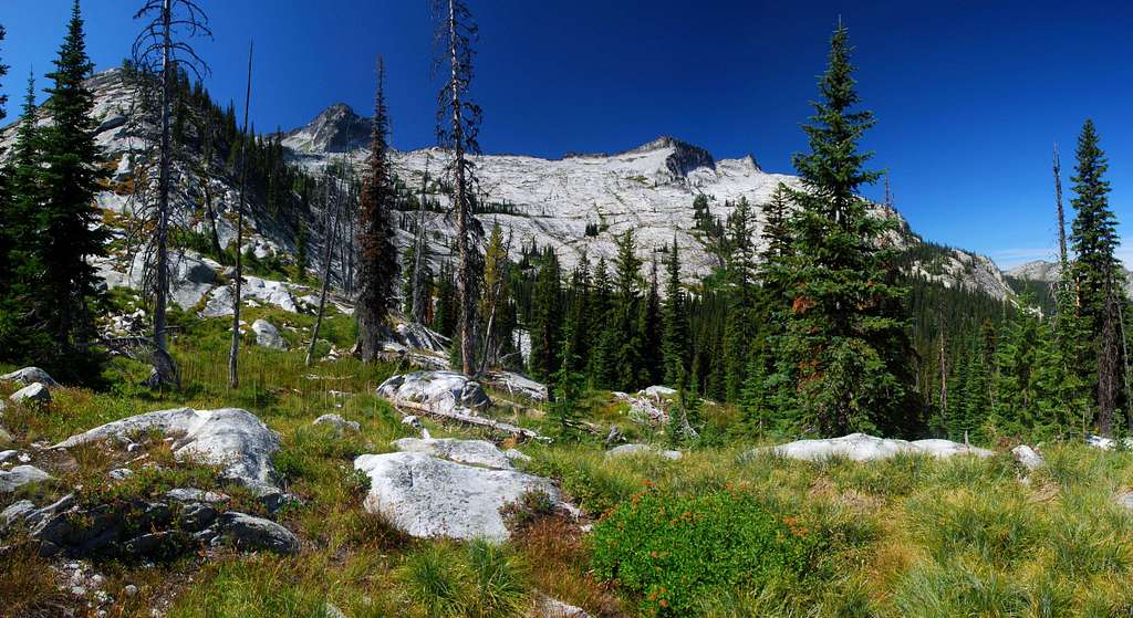
Far back Blodgett Canyon, due west of the pass from Montana into Idaho and on the Montana/Idaho state line, is Blodgett Mountain. One would think that with such a recognizable name, this mountain would have plenty of climbers visiting its summit.
Situated a long way from any trailhead, this mountain is seldom visited, even by the most adventurous. Its summit invisible from the Bitterroot Valley, only those who have traveled far into the wilderness have had the opportunity to view this summit, one which has watched the scourge of humanity from its lofty position in the Bitterroot Mountains.
Blodgett Pass, the saddle on the ridge-crest between Montana and Idaho, has been significant to humans for almost as long as we have inhabited this area of the earth. First used by Indians long before white men reached these rugged mountains, trappers where the next to use the pass to ease access to their winter trap-lines.
According to the journals and letters of Major John Owen, Blodgett Creek, Canyon, and mountain are named for Joseph Blodgett, a packer in the Bitterroot Valley during the early 1860s. In the late 1860s he settled along the creek.
Eventually the creek, the canyon, and eventually the mountain were assigned his name. The oldest known name applied to the creek was George Red Crow, a Nez Perce who was a long-time resident along its banks.
This mountain existed before humans appeared and, unconcerned by our ethnocentrism, will likely remain long after we've disappeared.
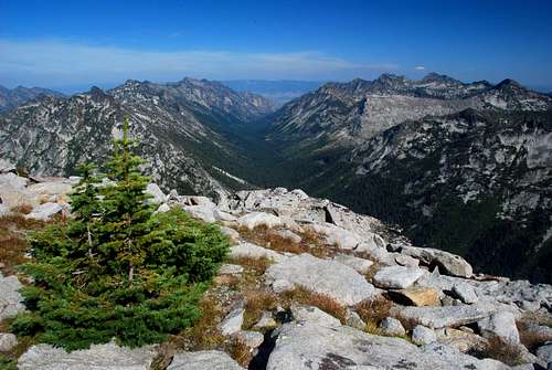
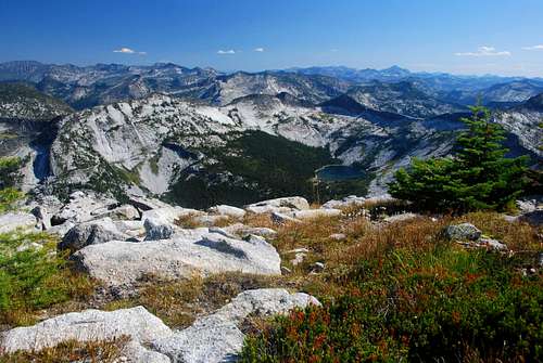
Note: When the Selway-Bitterroot (an area which includes most of the Bitterroot Mountains) was turned into an official wilderness area, a compromise was reached which placed the boundary line farther back in this canyon than in many others -- seven (as opposed to the more typical two to four) miles from the trailhead . The reason was that Blodgett Canyon has historically been heavily used by trappers and hunters and stockmen, many of whom did not want any "extra" restrictions on their activities.
Getting There
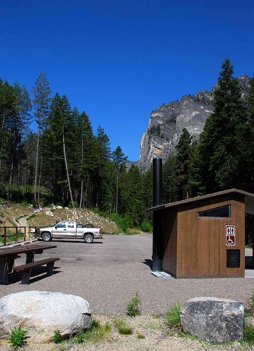
Access to the climbers' routes for Blodgett Mountain begins at the Blodgett Creek Trailhead.
In Hamilton, Mt, drive west on Main Street (out of the downtown area) until you reach the bridge over the Bitterroot River.
Just past (west of) the bridge, turn right (north) onto Ricketts Road and drive for .5 mile.
At the intersection (3-way stop), turn left (west) onto Blodgett Camp Road.
Stay right at the intersection with FS 735 in about 2.5 miles.
Continue for about 1.5 miles to the combined Blodgett Creek Campground and Trailhead.
On your left is parking for a couple of dozen vehicles, stock handling facilities, and an outhouse. This is the trailhead for Blodgett Creek and Canyon.
Going past first the parking lot takes you across a bridge and to the Blodgett Creek Campground and a second parking lot (on your right).
Area Restrictions (Red tape)
Around 7 miles from the trailhead you pass into an official wilderness area, The Selway-Bitterroot. All wilderness rules and regulations apply.
Camping
Besides the very nice camping area near the trailhead, there are several places along the trail which have established campsites. The first campsites are just after crossing a bridge, about 3 miles in. The second spots are near the Upper Falls, around 4.5 miles from the trailhead. The best spots are on the east edge of the Nine Mile Meadows, paradoxically 9.5 miles from the trailhead.
If you're interested in fishing, you can continue on the Blodgett Creek Trail approximately 1.5 miles past the cutoff for Blodgett Pass to the campsites at Blodgett Lake.
The Route
Best ascended during a multi-day outing, this mountain offers some of the best backcountry wilderness climbing one can experience in the Bitterroot Mountains. Only a moderately strenuous climb if ascended from a base-camp near the pass, this climb becomes very strenuous if completed in one day from the trailhead.
|
|---|
| Route Type – Scramble Class Level – Class 2+ Effort Required – Moderately Strenuous Summit Elevation – 8,647 Elevation Gain – 1,950' (rt - pass to summit) Distance – 3 Miles (rt - pass to summit) |
Approach – Trailhead to Blodgett Pass
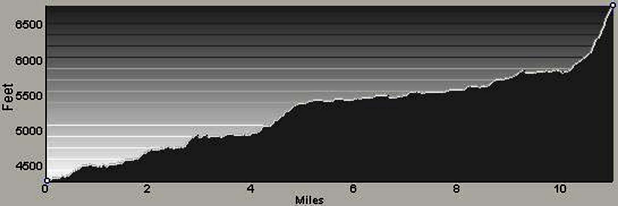
From the trailhead, travel west on the Blodgett Creek Trail. A heavily-used path by hikers, fishermen, and stock animals, this trail is also used by climbers to reach a few of the Bitterroot's truly grand climbing spires.
During spring runoff, low portions of the trail are often inundated by water from the rushing stream. These wet spots can generally be skirted with a little uphill bushwhacking.
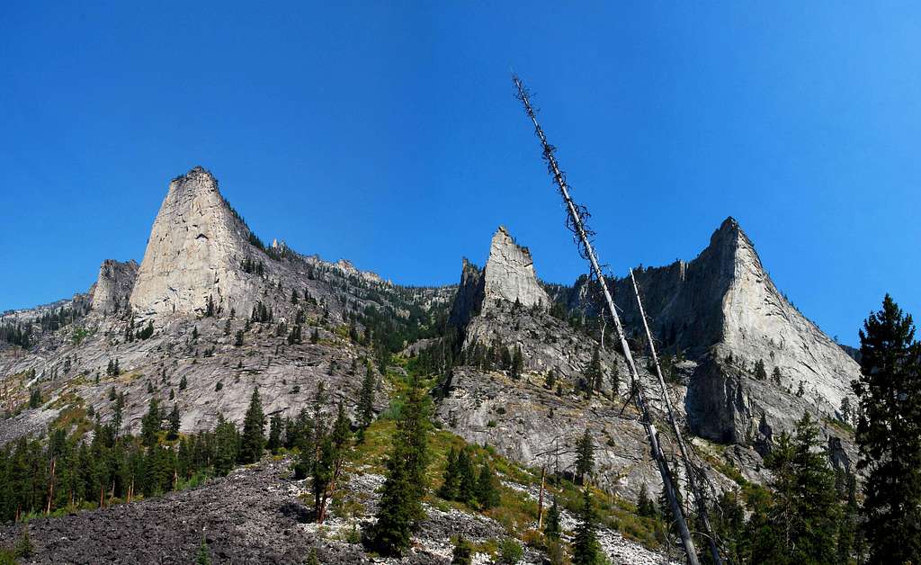
The trail proceeds through a fairly open wood (mainly because it's seen fire in the not-too-distant past) so you shouldn't have trouble spotting the spires to your right (north) on the other side of Blodgett Creek.
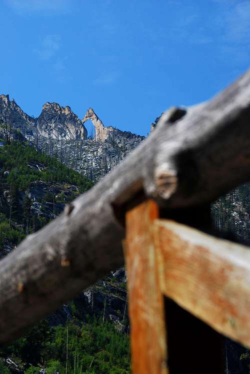
Just before reaching the bridge crossing (3 miles from the trailhead) you should be able to see the Horsehead Arch high on the canyon's south side. Before reaching the bridge there is a small (2'-3' high during late summer and fall) waterfall near the spot where you get a good view of the arch.
Just after crossing the bridge to the north side of the creek there are a couple of adequate campsites, though they are quite close to the trail.
Four and a half miles from the trailhead the trail passes Upper Blodgett Falls.
The junction for the steep hike to High Lake, which sits in a high cirque just west of Canyon Peak, goes left (south) from the trail 6.2 miles from the trailhead (46.277028 N / 114.35716 W – elevation 5,450').
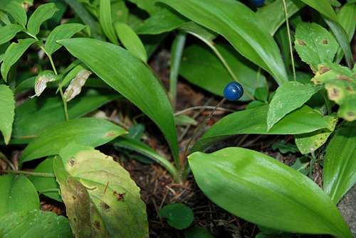
About 9.5 miles from the trailhead, just right (north) of the trail, is a long-established camping area (46.27215 N / 114.42413 W – elevation 5,812'). The beautiful open area immediately past this multi-site camping area is referred to as the Nine-Mile Meadow. The creek is close by at the southern end of the meadow which makes this the perfect place to camp for a multi-day outing to Blodgett Mountain.
At the base of the pass,10.3 miles from the trailhead, is the junction with the side trail to Blodgett Lake (46.26950 N / 114.43938 W – elevation 5,885'). The lake is approximately 1.5 miles from this junction. A nice backcountry tarn, it's a good place to visit if you're in the area for several days and enjoy fishing for Cutthroat Trout.
The trail from the base to the top of the pass is generally in good shape. Because it is a through-trail between Montana and Idaho, it is cleared on an annual basis by the Forest Service. Though the slope is quite steep, hiking to the pass is not bad. The trail is well engineered with an adequate number of switchbacks. Also, if you happen to visit at the right time of year, this pass has some of the highest-producing Huckleberry bushes I've run across in the Bitterroots. False Huckleberries also grow here, too, but you can tell them apart quite easily. False Huckleberries grow in clumps on the bushes while real Huckleberries appear singly. Most importantly, real Huckleberries taste great whereas False Huckleberries, though not poisonous, taste a lot like paste. Yuck!
Climbers' Route – Blodgett Pass the Summit
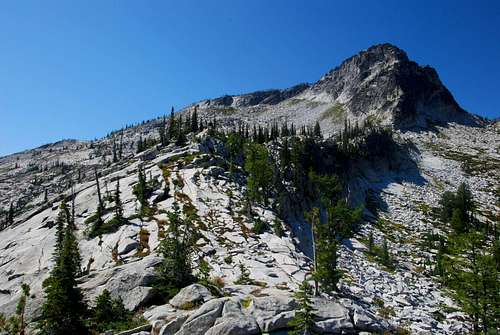
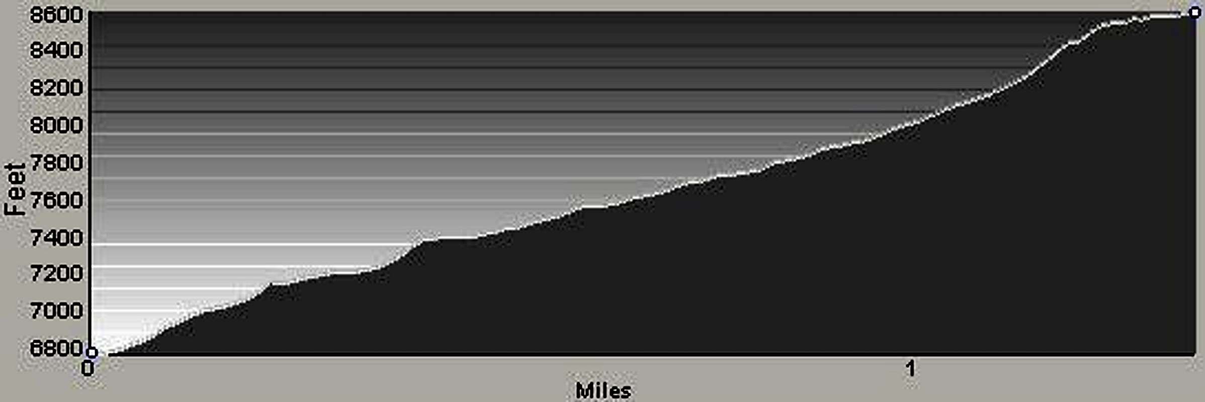
Leave the maintained trail where it crosses Blodgett Pass and head west-southwest along the ridge-crest which is the Montana/Idaho state line. The ridge consists of slab-granite mixed with patches of grass and small groves of trees, all of which make for pretty easy climbing.
Early on during the climb there is one cliff-band of slab-granite which must be negotiated using a couple of very easy Class 3 moves. This very short section is the most technically difficult of the entire climb. It's so short and easy, most people don't even notice it.
Continue upward along the ridge staying close to the ridge-crest as you ascend.
Approximately .5 mile from Blodgett Pass the ridge makes a long slow swing from west-southwest to west-northwest. Once the swing is complete the incline of the ridge increases a bit.
Persist climbing as close to the ridge-crest as makes sense until you reach an elevation around 7,875' (46.27261 N / 114.46018 W). Leave the ridge and begin a climbing traverse across the south face of Blodgett Mountain.
During the traverse you will notice a cliff-band which appears to protect the highest portion of Blodgett Mountain's southwest ridge. Head directly for that cliff-band.
As you continue the traverse, you will eventually be close enough to see that there is a weakness near the upper part (right) of the cliff-band. Adjust your direction of travel as needed so you will arrive at the southwest ridge just below that weakness.
Proceed completely across Blodgett's south face to the cliff-band.
Follow the base of the cliff-band upwards (north-northeast) and climb (northwest) on a mix of grass and scree through the weakness to the ridge-crest.
Once on the crest of the ridge it's an easy northeast walk up the broad ridge to the summit.
Descend by reversing this route to Blodgett Pass then your base-camp or the Blodgett Creek Trailhead.
When To Go
It's possible to visit this summit any time of the year. However, the south face of the mountain is prone to avalanche, so only make attempts when avalanche danger is low.
Because of the profusion of Huckleberries along the trail just below the pass, I believe the best time to visit is when they are ready to eat, usually mid to late August.
Essential Gear
Trying to climb this mountain as a day trip is only for the young or the foolish. Bring your camping gear and make it a multi-day affair. If you enjoy fishing, stay an extra day and carry your fishing rod for a try at catching Blodgett Lake's Cut-Throat Trout.
Route Statistics

Gain – 5,573'
(total round trip)
Distance – 25.2 miles
(total round trip)
