|
|
Mountain/Rock |
|---|---|
|
|
38.68028°N / 106.29277°W |
|
|
Chaffee |
|
|
Mountaineering |
|
|
Summer |
|
|
13528 ft / 4123 m |
|
|
Overview

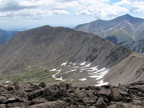
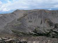
Boulder Mountain is the second peak from the left, north face
Boulder Mountain rises on the west side of Baldwin Creek Gulch across from the famous 14er Mt. Antero in the Sawatch Mountains of central Colorado. Except to the southwest where a ridgeline connects it to Mt. Mamma, Boulder Mountain is otherwise surrounded by valleys. Its western slopes go into the Deer Canyon and its northern slopes drop 4200 vertical feet to the bottom of Chalk Creek Valley.
Like Mt. Antero, Boulder Mountain has a rough 4WD road that climbs its slopes to above tree-line. Boulder Mountain Road branches off of the beginnings of Mt. Antero Road and ends at an abandoned mine at an elevation of 12850 ft. While the road is rough and potentially dangerous to drive (see “External Links” below), it can serve as a wonderful hiking trail. Unlike Mt. Antero, you are not very likely to see anyone else on Boulder Mountain.
Boulder Mountain can also be climbed from the south starting at the 12100 ft Baldwin Lake. For a high ridge-top experience, you could combine Boulder Mountain with the 13646 ft Mt. Mamma and the 13707 ft Grizzly Mountain (See Route for Grizzly Mountain).
Boulder Mtn. on left W/SW face, Mt. Antero on the right
Getting There
The trailhead for Boulder Mountain is the same as the trailhead for Mt. Antero.From the town of Buena Vista drive 8 miles south on Route 285 to a place known as Nathrop and then turn west onto Route 162. Drive the road 12.2 miles until you see the sign for Baldwin Gulch/Mt. Antero Trailhead (the first 10 miles are paved and the rest is a smooth dirt road passable by any car)
Route (Boulder Mountain Road Hike)

The information provided here focuses on hiking the Boulder Mountain Road. The road is very narrow and potentially dangerous to drive (see “External Links” below).
All distance are per my GPS.
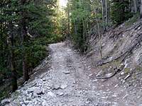
At the trailhead, you will see a map that shows the 4WD roads of the area. Boulder Mountain Road is identified as Road 279. Hike up the steep and rocky Mt. Antero Road for roughly 1.3 miles until you see Road 279 on your right side.
Turn onto Road 279. The road is narrow and makes a long switchback going in a dense forest of pines.
 |  |
After a while, you will reach a somewhat open area.
 | 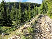 |  |
The road then begins a series of switchback going through a forest of small Aspen trees.
 |  |
Higher up, Pine trees appear again.
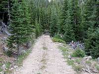 |  |
You will then reach the tree-line at around 12300 ft.
 |  |
The summit of Boulder Mountain (or the slopes just below the summit) come to view.

Along the way, you will have spectacular views of some of the nearby peaks.
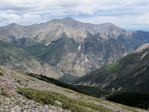
Mt. Princeton
 Mt. Antero |  Cronin Peak |  Peaks 13317 ft & 13299 ft |
The road continues with a few more switchbacks above the tree-line.
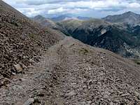
At 12850 ft you will reach the end of the road and see the remains of an abandoned mine.
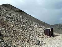
You can then hike up easy boulder covered slopes to reach the summit of Boulder Mountain.

Views from the summit:
 East/Mt. Antero |  NE/Mt. Princeton |  North |
 West/Mt. Mamma | 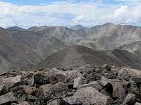 SW/Grizzly Mountain |  SE/Tabeguache & Cronin Peaks |
Red Tape
No fees or permits for day hikes. For other regulations, see the site for San Isabel National Forest.