
-
 14498 Hits
-
 84.26% Score
-
 18 Votes
|
|
Mountain/Rock |
|---|---|
|
|
36.44538°N / 118.2113°W |
|
|
Tulare |
|
|
Hiking, Scrambling |
|
|
Spring, Summer, Fall |
|
|
11622 ft / 3542 m |
|
|
Overview
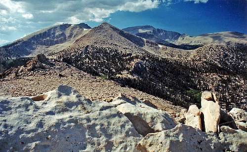
Cirque Peak and Mt. Langley from Smatko Peak
In spite of it's relative obscurity this peak is higher than it's fairly popular neighbor Trail Peak. This very accessible half day hike is a short scramble directly from Cottonwood Pass. It could be done as a brief diversion by anyone crossing the pass or the forested east slope can be hiked directly from Horseshoe Meadows. The high point is the second one .6 mile south from Cottonwood Pass.
The summit views include Cirque Peak and Mt. Langley to the north. To the east over Horseshoe Meadows and the Owens Valley rise the Inyo Mountains. To the southeast are Trail Peak and Muah Mountain with Olancha Peak further down range. To the south the breadth of the Golden Trout Wilderness stretches to include Kern Peak and to the west is the Great Western Divide with Kaweah Peaks Ridge rounding out the vista to the northwest.
Getting There
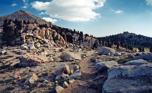
Cottonwood Pass area with Smatko Peak on left
From Cottonwood Pass: The Cottonwood Pass Trailhead is off of the road's circular loop at the far west end of the lot (9,920').
Take the Cottonwood Pass Trail along Horseshoe Meadow and up the forested swichbacks to Cottonwood Pass at 3.5 miles (11,120'). From the pass hike/scramble .6 mile directly south up to the second high point (class 2) which is the summit.
East slope from Horseshoe Meadows: Take the Cottonwood Pass Trail about a half mile break off to the left, cross Horseshoe Meadow with a small creek crossing and hike the forested east slope of Smatko Peak to the summit.
Red Tape

Southeast from Smatko Peak. Muah Mtn. and Trail Peak, right.
The Cottonwood Pass Trail is a quota trail. For overnight access to Sequoia National Park or Inyo National Forest contact the Eastern Sierra Interagency Visitor Center in Lone Pine.
640 S. Main St.
Lone Pine, Ca. 93545
760-876-6222
Camping

Talus pile on Smatko Peak