
|
|
Mountain/Rock |
|---|---|
|
|
39.77902°N / 119.85321°W |
|
|
Washoe |
|
|
Hiking |
|
|
Spring, Fall, Winter |
|
|
7192 ft / 2192 m |
|
|
Overview
Freds Mountain is a mountain ridge north of the Reno-Sparks area in northwestern Nevada. Not well known outside local circles, Freds Mountain offers a splendid jaunt up into the desert mountain landscape without traveling far from civilization.
Freds Mountain is visible from many parts of Reno, as a tall brown hill to the north beyond Peavine Peak. It isn’t part of any single mountain range, but rises up on its own from the valleys below.
Views are excellent because it is surrounded by mountains on all sides. The northern Sierra Nevada are visible to the south, while the highest mountains in the nearby Pah Rah Range are prominent in the eastern skyline. Mountains surrounding Pyramid Lake are well viewed, including Tule Peak and Tohakum Peak. A small part of Pyramid Lake is visible from the summit.
Freds Mountain is best hiked in spring, fall, or wintertime. Keep in mind that mud can be a problem in the springtime, and excessive heat and snakes are a problem during the summer. The best times of year to hike are October through mid-April. Do not hike after a rain or snowstorm as mud can get pretty bad, not just on the mountain, but on the dirt roads in the area.
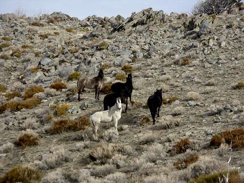 Wild horses on Freds Mountain.
Getting There
There are two primary routes.
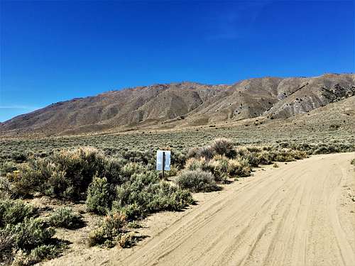
The best route is probably from Alum Rock Road. From Reno take 395 North to Exit 74 to Lemmon Valley. Drive north a few miles as the road curves towards a residential area, and turn right on Waterash and then right on Tupelo, and left again on Matterhorn Blvd. Follow until the road ends at Antelope Valley Road. Take a right and continue until you reach a circle. Turn left on Serpentine, then north on Alum Rock Road, which curves to the left towards public lands. Park next to the public lands sign.
Take the road heading directly to the face of the mountain and follow switchbacks up to the ridge. A road leads to the summit from the ridgetop. Total hiking distance is about 3 miles and 2,000’ of elevation gain.
You can also take Marble Point Road from this starting point, but there is some private land and signs up there trying to prevent access up the road; even though there is no property up the road. However, if you do take the road, it adds some mileage and makes the hike more gradual.
The other route is from Freds Mountain Road, which has some similar issues. Private land signs trying to deter visitors from getting on the public lands. However, this shouldn’t prevent legal access.
From Reno take 395 North to Exit 78 in Cold Springs (Red Rock Road). Follow Red Rock Road north for 7.9 miles, and turn right at Antelope Valley Road, a well graded dirt road. Follow east for 2.6 miles and then take a left on Freds Mountain Road.
The road curves left around a hillside. Find a place to park once the road straightens out and is heading directly towards the mountain. There is space to park on the left side of the road. This is a little over ¾ miles up the road.
The easiest approach is up the southeast side. Start the hike by walking up Freds Mountain Road until you see a brown little horse stable, or something of the like, on the right. Take a right on a sandy, well-worn road that heads past the horse stable, and follow it as it winds towards the Freds Mountain ridge to the north. Eventually you will reach a gate, which signifies public lands. Walk around the gate and continue up the road until you reach the base of the ridge. The road continues to the east side of Freds Mountain. Do not stay on the road. Instead, head up the ridge.
After an initial 200' hike up the ridge, you crest a hill. Descend slightly and the hardest part of the hike comes. It is a 500' climb in about 0.4 miles. After reaching the top of this section, the rest of the hike is pretty easy.
In total, once leaving the road, at about 6200’, it is about 1 1/3 miles to the summit with a little over 1,000’ of elevation gain. There is a faint trail at times, but the land is pretty open, so the route is pretty straight forward. Overall, the hike from the suggested parking area is about 5 1/2 miles round trip, with the elevation gain to the summit of about 1600 feet. In total expect 2½ to 3 hours of hike time.
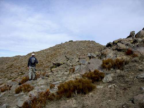 Jim looking up at the final summit block.
There are other ways to approach Freds Mountain, either from the north further up on Red Rock Road via Bird Springs Road, or from the east from the Antelope Valley via Alum Rock Road. However, the route described above is the most direct, most accessible, and probably the most scenic.
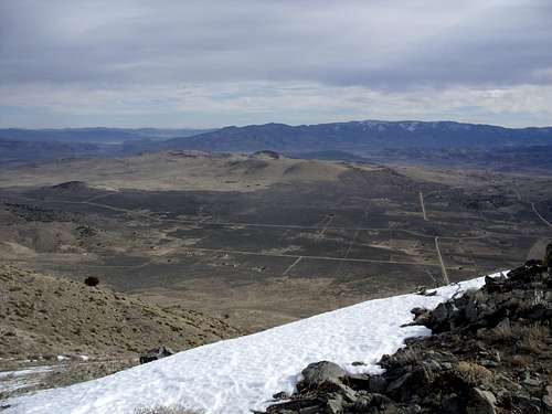 View down the steep 2000' east face to the Antelope Valley.
Red Tape
Freds Mountain Road has a sign that says "Private Road, not a Through Route". However, this does not mean the road is off-limits to hikers. There are several "No Trespassing" signs on the way up the road, but those are for the actual private land, and do not block the road. Much of the land around Freds Mountain Road is owned by a church. However, most of Freds Mountain is on public lands. That being said, be respectful of the land. Stay on the standard route, and everything should be fine.