
-
 4563 Hits
-
 84.82% Score
-
 19 Votes
|
|
Mountain/Rock |
|---|---|
|
|
19.80207°S / 65.65291°W |
|
|
Hiking, Scrambling |
|
|
16637 ft / 5071 m |
|
|
Overview
At 16,637 feet, Cerro Cunurana is the highest peak in the mountainous region surrounding Potosi, Bolivia. Located in the Andean Cordillera Central, Cunurana and the surrounding landscape consist of exposed rock, nearly devoid of plant life. Only sparse clumps of grasses and small shrubs can be found at the higher elevations. Cerro Cunurana is an ideal acclimatisation hike in a remote alpine setting.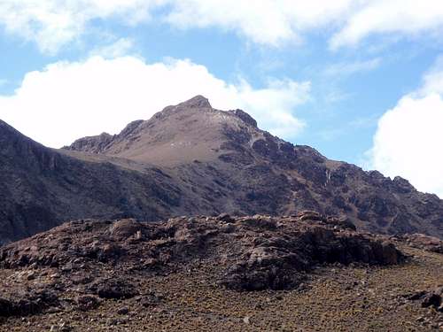 The Northwest Face
Cunurana is a pyramid shaped mountain with long north and southeast ridges. There is a sub-peak located at the end of the southwest ridge. Numerous small lakes can be found below each of the three faces, the largest just a half miles west of the summit. As with most of the ground water in the area, some of the lakes display an unusual color. This is caused by the presence of minerals in the water, unearthed by mining operations past and present.
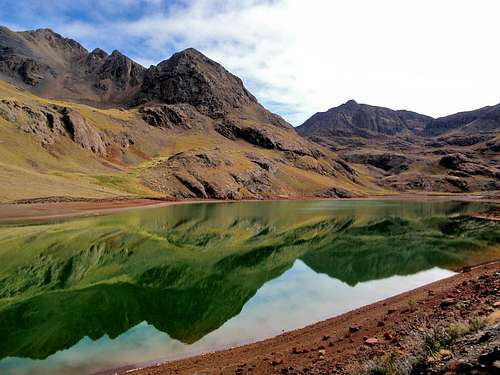 The Large Lake West Of Cunurana
Spanish silver mining operations in the 16th century provided a constant although dangerous source of income for the local inhabitants of the region. It is estimated at one time nearby Cerro Rico produced 75% of the world's silver. Furthermore, it is estimated that 8 million miners have died inside the mines of Cerro Rico, not include miners who have died from silicosis related illness. Silver production in the vicinity of Cerro Cunurana has all but died out, but many mining operations are still at work extracting the less valuable metals like tin. It's anyone's guess as to how many hundreds of year old the ruined buildings are, which are encountered during a climb of Cunurana.
Getting There / Driving Directions
 The Approach Drive
From the city of Potosi drive south on Highway 1 for 36 kilometers to the junction with Highway 14. Keep to the left on Highway 1. In less than 1 kilometer from the junction, turn left after crossing the first bridge. Continue north for 300 meters and keep right at the next junction. Continue driving north on the main road for 11 kilometers. You will pass several small housing tracts with curious llamas. The main mining operation and gate are passed 6 kilometers from Highway 1. Park your car somewhere in the vicinity of the second lake or third lake at 15,200 feet.
North Ridge Route
 The Upper Lake
Beginning at the highest of the three lakes, hike east to where the road ends at the abandoned ruins of an ancient mining operation. Continue east to the saddle. From the saddle, hike south along or near to the crest of the ridge. This is the north ridge of Cerro Cunurana and can be followed easily all the way to the summit, with one exception.
 The Rock Step
There is a steep rock step at 15,970 feet. It's only about 20 feet tall and there are enough cracks and protrusions to make it a YDS Class 3 scramble. Beyond the rock step the north ridge opens up into more of a slope than a ridge. The last few hundred feet below the summit involve a lot of loose talus. There is a marker on the summit placed in 2003 by the National Institute of Land Reform.
 On The Summit
Red Tape
The large mining operation 6 kilometers north of Highway 1 controls access to the road above 13,500 feet. They're main concern is the prospecting of competing mining operations. If they suspect that you plan to scope out the terrain then they will not grant you access. They have a makeshift gate across the road. You have two options for gaining access. Either arrive early in the morning before anyone is around, or to try to explain that you are an "alpinista". I suggest the first option.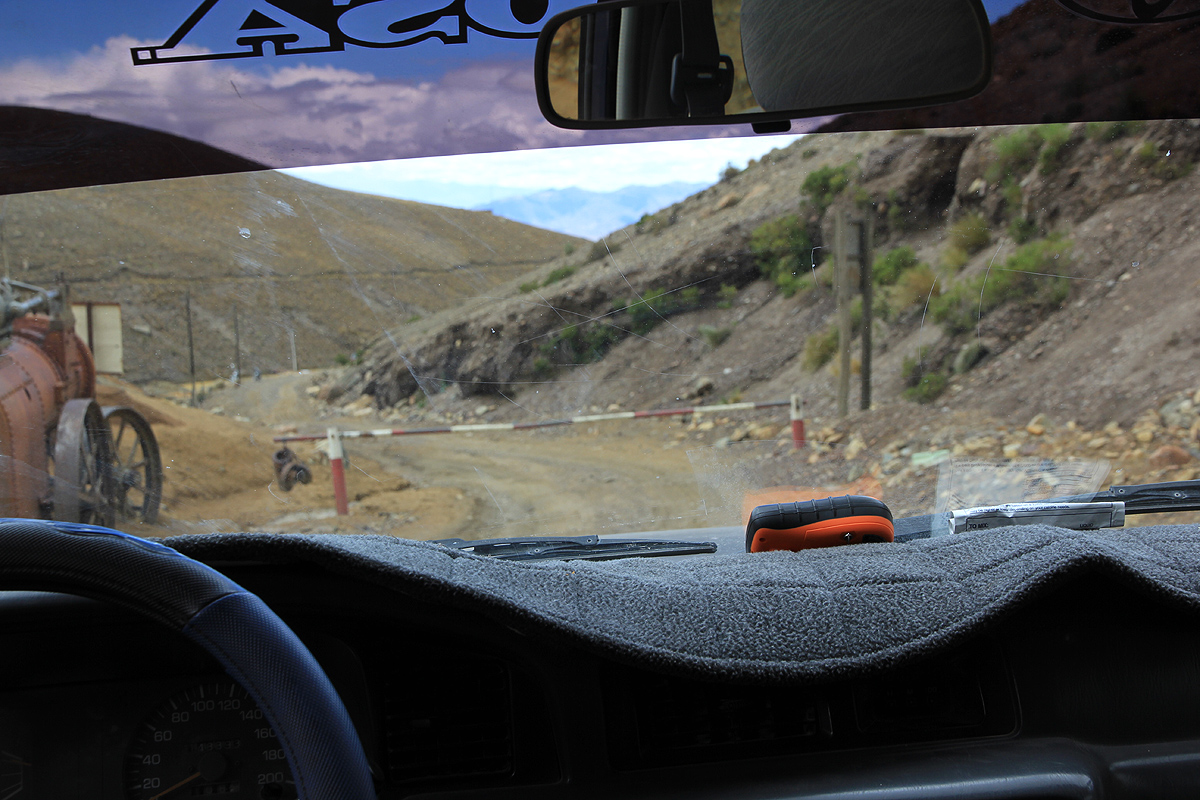
 Below The Summit
AMS / HACE / HAPE
Make sure you know the difference between normal altitude sickness and the more serious HACE and HAPE. It's quite common to have a headache or loose you appetite at altitude, but if you or someone you climb with was to get seriously ill, could you diagnose it in time? Knowing what to watch for, and making the decision to turn around without delay, might save a life.
External Links
Informational page by Petter BjørstadPhotos by Rob Woodall