
-
 22179 Hits
-
 85.28% Score
-
 20 Votes
|
|
Mountain/Rock |
|---|---|
|
|
61.43376°N / 149.09683°W |
|
|
Hiking |
|
|
Spring, Summer, Fall |
|
|
5423 ft / 1653 m |
|
|
Overview
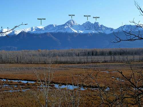 Pepper Peak, the Twins, and Goat Rock from sea level in the Matanuska Valley. Click, then click again, to enlarge.
Pepper Peak is a huge, gentle lump that doesn't have a lot of character of its own, but gives a fantastic outlook on lots of neighbors that do. In a few hours you can be between the rugged Twin Peaks and the even more impressive giants at the end of Eklutna Lake, looking down a vertical mile on the Matanuska Valley. The 4500-foot elevation gain for this hike is hefty, but with a good trail well past treeline and reasonable footing beyond, the height comes pretty easily.
If this is Pepper, is there a Salt? Yes, there is--it's the mountain a mile and a half due east that's practically a twin of this one in size and shape. The summits are within a few feet of one another in elevation.
To pick out Pepper Peak from the Mat Valley, click to enlarge the peak i.d. photo at right.
Getting There
Pepper Peak is climbed from the Eklutna Lake trailhead at the outlet of Eklutna Lake. Take the Eklutna exit from the Glenn Highway (Alaska Highway 1) about 26 miles north of Anchorage, and follow signs to Eklutna Lake. Park near the boat launch. Unless you have an annual pass, there is a $5 parking fee. Bring exact change.Routes
Southwest Ridge Trail: From the parking at the end of the Eklutna Lake road, elevation 900 feet, follow the prominent signs for the Twin Peaks Trail. This trail climbs 1800 feet in 2.6 miles, passing one park bench and continuing to a second one at treeline. The trail follows an old road bed, which makes for excellent footing and fast travel.At the second park bench, take the big trail that heads upward and makes its way southeastward to the crest of the southwest ridge. You'll hit the crest in about 20 minutes, at an elevation of about 3200 feet. The views from here are stupendous, and this makes a good destination in itself. You're about halfway to the top.
For the summit, turn left up the grassy ridge and stay on it all the way up. There's a decent path most of the way on this beautiful ridge walk.
Southwest Ridge Direct: From the first park bench, a very steep but good trail leads directly up the southwest ridge, joining the first route at 3200 feet. This route can be dry and snow-free by April, giving some of the best early season access to the high country.
North Ridge: From the second park bench mentioned above, instead of going up, look for a smaller path that drops quickly to Thachkatnu Creek. After jumping this little watercourse, follow the path north and northwest all the way to East Twin Pass, elevation 4450'. Now find a wonderful sheep trail that links the pass with the top of Pepper Peak. It follows Pepper's gentle north ridge, generally sticking to its east flank.
Camping
There is exposed, waterless--but gorgeous--camping at 3200 feet on the southwest ridge, and likewise at East Twin Pass. Most people day hike this mountain, however. Fires aren't permitted, and large groups (12+) will need a permit to camp.At the foot of the mountain there is nice car camping at Eklutna Lake Campground, with 60 sites and basic facilities.
Weather
Weather in the area of Pepper Peak can be dramatically different from Anchorage. For real-time weather conditions at Thunderbird falls, below the outlet of the Eklutna Valley, click here. There is currently no weather data available online for the Eklutna Lake trailhead itself, 900 feet higher and farther into the mountains.Scenery on the Way Up


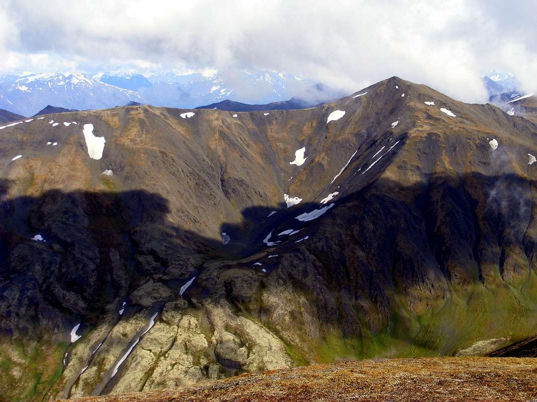
Summit View
Links
Description of trails at Eklutna LakeChugach State Park
Native Village of Eklutna