
-
 6357 Hits
-
 72.02% Score
-
 4 Votes
|
|
Mountain/Rock |
|---|---|
|
|
48.69711°N / 120.7031°W |
|
|
Download GPX » View Route on Map |
|
|
Okanogan |
|
|
Hiking |
|
|
Summer, Fall |
|
|
7391 ft / 2253 m |
|
|
Overview
Tatie Peak can be reached by an easy off-trail hike/scramble from the Pacific Crest National Scenic Trail (PCT) near Hart's Pass. Hart's Pass Road accesses the Pacific Crest Trail and a network of other trails heading into the Pasayten Wilderness and is the highest road in the state of Washington.Getting There
Drive forest road #5400-500 (Hart's Pass Road) for 34 miles northwest of Winthrop. The single-lane road is narrow, windy, with steep cliffs in places. ROAD CLOSED TO ALL TRAILERS. From Hart's Pass turn left onto FR400-500 (signed for Meadows Campground) and in 2 miles come to the road end and trailhead (elevation 6400ft).Route
Start on a little connector trail and in just a few minutes reach Trail No. 2000, the Pacific Crest Trail. Turn left to head towards Grasshopper Pass. Hike the PCT for two glorious view-filled miles until you reach a small gap on Tatie Peak's eastern shoulder. Follow the bootpath along the ridge crest for 0.5 mile, climbing 400 feet to reach Tatie Peak's summit. Use caution as there are some drop-offs along the northern slopes.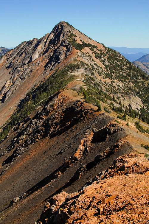
Tatie Summit View
Red Tape
NW Forest Pass required at all trailheads in the Hart's Pass area.Contact the Methow Valley Ranger District (24 West Chewuch Road, Winthrop WA 98862 or 509-996-4000) for the latest information on road and trail conditions.