
|
|
Mountain/Rock |
|---|---|
|
|
47.96245°N / 121.57101°W |
|
|
Snohomish |
|
|
4602 ft / 1403 m |
|
|
Overview
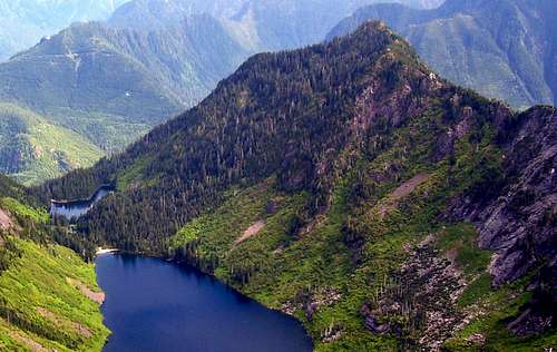
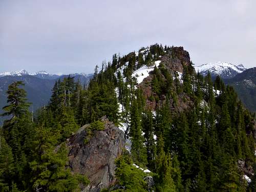
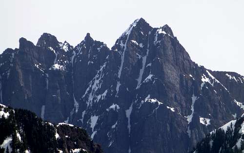
Little Greider Peak from Static Peak. Scramble route starts at the outlet log jam on Big Greider Lake, then follows the obvious forested slope to the summit.
Now for the bad news: A couple of years ago, the South Shore Road along Spada Lake was decommissioned at the South Shore boat launch. This necessitates a two mile road walk to the Greider Lakes trailhead, which is aggravated by tank traps and dug up culverts. There is, however, a silver lining: solitude. I have been in this area three times in recent months (weekdays) and have yet to see another person. So, if you're not put off by a little creek jumping and road walking, give Little Greider a try.
From the east end of the town of Sultan (accessed by US2), turn north onto Sultan Basin Road. After 10.25 miles, the pavement will end - drive the gravel portion another three miles to the check-in station (free registration) at Olney Pass. This is required for all visitors, and the watershed patrol is pretty serious about making sure you have your 'yellow copy' in your windshield. After pulling out of the registration kiosk, the road will split in three: the left fork leads down to Culmback Dam (which, by the way, is now open to bikes and pedestrians), the right fork is gated (leads towards the Kromona Mine), and the middle fork leads to the new (but not improved) Greider Lakes Trailhead. The trailhead will be reached in 5.3 miles - be sure to park in the area of the parking lot designated for the Greider Lakes and Boulder Lake trail.
Note: It might be prudent to check online (www.snopud.com) to verify that the gates are open at Olney Pass - they are occasionally closed (usually in the winter with low snow levels). There is also a sign just a few miles up the Sultan Basin Road (at the intersection of Sultan Basin Road and Kellogg Lake Road) that shows the status of the gates at Olney Pass.
Route
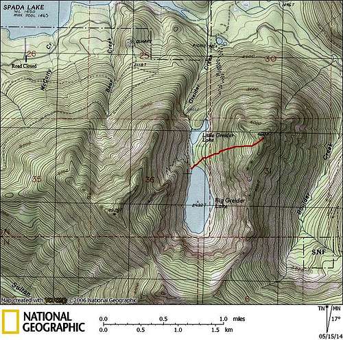
Little Greider Peak route map
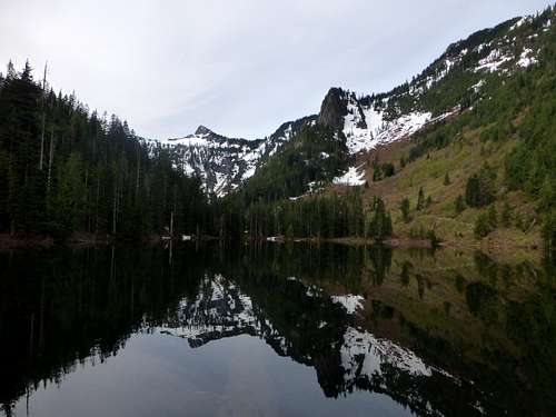
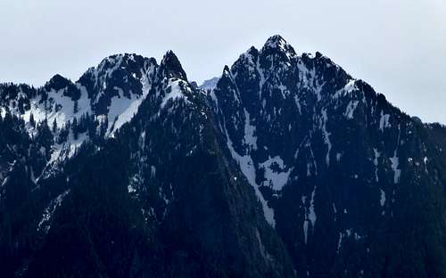
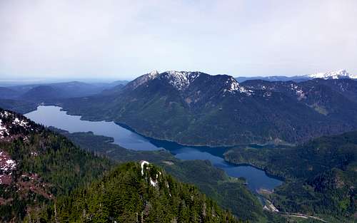
Little Greider Lake and Static Peak
It would be possible to traverse clockwise around Little Greider Lake, and begin the scramble at this point, but this appears as if it would be a little steeper, with a good chance of encountering nuisance cliff bands. Unless you are feeling adventurous, continue another half-mile to Big Greider Lake (besides, who would want to skip a lake as nice as Big Greider?). Take a moment to study the route from the trail between Little Greider Lake and Big Greider Lake - it should be fairly obvious. Too far left, or too far right, and you'll start to encounter small cliff bands. You will probably notice two small creek drainages, and associated waterfalls spilling down Little Greider Peak's west slope. Generally speaking, as long as you stay between these two drainages, you'll do just fine.
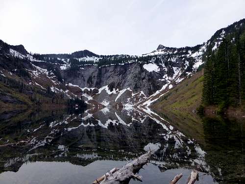
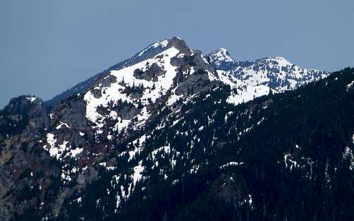
Big Greider Lake and Static Peak
Cross Big Greider Lake's outlet on the log jam, and begin proceeding uphill. It's best to make a very slight traverse to the left, to avoid the slightly steeper terrain. The route will be steepest between 3400' and 3800', but there is plenty of vegetation to hang on to as you battle through this section (mostly class 2, a few moves of class 3). The slope will begin easing up at 3800', and from here, I had continuous snow to the summit (mid-May). I elected to go straight up to the ridge, thinking I would follow the ridge north to the summit. This turned out to be a poor choice, but it did allow me to get a good photo of the summit from the south.
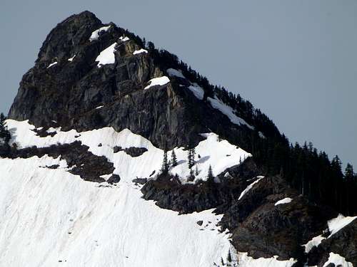
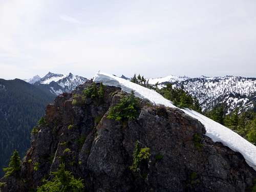
Little Greider Peak summit from the south
Views from the top of Little Greider Peak are quite good for the modest amount of effort required to reach the top. It's way too early in the year to decide, but Little Greider may be in contention for 2014's 'Underrated Peak of the Year Award'. Sorry about all the pictures - I got a little carried away with the camera...
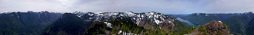
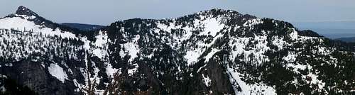
Little Greider Peak summit pano
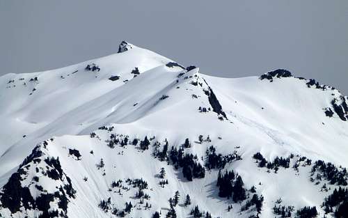
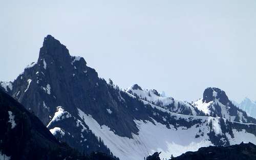
Vesper Peak from Little Greider Peak. Notice the huge cornice, and associated avalanche near the center of photo.
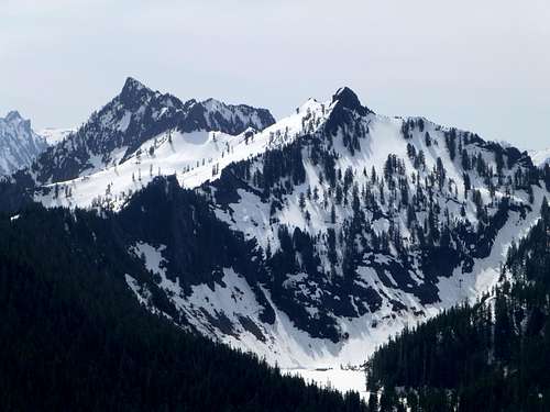
Bald Mountain from Little Greider Peak. Mount Pilchuck summit and lookout can be seen just to the left, Pt. 5198 just to the right.
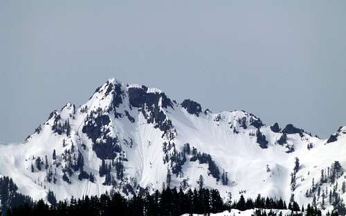
Bushwhack Peak (Pt. 5145) from Little Greider Peak
Frostbite Peak and Boulder Lake from Little Greider Peak. Peak on the right is unnamed. The Boulder Lake trailhead is located another 1.2 miles past the Greider Lakes trailhead on the South Shore Road.
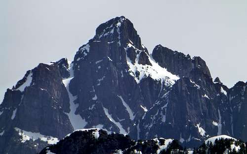
Static Peak and Greider Peak from Little Greider Peak. As is suggested by this photo, it is probably fairly simple to proceed straight up to Greider Peak's summit in early season from the trail between Little Greider Lake and Big Greider Lake. These peaks could easily be combined with Little Greider Peak on the same trip for a '3fer'. The normal couloir for accessing the low saddle between the two peaks can be plainly seen in this photo - getting to its base requires traversing around, or floating across, Big Greider Lake.
Be sure to take a couple minutes to walk a few hundred feet to the false north summit, as it provides the best view of Spada Lake - you also get a little bit of a Greider Lakes view from this point.
Spada Lake from Little Greider Peak's north summit
Little Greider Peak summit from the north