
|
|
Mountain/Rock |
|---|---|
|
|
42.93126°N / 122.04313°W |
|
|
Klamath |
|
|
Hiking |
|
|
Summer, Fall |
|
|
8065 ft / 2458 m |
|
|
Overview
Cloud Cap is the smaller peak to the left of Mount Scott (the large peak)
Cloud Cap, located on the eastern rim of Crater Lake, is a smaller side summit in the Crater Lake National Park. Like all the other summits in Crater Lake National Park, it is of volcanic origin. What makes this summit noteworthy is that it contains the highest paved road in the entire state of Oregon. Cloud Cap features two high-points; the higher east summit and the lower west sub-summit. The road literally comes up to the valley between the two roads and turns out with excellent views of Crater Lake. Luckily most tourist don't head up to either the eastern or western summits of Cloud Cap.
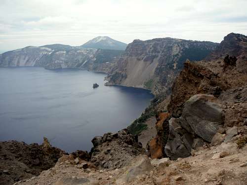
 Mount Scott rises above the fields from the true summit. | 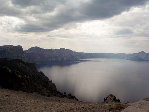 Crater Lake from the western sub-summit |
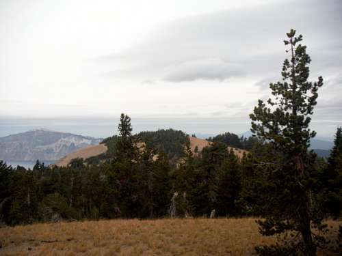
Both of these high points do have excellent views. The western sub-summit features dramatic views off the cliffs towards Crater Lake. The eastern true summit does not contain dramatic views of Crater Lake but does contain excellent views of Mount Scott and Mount Theilson up north. This true summit though is unfortunately partially tree covered on its western slopes. The tree coverage along with the fact that the true summit is away from the edge makes views of Crater Lake very limited.
Getting There
If you are coming Medford, Oregon then take Highway 62 east about 65 miles to the South entrance (Mazama Village). From Klamath Falls take Highway 97 roughly 20 miles and then pick up Highway 62 to the south entrance Mazama Village. From Mazama Village head north 4 miles and then make a right onto East Rim road. Take the road 7 miles until you reach signs pointing toward Cloud Cap. From there make a left and drive all the way to parking area marked Cloud Cap.From Bend Oregon take Highway 97 south to Highway 138 west. Take that road to Diamond Lake Junction Make a left on Crater lake Highway and go to the north entrance. Once past the gate (National Park Fee) head south 7.2 miles until you reach East Rim road. Make a left on East Rim and take the road 11 miles to the sign that say Cloud Cap. From there make a right and go all the way to the turnaround where there are parking area for Cloud Cap.
Route
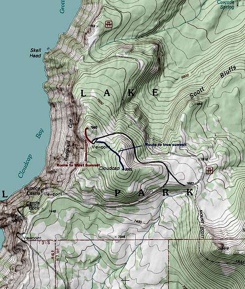
Cloud Cap Map
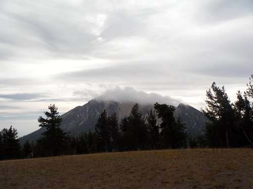
 Looking over at the western sub-summit | 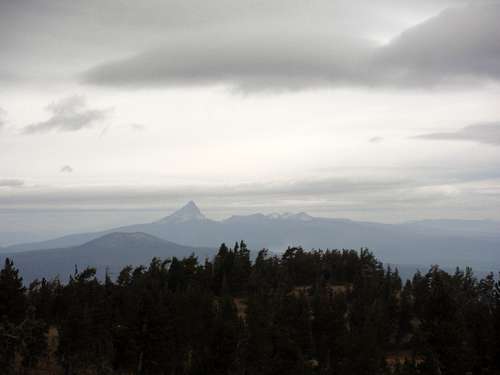 Mount Theilson from the true summit |
From the true summit of Cloud Cap there is no established boot path or trail. The off-trail walk up is about one mile round-trip and 200 feet of elevation gain. This area is thick in pumice sand so the effort maybe a little more than one would normally expect. That being said this quick off-trail walk up will take less than an hour. Presently there are no restrictions on hiking up to summit of Cloud Cap. The summit does have a great closeup view of Mount Scott along with a good view of Mount Theilson and Bailey to the south.
Red Tape
Crater Lake National Park does have an entrance fee in order to get in of $10 per vehicle and $5 per person. The park does accept the Golden Eagle Pass.When to Climb
The best time to climb here would be whenever the East Rim Road is open which is usually in summer and fall. Keep in mind that there maybe snowfields on or around this summit as late as mid August.Camping
Camping is not advised on the summit of Cloud Cap. It is very close to the road and many tourist go up very close to the summit to take photos of Crater Lake.For more organized camping and lodging check out Mazama Campground
External Links
Cloud Cap Peakbagger PageInteresting link on the geological features of Cloud Cap