
|
|
Mountain/Rock |
|---|---|
|
|
26.95°S / 68.51667°W |
|
|
Chile |
|
|
Hiking, Mountaineering, Scrambling |
|
|
Spring, Summer, Fall |
|
|
19390 ft / 5910 m |
|
|
Overview
Mulas Muertas is a high volcano, not for from the much higher and more famous Ojos del Salado. Mulas Muertas is a popular acclimatization peak for Ojos del Salado, but seldom do people go all the way to the summit. The peak is fully within Chile, but very close to the Argentina border. Mulas Muertas from the south.
The name Mulas Muertas is Spanish for “Dead Mules”. Mulas Muertas lies in the heart of the Atacama Desert and this is one of the most inhospitable regions on earth. This region is extremely barren and many place names around Mulas Muertas have the name “dead” in them. Laguna del Muerto (Lake of the Dead) and Riscos del Muerto (Crags of the Dead), Quebrada Mulas Muertas (Ravine of Dead Mules), Cerro El Muerto (the Dead Mountain) area all to the south of Mulas Muertas. If it weren’t for the lure of gold, copper, and other minerals, access to the area would be extremely difficult. Because of valuable minerals and the link between Argentina and Chile, the area is somewhat easy to access for such a remote region, though there is no public transportation and it’s a long way from civilization.
There is very little fresh water in the region. All lakes are salty. There are a very few freshwater springs, but these are few and far between. Nothing really rots here; it just dries out or freezes. One mummified cow at Laguna Verde looks like it died not that long ago, but it really died over 70 years ago. There are hot springs right near the trailhead.
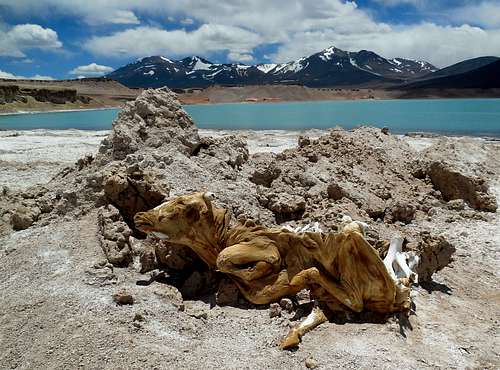 Mummified cow at Laguna Verde. It looks like it died fairly recently, but it actually died more than 70 years ago. The air is so dry and usually cold that it just dries out and freezes everything, so nothing really decays.
Since this area is so dry and windy, there are no glaciers on Mulas Muertas, though there seem to be a few tiny permanent snowfields. There are no technical difficulties on this mountain, but the wind and sun are relentless. My son and I noticed that the weather seemed to never be temperate; it was either freezing cold or felt roasting hot. The altitude and length of the climb is the only other difficulty on this mountain.
Interestingly, Mulas Muertas often has the same listed elevation as a much more famous Andean Volcano, Cotopaxi. Other than elevation however, and the fact that both are volcanoes that happen to be in the Andes, they have very little in common. John Biggar list the elevation for Mulas Muertas at 5910 meters/19,390 feet.
Most people start the climb from Laguna Verde and only as an acclimatization peak for Ojos del Salado. The peak is a worthy destination on its own, if only for the nice views of Laguna Verde and countless other volcanoes.
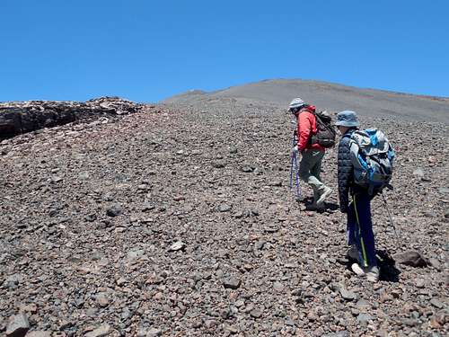
 High on Mulas Mertas.
Getting There
The normal trailhead for Mulas Muertas is at Laguna Verde. The journey to Laguna Verde starts in Copiapó. From Copiapó to Laguna Verde is five to six hours on good roads. There is no public transportation, so you either have to hitchhike, hire a vehicle and driver, or drive your own (rental) vehicle.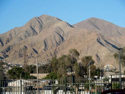 Copiapó.
Laguna Verde is too high (4328 meters/14,200 feet) to comfortably sleep at unless you are acclimatized, so it is wise to spend time at a lower altitude before trying to sleep at Laguna Verde. Valle Chico (~3050 meters/10,000 feet) and Laguna Santa Rose (3800 meters/12,470 feet) are both popular stops along the way for acclimatizing.
Laguna Verde is on the main road between Copiapó and the Chile/Argentina border post at Paso San Francisco, so you can’t miss it.
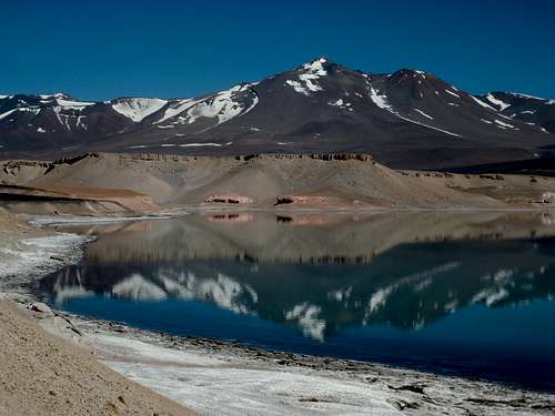 Laguna Verde.
Routes Overview
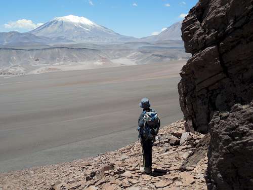
The most popular route to climb on Mulas Muertas is from Laguna Verde. A trail goes south and right up the north ridge of Mulas Muertas to the summit ridge. Most people never make the summit as it is actually a long way. The elevation gain is 1700 meters/5600 feet and getting to the summit involves a long traverse at high altitude. Most people don’t make it beyond 5500 meters.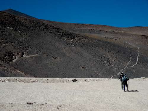 Starting up Mulas Muertas.
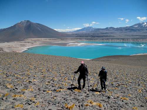 Hiking up Mulas Muertas. Laguna Verde is far below.
The route is steep in places, but completely non-technical and no special equipment is required. The winds can be strong and the sun is very intense, so bring good sunscreen.
 High on Mulas Muertas.
At the summit is a crater lake.
IF you have access to a 4X4, you can drive to 5000 meters and start the climb from the road to Refugio Tejos. I don’t know anything about this route, but you would pass near or by the Laguna del Muerto.
The mountain can likely be climbed from most directions as there are no real obstacles other than scree or some lava fields.
If you are serious about reaching the summit, it might be a good idea to try it in two days, though unless there is snow around, you will have to carry a lot of water. I don’t recall any really good campsites, but you should be able to find a place to pitch a tent. As mentioned, the mountain is extremely windy, so make sure that it is a good tent!
Red Tape
There is no red tape, but please leave a clean camp. No Red Tape, but Laguna Verde is Green.
When to Climb
Any time December through March if the most popular times to climb here, but November and April can also be good. November is said to be very windy though (all months are actually windy). This is one of the windiest regions in the world.From May to October, temperatures are extremely cold, and although this is a dry area, occasional storms do block access.
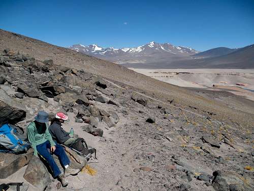 Part way up Mulas Muertas on a sunny day in January.
Camping
There are good campsites at Laguna Verde, but they are very popular. Also, there is a hut at Laguna Verde, but it is extremely dirty. Please pack out all of your trash. Chile is overall a very clean country, but the same can’t be said about the area around the hut. A Russian Expedition camping at Laguna Verde.