
-
 8178 Hits
-
 86.85% Score
-
 23 Votes
|
|
Mountain/Rock |
|---|---|
|
|
37.94371°N / 107.55545°W |
|
|
San Juan |
|
|
Hiking, Mountaineering, Scrambling |
|
|
Spring, Summer, Fall, Winter |
|
|
13722 ft / 4182 m |
|
|
Overview
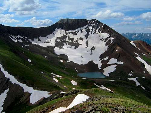
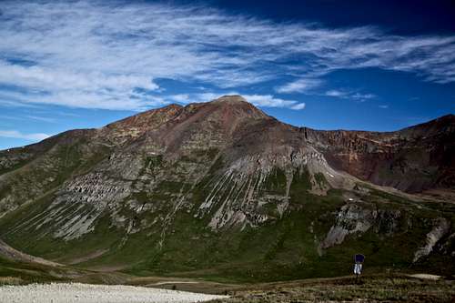
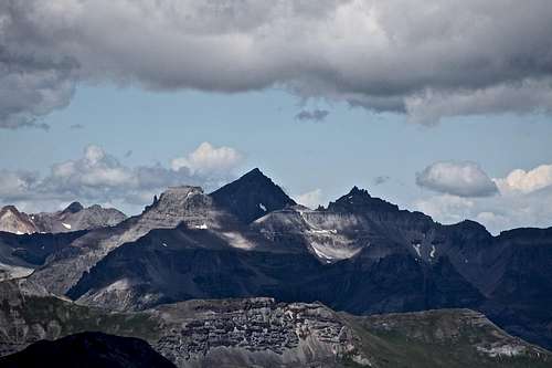
Animas Forks Mountain as seen from Seigal Mountain
Animas Forks Mountain from east Cinnamon Creek area
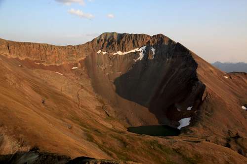
Animas Forks Mountain in the evening light - from Seigal Mnt.
Cinnamon Pass is a 12,620 foot, four wheel drive pass, fifteen miles northeast of Silverton. The Pass provides excellent access to Wood Mountain, Peak 13,708 and Peak 13,722 = "Animas Forks Mountain". Combining these peaks provides a pretty high altitude walk with some nice ridges.
![Animas Forks]()
Animas Forks ghost town![Animas Forks Mountain]()
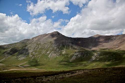
Animas Forks Mountain as seen from the summit of Cinnamon PassCinnamon Pass Trail Little History: The Utes used this pass road before white exploration of the area. Then, in the early 1860s, Charles Baker used the pass on his journey into the San Juan Mountain when he reported finding gold, triggering a minor gold rush. In 1873, The Hayden Survey Party crossed the pass. In 1877, Enos Hotchkiss constructed the first wagon road over the pass. It was an important freight road for a period but was not maintained after the ore in the area declined.
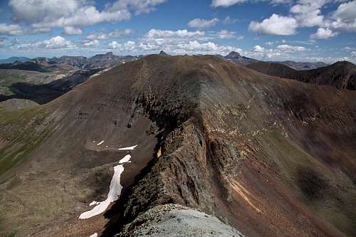
![Catwalk to Animas Forks Mnt.]()
Catwalk to Animas Forks Mnt.![Catwalk]()
Catwalk - about half way on it.As any mountain there are many routes up it. Probably the easiest and the most logical one is from Cinnamon Pass. It combines really nicely with Wood Mountain and Point 13,708. If you wish to hike only "Animas Forks Mountain" you can hike below Point 13,708 and ascent the start of the catwalk on the Point's 13,708 side. It is too steep on the "Animas Forks Mountain's" side, and loose.
Guide to Colorado Mountains with Robert Ormes (sort of a bible of Colorado Mountains) uses only the name Peak 13,722. The description in the book is brief:"Peak 13,722' can be combined with Wood by proceeding west along the ridge one mile to the 13,708' sub-peak. Stroll the half mile "catwalk" south and finish on short, steep talus. The steep east ridge can also be ascended easily from the bowl just northwest of Cinnamon Pass".
The San Juan Mountains: A Climbing and Hiking Guide by Robert Rosebrough also uses the name Peak 13,722 and briefly describes two routes: Northeast Ridge and Southeast Face (see below more in route description).
Colorado Rank: 136 (bicentennial)
Parent Lineage: Jones Mountain
Class: 2+
Nearby Mountains:
- Unnamed 13708 0.5 miles
- Wood Mountain 13,660 feet 1 mile
- Seigal Mountain 1.03 miles
- Unnamed 13688 1.1 miles
- Cinnamon Mountain A 1.1 miles
- Gravel Mountain A 1.35 miles
- Houghton Mountain 13,052 feet 1.7 miles
- Engineer Mountain A 13,218 feet 2.56 miles
- Tuttle Mountain 13,203 feet 3.17 miles
- Darley Mountain 13,260 feet 3.23 miles
- Handies Peak 14,053 feet 3.49 miles
Getting There
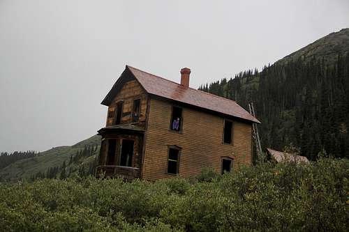
Animas Forks ghost town
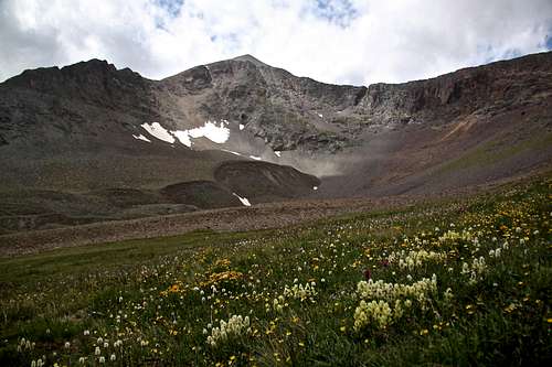
Animas Forks Mountain as seen from the summit of Cinnamon Pass
Description: Today Cinnamon Pass Trail is a seasonal, moderately difficult 4WD road. It is a part of the very popular Alpine Loop. The other half of the loop is Engineer Pass Trail. You can access Cinnamon Pass Road either from Lake City, or from Silverton. You can also access it from Ouray over Engineer Pass, but it does take longer than driving Million Dollar Highway over Red Mountain Pass to Silverton. The scenery varies from the rugged alpine environment and barren talus slopes near the summit to the wild flower covered valleys and rushing streams. You will pass by Animas Forks ghost town. At either end of the route are wonderful historic town.
From Silverton: Drive through Silverton in its main street northeast out of town. Bear rich onto Colorado 110. Pass a campground on your right, and Hillside cemetery on your left. Continue on paved road until it changes into a good dirt road. The route follows the Animas River and it passes through numerous mines. At 4.2 miles drive across the bridge spanning Cunnigham Creek. At 7.8 mile point is the town site of Eureka, this is where the road closes in the winter. There is a campground in Eureka and a cabin (available for hire and popular with ice climbers in the winter).
Pass Sunnyside Mill on your right and follow the more narrow road up and above Animas River. About 4 miles from Eureka is a public restroom on your left and right above it the road is signed for Cinnamon Pass. (To the right would be the ghost town of Animas Forks). The road here becomes steeper and bumpy. 4WD and high clearance is needed at this point. Engineer Pass Rd. will continue straight and you will take a sharp turn right and uphill, well signed for Cinnamon Pass. The roughest section of the road is just above Animas Forks for about 1/2 mile. It is roughly 2 more miles from Animas Forks to the top of Cinnamon Pass. The road winds along the southern slopes of "Animas Forks Mountain". If you don't have 4WD, you can just park close to Animas Forks ghost town and hike up.
From Lake City: Dive on Colorado 149 and follow signs for Alpine Loop past San Cristobal Lake. At 14 miles pass the intersection County 35 to Sherman townsite (up to here snowplowed in the winter). Continue on main road towards Cinnamon Pass. At 18 miles pass Grizzly Gulch - a popular TH for three 14ers: Sunshine, Redcloud and Handies. At 21 miles there is a turn off for American Basin. It is another 2.2 miles from here to the summit of Cinnamon Pass.
Route
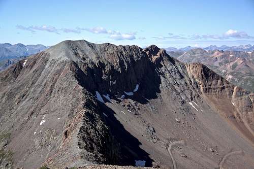
Catwalk to Animas Forks Mnt.
Catwalk - about half way on it.
Northeast Ridge: From the summit of 13,708 you use the ridge between the two peaks to climb 13,722. The ridge starts very easy and relatively wide, it does get some little interesting sections, but nothing harder than class 2, possibly a few 2+ moves. There are some loose rocks when the catwalk = ridge ends and starts to ascend up Peak 13,722 = "Animas Forks Mountain". After a few moves, the ridge gets more stable and walk to the actual summit. There was no summit register and instead of a cairn, there was a summit shelter.
Southeast Face: From the flat area around 12,200 on Cinnamon Pass Rd (about 1 mile from Animas Forks turn-off), you can pick up the grassy slopes of the southeast face and get eventually on south ridge. The ridge did not seem to steep and most of the lower section was steep grass, higher up talus.
North Couloir: I have hiked the mountain in the August, so there was no snow, but it does appear that there is a nice couloir on the north side (from Horseshoe Lake), which leads just slightly to the west of the main summit. I would imagine this being a nice late spring/early summer snow climb.
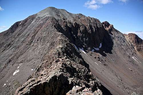
 Animas Forks Mnt and Point 13,708 |  Animas Forks Mountain from Point 13,708' |
 Point 13,708 and catwalk from Animas Forks Mountain | 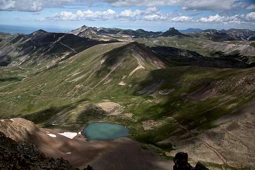 Horseshoe Lake and Seigal Mountain above it |
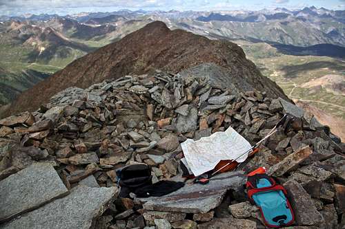 Summit shelter | 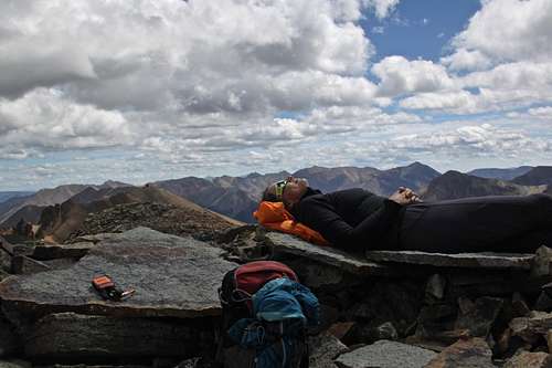 Summit nap |
 Mount Sneffels, Potosi on left, Teakettle on the right | 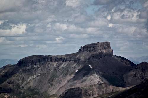 Coxcomb Peak |
 Uncompahgre Peak |  Wood Mountain |
Red Tape
Driving scenic Alpine Loop is free. There are enough parking places at the summit of Cinnamon Pass and a sign. Expect a lot of alternative off road vehicles during the peak summer months. Hiking is free.When to Climb
Summer is the easiest since you can drive to the top of Cinnamon Pass. Autumn, winter and spring provide a more difficult access, and you have to travel through avalanche prone terrain. Check avalanche conditions prior venturing out there in the winter - Northern San Juan Avalanche Information Center.The alpine scenic loop is usually open to motorized vehicles in June and closes with the first big snowfall - late October, early November.
Camping
Primitive camping is available along the Cinnamon Road at various turn offs. You can sleep at the top of the pass - flat parking makes sleeping in a car comfortable. There is a small unnamed lake just north of the pass (? 100 feet) you could easily pitch a tent over there and watch a sunrise over Handies.Developed campgrounds are closer to towns - Eureka Campground on Silverton site.
External Links
- Animas Forks Mountain on 13ers.com
- Animas Forks Mountain on List of John
- Peak 137222 on Peakbagger
- Nice TR on Wood Mountain, Peak 13,708 and Animas Forks Mountain
- Scenic Alpine Loop nice informative website about 4WD roads over Cinnamon and Engineer Passes.