
|
|
Mountain/Rock |
|---|---|
|
|
48.55952°N / 120.85332°W |
|
|
Skagit |
|
|
Scrambling |
|
|
Summer |
|
|
7945 ft / 2422 m |
|
|
Overview
A peak of moderate altitude, missing the 8000 foot mark by 55 feet, Arches aka Little J'Berg sits in the middle of one of many spots of great beauty in the North Cascades National Park. It is surrounded by a number of slightly taller peaks, creating sort of a theater-in-the-round for anyone lounging on Arches summit.
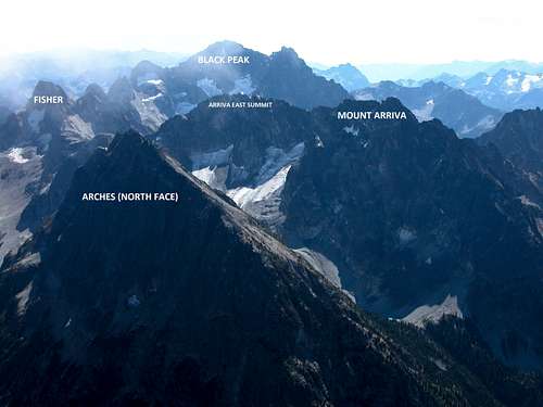
Theater-in-the-round
That fact combined with the relaxed and enjoyable, partly off-trail approach, and the fact that this high summit is rarely visited – my climb this year (2016) represented the 16th party to visit according to the original summit register placed in 1968 – means a climber will have a classic wilderness scrambling experience, likely having the place all to themselves.
Getting There
Drive the North Cascades Highway, state route 20, 21.5 miles east from Colonial Creek Campground or 6.2 miles west from Rainy Pass to the Easy Pass Trailhead. Ample parking and restroom facilities.
Approach, first on trail, then cross-country: Walk the trail to Easy Pass, and behold one of the best on-trail views anywhere in the North Cascades National Park. Descend to the valley bottom on well-maintained trail. At the sign pointing west to the Fisher camp, instead of following the main trail, turn left (east). There is actually a boot-built trail going that way at first, but after about ten minutes of walking it disappears at a brushy pile of trees blown down by avalanches. This is a good place to then cross the creek and open marshy meadow to the south side of the valley; head straight across to the nearby talus slope to find drier ground, and then continue east. Once across, you’ll want to turn around and make a mental note of the spot, so on the return trip you’ll get across the marsh with the least boot soaking and be able to re-find the trail. In earlier season, often until mid-summer, snow bridges the creek and covers the marsh, eliminating this obstacle.
Then turn up valley and enjoy a relaxed off-trail ramble through some very pretty parklands, boulders, marmots, flowers, and abundant blueberries in late summer. At the valley end find a camp. One could camp directly below where one might expect to begin the ascent of Arches, or at the rocky & snowy cirque end of the valley. In the upper cirque there is a nice tent site or two in the line of larch trees and boulders to the left, the other someone recently excavated on the shelf right on the lip of the cirque next to the waterfall.
Route
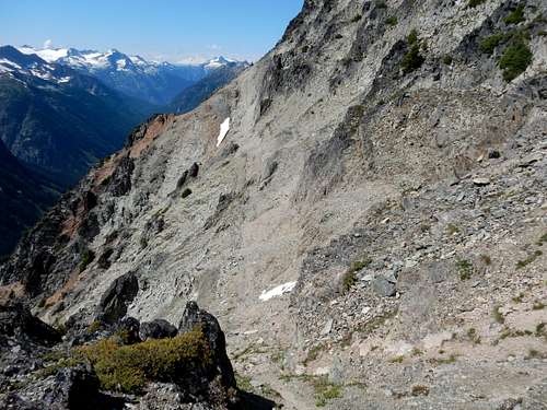
From camp, head up the obvious northeast slope(see photos).
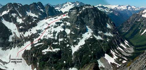
Arches NE slope, another view
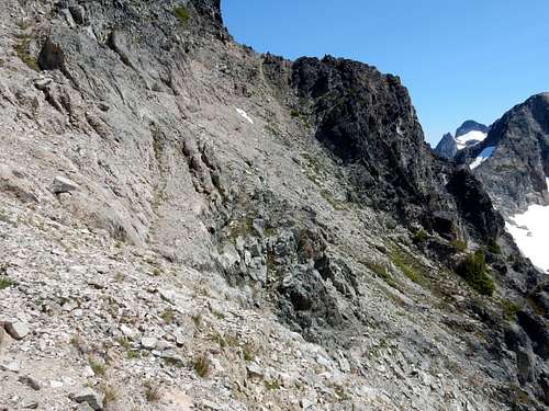
Arches NE slope, aim for the right notch
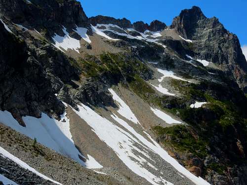
This will involve some talus and loose rock slopes, and some snow. Early in the morning on my climb the snow was frozen moderately hard, so crampons and axe made this safer and easier. Up higher, the talus and loose rock gives way to pleasant tilted meadows, rock shelves, small creeks, then a snowy basin just before the notch.
At the notch, cross onto the south face at just over 7400 feet.
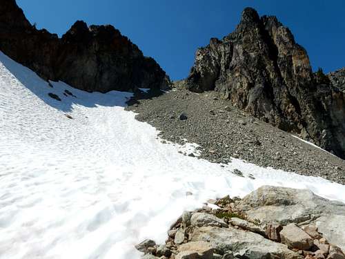
Approaching the high notch on Arches Peak
After an initial drop, there is sort of an undulating “shelf” leading across the face, taking the climber up and down about 50 feet in alternating altitude. The “shelf” is not really a distinct flat shelf, it is more just the area in which somewhat better footing exists on tilted bedrock covered in rubble and loose grit. One can sort of see the “shelf” with careful study.
Arches Peak south face. See the "shelf?"
Arches Peak, mid-way across the shelf, looking back at the notch
For my climb it worked to follow this shelf a couple hundred yards, then climb up an open ravine. This ravine was just before the snow-patch visible in the photo. The ravines before the correct one led to more difficult climbing, possibly class 4+.
Once starting up the correct ravine, the low-angled rock improves quite a bit, and leads easily to the summit. It can look a bit tricky figuring which point above is the summit; left-ward or westerly will take you to the right choice.
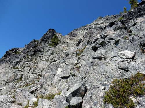
Final bit up toward the summit, Arches south face, easy class 3
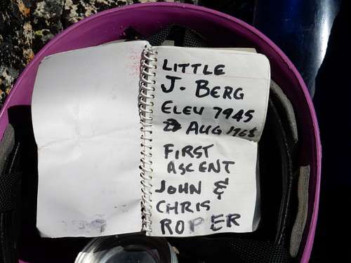
Arches original 1968 summit register
The original summit register was placed by non other than the famous Ropers; they named it Little J'Berg... not sure how /when it got switched over to "Arches". Despite having been here since 1968, only 15 parties had signed in since then, with many intervening years passing having no visitors. When in the mood for a non-tech scramble, this is my kind of summit.
Red Tape
A camping permit is required for overnight stays in the backcountry of North Cascades National Park. Visit their webpage for complete information about the permit system, and to find where to obtain a permit.
In addition, a trailhead parking permit is required for the Easy Pass trailhead. Click here for more information about the Northwest Forest Pass.