|
|
Mountain/Rock |
|---|---|
|
|
44.22200°N / 71.513°W |
|
|
4054 ft / 1236 m |
|
|
Overview
Appalachian Mountains > White Mountains > Twin Range > Little River Mountains > Mt HaleThere is nothing very impressive about this mountain. It is no giant, in fact it ranks a lowly 38th on the AMC's White Mountain 4000-footer list. The views from the summit are reasonably good, but limited by tall trees. Its shape is uninspiring and it has no points of interest such as waterfalls or rock faces.
On the summit is a clearing containing the foundations of an old fire tower. That tower, built in 1929, was made of steel, but a you will find a pile of stones (from an older building?) serving as an oversized summit cairn, and by climbing to the top of this stack you can obtain good views over the tops of the surrounding trees. Climb soon because the trees grow taller each year. Some of the rocks on the summit are magnetic - bring a compass and check.
Mount Hale is the largest and southernmost of the Little River Mountains, located between the Zealand River and the Little River. The other Little River Mountains are North Sugarloaf (2310'), Middle Sugarloaf (2539'), and South Sugarloaf (3024'). The Little River Mountains are a northeastern extension of the Twin Range, connected via the east end of Zealand Mountain.
"East Hale" is the tiny (about 80 ft prominence) 3490' peak to the east of the summit. No trails lead there, but bushwhackers report that East Hale, unlike the true summit, has open views.
Origin of Name
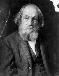
The mountain is named for Rev. Edward Everett Hale (1802-1909), a pastor, writer, editor, abolitionist, and promoter of philanthropy who was born in Boston, attended Harvard, and at one point served as chaplain of the U.S. Senate. According to desainme, Hale was also a mountaineer, and made the first recorded ascent of the North Peaks of Katahdin, in 1845.He is best remembered today as the author of the patriotic story "The Man Without a Country", published in 1863 to support the Northern cause in the Civil War.
In his day, Hale's most influential story was "Ten Times One is Ten" (1870), which inspired the formation of a number of charitable groups including "Lend-a-Hand Clubs" . The Lend-a-Hand Trail is thus a further memorial to Hale.
Hale was also the grand-nephew of Nathan Hale, whose famous last words were "My only regret is that I have but one life to give for my country."
Getting There
Mt Hale sits to the northeast of the (main peaks of the) Twin Range, and to the west of the Presidential Range. (Actually, the Rosebrook Mountains, a low northern extension of the Willey Range, lie between Hale and the Presidentials, but those peaks rarely get noticed except for the Bretton Woods ski resort on Mt Rosebrook). The simplest acess is from Zealand Road, which extends south from Route 302 about 2 miles east of its intersection with Route 3.Route 3 is most easily reached from Interstate 93 - the intersection is just north of Franconia Notch State Park.
Zealand Road is closed in winter, but for those willing to walk (or ski) the road, there is plowed parking on route 302 a few dozen yards east of the Zealand Rd intersection. Current status of forest roads
Trails
The simplest route to the summit is the Hale Brook Trail which starts from a parking lot about 2.5 miles down Zealand Road and climbs fairly directly up the mountain's northeastern slope. 2.2 miles, 2300 vertical feet.The only other maintained trail to the summit is the even easier Lend-a-Hand Trail which originates at the Zealand Falls Hut. 2.7 miles, 1300 vertical feet.
For hikers who prefer a loop hike, the above two trails can be enchained (in either direction) and combined with the Zealand Trail and the southernmost section (less than a mile) of Zealand Road to form a loop of about nine miles. The Zealand Trail is a former railway (used for hauling lumber), and virtually flat, so this loop is not significantly more strenuous than a simple up-and-back, just longer.
There is also an unmarked, unmaintained trail known as the Firewarden's trail which reaches the summit from another direction. Evidently this trail was used when the fire tower on the summit was occupied, but has been erased from recent maps. A map from the early 1940s actually shows two trails on Mt Hale not on today's maps. The trail now known as the "firewarden's trail" was called simply the "Mt Hale" trail. The other trail was called "Tuttle Brook." The firewarden's trail is sometimes used today by local hikers (who wish to keep its precise location secret in an effort to protect it from over-use), but the other one may be totally abandoned.
Red Tape
White Mountain National Forest parking $3/day.There's a deposit-box system for purchasing parking at the trailheads, or you can purchase annual or multi-day passes, which is much cheaper, from designated vendors.
Note that Zealand Road is closed in winter. Check road status
When To Climb
Year-round. Usual New England weather precautions apply. The trails are utterly non-technical but snowshoes or crampons may still be useful in winter. Note that Zealand Road is closed in winter. current status
Campsites, Huts, Backcountry Camping
Commercial and park-run campgounds abound within easy driving distance of the trailheads. The closest are Zealand Campground, Sugarloaf I and Sugarloaf II, all located at the beginning of Zealand Road.Another popular way to visit Mount Hale is to stay at the Zealand Falls Hut.
Backcountry camping is also permitted, with restrictions which can be summarized as:
Unless otherwise posted, you may only camp: Below treeline (where trees are 8 feet or taller). At least 200 feet from the trail and water sources. At least a quarter of a mile from any road or facility (ie, campsite, platform, shelter, hut).


