

-
 10323 Hits
-
 81.06% Score
-
 13 Votes
|
|
Mountain/Rock |
|---|---|
|
|
46.44555°N / 7.59314°E |
|
|
Trad Climbing |
|
|
8973 ft / 2735 m |
|
|
Overview
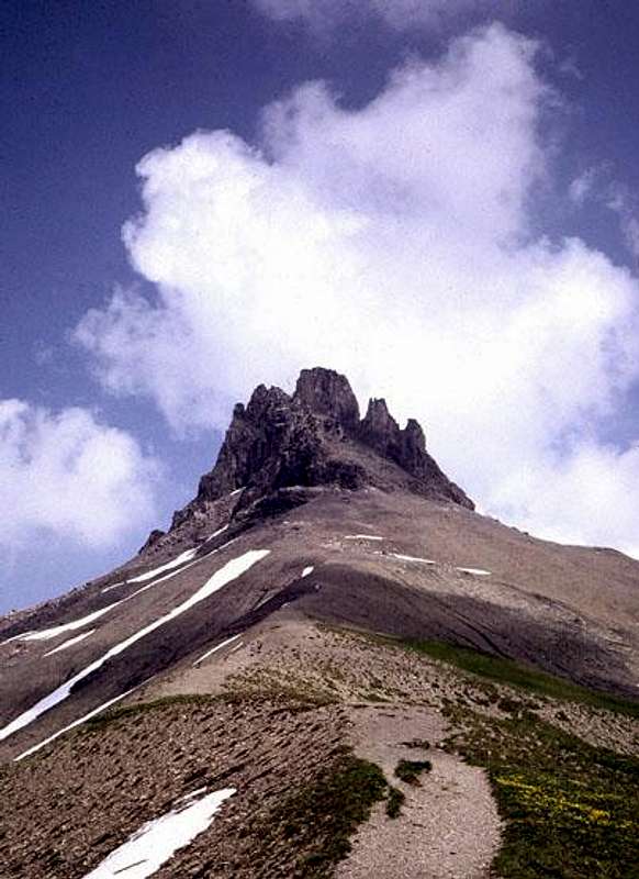 From the west
The Tschingellochtighorn is a small limestone peak located on the north end of the Engstligengrat above the picturesque Engstligenalp south of Adelboden. It consists of four towers. The north summit is rather insignificant and now rarely climbed since an earthquake in 1946 created a gap requiring a rappel in and climb back out from what had been a one and a half meter jump across a cleft. A traverse of the other three towers is included in: "Berner Oberland Die 100 Schoensten Touren" (The 100 Finest Routes in the Berner Oberland) by Grossen and Rebuffat (unfortunately out of print). Many parties choose to climb just the highest summit.
The first ascent of the Tschingellochtighorn was made by Dr. Panchaud, J. Martin, and A. & G. Müller in the fall of 1903.
This is a good peak to keep in mind for days when the high mountains are weathered in or just for a relative restful change of pace.
Getting There
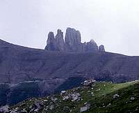
 Setting from the east
The shortest and easiest approach is to take the tram from Adelboden up to Engstligenalp and hike from there (1 to 2 hours). The peak can also be approached by trail from the mountain hotel at Schwarenbach which can be reached from either Kandersteg or Leukerbad or by several other routes bypassing Schwarenbach.
Adelboden is reached by train from Bern via Spiez to Frutigen or from Brig to Frutigen. From Frutigen a bus leaves every hour for Adelboden. Another bus then takes one to the tram. The car route parallels the train and bus routes. There is parking at the tram base station.
To reach Schwarenbach, one must travel to Kandersteg, which lies south of Frutigen. At the head of the Kander Valley there is the Sunnigen tram. A 3/4 hour hike from the top station to Schwarenbach follows a very wide trail (local fram road).
 Ibex on the trail
More information:
Engstligenalp
Schwarenbach
Stephen & Frances Robone's hike with a sketch map and some more photos : Kandersteg to Engstligenalp
TOPO MAP LINK: .

Red Tape
There is no "red tape". In Switzerland, one still enjoys "The Freedom of the Hills".Routes Overview
 Route main summit
 Climbing on main summit
The approach to the routes on the Tschingellochtighorn is from the west side of the mountain up the more gentle lower slopes to base of the towers.
1) Main Summit (Hauptgipfel), UIAA II+ or III- (YDS 5.0 to 5.1)
The main summit is climbed via steep plates and a chimney on the west - northwest side of the tower. The route is very obvious and not difficult to follow. Protection and belay stances are fixed. Descent is by down climbing or one rappel. (see photo on right)
2) Traverse, UIAA III (YDS 5.2)
The "traverse" of the three northern towers is really just a climb of the three, since only the middle tower is actually traversed. From the notch between the middle and south towers, the south tower is climbed, and then descended back to the notch. One then climbs over the middle tower and goes around the base of main summit tower to the route on the W / NW side. There is a caution regarding loose rock on the south and middle towers. The loose rock is mostly gone from the route on the main summit.
Weather
 From the SE
Live cam at Engstligen Alp
Extreme Weather