

-
 8924 Hits
-
 74.92% Score
-
 5 Votes
|
|
Mountain/Rock |
|---|---|
|
|
38.73000°N / 79.113°W |
|
|
2844 ft / 867 m |
|
|
Overview
Fisher Knob is located in the Shenandoah Mountains in George Washington National Forest. It is located in Pendleton County, West Virginia, not too far from the border with Virginia.
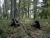
Fisher Knob appears to be rarely visited by anything other than animals. There are numerous game trail running parallel to the mountain but there is no trail which leads directly to the summit. The mountain is heavily forested with old growth trees and makes for a beautiful hike through the forest.
As there are no trails to the summit, make sure you bring a topographic map as there are plenty of features to keep you from getting lost. I choose to park along the road where the creek crosses it and started my hike up the creekbed. The topographic map seems to indicate a trail here but it must be overgrown as I saw no evidence.
The summit of Fisher Knob is pretty heavily wooded and there aren't very good views. On the other hand, it is very secluded and peaceful. It was a real nice spot for lunch. I saw several deer and signs of Black Bear along the ridge line.
 |  |
Getting There
There are sevral routes to Fisher Knob. I went there after being unable to access Cow Knob (a summit further south).
Route #1: From Washington, D.C., take Interstate 66 west to it's intersection with Interstate 81. Follow Interstate 81 south for several miles and then take the Strausburg exit, Route 55, west. Follow Route 55 west into West Virginia, passing by Wardensville until you reach Moorefield. Once in Moorefield, make a left hand turn onto Route 654 and follow for between 30 to 60 minutes. This is a beautiful drive through a valley with nice mountains on either side (very relaxing drive). Anyhow, look for signs on your left hand side for Camp Run Campgrounds. Make this left turn, pass by a beautiful lake on the right, continue for about 1/2 mile and you will cross a small stream. This is where I parked.
Route #2: From Washington, D.C., take Interstate 66 west to it's intersection with Interstate 81. Follow Interstate 81 south and then take the Route 211 exit west. Follow Route 211 until you get to Timberville. At the traffic light, make a left onto Route 42, go several miles until you enter Broadway. Once in Broadway, make a right at the light onto Route 259. Follow Route 259 west, pass through Chimney Rock, Cooters Store, and Faulks Run. Once past Faulks Run, you will pass Route 612 on your left. Make the next left after Route 612 onto an unnamed road and follow until it ends in West Virginia (4 wheel drive would be a real assest on this road due to several creek crossings which require high clearance). Where this roads ends is on Route 654. make a right hand turn onto Route 654 and follow it a short distance until you see the sign for Camp Run Campground. Make a right hand turn here and follow to the creek / campground.
There are (2) ways to actually reach the summit. I chose to try going up the creek bed for 1/2 mile looking for a trail. Once I couldn't find a trail, I headed to the right and went as straight up the mountain as I could. It was a (2) mile hike up the mountain with lots of switchbacking. On the way down, I stayed along the ridge line and ended up in the campgrounds. This seems like the best option for both ways.
 |
Red Tape
There are no permits required for climbing Fisher Knob.
There are no fees.
Parking is free.
When To Climb
Fisher Knob can be climbed year-round. It is prety steep and I would think that it would be a real bear in the winter.
Camping
Camp Run Campgrounds are located at the base of the mountain. There are about a dozen camp-sites with tent sites, picnic tables, fire pits, and outhouses available. It is first come, first served. No sites were being used when I was there on a Saturday afternnoon in August.
There are also numeorus spots for camping throughout this area which are just along the mountain roads. They offer no service.
 |  |
Mountain Conditions
Fisher Knob is under the jurisdiction of the Dry River District Range.
540-828-2591
southernregion.fs.fed.us/gwi/