

|
|
Mountain/Rock |
|---|---|
|
|
39.36526°N / 120.3493°W |
|
|
Nevada |
|
|
Hiking, Scrambling |
|
|
Spring, Summer, Fall, Winter |
|
|
9103 ft / 2775 m |
|
|
Overview
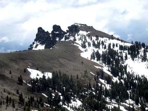
Castle Peak is one of the most popular hiking destinations in the Lake Tahoe Basin. Castle Peak is the throat of an ancient volcano and its three turrets are easily visible form nearby Interstate 80. Castle Peak feels like a much higher mountain. Its towering rocky summits are not unlike the rock towers found further south in the Sierra Nevada Range. Although the mountain also reminds one of another volcanic mountain in the region, Lassen Peak. Whatever the comparison, Castle Peak is a wonderful hiking destination close by to Reno, Nevada and Sacramento, California.
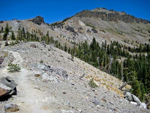
In the warmer months Castle Peak is an easy, quick hike with nice views of the northern Tahoe area and the Sierra crest. In the winter it is also an easy venture with ski descents to the west into Round Valley and south into Castle Valley back to the interstate. Frequently the lower and flatter portion of the trail is choked with people and must be shared with mountain bikers and horses.
What makes Castle Peak interesting is the summit itself. Most people opt not to go to the true summit. The West summit is the first one reached and only several feet lower than the true summit. The true summit requires some steep scrambling down and then up to reach it. Then, the summit is reached via a Class 3 scramble not for those with fear of heights. Truth be told, it isn't all that bad.
 Castle Peak summits - true summit furthest left
Getting There
Take Interstate 80 to the Castle Peak/Boreal Ridge exit 176. This is about 40 miles heading west from Reno, NV and 90 miles heading east from Sacramento, CA. In the winter it might be necessary to park at either the Sno-Park or the Boreal Ridge parking lot. Both are on the south side of the freeway. Otherwise everyone just parks on the road to the north of the freeway exit where it is paved, free and often crowded.
For information on Sno-Park fees and permits:
For road conditions:
The most popular route starts at the road just north of I-80 at the Castle Peak/Boreal Ridge exit. The road is paved for an eighth of a mile or so up to the gate where it turns into a dirt road and heads north. There are guidebooks and information out there suggesting starting south of I-80 at the PCT trailhead. The PCT goes under a bridge often flooded with water, and is very hard to follow. It is also way longer. For day-hikes, the road north of I-80 is recommended.
The road terminates after about one and a quarter miles. A trail continues north to Castle Pass at 7,938'.
 Castle Peak from Castle Pass
From there, follow the Route Page to the summit. The true summit is the East turret.
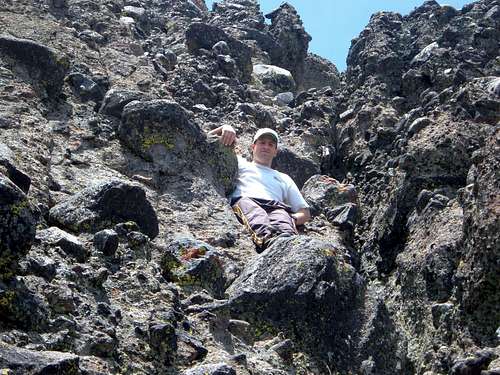 On the way down the east turret (true summit) of Castle Peak
Red Tape
The road is on land managed by the U.S. Forest Service and there is no red tape.
When To Climb
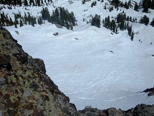
Castle Peak can be climbed any time of year. It is a good snowshoe destination. Watch out for ice in the middle of winter on the rocky areas. From June through October, the area is usually free of snow. The east face tends to hold snow for a long time, while the west face loses it much earlier in the season.
 Looking east from near the summit May 26, 2007
Typical Sierra winter weather patterns are encountered here and the summers are usually mild to warm.
Camping
This is such a short endeavor that camping is just not necessary except perhaps in the winter if you'd like to make it a long ski weekend. In that case the famous Peter Grubb Hut is an excellent option. For a nominal fee you and several others can stay in this rustic hut, which is right smack in the middle of Round Valley. Its location facilitates making laps from Castle Peak to the east, Basin Peak to the north and everywhere in between. The hut is available through reservations.
Mountain Conditions
By virtue of its location and orientation, the Sierra Nevada mountain range is the first area that receives significant precipitation in the form of snow. Many tales of people at odds with extraordinary winter weather originate from the area of Donner Pass including the famous Donner party. Weather data has been gathered here for over 130 years and can be accessed online. Please take a look at weather historian Mark McLaughlins home page:
Considering how much snow this area receives it should come as no surprise that the north ridge between Castle and Basin Peak usually becomes corniced in the winter. So, here is a link to the local avalanche report:
Local weather report:
Etymology
Castle Peak was originally named Mount Stanford by the Whitney Survey.