
|
|
Mountain/Rock |
|---|---|
|
|
44.64240°N / 15.04330°E |
|
|
Hiking |
|
|
Spring, Summer, Fall, Winter |
|
|
5328 ft / 1624 m |
|
|
Google Earth
Since Google has blessed us with its magical Google Earth software you can visit any corner of the world from the chair parked in front of your computer. Thankfully Velebit is amazingly clear so you can discover its corners and see for yourself how it looks from the above and where are the places this page is dedicated to.Each geographical point of interest described on this page has coordinates on the top of its section. You can use these coordinates with Google Earth’s fly to search engine. Just copy the coordinates (like it is written, with coma) and paste them into fly to tab and press enter. And, of course, enjoy the flight!
Intro
 View from Mid Velebit towards Adriatic Sea
It is pleasant October day. Imagine you are lying in yellow grass on beautiful meadows, absorbing warmth of the Sun. Idyllic beech/spruce forest, on the slope behind, is getting ready for the first snow. Its clothes is painted in amazing spectrum of autumn tones and ready to be thrown away. Yellow grassy domes under deep blue dome wonder why forest is throwing away something so beautiful and valuable. If only those leafs would fall upwards they would cover themselves before cold white blanket covers everything. From far below gentle breeze, whose job is to undress the beeches, caries the scent of the sea. Its amazing blue color and rugged bare rock islands on anchor act like magnet to your eyes. You’ve been all over Velebit but sea never felt closer, it seams like you could reach for it, spoil its mirror surface, to create ripples. Then you spot a boat, probably a ferry, and it is hard to believe how tiny it is. As it slowly sails you realize goal is still far away, it’s time to move on. Yet, intoxicated by beauty, reason indulges before desire to extend this perfect moment. As red leaf gently falls, detached from its tree by a whisper with smell of the sea, you lie back in grass and enjoy with every sense, filling batteries with positive energy, heart with warmth and mind with beauty before inevitable return to every day life, but not today. All I really wanted to say was welcome to Mid Velebit.
 |  |  |  |
Overview
 Grassy domes and forests of Borovacko Brdo
Indeed, northern and highest part of Mid Velebit to which this page is dedicated, is gentlest area of whole Velebit. Soft grassy domes and mixed beech/spruce forests rule here. Between Alan road and Satorina there is whole undulating sea of such peaks which stick above tame forests. Velebit is incredibly diverse mountain. Its various parts are so different from one another that it seams like you are not on the same mountain. This area is great example. Rock, one of predominant features of Velebit, is almost invisible here, among the highest peaks of Mid Velebit.
To disturb this tame image a bit we will descent down the seaboard side where rock is irreplaceable feature. As along whole Velebit seaboard terrace is also present here. Till modern times people used to live here between snows, on the mountain and of the mountain. Thousands of cattle wandered along avaricious yet very juicy pastures of the fields placed behind the peaks of 1st step. They cultivated shallow layer of soil till snows and Bura would drew them away. In spring, as mountain awakened from its winter hibernation, they would return and smoke raised again from chimneys of numerous houses. Not any more as today chimneys are unrecognizable part of rocky piles that were houses or they are still falling apart under pressure applied by sharp teeth of Velebit climate. Lately there is a growing trend of people returning and rebuilding houses, after decades of exile into civilization, in search of long lost peace. Life on this part of Velebit, especially around Alan pass, has long history. We will remember how it looked through centuries.
Unlike on North Velebit, where highest peaks are quite deep inside as seaboard side rises in several steps, or on South Velebit, where seaboard terrace is quite wide/deep, which also pushes peaks of seaboard streak little bit deeper from the shore, seaboard terrace is quite narrow here. This brings many of highest peaks of Mid Velebit very close to the sea and they offer fantastic views of blue Adriatic and white islands, barren by incredible Bura wind.
We will also visit area behind this group of peaks, the legendary Stirovaca valley, placed between highest peaks group and inland streak of peaks, which boasts largest conifer forest on Velebit, predominantly of spruce. It should have been oldest Velebit and Croatian national park as it was declared in 1911! Forest exploitation couldn’t have been stopped so it remained dead letter on a paper till most recent times when it was included in North Velebit NP.
Border between North and Mid Velebit is narrow valley/depression which harbors beautiful series of tame grassy valleys that are surrounded by idyllic forests. We will visit them too.
Page is named after the highest peak of Mid Velebit - Satorina (1624m) (read Shatorina), which is main hikers goal of the area. Marked paths make peripheral circle around the area but non gets inside. Apart from Satorina marks only reach Zecjak (1623m), second highest peak of Mid Velebit, and Ogradjenik (1604m), its best view point.
Famous Premuziceva Staza path, on its way from Zavizan on North Velebit towards Ostarije pass at the end of Mid Velebit, traverses grassy slopes of seaboard streak of peaks. On this stretch it has fantastic views towards sea. Somewhere along it little intro story unrolls.
 |  |  |  |
Satorina (1624m)
44°38'54.30"N, 15° 2'59.57"E Satorina from Dokozina Plan
Grassy dome of Satorina reached highest altitude of Mid Velebit peaks and is placed in its central part. This large topless cone considerably sticks above its surroundings and dominates above this part of Velebit. On the west, in the seaboard streak of peaks, is Matijevic Brijeg (1611m), its closest neighbor. Very picturesque undulating area of meadows and beech groves is placed between them. Above it Satorina has lowest side. On the east is SE corner of Stirovaca valley, called Klepina Duliba, above which Satorina rises almost 500m. On the south, some 400m lower, are Satorinski Doci, series of smaller depressions in forested valley. On the north, some 150m above the Stirovaca valley floor, is small terrace with beautiful Dokozina Plan meadow. Slopes of Satorina are dipped into deep beech/spruce forests. Upper part of the cone is grassy from all but northern side, which is under dense dwarf pine colonies. Very summit consists of two small heads of equal height. From several directions shape of Satorina reminds of sator which means tent and that is how it got its name.
By just one meter Satorina exceeded Zecjak (1623m) for the title of highest Mid Velebit peak. We know that among humans winner takes it all and such is the case with Satorina which is goal for most hikers that visit this part of Velebit. View from the summit is wide and beautiful but obscured towards sea (west) by Matijevic Brijeg. In section below it is described in detail.
Satorina can be approached from 4 directions. 2 of them lead from Premuziceva Staza path which traverses slopes of seaboard peaks streak on its way along Mid Velebit. Main path is the branch of Premuziceva Staza itself, which means it has also been built by Ante Premuzic who cared that there are nowhere steeper ascents. It leads over Ogradjenica pass where small Ogradjenica refuge (1400m) stands. Sadly on one spot path has been destroyed by macadam road which comes from Dokozina Plan. Of course, it was built for forest exploitation purposes. Second path leads over Matijevic Brijeg. It is more panoramic but quite steep. People on the way along Mid Velebit or Velebit in general via VPP (whose part Premuziceva Staza is) mostly ascent via Ogradjenica and descent via Matijevic Brijeg. Third path approaches from Stirovaca valley and ascends over Dokozina Plan. It joins Ogradjenica path well before summit. Finally fourth path ascends from Kugina Kuca refuge which is placed on the south.
 |  |  |  |
Views
 View from Matijevic Brijeg
View from Satorina is wide and beautiful. The only minus is that nearby Matijevic Brijeg obscures it towards west, where is most of the sea. On the other hand inner Mid Velebit is completely on your palm. Because Satorina is highest peak view from its summit is described. If you prefer sea views Ogradjenik (1604m) imposes itself as best viewpoint of Mid Velebit. It is one of the highest peaks and placed in seaboard streak. The only difference in view is that from here southern part of Mid Velebit is obscured also by Matijevic Brijeg.
N: undulating forested area of northern part of Mid Velebit. Right of them is Stirovaca valley. Behind are peaks of North Velebit beginning from Seravski Vrh (1661m), on the left, over Rozanski Kukovi group (1676m), Zavizan group (1676m), Hajducki Kukovi (1650m), both Rajinac brothers (1699m & 1667m) and Veliki Kozjak (1629m).
E: behind Stirovaca valley and inland streak of peaks is Lika region. On its opposite side Licka Pljesivica (1657m) mountain stretches.
SE: In this direction Velebit stretches. In the foreground are deep forests of Mid Velebit. Of several peaks in this area Bacic Kuk (1304m), with its white cliffs that stick above the forest, is worth mentioning. Left of it is whole long streak of white cliffs of Dabarski kukovi. Beyond is long inland side of South Velebit. Of all recognizable peaks it is worth to mention Visocica (1619m), Vaganski Vrh (1757m) and Sveto Brdo (1751m). Left of Velebit is southern part of Lika.
S: behind the forested peaks of Mid Velebit is Velebit channel and Pag island. Further behind is flat area of Ravni Kotari and islands of Sibenik & Zadar archipelagos.
W: in this direction Satorina has shortest view which is obscured by nearby Matijevic Brijeg (1611m) and Ogradjenik (1604m). Farther open sea is visible behind.
NW: undulating sea of forest and grassy domes of Mid Velebit.
 |  |  |
Malovan (1610m) & Matijevic Brijeg (1611m)
Malovan: 44°38'59.70"N, 15° 1'54.81"EMatijevic Brijeg: 44°38'40.86"N, 15° 1'52.35"E
 Malovan from Ogradjenica
If Satorina, highest peak of Mid Velebit, would sue for not having western view subpoena would arrive on the address of Matijevic Brijeg. Indeed, geological forces decided that this nice undulating grassy ridge would be highest in seaboard streak of Mid Velebit. On each end the ridge, some 1km apart, are two nice cones. Malovan (1610m) is on the NW, above Ogradjenica (1400m) pass, while Matijevic Brijeg (1611m) is on the SE. Both peaks and ridge rise above beech/spruce forest and are grassy with some rocks. Scattered all over are colonies of dwarf pine which are quite dense around both peaks, which makes them hard to access. Deep in the foot is Mliniste (1000m), 2km long field placed behind the peaks of first step.
Easiest Malovan (1610m) approach leads from meadows of Ogradjenica at whose edge Ogradjenica refuge (1400m) is placed. There is one grassy/rocky passage on the slope where there is no dwarf pine. Matijevic Brijeg (1611m) approach is short branch from marked path which leads over it towards Satorina from Premuziceva Staza path. Once marks reach the ridge it is 10mins right to the summit or towards left if coming from Satorina direction. Here you have to find a way through dense dwarf pine. View from both peaks is beautiful, especially towards sea, but even better from Matijevic Brijeg because NW view from Malovan is obscured towards NW by bulky Ogradjenik (1604m).
 |  |  |
Ogradjenik (1604m) & Ogradjenica
Ogradjenik: 44°39'21.53"N, 15° 1'13.28"EOgradjenica: 44°39'1.02"N, 15° 1'27.01"E (approximate refuge position)
 Ogradjenik from Malovan
Ogradjenik is first NW neighbor of Malovan (1610m) and of little bit more distant Satorina (1624m). From Malovan it is separated by Ogradjenica (1400m) meadows and pass (diminutive of Ogradjenik). On the west is also grassy Luksanovac (1472m). Ogradjenik is quite large peak, placed in the seaboard streak of Mid Velebit, whose dome considerably rises above beech/spruce forest that surround it. Southern and eastern slopes are grassy with colonies of dwarf pine while northern side is completely under it. Northern corner of Mliniste (1000m) field, placed on the seaboard terrace, lies SW of Ogreadjenik and some 600m lower.
Ogradjenik is pushed farthest towards the sea of highest Mid Velebit peaks which makes it its view champion. Panorama is wide, like from Satorina, but towards sea is fantastic. Just below the mountain is Pag island while behind are numerous other islands. Marked route from Ogradjenica pass reached the summit. From the refuge it takes some 30mins.
 |  |
 Ogradjenica with Malovan
Ogradjenica (1400m) is beautiful complex of soft meadows, placed between Ogradjenik and Malovan. Being placed at forest line Ogradjenica is surrounded by beech groves among which there is some spruce and fir trees. Beeches above the meadows are exposed to fierce winds and therefore stunted to bush form. On the meadows there is also quite a lot of dwarf pine. Behind the meadows is pass between Ogradjenik and Malovan over which leads path from Premuziceva Staza path towards Satorina. These meadows were pastures for cattle of the families which lived during summer on 400m lower Mliniste field because its precious land was cultivated.
On the southern slope of grassy shoulder that rises right of Ogradjenica meadows ruins of rocky house stand. In the distant 1935 it was newly build mountain hut of medical school from Zagreb. Its first maintainer was Antun Vrban and he marked the path from Premuziceva Staza then. In WW II house crumbled and was never rebuild. Huge cistern under the house, whose capacity was 18 cubic meters, remained but with time it also fell apart.
In summer of 2003 helicopter brought a small aluminium object and placed it on the terrace next to the ruined hut. It is Ogradjenica (1400m) refuge which has 4 sleeping places. When approaching from Premuziceva Staza path once you leave the forest behind refuge is just right above.
Zecjak (1623m)
44°42'15.98"N, 14°59'13.30"E Zecjak and Stokic Duliba
Between the depression that separates North and Mid Velebit and which is used by Alan pass road, on the north, and Satorina, highest peak of Mid Velebit, on the south, wide undulating forested area spreads. Average height of this area is considerable, around 1500m. Many grassy domes stick above it and almost reach 1600m. Zecjak (1623m) is highest of them. It is placed on the NW edge of the area, close to Veliki Alan (1375m) pass. Zecjak is one of three similar neighboring heads, both in look and height. On the north, east and south is wide undulating area of forest and rounded peaks. On the west is forested valley which separates it from grassy ridge of Plesivica (1448m), which is placed in seaboard streak of peaks. Heads of Zecjak are mix of grass and rock with plenty dwarf pine. On the ridges around there is some stunted beech between dwarf pine. Fierce winds, especially Bura, reduced them to bush like form as they are only up 2m high and their branches are so entangled that they form impassable barrier.
Zacjak is approached by marked path which branches from Premuziceva Staza path, some 20mins from Alan pass. From the junction it takes around 1h to the summit, or bit more. Once path reaches the grassy ridge views, especially towards sea, are beautiful. View from the summit of Zecjak is wide and beautiful. On all but western are closer areas of North and Mid Velebit. On the east, beyond Velebit, is Lika region with Licka Pljesivica mountain behind. Towards the SE, left of huge Satorina (1624m) is long stretch of South Velebit with its highest peaks. Towards west is sea and islands. Because Plesivica ridge is close and quite lower it doesn’t obscure the fantastic view which can be compared to that from Ogradjenik.
 |  |  |  |
Plesevica (1451-1448m)
44°41'53.41"N, 14°58'36.58"E Velebit classic; sunset from Buljma
Long crest of Plesevica stretches as part of the seaboard streak of peaks of Mid Velebit. Plesevica begins above Veliki Alan Pass (1375m), on the NW, and ends above Stokic Duliba (1200m) basin, on the SE. It is around 3.5km long. SW side of Plesevica is part of the seaboard side of Mid Velebit. Side is quite steep and high; it rises some 700m above the seaboard terrace. NE side is much lower and it rises above the narrow valley that is squeezed between Plesevica and main seaboard crest of Mid Velebit or crest of Zecjak (1622m) here. Zecjak is second highest peak of Mid Velebit. Both sides of Plesevica are forested; NE with the mix of beech, spruce and fir forest while SW seaboard side has several vegetation layers. Above the seaboard terrace it begins with hornbeam and oak, in the mid part maple is predominant tree while in highest part it is beech forest that is on places mixed with black pine. At the top of tree line beeches are stunted to bush form because of fierce Bura wind. Crest of Plesevica is grassy but grass is mixed with rock.
Crest of Plesevica is undulating and has several peaks that stand out. On the NW, above Alan Pass, is highest peak Buljma (1451m), very popular sunset viewing point for visitor of Alan hut. From Buljma towards SE crest slowly loses altitude till Baricevic Dolac (1350m), a larger meadow. Then it begins to gain altitude again. Above it is nameless peak 1442m. Further 1km towards SE is Visibaba (1448m), where crest of Plesivica ends. First SE neighbor of Visibaba is rocky Kosa (1399m).
Plesivica isn’t marked. Premuziceva Staza path, on the way from Alan towards SE, traverses its slopes some 50 to 100m below the crest. Because of amazing sea panoramas it is worth to avoid the path, which also panoramic but not like the crest, and walk over the entire crest of Plesevica. From last peak, Visibaba, you can easily descent to visible path, some 100m below the peak on the seaboard side. Walking the entire crest is around 30mins longer than the same distance when using the path.
 Man vs Bura on the shiny slopes of Buljma
 |  |  |  |  |
Veliki Alan (1375m) pass & Alan road
Veliki Alan pass: 44°43'7.83"N, 14°58'23.82"E Detail from the Veliki Alan pass road, near the pass
Veliki Alan is highest road pass on Velebit and part of border between North and Mid Velebit. It is not typical pass where you descent on the other side but more like door between the peaks of seaboard streak behind which you enter inner Velebit from the coast or vice versa. North of pass is massive Alancic (1611m), which belongs to North Velebit, while on the south is Buljma (1451m) on the Mid Velebit. Behind the pass or in eastern direction Mirevo is placed. It is undulating grassy plateau or shallow basins surrounded by forested slopes of peaks around. Mirevo is separately described below. By the road, just behind the pass, on location called Kosica, there are dozen small houses. They were used during summers in the past when people used to drive their cattle from the shore to juicy Velebit pastures. Today they are used for leisure. On the seaboard or western side, just below the pass, is short grassy valley Alan. In it, at the edge of the beech forest on northern side, Alan hut (1340m) is placed. In the center of Alan, on the meadows, ruins of upper station and rusty towers of former cable railway, stand. It was build in early 20th century and used to transport logs from Stirovaca to Stinica on the coast where sawmill was located. It is not in use for decades now.
Alan pass has very long history. It was used by people to cross over Velebit for thousands years. Pisani Kamen (written stone / document carved in stone) near the Begovaca source on continental side of Velebit is most important proof of this, dating from Roman times. It says, in Latin, that Ortoplin tribe, which lived on the coast in Stinica near Jablanac (then Ortopula), can use Begovaca source which is on territory of Parentini tribe, which lived in Kosinj in Lika behind Velebit (then Tesleum). Both tribes were of old Illyrian people which lived here before Croats came in 7th century. They were connected over Alan pass, which is shortest way between coast and Lika. Over it they also exchanged goods. When Croats came they adopted Illyrian culture and same way of life continued. During summer they used to drive cattle to Velebit pastures over Alan pass and exchanged good with people from Lika region. After Croats lost famous battle on Krbavsko Polje field in Lika, in 1493 from Ottoman empire, Turks used to crossed over Alan in their pillage campaigns and completely destroyed Jablanac village. They scattered all domestic Croats from Velebit and its coast which ended being completely deserted. Several names date from those times like Turska Vrata pass (Turkish Door) over which Jablanac – Alan path crosses over first step. When Turks were expelled from Lika in 17th century old way of living returned. But goods exchange wasn’t enough for ‘new’ times. In 18th century exploitation of rich Velebit forests began for ship building purposes for domestic and Venetian needs. Track was opened for ox’s to drag masts from Stirovaca to coast. From there they were transported to shipyards all over Adriatic including Venice. People called it Mother Teresa’s track as it was build during her rule (1740-1780) of Austro-Hungarian monarchy. Even today this track is recognizable on many place as well rammed track with rocky edges. In second half of 19th century monarchy began savage exploitation of forest so they opened sawmill in Stirovaca in 1870. Alan road was also build then. This changed way of life for domestic Croats forever. Ox’s were replaced by horses and many came to work here even from Lika region. During Italian and German occupation local Partisans of Alan detachment held this area of Velebit and prevented occupation and exploitation then. In 1981 monument was erected on Alan pass in their honor. After WW II few trucks replaced the need for hundreds of horses and workers. Also cable car was build between Stinica on the coast and Alan pass to transport logs. This failed investment further fueled loss of jobs which led to exodus of 80% of domestic people from Velebit coast. They scattered all over Croatia, many moved to plains of Slavonia, and around the world. Also semi nomadic way of life was time of history. Those that remained turned to coastal tourism. After 2000 years, maybe even more, life ceased to exists on Velebit. Today Alan pass is oasis of peace, even in summer.
Alan road branches from Adriatic road some 3km above Jablanac village on the coast and 39km south of Senj. From the junction it is 18km to the Alan pass. Lower half (9km) is asphalted while upper half is good macadam. From junction road goes far right and ascends steadily. With two sharp bends it crosses over first step. From the second sharp bend or serpentine as we call it here is fantastic view towards sea and Rab island. Behind the first step road goes far left and in 3 long straights (2 serpentines on the way) gains altitude. Last 2 km before road enters Alan meadows below the very pass views towards sea are breathtaking. Behind Alan pass road enters the long valley which divides North from Mid Velebit and traverses forested slopes above beautiful grassy basins within the valley. 2km behind the pass is Kosica (1412m) pass, highest point of the road. In another 4km road reaches Mrkviste (1276m), an important junction on asphalted Krasno – Stirovaca road. From here one can reach many places on North and Mid Velebit as in Lika region by car. Left is 24km to Krasno village on North Velebit. Along the way there are several macadam branches of which one leads towards Zavizan and two towards Lika region. From Krasno you can descent to the Sveti Juraj on the coast (24km) or go to Otocac town in Lika (21km). Right turn on Mrkviste takes you to the heart of Stirovaca valley in 3km. From there Velebit longitudinal road continues through inner Mid Velebit and after passing through beautiful Dabarski Kukovi group exits on Karlobag – Gospic road, which leads over Baske Ostarije (927m) pass, in 34km. Along the way there are several junction from which branches lead left to Lika region.
Alan road is not cleaned of snow as is none of Velebit macadam roads. Asphalted Krasno – Stirovaca road is also not cleaned. They are usable from June till first snow. In late winter or early spring southern slopes of Velebit below Alan pass can look free of snow but that is still not guarantee that road is usable to Alan pass because of huge drifts that Bura winds builds. They can be true walls on the road, up to 5m high or even more.
Detailed description of Alan Road is on Alan from Jablanac route page.
 On the edge of Alan plateau below Veliki Alan pass
 |  |  |
Mirevo
44°42'51.78"N, 14°58'40.92"E Mirevo from Alan pass road
Visitors that ascend up the Alan pass, either by car or on foot, are accompanied by marvelous sea views. Over the pass you enter inner Velebit and vistas dramatically change. Sea views are replaced by idyllic undulating meadows that are divided by intersecting rocky fences or suhozid (dry wall). Ruins of old houses on the meadows are witnesses of forgotten times when people used to live of the mountain. But not all houses died, some were renovated some where born on the lands of grandfathers. Ancestors that left the mountain in search of better life would be happy to see that their descendants are returning more and more today as they run away from that same life ancestors looked for. But it is different and it will never be the same. Hard work on the mountain is replaced by leisure. Mirevo today is perfect place to rest mind and soul, close but yet so far from civilization.
Mirevo is large undulating complex of rocky meadows on the western edge of valley which divides North from Mid Velebit. It is placed behind Alan pass and long ridge of Buljma (1451m) in the seaboard streak of peaks. Altitude of Mirevo varies from 1300-1370m while dimensions are 1.2x1km. Around are soft, by beech, spruce and fir forested, slopes of neighboring peaks on north and south. Towards east Mirevo gradually rises towards Kosica pass (1412m) which divides it from Bilenski Padez and is also highest point of Alan road. Mirevo is divided in two parts that are basically one space. Both have oval shape and are perpendicular on one another. On the map their form resembles of distorted ‘L’ letter. Bilensko Mirevo is on the west, under the ridge of Buljma, and is spreading in N-S direction while the ellipse of eastern Dundovic Mirevo is spreading in W-E direction. Floor of whole Mirevo is intersected by rocky fences (suhozid) which were build to divide land between families and their members or to protect cultivable pieces of soil from erosion. These parcels were either cultivated or were pastures for cattle. On Dundovic Mirevo several houses lie in ruins. In summer they are barely recognizable in grass. On Balensko Mirevo few houses were renovated while in the forest above the field, along the Alan road, is Kosica, whole hamlet of renovated or newly build small leisure houses.
Alan road traverses slopes above northern edge of Mirevo offering beautiful views on it. Premuziceva Staza path makes its first kilometer on Mid Velebit while traversing slopes of Buljma above western edge of Mirevo, also offering beautiful views upon it. Most beautiful views upon Mirevo are from ridge of Buljma.
 |  |  |  |
Bilenski Padez, Segotski padez & Dundovic Padez
Bilenski Padez: 44°42'59.28"N, 15° 0'10.26"ESegotski Padez: 44°42'21.42"N, 15° 1'17.83"E
Dundovic Padez: 44°42'10.35"N, 15° 2'6.42"E
 Bilenski Padez from Alan pass road
Amidst deep forests of inner North and Mid Velebit, in the W-E laid valley which separates them, there is series of beautiful and amazingly romantic and calm grassy basins. Their bottoms are undulating soft grasslands which are squeezed between steep sides of Goljak (1605m) group on the north (North Velebit) and wide area of gentle rolling peaks on the south (Mid Velebit). These sides are mostly under beech with some spruce and fir while around each Padez there is ring of spruce what is indicator of their own microclimate and temperature inversion that frequently occurs. Bilenski Padez (bottom 1250m) is on the west. It is largest and deepest of three. Kosica (1412m) pass separates it from Mirevo on the west. Segotski Padez (bottom 1250-1300m)is in the middle. It is narrowest of three and connected with Bilenski Padez on the west. Dundovic Padez (bottom 1280m) lies on the eastern end of valley which then ends at the edge of steep step which falls into Stirovaca valley. From middle Segotski Padez it is separated by forested pass.
Beautiful view towards all three Padez valleys is from Alan road, sections between Kosica pass and Mrkviste junction (more in Alan pass section under Alan road). They fall steeply bellow the edge of the road which traverses slopes above them. These are incredibly calm places where beauty of nature intoxicates and it feels time has stopped. One of such places where one could lie in the grass and smell scents of the forests, grass and flowers for hours.
Padez in Croatian is what case is in English. But on this part of Velebit word also describes grassy valley that is surrounded by conifer forest.
 |  |  |  |
Kita (1573m)
44°42'29.86"N, 14°59'57.27"E Summit of Kita
South of the quite long, W-E laid valley, which separates North from Mid Velebit there is a streak of gentle peaks whose grassy heads just stick above beautiful beech/spruce/fir forests. They are NW edge of Mid Velebit. Highest among them is Kita (1573m). This streak of peaks is also NW edge of wide area of inner Mid Velebit placed between Alan Pass road and Satorina (1624m). Area consists of numerous peaks like Kita which rise above numerous funnel shaped basins and depressions among them. This area is very precious as it is last completely untouched (no marked path, no forest roads) larger area of Mid Velebit and what also adds to that importance is that it is placed in high part of the massif. Unfortunately Hrvatske Sume (Croatian Forest), state owned company which manages forests, set its eye on this area and started penetration of first road into the area, which is unacceptable! Hopefully this can be stopped before damage is done?!
Slopes of Kita are mostly covered by beautiful beech forests. Top part is mix between gentle grassy slopes and forest groves. Close to the summit vegetation is stunted because of exposure to winds. Branches of beeches are interlaced so such groves are hardly passable. Summit soft is grassy dome which offers views in all directions. As said Kita is placed in the streak of Mid Velebit peaks above the valley which separates Mid from North Velebit. This streak stretches in W-E direction so slopes of Kita on these sides are not high but still separated by passes and funnel shaped depressions from western and eastern neighbors, which are nameless forested heads. N-NW slopes descent into Bilenski Padez, grassy basin which is part of separation valley. Its bottom is bit over 300m lower. On the S-SE slopes of Kita descent into the funnel shaped depression of mentioned untouched area which has no particular name.
Kita has been approached by marked path from Kosica (1412m), highest point of Alan Pass road. Kosica is small pass which separates basins of Mirevo and Bilenski Padez basins in the separation valley. Path leads through the forest and over the grassy slopes closer to the summit. Ascent is easy and beautiful. View covers part of North and most of Mid Velebit. Because Kita is in inner Velebit, between seaboard and continental streaks sea is not visible while behind continental peaks parts of Lika region are visible. On the North Velebit Rozanski Kukovi (1676m), Hajducki Kukovi (1650m) and Veliki Kozjak (1629m) are visible. Below, on your palm, are beautiful grassy basins of Bilenski, Segotski and Dundovic Padez. On the south is Satorina (1624m) while nearby, on the SW, is bulky Zecjak (1622m), second highest peak of Mid Velebit.
Recently Zecjak has been connected with Kita by marked path so now you can make a beautiful circle over both peaks from Alan hut.
 |  |  |
Stirovaca
Stirovaca meadows where source and forest cottages are: 44°41'53.69"N, 15° 3'4.20"EJovanovic Padez: 44°40'43.76"N, 15° 3'26.26"E
Borovacki Padez: 44°40'16.43"N, 15° 3'40.72"E
 Autumn in forests of Stirovaca
Stirovaca, harbor of most beautiful conifer forest on Velebit (predominantly of spruce) and one of most beautiful in Croatia, is best know valley of inner Velebit. Its name is legend, one of those rare known even to those that have no interest in Velebit and mountaineering.
Stirovaca is 8km long and 1-3km wide. Its mostly flat bottom lies at the altitude of 1100m. Valley stretches in N-S direction between continental streak of peaks on the east and main streak of Mid Velebit on the west. Peaks around exceed 1500m among which Satorina (1624m) is highest in main streak while Veliki Golic (1550m) holds that title in continental streak. On the north is steep step below Mrkviste (1276m) which is well known road junction. Southern most part of Stirovaca is Klempina Duliba. While slopes around are mostly under beech forest, which is mixed with some spruce and fir, bottom is under dense spruce and fir forest. Trees are beautifully developed and high. Some species are real giants which exceed 40m. Amidst the forest there are several nice meadows. Stirovaca is northern most and gave name to whole valley. In the mid part of the valley are well know Jovanovic Padez and Borovacki Padez (also known as Crni Padez). On them there are several small leisure houses. In the eastern part are Petrasica and Grzanusa meadows. These meadows are very nice and romantic spots between which scents of conifer forest and flowers spread. Unlike most spots on Velebit Stirovaca has plenty of water sources. After stronger rains streams flow on many places before being swallowed by thirsty karst terrain. Best known source is the one on Stirovaca meadows which never dries and Slatka Voda source on Jovanovic Padez.
Although Stirovaca meadow (1102m) is located in the northern corner of Stirovaca valley it is its heart. It gave its name to whole valley. Rounded meadow has some 500m in diameter. Fantastic and abundant source of water, which never dries, is located on the meadow. Water temperature in July is only 5°C. After stronger rains it forms a creek which soon disappears underground. Unfortunately Stirovaca is also know as heart of forest exploitation in Stirovaca valley. Already in 1870 Austro-Hungarian monarchy opened steam sawmill here, rangers cottage and restaurant. That is remarkable because even in mid 20th century Velebit was still very isolated area and Stirovaca itself is one of remotest parts of Velebit, very distant of permanently inhabited places. It was approached by Alan road from the coast which was build in same period when sawmill was. Thankfully saw mill burned out and then came world war so exploitation was halted. In 1928 came first effort to protect these forest by declaring it a National Park. But protection lasted only one year as local interests were far stronger. Forest was one of rare sources of income for poor Velebit villages. In 1999 small part of Stirovaca was included in newly established North Velebit National park, although Stirovaca is on Mid Velebit. Hopefully one day entire Stirovaca and Velebit will be national park, which will end centuries long exploitation. Although forests of Stirovaca have been exploited over two centuries that is not obvious and superficial look says that it seams intact. But if you look better inside many trunks are missing. On Stirovaca meadows few wooden houses of forest service remain. They are dormitories for forest workers. Perhaps forest service might give one to some mountaineering club to be turned into hut as one would be welcomed in Stirovaca valley.
Because Stirovaca is in the middle of Velebit it is quite far to access on foot so those who visit mainly come by car. Closest hiking approach from the foot of Velebit is from Jablanac or Adriatic Road via Alan pass which lasts some 6h. Asphalted road approaches Stirovaca from Krasno which is 27km away (more about this Velebit village see on Zavizan page). Part of this road is section of Velebit Longitudinal Road which is macadam that runs through North end Mid Velebit. It begins on Oltari pass that is on Sveti Juraj – Krasno road. After passing over Zavizan, through Lomska Duliba, Stirovaca and Dabarski kukovi areas it ends in Susanj on Karlobag – Gospic road between Baske Ostarije on Velebit and Karlobag on the coast. Many other roads are attached to it from various directions, mainly from Lika region.
 |  |  |  |
Mliniste
Nuglo: 44°38'41.73"N, 15° 0'32.32"EGrabarusa: 44°38'13.00"N, 15° 0'44.67"E
Kut: 44°37'53.11"N, 15° 1'2.25"E
 Mliniste - Nuglo
With 2km in length and up to 1km in width Mliniste (read Mlinishte), a typical karst field, is largest of those placed on the seaboard terrace of Mid Velebit. It lies on 1000m and is almost completely closed from all but western side where is few hundred meters wide opening between the peaks of first step. In it, some 50m lower than Mliniste, is Sinokos (950m) field which acts like entrance into Mliniste from the sea. These doors are guarded by Sinokosa Glava (1081m), on the north, and Cukovo (1060m) on the south. South of Cukovo ridge continues to rise towards the head of Kokirna (1105m) and further towards Meralovac (1184m) which divides Mliniste from neighboring Radlovac (950m) field on the south. On the north are two similar nameless peaks (one is 1176m high) which separate Mliniste from neighboring Vrata, Jurcic Dolac and Starcevic Dolac fields/meadows on the north. All these peaks and ridges are rocky with some grass, barren by fierce Bura wind which in winter often reaches hurricane force. Grassy treeless Mliniste perfectly fits into the area which altogether resembles of rocky desert. On the east above Mliniste Ogradjenik (1604m) and Matijevic Brijeg (1611m) dominate. Lower 200m of the slope towards them is also forest free mix of rock and grass.
The field itself is quite flat. Many rocky fences, which were build to keep all the cultivable soil from erosion, split it in many sections. It is interesting that families who lived in summer on Mliniste drove their cattle on 400m higher Ogradjenica meadows as they cultivated all available soil on Mliniste. Northern corner below Ogradjenik is rounded with some lonely trees on the field and forested slopes around. It is called Nuglo. Mid part is narrow and completely bare only with some trees by the fences. Several houses and Sv.Jelena chapel are here. This part is called Grabarusa. Largest is southern corner which is called Matijevic Kut (Matijevic corner). At the edge of the field there is also small hamlet. Above it is Donja Korita source which never dries.
Several paths ascend towards Mliniste from the coast but none is marked so they are hard to find. Premuziceva Staza path traverses slopes high above Mliniste. It is partially in the beech forest but large section leads along the upper edge of bare northern slope above the field, below Matijevic Brijeg. This section is called Pogledalo which is some distortion of word pogled which means view. Indeed, this part of Premuziceva Staza has beautiful views upon Mliniste and sea and islands in the background. Above southern or Matijevic Kut corner of the field is junction where left path leads over Matijevic Brijeg towards Satorina. Here is Gornja Korita (1200m) source which is quite week and dries out in warm part of the year. From it marks descent to 5mins lower Donja Korita source.
 |  |
Radlovac
44°36'59.79"N, 15° 1'8.83"E Radlovac in June
Radlovac (950m) is second largest karst field on the seaboard terrace of Mid Velebit, placed between seaboard and first step peaks. Its shape is more or less oval, stretching in NW-SE direction which means parallel with mountain. On that stretch it is around 1km long while in SW-NE direction is around 0.6km wide. As neighboring Mliniste, which is on the north, Radlovac is only narrowly opened towards sea or SW with side valley between the peaks of first step, Meralovac on NW and Kurozeb on SE. Behind the edge of the valley seaboard side of Velebit descends quite steeply towards the coast. Valley acts like Bura wind accelerator which here often reaches hurricane force preventing anything to grow so valley and slopes above it are bare rocky with very grass. With this side valley Radlovac is 1km wide in its northern part. From Mliniste it is divided by Meralovac (1184m). On the NE are 300m high rocky/grassy slopes of Ljuljacka (1278m) which belongs to seaboard streak of Mid Velebit. On the SE Razvrsje (1188m) divide it from neighboring field of Jasenovaca. Southern part of the field is closed towards the sea by Kurozeb (1167m). Its NE side above Radlovac is under beech forest which is higher up stunted by Bura wind and disappears below the ridge which is bare rocky.
In the center of Radlovac is small hamlet. Once, when people used to live here during summers, it had 35 houses. Many of them are in ruins today, as are few open water cisterns, but some have been renovated. Sveti Rok chapel (Saint Rok) is the center of Radlovac. Every August 16th there is small procession from the coast. Few old people still return to Radlovac during summer. For a short period of time refuge was in one of private houses but owner didn’t extend the deal. Radlovac is intersected by many rocky walls which used to divide family land. Around the houses there are some beech trees and groves in the northern part of the field while rest is open grass land.
Radlovac is approached by marked path from the Cacici (read Chachichi) village on the Adriatic Road, that is 200m above the sea. Above Radlovac path reaches Premuziceva Staza path which traverses slopes of Kovrinac (1249m) and Ljuljacka (1278m) some 200m above the field. Two marked path also reach Radlovac from Kugina Kuca hut that is placed in the inner Velebit, by the longitudinal road. One leads via Smojverske Dulibe valley, the other via Bacin Plan.
 |  |  |  |  |
Jablanac
44°42'21.02"N, 14°53'52.74"E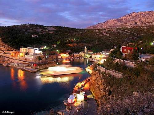 Jablanac
Jablanac is picturesque, 800 years old, village placed in small bay with steep sides on the coast of Velebit. It is first mentioned in the charter of Croatian king Petar Kresimir IV from 1179 under name Ablana. In 1493 it was completely destroyed by Turks of Ottoman empire. Today in the village there is post office, store and Ablana Hotel. 150 inhabitants of Jablanac would enjoy unearthly peace if their small bay wasn’t ferry port to Rab island which is anchored on the Adriatic Sea in front and closes this part of Velebit channel. Point of Rab closest to the shore is just 3km from Jablanac. Since Rab is very popular island among domestics and tourists alike ferry queue can extend all the way to 3km distant Adriatic Roadin summer. On the narrow one way road that descends to village there is separate line for those that are waiting ferry queue. On the spot where road towards Jablanac branches from Adriatic road is gas station. Curiosity is that Jablanac has mountaineering hut, Dom Miroslav Hirtz, whose altitude of only 20m probably ranks it among lowest on Earth. It is placed on the top of cliff, just above the sea and ferry (more about it in Objects section). Jablanac is also well known because of nearby Zavratnica bay, which is amazingly beautiful. Very nice build path leads along the sea from Jablanac towards it.
If Alan pass is your trailhead for either Satorina region of Mid Velebit or Rozanski Kukovi and other parts of North Velebit, make sure you descent to coast prior or after your trip and visit Jablanac and Zavratnica or even fantastic Rab island. Outside of busy season and holidays, when traffic towards Rab is low, Jablanac is very peaceful place where one feels like time has stopped.
 |  |  |
Zavratnica
44°41'56.45"N, 14°53'51.72"E Zavratnica is highlight of Velebit coast
Zavratnica is one of trademarks of Velebit coast. This deep and wild bay is placed 1km south of Jablanac. Some people even wrongly call it a fjord. It is few kilometers long wild torrent or even canyon whose mouth was submerged when sea level raised after last glacial period. Its function was to take waters from Velebit towards sea, not it is dry. From the entrance sea penetrated almost 1km inside while sides are around 200m high. They are very steep and fall towards sea with torn cliffs and scree slopes. On the southern side of inner part of Zavratnica scree slopes are supported by few levels of picturesque rocky walls. When there is no wind reddish, pinkish and grayish cliffs reflect of mirror surface underneath which is crystal clear deep blue sea. Most beautiful moments in Zavratnica are at sunsets. Just by the inner part of northern shore is a wreck of sank Austrian ship.
Beautiful build path approaches Zavratnica from Jablanac. There is variation by the sea which leads from ferry port and reaches Zavratnica in 10mins. On the entrance into bay there is nice tunnel carved through cliff which rises from the sea. It continues along the northern shore till the end of bay and further few hundred meters along the other side where it ends. From the bottom of the bay variation of marked path towards Alan pass ascends. Upper variation leads from Miroslav Hirtz hut. After few minutes on the road build path begins above it. In some 10mins it reaches rocky observation deck (like small tower), which stands on top of cliffs above the sea at the entrance into the Zavratnica. Behind the panoramic spot path descends few minutes till it joins variation by the sea.
It is best to go there by the sea and return to Jablanac via panoramic deck. Whole trip from Jablanac and back lasts around 1h. Add on that some time for taking shots or additional swimming in warm part of the year.
 |  |  |  |  |  |  |
Hike Advices
Via RadlovacThose that want to experience grandness of Velebit will ascent Satorina from coast via Radlovac. It is possible to do it in one way up and back. This is only for super hikers who can do kilometers and large quantities of vertical meters. This daily combination demands long day. Once above Radlovac it is best to approach Satorina via Matijevic Brijeg (6h and return via Ogradjenica (5h).
This difficult route can be split in two days by sleeping over at Kugina Kuca refuge. Ascend Satorina as above. From the summit descent to Kugina Kuca where you’ll sleep over (1.30-2h). On the 2nd day return to Radlovac via Smojverske Dulibe or via Bacin Plan (2h) and further to the car in Cacici village (2h).
From Alan pass
Satorina is quite long but not too difficult daily trip from Alan pass because there isn’t much altitude gain/loss. Most beautiful sea views from Premuziceva Staza path are along this section. They are just fantastic. It is best to ascent Satorina via Ogradjenica. Return to Premuziceva Staza via Matijevic Brijeg. From it views towards sea are beautiful. This way you also get to see Mliniste field on the return and at least by bit avoid repeating whole route on the return. If you don’t want to return via Matijevic Brijeg then you can ascent Ogradjenik above Ogradjenica on the return because of its fantastic sea views. Trip requires around 8h of walking, 4h in each direction.
Another nice but long daily trip is circle combination of Stirovaca and Satorina. It is best to do it in clockwise direction and leave Premuziceva Staza path for the return when you may observe sunset from it. From Alan hut head towards Stirovaca using Alan road. On Kosica pass (1412m), highest point of Alan road, you have option to continue via Alan road north of Bilenski Padez grassy valley or to descent shortly to forest road that goes along its southern side, which is bit shorter. Down the road where it branches from Alan road continue right using forest road instead of Alan road (if you used Alan road till this point also turn right here). Road goes along souther edge of Dundovic Padez grassy basin. On the spot where road reaches the edge above Stirovaca valley you can descent down in it or continue down the road all the way to Dokozina Plan where you’ll meet both Stirovaca approaches. If you are in shape I’d recommend descending into Stirovaca because of its beautiful conifer forest and great water source while road is rather boring forest walk. From Satorina descent to Premuziceva Staza via Ogradjenica or Matijevic Brijeg and return to Alan. This is all day walk and you can split it in two by sleeping over at Ogradjenica refuge.
From Stirovaca
Easiest Satorina approach leads from Stirovaca valley, of course only if you get there by car. From it you only need 1.30h to the summit. To extend and enrich trip with smell of the sea and beautiful view towards it descent to Premuziceva Staza path via Matijevic Brijeg (1h. Once on it turn right towards Alan pass. After some 40mins is junction where you’ll return to Stirovaca via Ogradjenica (2h).
Alan hut is great base not only to visit Mid Velebit and Satorina but also Rozanski Kukovi group and Veliki Kozjak (1629m) on North Velebit. Once here it is best to visit Satorina on one day and Rozanski Kukovi on the other.
Getting There
Center of the region is Senj town on Velebit coast. Others are Krasno village on North Velebit and Jablanac on the coast below Alan pass. Public transportation can be used to access coastal trailheads while places in Lika are too far to walk from this part of Velebit.by Plane
Zagreb international airport is air gateway to Croatia. More info about flights find on official site of Croatia Airlines. From Zagreb you have to take a bus.
by Bus
There are several bus lines from Zagreb to Senj each day. Also there are lines towards Rab and Pag islands that after Senj continue along the Velebit coast till Jablanac (ferry to Rab) or Prizna (ferry to Pag). Detailed bus timetables from Zagreb find on Zagreb bus station site. If your line only takes you to Senj there you’ll have to wait for bus from Rijeka towards south.
by Car
This is always best possible option which gives you freedom to do and go wherever you want. There are three main directions to come to this area, from Rijeka, Zagreb or Zadar.
From Rijeka, along the coast
This route is suitable if you are coming from western Europe, via Trieste (Italy).
Trieste – Rijeka: 70km
Rijeka – Senj: 63km
Senj – Jablanac: 38km
From Zagreb
This road is suitable if you are coming from eastern or central Europe via Ljubljana (Slovenia), Maribor (Slovenia) or Budapest (Hungary).
Ljubljana – Zagreb: 138km, Maribor – Zagreb: 113km, Budapest – Zagreb: 347 km
Zagreb – Senj: 156km
Zadar – Starigrad Paklenica – Jablanac: 55km
Look for current road conditions in Croatia on the page of Croatian Automobile Club (HAK)
When To Climb
Learn about climate of Velebit mountain on its main page.Winter: in high area described on this page winter lasts from mid November till mid April. In this period Velebit is under deep snow which reaches its peak in February or in March. This changes from year to year. But even in this period after short periods of warm time snow can remain only in patches on warm grassy southern slopes. To ascent any of peaks crampons are necessary because snow is usually transformed into white concrete. Most dangerous factor is Bura wind which often reaches hurricane force. It brings terrible wind chill.
Spring: snow begins to melt faster as April progresses but still falls frequently. Real spring begins with May when greenery gradually climbs up the mountain. By the coast it will turn green between 15-20th of April while high placed beech forests will around May 20th. End of May is fantastic time to visit as forest is fluorescent green. Flowers reach their peak during June.
Summer: lasts between mid June till end of August. July and August are real hell months on the coast with daily temperatures regularly around 35°C. Avoid day time ascent from the coast them because sun kills. On high elevations there is plenty of shade in the forests. Temperature rarely reaches 25°C in highest elevations. Temperatures usually range between 15-21°C. First snow fell many times at the end of August but it won’t last long then.
Autumn: in highest area begins as September progresses. Colors are at peak between September 25th and October 5th. This is fantastic period to visit. By the coast colors peak only at the end of October.
Mountain Conditions
Conditions on Velebit are very well known thanks to Zavizan meteo station, which is observing weather since 1953. On WeatherOnline & DHMZ (Croatian Meteorological and Hydrological Association) sites you can find current data for Zavizan and even forecast for Zavizan on WeatherOnline.Here are the links where you can find out about the current weather on Velebit (Zavizan) and forecast for Croatia:
WeatherOnline:
WeatherOnline home page
Croatia at WeatherOnline,
Zavizan at WeatherOnline
Croatian Meteorological and Hydrological Association (DHMZ):
DHMZ home page
DHMZ Forecast page
DHMZ 7 Day Forecast for Croatian cities and places World wide, including Zadar and Gospic
Current Weather Conditions in Croatia including Zavizan, Gospic and Zadar (from 5-15h and 19-21h, during summer +1hour)
Snow Depth's in Croatia
Objects
Kuca na Alanu (1340m) (Alan hut) stands by the Alan road, 500m from Veliki Alan (1380m) pass, on the seaboard side. Hut is at the edge of the forest below Alancic (1611m) peak and meadows around pass. It was build in 1960 as foresters house. Forestry service gave 2 rooms to mountaineers to be used as refuge. In 1990’s it was completely handed over to mountaineers. It is open all year and managed in summer season when is partially supplied with drinks. You can prepare your own food in kitchen. It has 45 sleeping places in 4 rooms and water cistern. Hut is fantastic base to explore North and Mid Velebit.Visit Alan hut on the web.
Dom Miroslav Hirtz (20m) is placed on top of 20m high cliff that rises above ferry berth in small bay of Jablanac village (learn more about Jablanac in its own section). Miroslav Hirtz hut probably ranks among lowest in the world. It was built before the WW II by Miroslav Hirtz. In 1955 Croatian Mountaineering Organization bought it from his ancestors and electrified it. In 1962 it was handed to mountaineers from Samobor who handed it in 1980 to MIV club from Varazdin. They completely renovated it. Today hut has 40 beds, 2 kitchens, water, electricity, TV and so on. It is open June 1st till October 1st and on arrangement by phoning Milan Turkalj (042 – 231764). Number at the hut is (053 – 887323). During season drinks and meals can be bought in the hut. Refuge by the hut is open all the time. From the terrace on which hut stands is beautiful view on Jablanac and North Velebit in the background with Lisac (1541m), Rozanski Vrh (1638m) and Alancic (1611m).
Kugina Kuca (1180m) was built in 1975 by forest service for their purposes. In 2001 it was completely handed over to mountaineers from Gospic (Zeljeznicar club). It is placed by the Velebit longitudinal road in the very heart of Mid Velebit and is surrounded by deep and ‘endless’ forests. It is a shelter that has 16 beds and separate kitchen. At the back of the house is ever open winter room. By the house is water cistern. Kugina Kuca is open from June to October or on the request by phoning Tomislav Canic (053 – 574065). By car it can be accessed from many directions while marked paths lead towards Premuziceva Staza path.
Skloniste Ogradjenica (1400m) (Ogradjenica refuge) is placed at the edge of Ogradjenica meadows, below the pass between Ogradjenik (1604m) and Malovan (1611m). In is small metal cubic which was brought here in summer of 2003 by a helicopter and placed it on the terrace next to the ruined hut from 1935 (more in Ogradjenik section). It has 4 sleeping placed and stove. In winter is merely a shelter where one should stay only in case of emergency. Shelter has no isolation so inside is cold as it is outside. Another problem then is finding wood because ground is covered by deep snow.
Relatively close to Alan is Lubenovac hut (1265m) placed on Veliki Lubenovac on North Velebit. More info about can be found on Rozanski Kukovi page.
 |  |
Camping & Accommodation
Camping is forbidden on Velebit except on authorized places like camps but none is in the vicinity of this area. To stay on the mountain use huts and refuges. Here are few links to help you find accommodation on the coast and around Velebit.Adriatica.net, accommodation on Croatian coast
Senj town page
Karlobag place accommodation
Hotel Ablana, Jablanac
Marijana apartments, Stinica
Otocac town in Lika region (behind Velebit), accommodation list
Lika-Senj county, various info about nature, places, accommodations…
Red Tape
Area of Mid Velebit described on this page is of course part of Nature Park Velebit but this category of protection does not include entrance tickets. Stirovaca is part of North Velebit National park which requires entrance tickets but there are no entrances. Tickets can be bought in Lubenovac and Alan huts.Other Velebit pages on SummitPost
~ Velebit massif, main page, general info~ Zavizan area, North Velebit (Mali Rajinac (1699m) highest peak on the page)
~ Rozanski Kukovi group, North Velebit (Gromovaca (1676m) & Vratarski Kuk (1676m) highest peaks on the page)
~ Alancic / Rozanski Vrh / Seravski Vrh, North Velebit (Goli Vrh (1670m) highest peak on the page)
~ Veliki Kozjak (1629m), North Velebit
~ Stap area, South Velebit, (Debeli Kuk (1269m) highest peak on the page)
~ Visocica (1619m), South Velebit
~ Bojin Kuk (1110m), South Velebit
~ Viserujna (1632m) & Rujno, South Velebit
~ Paklenica area, South Velebit
~ Vaganski vrh (1757m), South Velebit (highest peak of Velebit)
~ Liburnija (1710m), South Velebit
~ Sveto Brdo (1751m), South Velebit
~ Tulove Grede (1120m), SE Velebit
~ Crnopac (1404m), SE Velebit
Note: Text on this and pages above is copyrighted and cannot be used in any kind of publications.
pavlakovics - Mar 11, 2004 10:16 am - Voted 10/10
Untitled CommentThere is a myth about magical power of water from Stirovaca spring: it is said that lumber workers, coming home after months of work in Stirovaca forests drinking only water from spring, have shown great sexual ability. To be true, this ability is probably more caused by long absence from their wives. However, when you drink this water, and then take a look around towards magnificient nature, you can really feel some magic power. :-)
pavlakovics - Mar 11, 2004 11:09 am - Voted 10/10
Untitled CommentIt is not unusual to meet brown bear on this section of road. One small and deep valley behind Dundovic padez is called "Medina dulibica" or "Bear walley" - "duliba" is another sinonyme for valley, often used on Velebit.