
|
|
Mountain/Rock |
|---|---|
|
|
40.00040°N / 84.8504°W |
|
|
Wayne |
|
|
1257 ft / 383 m |
|
|
Overview
Up a small hill in the American Heartland, you will find the high point of Indiana, Hoosier Hill. In a small township right on the Ohio border, rests a highpoint sign in the woods, that nobody would really know about or think about otherwise. Everything leading up to the point goes uphill to get there, but the highpoint area is basically flat. I wish to put up this site because summits are large and small, and sometimes a summit may be in the last place you look...like Indiana. I also want to let highpointers know how to find this highpoint, tucked away in the farmland of Wayne County, Indiana. Everything basically goes downhill from Franklin Township. The actual highpoint is privately owned, but the owners are friendly to highpointers, and encourage visitors. I met them in the summer of 2001, and they showed me to the highpoint. They said that they have asked the state to provide a road sign, but they were not given one.
Things have changed dramatically for the better since the summer of 2001. Road signs now indicate the location of the highpoint. A Boy Scout named Kyle Cummings used his Eagle Scout merits by rebuilding the highpoint in May of 2005. There is now a gravel walkway, a bench, a picnic table, and a new sign. He even put up a bat house to attract bats to kill mosquitos (which normally plague the highpoint during the warm weather months).
 |
 |
 |
 |
Getting There
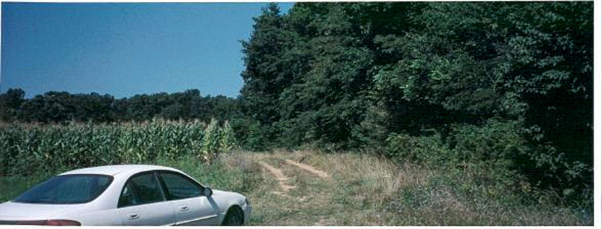
Hoosier Hill is about a mile from the Ohio border. From Indianapolis, Indiana take I-70 East until you get to Richmond, Indiana. Take route 227 North up to Franklin Township. Go about 10 miles, and then take a left on Bethel Road, follow it for about a mile, and then take a right on Elliot Road, and head north for almost a mile. There is the short trail to the top that is well marked.
 |
 |
 |
 |
Highpointing
Some may ask why anyone would want to travel to this remote area of the midwest farmland. Hoosier Hill certainly does not provide the best Indiana has to offer, but highpointing takes you places you would never think of going. Like a unique tour of America that few get to experience. Hoosier Hill is one of the few flatland highpoints, but it is accessible from I-70, a highway that goes from Baltimore to Central Utah, and is used by many to drive cross-country. For more information on highpointing, check out the Highpointers Club.
 |
Red Tape
The private property is owned by Kim E. Goble
136 Sw 9th St,
Richmond, IN 47374-4012
765-966-5674
It is open to the public, but never forget that as guests, we must be respectful, and to be friendly in all local establishments, not make too much noise, and clean up all our trash.
Outside of the winter months, bring bug spray due to mosquitos.
When To Climb
All year round
Camping
Richmond KOA offers camping in Wayne County.
Miscellaneous Info
This is not the only place to "summit" in Indiana.
Also check out Hoosier National Forest, near I-64 in Southern Indiana.
Check out Indiana Department of Natural Resources - State Parks and Reservoirs
There are some climbing areas in Northern Indiana approximately 50 miles from Chicago in a place called the Indiana Sand Dunes National Lakeshore. There are 10 trails totaling 16.5 miles pass over nearly 200-foot tall drifting mounds of sand.
For more information, call (219) 926-1952.
To get there from Chicago, take I-90 south, then east, into Indiana. Exit at Rte. 49 north for 2.6 miles until you reach the entrance to the state park.
External Links
- Weather
Weather for Richmond, Indiana - Highpoint page from WayNet - a nonprofit organization in Wayne County
Website contains some information, photos and maps to Hoosier Hill.
Alpinist - Jun 13, 2007 12:04 pm - Voted 10/10
Indiana State ParksAdditional camping info can be found on the Indiana DNR website
hgrapid - Jun 17, 2007 1:48 pm - Hasn't voted
Re: Indiana State ParksThanks. This is added.
sm0421 - Jan 21, 2011 8:45 pm - Hasn't voted
Sign StolenAs of Jan.18/2011, unfortunately the sign of Hoosier Hill has been stolen, on the top there is now a 'mail box' on the ground with Hoosier Hill postercards, climber log and pens in sealed plastic bags. Also a Timex watch left by a hiker. In addition, the sign for short off-road trail on Elliot road has been stolen, so you couln't tell when to stop to follow the short trail to the summit. It is about immediately when you turn to the gravel road and see an open field to your right. Thanks for maintaining the page hgrapid! Regards, Alex
Colin - Aug 11, 2015 5:21 pm - Hasn't voted
Sign Is BackI visited on 8/6/15. There is now a green sign by the short access road, but it is obscured by low hanging branches. I recommend you scout the area on Google Earth in advance so you'll know where to look. Once you've parked, walk 10 yards down the access road and look into the woods on your right. You'll see the high point installation, which is quite nice. Best of luck, Colin
James Bednar - Oct 7, 2019 11:13 am - Hasn't voted
My 14th state highpoint.This was my 14th state highpoint to visit. Currently have 29/50. Have visited this spot twice. First visit was in November 2008, during the Thanksgiving Weekend. I drove north along Indiana HWY 227 from Richmond, IN. There were a few green signs pointing the way. Once I got to Randolph County Line Road (1100 S). Turned west on that road and traveled for about 1 mile until intersection with Elliott Road - there was a blue sign indicating where to turn. Turned south onto Elliott Road and drove roughly 0.3 miles and turned west onto the first road came to. Saw a sign indicating highpoint and parked along side of road. Highpoint was inside a grove of trees. Park vehicle and a very short walk into that grove of trees will reveal the highpoint marker. During my visits, the highpoint marker was a pile of rocks with a marker, a few benches, Wooden marker, and information stating that the Boy Scouts had made improvements to the area.