
-
 22061 Hits
-
 88.61% Score
-
 27 Votes
|
|
Mountain/Rock |
|---|---|
|
|
45.88720°N / 7.00670°E |
|
|
Mountaineering, Trad Climbing |
|
|
Summer |
|
|
12332 ft / 3759 m |
|
|
Overview
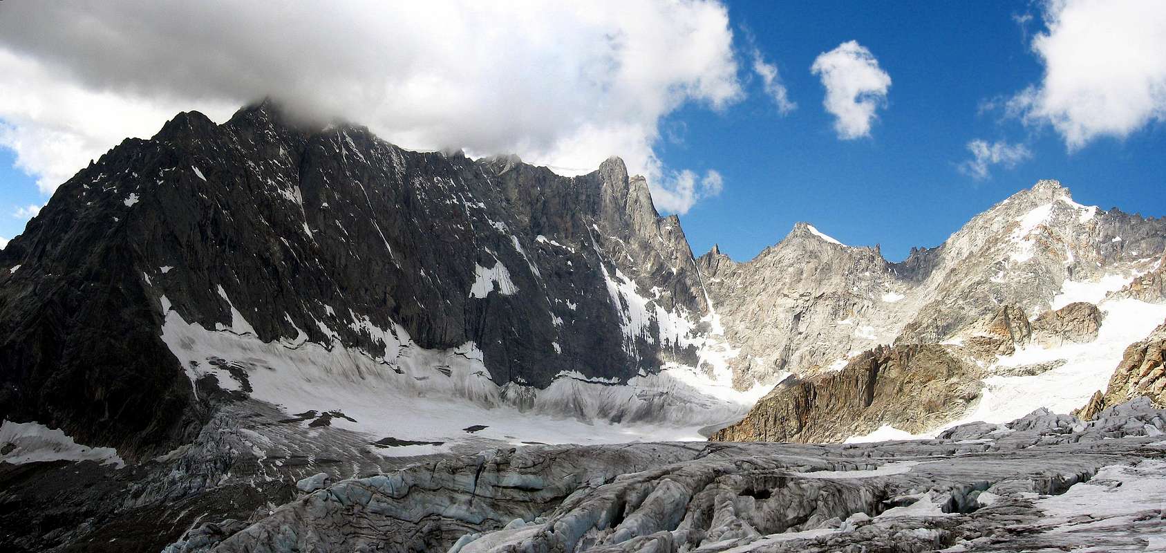
In the Eastern part of Mont Blanc group, East of Grandes Jorasses, on the main ridge between Italy and France, this smart and mighty mountain divides:
- the Glacier de Leschaux (France),
- the Glacier de Freboudze (Italy) and
- the Glacier de Triolet (Italy) Its scructure is quite simple: 2 walls on the italian side and 1 wall on the french one.
on the left side the Aiguille de Leschaux, on the right side the Petites Jorasses
![]()
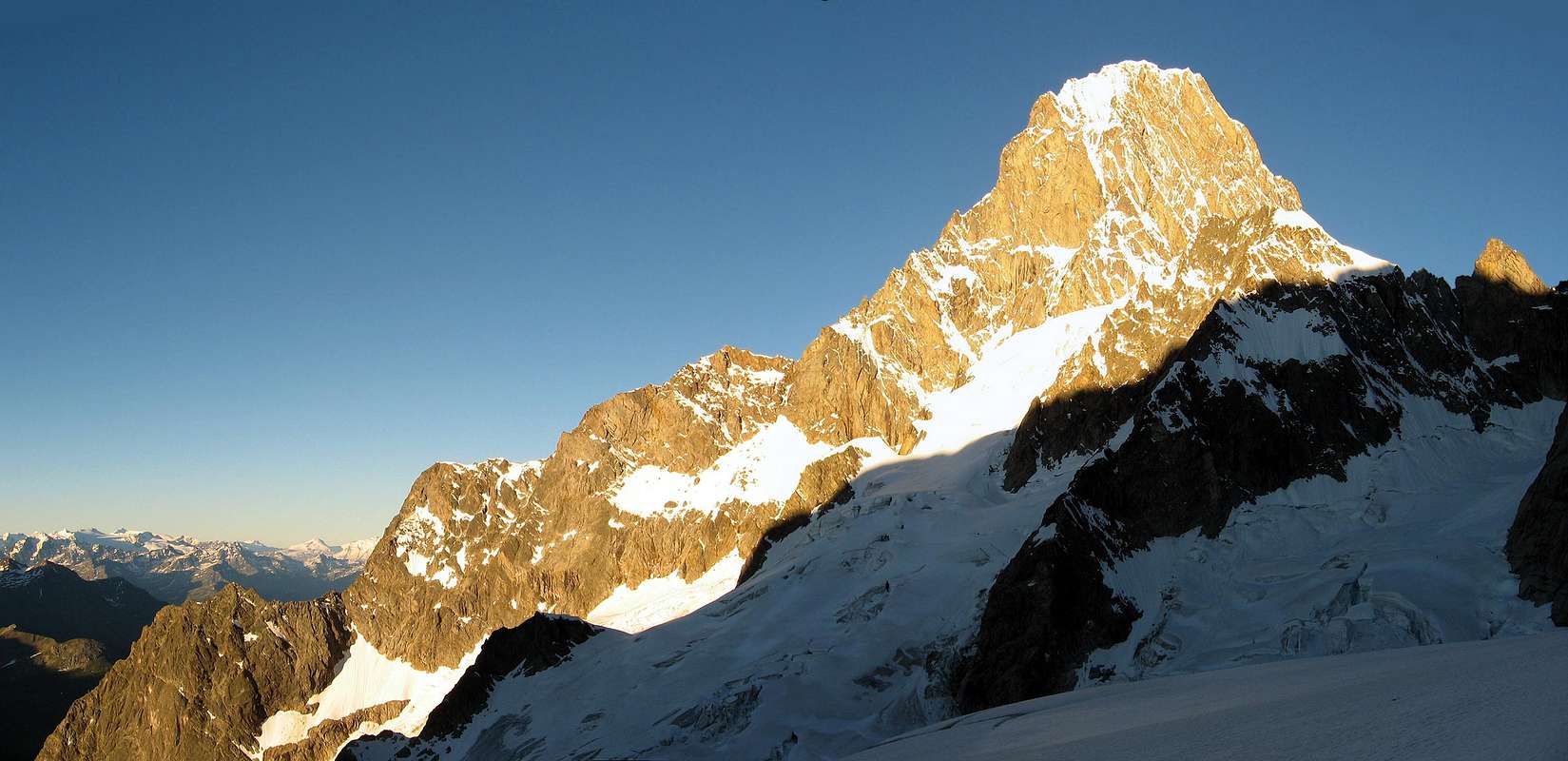
Triolet side
- from Freboudze side it looks like a "normal mountain" ... a small rock bulwark and a small glacier leading almost to the summit
- from Triolet side it looks very severe, a very steep ice slope leads to a vertical and high rock wall
- from Leschaux side a fine wall of slabs This is the hub where Greuvetta ridge starts toward East
Getting There
Three different approaches:
from Italy - Val Ferret - Bivacco di Freboudze (2.360m) - Bivacco Gervasutti (2.870m) to get it you must start walking from Lavachey, cross the Dora river, get the Lavachey and follow a small track that leads you to the Bivacco di Freboudze (2.360m) - 2 hours - passages of 2° UIAA (PD) Then, along tracks toward NW, get the Freboudze glacier. Cross under the eastern part of it (danger of ice falls) and pass to the left of a rocky ridge coming down. Here you must find the best way to reach the rocky isle of the Bivacco (less than 2 hours from Bivacco di Freboudze).
from Italy - Val Ferret - Rifugio Dalmazzi al Triolet (2.360m) The access is normally done from Val Ferret (Courmayeur, first valley on the right), using the road till about Arnouva (after Lavachey) and with a confortable walk less more then 2 hours long you can reach the Rifugio Dalmazzi al Triolet (~2.600m) Once it was a small and not always comfortable hut, now a modern costruction (not so fine ..) can give you more comforts.
from France - Chamonix-Montenvers - Refuge de Leschaux (2.450m) along the tracks on the Mer de Glace (same as for Rif. du Requin) till it turns to right. Now you have to cross it (red marks) till the lateral moraine to get the Glacier de Leschaux. Cross the medial moraine and follow directly on the glacier. The Refuge is on the east margin. (3 hours from Montenvers).
 |
 |
 |
 |
 |
Routes overview
from Freboudze side (Italy): Bivacco Freboudze and Bivacco Gervasutti
- SE side (normal route from Rif. Gervasutti) - AD.
- SW ridge (fron Col dee Petites Jorasses) - 240m - AD sup - D.
- East ridge (from Biv. Freboudze) - PD/PD+ - useful with good snow at the beginning of summer.
from Triolet side (Italy): Rifugio Dalmazzi
- from Col de Leschaux and the NW ridge (Rey-Rivetti) - 350m - D.
- NE wall and NW ridge (Boccalatte) - 800m - TD (forgotten).
- NE wall (Cassin) - 800m - ED inf.
from Leschaux side (France): Refuge de Leschaux
- W wall - normal french route - 700m - D.
- W wall (Azema-Frassinet) - 700m - TD + A1.
- W wall and NW ridge - AD till the ridge then D.
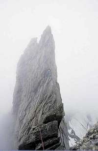
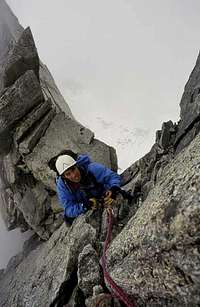
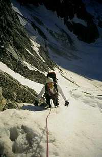
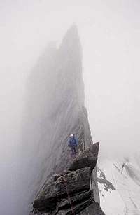
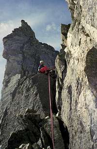
some pics of the NW ridge
 |
 |
 |
 |
 |
When To Climb
summer.
Logistic Info
all necessary logistic info can be found in Mont Blanc group page.
Mountain Conditions
- You can get meteo information at the official site of the Regione Valle d'Aosta:
- Valle d'Aosta Meteo
Triolet side
Webcam
- WEBCAM on Aosta Valley:
- Webcam
Books and Maps
BOOKS:
- "Guida delle Alpi Occidentali", di Giovanni Bobba e Luigi Vaccarone C.A.I. Sezione di Torino Volume II (parte II), 25 Maggio 1896.
- "Guida dei Monti d'Italia-Monte Bianco" (Vol. II°) di R. Chabod, L. Grivel, S. Saglio, G. Buscaini-Club Alpino Italiano/Turing Club Italiano, 1968 (in Italian).
- "I Rifugi della Valle d'Aosta" di Stefano Ardito, Ed. Guide iter, Febbraio 2003.
- "A piedi in Valle d'Aosta" (Vol.1), di Stefano Ardito, Ed. Guide iter, Giugno 2003.
- "80 itinerari di Escursionismo Alpinismo e Sci Alpinismo in Valle d'Aosta", di Osvaldo Cardellina, Ed. Musumeci, Giugno 1977 (in Italian); seconda Ed. Luglio 1981; terza Ed. Luglio 1984; (in French), prima Ed. Febbraio 1978; seconda Ed. Marzo 1980.


MAPS:
- Kompass "Massiccio del Monte Bianco Valle d'Aosta Sentieri e Rifugi" Carta turistica 1:50.000.
- I.G.C. Istituto Geografico Centrale Torino "Massiccio del Monte Bianco" (n° 4), Torino, 1998 1:50.000.
- I.G.C. Istituto Geografico Centrale Torino "Monte Bianco-Courmayeur-Chamonix-La Thuile" (n° 107), 1:25.000.
- L'Escursionista "Monte Bianco Courmayeur" (n° 1) Edizioni Rimini 2004 1:25.000.
- Edizioni Tabacco "Mont Blanc" Udine, 1978 1:50.000.
- Studio F.M.B. Bologna 1988 "Monte Bianco-Mont Blanc" 1:50.000.
Important Information
- REGIONE AUTONOMA VALLE D'AOSTA the official site.
- FONDAZIONE MONTAGNA SICURA Villa Cameron, località Villard de la Palud n° 1 Courmayeur (AO) Tel: 39 0165 897602 - Fax: 39 0165 897647.
- Società Guide Alpine Courmayeur www.Guidecourmayeur.com - Strada Villair n° 2 - 11013 Courmayeur (Aosta) Italy - Tel. +390165842064 Fax. +390165842357 - P.I. 01022640070
- A.I.NE.VA. (Associazione Interregionale Neve e Valanghe).
 |
 |
 |
 |
 |
Useful numbers
- Protezione Civile Valdostana località Aeroporto n° 7/A Saint Christophe (Ao) Tel. 0165-238222.
- Bollettino Meteo (weather info) Tel. 0165-44113.
- Unità Operativa di Soccorso Sanitario Tel. 118.