
|
|
Mountain/Rock |
|---|---|
|
|
43.80000°N / 17.17000°E |
|
|
3018 ft / 920 m |
|
|

Dinarides-->Maritime Dinarides -->Biokovo/Rilic group
Overview
This page is dedicated to the less known area of the Maritime Dinarides.
In fairness, nothing much stands out about mt. Rilic. People climbing it these days are far and few between.
Still , when brave mountaineer decides to visit mountains spanning Easterncoast of the Adriatic Sea,
Rilic (correct spelling is Ree-leach)
may be a prospective 2nd (or, perhaps, 3rd) choice to the big guns like Velebit, Biokovo, or Orjen.
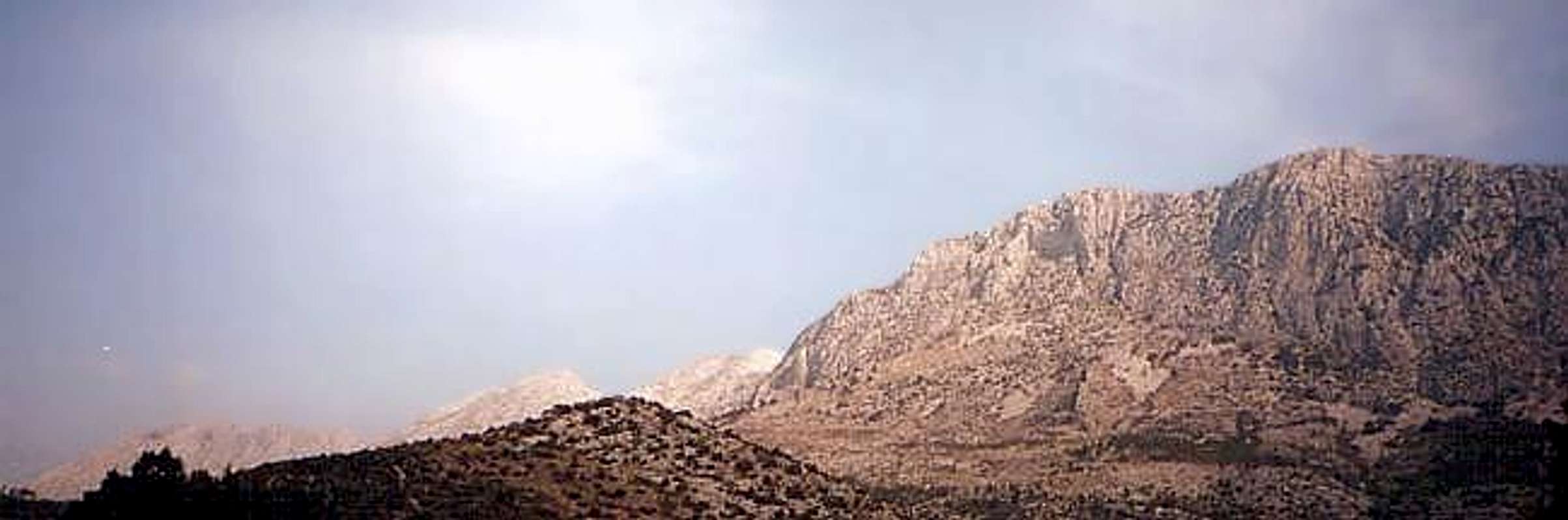
At meager 920m elevation, it sharply separates Dalmatian coastal area from the hinterland. Rilic begins right where Biokovo ends,
(the Staza pass separating those two)
and spans in NW-SE direction further 12 miles, untill it reaches Bacina lakes (Bacinska jezera), close to the Neretva river delta.
Upper plateau of Rilic is typical karst landscape, whilst flish zone separates its western side from the sea.
Hence no part of the whole Mediterranean shore is so deeply indented as Dalmatian littoral (except the coast of Greece),
the views from Rilic, are just about fine. The azure blue sea of Neretva and Peljesac channels right under your nose,
with rocky, reef type islands and the Peljesac peninsula edging the horison
Getting there and away
| By train and/or bus | Nearest railway stations are those in Split (northwest) and town Ploce (southeast). Ploce are more convinient in case you are coming from Bosnia (direct train connection with Sarajevo.) No railway line goes down the coast, thus one should relay on the coach service. Coaches are frequent. Any coach serving the Split-Makarska-Ploce route will do the job. Coach will stop at Drvenik, Zaostrog, Gradac, as well as at any small town if you request the driver to stop.. |
| By car | Main road Split-Dubrovnik passes the W side of Rilic foothill. Around hour and half of drive from Split takes you there. |
| By ferry | Regular ferry service connets Sucuraj on the island of Hvar and port of Drvenik six times a day. One way ride costs around 1 US$. |
| By plain | Nearest intl airport is located in Split. (See Links section further below, please) |
Bits on history and moving around
 Moltkia petraea (Tratt.) Griseb (Modro lasinje) photo by 5ani
NW Rilic:
Drvenik-Sokolic peak, 4 hours hike, marked route
Drvenik-Rocks of Drvenik (Drveniske stine) 2-3 hours, marked route
Drvenik or Gornja Vala-Plisivac hill, 1 to 1 1/2 hour, nonmarked but easy trail.
Zaostrog-Viter peak 3 hours, nonmarked walkup
Zaostrog-Despoti -Sapasnik peak (Rilic highest peak) 4-5 hours, nonmarked, walkup with scramble
Central Rilic:
Gradac-Miljacici-Crvene stine (red rocks) scramble or scramble+some easy climbing
SE Rilic:
Bacina lakes-Kolivrat-Sv.Ilija peak, 3-4 hours walk up.
Histotreks:
W side of Rilic was inhabited during the iron age. At a later date (1st century BC), coastal part became summer resort for retired Roman war veterans (vets were given fertile land there). Slavs settled here during 7th century AC and after year 812.Aachen peace agreement, Slav clans under mt. Rilic have formed independent principality, 10th century Constantin Porphyrogenetus reffered to it under name "Pagania". Afterwards,; they opted for piracy as a main source of income (major victims were Venetian ships). As Turks penetrate into Balkans, locals erected a network of small fortresses and watchtowers. Some of the Rilic peaks were used as observation points (namely Viter) If you folllow the old macadam road under Rilic, whole stretch from Drvenik to Gradac is lined with old thumbstones, abandoned churches, and ruins of 17th century watchtowers. Road is dusty, so a mountainbike is a reasonable option. In 1960s Rilic area was hit by an earthquake, many buildings were destroyed, villages abandoned. Natives have relocated downhill, next to the coast. Today its all about villa/apartment renting to the tourists. Yet, old settlements above the main road and close to Rilic are still untouched.
 |  |  |
When To Climb
Can be climbed all year long. Certain issues should be taken into consideration, though: Summers are hot and dry. There are no water sources. Bring sufficient amount of water with you. Prevailing wind is the sirocco (jugo in local language). It usually hits from the Peljesac channel, bringing rain and sometimes short storms. On the other side, strong wind by name Bura (Bora) .may blow at any season of the year. November to February are the windiest months, July and August normally very hot. April to early June are usually best months. September will do as well. |  |
Mountain Conditions
There is no meteostation on Rilic. Instead, here is a up-to-date weather conditions info for Bast (see links section further below).Bast is village on the foothill of Rilic mighty neighbour mt. Biokovo. Weather conditions on Rilic and Biokovo are almost identhical for most of the time.
Camping & Huts
There are no huts on Mt. Rilic. Camping is not prohibited.nearest camping grounds are down at the coast, at Blato and at Uvala Borova(Pinetree bay)near Podaca. As a spare option one may set a bivouac in one of the caves, just above the scree section on the low side of the mountain.
 |
Red Tape & Security
No fees or permits required.In case of trouble, please call corresponding Croatian mountain rescue service emergency phone number.
For Rilic area, it is 091 721 0011
Links
Split airport flight scheduleCroatian railways timetable in English
Up to date weather conditions and 8 day forecast for Bast
Main mountains and ranges of the Maritime Dinarides
| Mountains of the Maritime Dinarides | ||
| Name | Height | Country |
| Velebit | 1757m | Croatia |
| Kozjak | 779m | Croatia |
| Mosor | 1339m | Croatia |
| Poljicka planina | 450m | Croatia |
| Omiska Dinara | 863m | Croatia |
| Biokovo | 1762m | Croatia |
| Dovanj | 864m | Croatia |
| Rilic | 920m | Croatia |
| Snjeznica | 1234m | Croatia |
| Orjen | 1893m | Montenegro |
| Lovcen | 1749m | Montenegro |
| Rumija | 1594m | Montenegro |