
-
 27247 Hits
-
 89.01% Score
-
 28 Votes
|
|
Mountain/Rock |
|---|---|
|
|
45.89670°N / 9.42490°E |
|
|
Hiking, Trad Climbing, Sport Climbing, Via Ferrata |
|
|
Spring, Summer, Fall, Winter |
|
|
6152 ft / 1875 m |
|
|
Overview
the Resegone is one of the most known mountains of Italy and the most popular in Lombardia.Its name comes from its likeness to a very big saw (sega in Italian), with its 15 different summits : starting from N they are :
Pizzo Morterone 1751m, undefined, Pan di Zucchero 1760m, Cima Pozzi 1810m, il Dente 1809m, Punta Manzoni, Punta Stoppani (twin), Punta Cermenati 1875m (main summit), Torre di Valnera 1807m, Pizzo Daina 1850m), Pizzo Brumano 1754m, I Solitari 1667m, Cima Piazzo 1637m, Cima Quarenghi 1537m.
It is also known as Monte Serrada (a kind of big natural boundary)
Why is it so known ?
|

Despite its not high altitude, it is a not small mountain : the main ridge is almost 3 km long and the difference in elevation, from the valley, is almost 1500m.
Its orographic structure is complex,
about 500m under the main ridge the western side is divided by a the long ridge (whose main summit is Monte Magnodeno) into two basins : the N one ending in Germanedo (Lecco) and the SW one (the valley of the wild Galavesa stream - wonderful canyon) passing through Erve and ending in Calolziocorte:
Its boudaries are normally considered
This mountain is very frequently climbed: along its 2 easiest paths hundreds of hikers, each sunday, all year long, get the summit.
but ... very frequently climbed doesn't mean well known !
No books and no detailed maps about this mountain (... group), some areas are totally unknown :
absolutely to be avoided solo climbings out of the 2 main marked and frequented paths:
sometimes it happens that solo hikers disappear and can be found months or even years later
... few days ago (may 2005) a Priest missing from over one year was at least found (dead of course)
One important advice : if you want to avoid crowd and find place to park car without problems choose to get here on saturday
Getting There
From Milano - ss 36 (Spluga) till Lecco (at the bottom of the east branch of Como lake)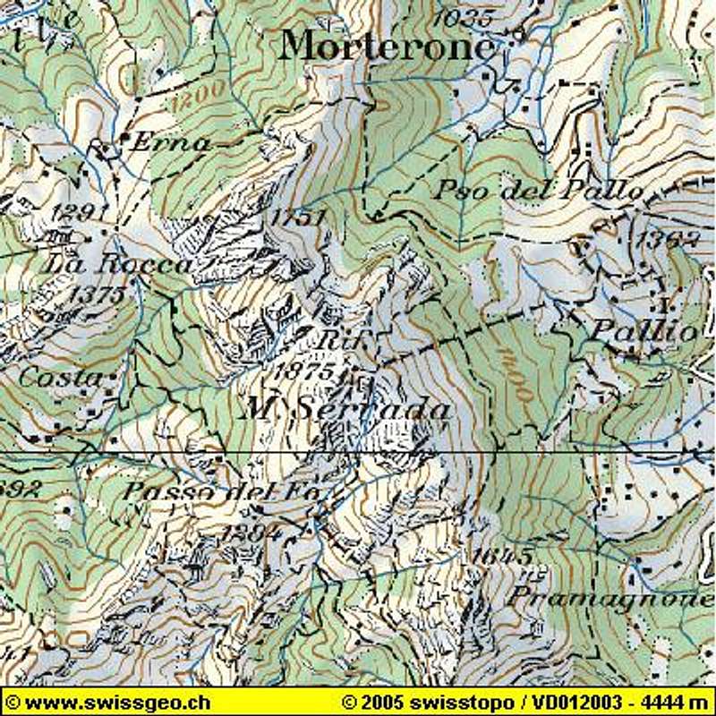

Here 3 different accesses to the mountain, all starting from Lecco:
- get the Piani d'Erna using the cable car
- start walking toward Rifugio Stoppani
 |  |
Routes overview
Easy HikingTwo main paths, good for hikers, to get the main summit :

Hiking
One very fine hiking along the Canalone di Bobbio (path n°10) easy, some fixed ropes in the middle part of Canalone, and a long cross on the main ridge (3-4 hours from piani d'Erna)
 -
-  -
-  -
-  -
- 
2 serious and not to be underestimated "ferrate"
Climbing
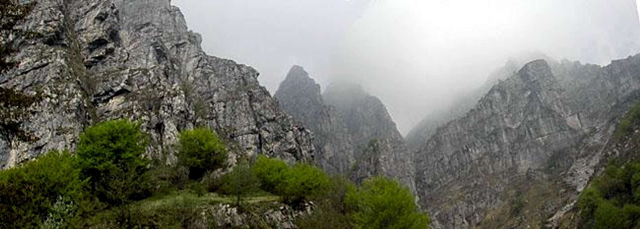
Resegone is little considered by climbers due to the not always fine rock and the long approaches to the difficult routes on the south and west walls of the northern summits (especially on the Dente and on Pan di Zucchero summits)
The wide wall (150m in elevation) that sustain the Pian Daina has a lot of rocky routes, some very difficult but seldom climbed.
Some rocky structures, near the Rifugio Stoppani offer good possibilities of modern climbing (multipitches routes) and the two classic towers (Torre CAI and Torrione Elisabetta) near the Rif. Alpinisti Monzesi offer good classic rock routes.
In this last area there is also a structure with many modern routes (difficulties up to 5.12)
About the big channels that lead to the summit ridge ...
One very fine winter climb along the Canalone Comera, to be done only with good snow conditions
 -
- 
The other ones, smaller than Comera, maybe dangerous for stone falls and very difficult in winter.
The ones that can be considered for climbing are the Canalone Cermenati (AD in summer. up to TD in winter) and the Canalone Cazzaniga (a little easier but more dangerous)
Good possibilities of Ice falls climbing (up to 300m high) on the northern walls of the group, along the road that leads to Morterone
Weather
Due to its nearness to Como lake (Lecco branch), to Adda river and due also to its position (first important mountain over the plan Pianura Padana) you can find good weather and no fog only in the windy days, especially when warm wind (Favonio - aka Phoen) comes down from north.When To Climb
All year long :To be absolutely avoided in sunny days of July and August (too hot !!!)
Some attention in winter months
Accomodations
No need to use accomodations for normal pathsthere are three huts in the area
and a fantastic relax area at the Piani d'Erna (1300m - cable car)
just to identify the summits ...

 |  |

